Beddington

Settlement in Surrey

England

Beddington

Saint Mary's Church Detail of the knapped flint on the exterior wall of the church.
Saint Mary's Church Credit: Peter Trimming

Beddington is a suburban area located in the borough of Sutton in Surrey, England. It is situated approximately 10 miles south of central London, making it a popular residential location for commuters. The area is predominantly residential, with a mix of housing types including detached and semi-detached houses, as well as some apartment buildings.

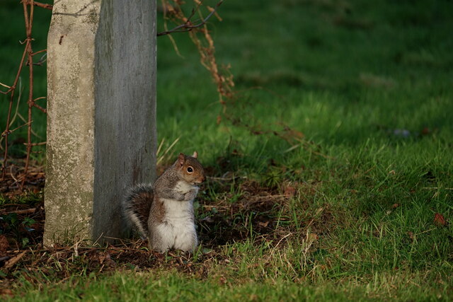
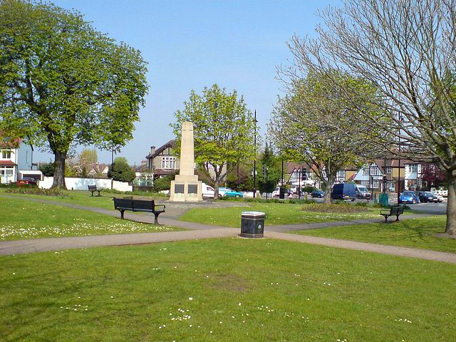
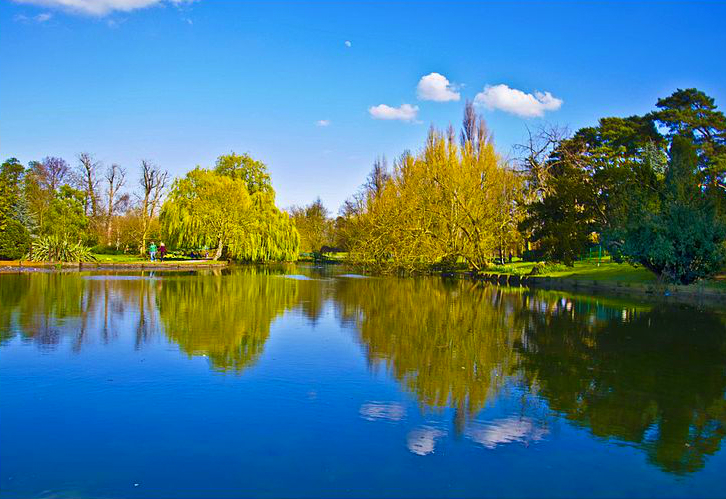
One of the notable features of Beddington is its close proximity to Beddington Park, a large public park covering approximately 100 acres. The park offers a peaceful retreat for residents, with beautiful green spaces, a lake, and a variety of sports facilities, including tennis courts and a cricket pitch. Beddington Park is also home to the historic Carew Manor, a Grade I listed building that dates back to the 16th century.

In terms of amenities, Beddington has a range of local shops and services, including a supermarket, convenience stores, and a post office. There are also several schools in the area, providing education for children of all ages.

Transport links in Beddington are excellent, with easy access to major road networks such as the A23 and the M25. The area is served by several bus routes, providing connections to nearby towns and train stations. The nearest railway station is Hackbridge, which offers regular services to central London and other destinations.

Overall, Beddington offers a peaceful and well-connected residential location, with a range of amenities and green spaces for residents to enjoy.

If you have any feedback on the listing, please let us know in the comments section below.

Beddington Images

Images are sourced within 2km of 51.369708/-0.141716 or Grid Reference TQ2965. Thanks to Geograph Open Source API. All images are credited.

Saint Mary's Church Detail of the knapped flint on the exterior wall of the church.
Saint Mary's Church
Detail of the knapped flint on the exterior wall of the church.
Beddington Resident I went in search of an albino grey squirrel, reported on the previous day, but I only saw five of the usual colouration. Photographed in the churchyard of Saint Mary's church.
Beddington Resident
I went in search of an albino grey squirrel, reported on the previous day, but I only saw five of the usual colouration. Photographed in the churchyard of Saint Mary's church.
Beddington Park Resident Grey squirrel, seen during a break in foraging.
Beddington Park Resident
Grey squirrel, seen during a break in foraging.
Beddington Farmlands The wetlands area saw gulls numbering in their hundreds (mainly black-headed) and a few grumpy-looking herons.
Beddington Farmlands
The wetlands area saw gulls numbering in their hundreds (mainly black-headed) and a few grumpy-looking herons.
Beddington Farmlands The wetlands area saw gulls numbering in their hundreds (mainly black-headed) and a few grumpy-looking herons.
Beddington Farmlands
The wetlands area saw gulls numbering in their hundreds (mainly black-headed) and a few grumpy-looking herons.
Beddington Farmlands The wetlands area saw gulls numbering in their hundreds and a few grumpy-looking herons.
Beddington Farmlands
The wetlands area saw gulls numbering in their hundreds and a few grumpy-looking herons.
Beddington Farmlands The wetlands area saw gulls numbering in their hundreds (mainly Black-headed) and a few grumpy-looking herons.
Beddington Farmlands
The wetlands area saw gulls numbering in their hundreds (mainly Black-headed) and a few grumpy-looking herons.
Beddington Farmlands Swan, coots and gulls.
Beddington Farmlands
Swan, coots and gulls.
Beddington Farmlands Swans and gulls.
Beddington Farmlands
Swans and gulls.
Beddington Farmlands Swans and gulls.
Beddington Farmlands
Swans and gulls.
Heads and Tails Two heads, three tails and a couple of gulls.
Heads and Tails
Two heads, three tails and a couple of gulls.
Beddington Farmlands Swans and gull.
Beddington Farmlands
Swans and gull.
Beddington Farmlands Swans and gull.
Beddington Farmlands
Swans and gull.
Beddington Farmlands Heron and gulls.
Beddington Farmlands
Heron and gulls.
Beddington Farmlands Swans and gulls.
Beddington Farmlands
Swans and gulls.
Beddington Farmlands Swans and gulls.
Beddington Farmlands
Swans and gulls.
Beddington Farmlands Swans and gulls.
Beddington Farmlands
Swans and gulls.
Little Egret Seen in Beddington Park. It had been fishing in the River Wandle, but noticed my approach.
Little Egret
Seen in Beddington Park. It had been fishing in the River Wandle, but noticed my approach.
Show me another place!

Beddington is located at Grid Ref: TQ2965 (Lat: 51.369708, Lng: -0.141716)

Unitary Authority: Sutton

Police Authority: Metropolitan

What 3 Words

///credit.number.successes. Near Carshalton, London

Nearby Locations

Beddington

Related Wikis

Wallington County Grammar School

Wallington County Grammar School (WCGS) is a selective state boys' grammar school with a coeducational Sixth Form located in the London Borough of Sutton...

Wallington, London

Wallington is a town in the London Borough of Sutton, South London, England, 9.7 miles (15.6 km) south-west of Charing Cross. Before the Municipal Borough...

Beddington

Beddington is a suburban settlement in the London Borough of Sutton on the boundary with the London Borough of Croydon. Beddington is formed from a village...

Bandon Hill Cemetery

Bandon Hill Cemetery is a cemetery in Wallington, south-west London. While it was founded in 1900 by the Croydon Rural District Council, it is actually...

Nearby Amenities

Located within 500m of 51.369708,-0.141716
Mini Roundabout
Direction: clockwise
Lat/Long: 51.3654867/-0.1403973
Created By: YahooApplet 1.0
Lat/Long: 51.3674226/-0.146056
Created By: YahooApplet 1.0
Lat/Long: 51.3676168/-0.1451762
Created By: YahooApplet 1.0
Lat/Long: 51.3688902/-0.1379837
Created By: YahooApplet 1.0
Lat/Long: 51.3689454/-0.1387561
Created By: YahooApplet 1.0
Lat/Long: 51.3683779/-0.1388466
Created By: YahooApplet 1.0
Lat/Long: 51.367993/-0.1378797
Created By: YahooApplet 1.0
Lat/Long: 51.3684542/-0.1378164
Created By: YahooApplet 1.0
Lat/Long: 51.367709/-0.1354789
Created By: YahooApplet 1.0
Lat/Long: 51.3685487/-0.1356545
Barrier: bollard
Lat/Long: 51.3696317/-0.1475035
Ref GB Tflcid: RWG216228
Traffic Calming: hump
Lat/Long: 51.3731306/-0.1400348
Crossing
Lat/Long: 51.3713568/-0.1407107
Crossing
Lat/Long: 51.3709427/-0.1405787
Crossing
Lat/Long: 51.3691358/-0.1353108
Post Box
Collection Times: Mo-Fr 09:00; Sa 07:00
Drive Through: no
Operator: Royal Mail
Operator Wikidata: Q638098
Post Box Type: pillar
Ref: SM6 162D
Royal Cypher: GR
Royal Cypher Wikidata: Q33102273
Source: survey
Lat/Long: 51.3678748/-0.1379097
Post Box
Brand: Royal Mail
Brand Wikidata: Q638098
Collection Times: Mo-Fr 09:00; Sa 07:00
Drive Through: no
Operator: Royal Mail
Operator Wikidata: Q638098
Post Box Type: pillar
Ref: SM6 181D
Royal Cypher: GR
Royal Cypher Wikidata: Q33102273
Source: survey
Lat/Long: 51.3689043/-0.1400647
Post Box
Collection Times: Mo-Fr 16:00; Sa 11:15; Su off
Drive Through: no
Operator: Royal Mail
Operator Wikidata: Q638098
Post Box Type: pillar
Ref: SM6 133
Royal Cypher: GR
Royal Cypher Wikidata: Q33102273
Source: survey
Lat/Long: 51.3693929/-0.145707
Post Box
Collection Times: Mo-Fr 16:00; Sa 11:15; Su off
Drive Through: no
Operator: Royal Mail
Operator Wikidata: Q638098
Post Box Type: pillar
Ref: SM6 132
Royal Cypher: GR
Royal Cypher Wikidata: Q33102273
Source: survey
Lat/Long: 51.3654387/-0.1415979
Rectory Court
Addr Housenumber: 1-8
Building: terrace
Lat/Long: 51.3691827/-0.1423729
Marlesford Court
Building: apartments
Created By: Potlatch alpha
Lat/Long: 51.3696006/-0.1417206
Barrier: bollard
Bicycle: yes
Foot: yes
Lat/Long: 51.3652881/-0.1416209
Crossing
Bicycle: yes
Crossing: traffic_signals
Crossing Ref: toucan
Lat/Long: 51.3698133/-0.139989
Yes
Barrier: bollard
Bicycle: yes
Emergency: yes
Foot: yes
Lat/Long: 51.3708622/-0.1369042
Ref GB Tflcid: RWG216625
Traffic Calming: hump
Lat/Long: 51.3684907/-0.1474282
Bus Stop
Church Road
Local Ref: GS
Naptan AtcoCode: 490005289E
Naptan Bearing: E
Naptan CommonName: Church Road Croydon Road
Naptan Indicator: Stop GS
Naptan Verified: no
Public Transport: platform
Lat/Long: 51.3698532/-0.1398936
Bus Stop
Church Road
Local Ref: GT
Naptan AtcoCode: 490005289W
Naptan Bearing: W
Naptan CommonName: Church Road Croydon Road
Naptan Indicator: Stop GT
Naptan Verified: no
Public Transport: platform
Lat/Long: 51.3698029/-0.1416892
Bus Stop
Guy Road
Local Ref: D
Naptan AtcoCode: 490008217E
Naptan Bearing: E
Naptan CommonName: Hilliers Avenue Croydon Road
Naptan Indicator: Stop D
Naptan Verified: no
Public Transport: platform
Lat/Long: 51.3691589/-0.135001
Bus Stop
Wallington County Grammar School
Local Ref: GV
Naptan AtcoCode: 490014136W
Naptan Bearing: W
Naptan CommonName: Wallington County Grammar Sch.
Naptan Indicator: Stop GV
Naptan Verified: no
Public Transport: platform
Lat/Long: 51.3687728/-0.1482295
Bus Stop
The Holt
Local Ref: GR
Naptan AtcoCode: 490013422E
Naptan Bearing: E
Naptan CommonName: The Holt
Naptan Indicator: Stop GR
Naptan Verified: no
Public Transport: platform
Lat/Long: 51.3693084/-0.1460657
Bus Stop
The Holt
Local Ref: GU
Naptan AtcoCode: 490013422W
Naptan Bearing: W
Naptan CommonName: The Holt
Naptan Indicator: Stop GU
Naptan Street: CROYDON ROAD
Naptan Verified: no
Public Transport: platform
Lat/Long: 51.3695258/-0.1443296
Parking
Lat/Long: 51.3716773/-0.1356859
Addr Housenumber: 334
Lat/Long: 51.3692867/-0.1475399
Addr Housenumber: 322
Lat/Long: 51.3695454/-0.1459065
Addr Housenumber: 300B
Lat/Long: 51.3699146/-0.1440476
Addr Housenumber: 10
Lat/Long: 51.3694525/-0.1464416
Addr Housenumber: 304A
Lat/Long: 51.3701248/-0.1447839
Addr Housenumber: 8
Lat/Long: 51.370165/-0.1452601
Addr Housenumber: 8
Lat/Long: 51.3699548/-0.1456771
Addr Housenumber: 332
Lat/Long: 51.3693981/-0.1471483
Addr Housenumber: 310
Lat/Long: 51.3697723/-0.1450602
Addr Housenumber: 302
Lat/Long: 51.3698878/-0.1442555
Addr Housenumber: 1
Lat/Long: 51.3697447/-0.1453995
Addr Housenumber: 5
Lat/Long: 51.3698786/-0.1460245
Addr Housenumber: 2
Lat/Long: 51.3697664/-0.1453204
Addr Housenumber: 314
Lat/Long: 51.369661/-0.1454706
Addr Housenumber: 2
Lat/Long: 51.3696233/-0.1468949
Addr Housenumber: 304B
Lat/Long: 51.3700863/-0.1449837
Addr Housenumber: 322A
Lat/Long: 51.369954/-0.1464134
Addr Housenumber: 302B
Lat/Long: 51.3701792/-0.1445532
Addr Housenumber: 6
Lat/Long: 51.3697196/-0.1466025
Addr Housenumber: 330
Lat/Long: 51.3694525/-0.1469807
Addr Housenumber: 3
Lat/Long: 51.3700787/-0.1456034
Addr Housenumber: 1
Lat/Long: 51.3693922/-0.1467313
Addr Housenumber: 302A
Lat/Long: 51.3702161/-0.1442823
Addr Housenumber: 32
Lat/Long: 51.3703063/-0.1440993
Addr Housenumber: 20
Lat/Long: 51.3703591/-0.1438404
Addr Housenumber: 34-38
Lat/Long: 51.3701849/-0.1440027
Addr Housenumber: 18
Lat/Long: 51.3703498/-0.1434797
Addr Housenumber: 1-15
Lat/Long: 51.370107/-0.1430411
Addr Housenumber: 2-16
Lat/Long: 51.3704444/-0.1431149
Speed Camera
Direction: 90
Maxspeed: 30 mph
Lat/Long: 51.369897/-0.1420245
Ref GB Tflcid: RWG216626
Traffic Calming: hump
Lat/Long: 51.367548/-0.1470714
Ref GB Tflcid: RWG216445
Traffic Calming: hump
Lat/Long: 51.3653328/-0.1420783
Ref GB Tflcid: RWG216443
Traffic Calming: hump
Lat/Long: 51.3656994/-0.1417284
Ref GB Tflcid: RWG216627
Traffic Calming: hump
Lat/Long: 51.3670727/-0.1469357
Ref GB Tflcid: RWG216452
Traffic Calming: hump
Lat/Long: 51.3653891/-0.1413942
Ref GB Tflcid: RWG216502
Traffic Calming: hump
Lat/Long: 51.3658877/-0.1403419
Ref GB Tflcid: RWG216499
Traffic Calming: hump
Lat/Long: 51.3653249/-0.1404333
Ref GB Tflcid: RWG216505
Traffic Calming: hump
Lat/Long: 51.3670228/-0.1402422
Ref GB Tflcid: RWG216530
Traffic Calming: hump
Lat/Long: 51.3655717/-0.1392113
Ref GB Tflcid: RWG216497
Traffic Calming: hump
Lat/Long: 51.3654565/-0.1407722
Ref GB Tflcid: RWG216496
Traffic Calming: hump
Lat/Long: 51.365518/-0.1399648
Ref GB Tflcid: RWG216397
Traffic Calming: hump
Lat/Long: 51.3695503/-0.1421398
Ref GB Tflcid: RWG218065
Traffic Calming: hump
Lat/Long: 51.3738364/-0.142466
Ref GB Tflcid: RWG216234
Traffic Calming: hump
Lat/Long: 51.3733979/-0.1413498
Ref GB Tflcid: RWG216398
Traffic Calming: hump
Lat/Long: 51.3686081/-0.1421634
Ref GB Tflcid: RWG216401
Traffic Calming: hump
Lat/Long: 51.3691446/-0.1401244
Ref GB Tflcid: RWG216518
Traffic Calming: hump
Lat/Long: 51.3684027/-0.1401576
Ref GB Tflcid: RWG216509
Traffic Calming: hump
Lat/Long: 51.3676909/-0.1402
Ref GB Tflcid: RWG216515
Traffic Calming: hump
Lat/Long: 51.367962/-0.1401814
Ref GB Tflcid: RWG216441
Traffic Calming: hump
Lat/Long: 51.3676522/-0.1420614
Ref GB Tflcid: RWG216238
Traffic Calming: hump
Lat/Long: 51.3734471/-0.1421445
Ref GB Tflcid: RWG216236
Traffic Calming: hump
Lat/Long: 51.37333/-0.1418306
Ref GB Tflcid: RWG216222
Traffic Calming: hump
Lat/Long: 51.372646/-0.1406568
Ref GB Tflcid: RWG216521
Traffic Calming: hump
Lat/Long: 51.3688208/-0.1401323
Operator: UK Power Networks
Operator Wikidata: Q7864927
Power: substation
Substation: minor_distribution
Lat/Long: 51.368251/-0.146382
Operator: UK Power Networks
Operator Wikidata: Q7864927
Power: substation
Substation: minor_distribution
Lat/Long: 51.3690127/-0.138296
Operator: UK Power Networks
Operator Wikidata: Q7864927
Power: substation
Ref: 211616
Substation: minor_distribution
Lat/Long: 51.368931/-0.14458
Operator: UK Power Networks
Operator Wikidata: Q7864927
Power: substation
Ref: 211609
Substation: minor_distribution
Lat/Long: 51.370974/-0.1373193
The data included in this document is from www.openstreetmap.org. The data is made available under ODbL.

Have you been to Beddington?

Leave your review of Beddington below (or comments, questions and feedback).