Vatem

Island in Inverness-shire

Scotland

Vatem

Grodhaigh, in the Sound of Harris Fish farming off one of the larger islands in the sound. Seen from the ferry to Berneray.
Grodhaigh, in the Sound of Harris Credit: M J Richardson

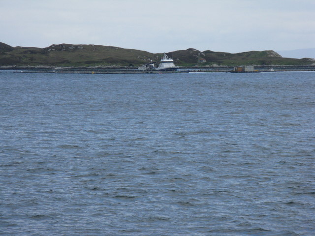
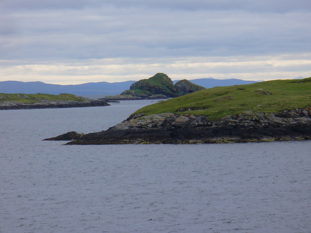
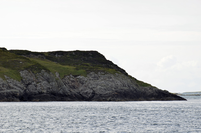
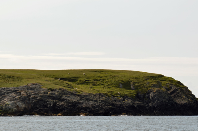
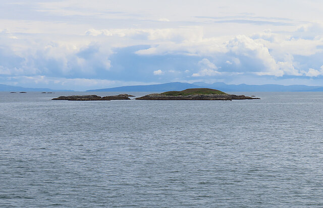
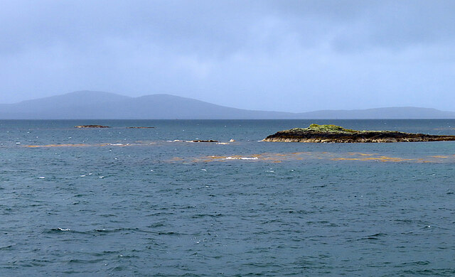
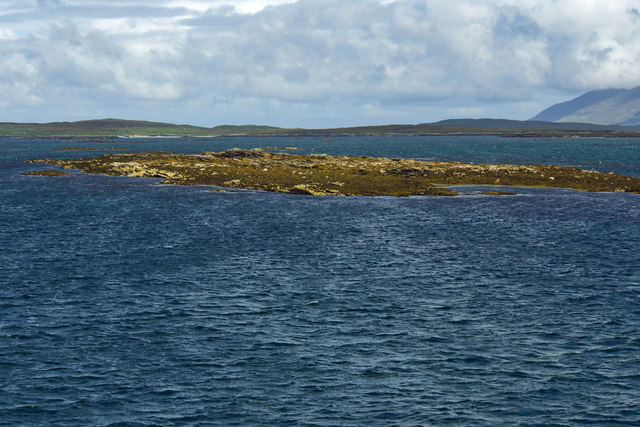
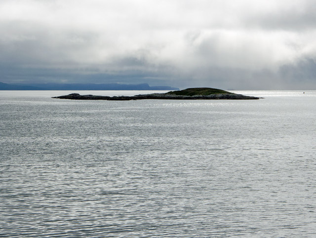
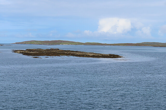
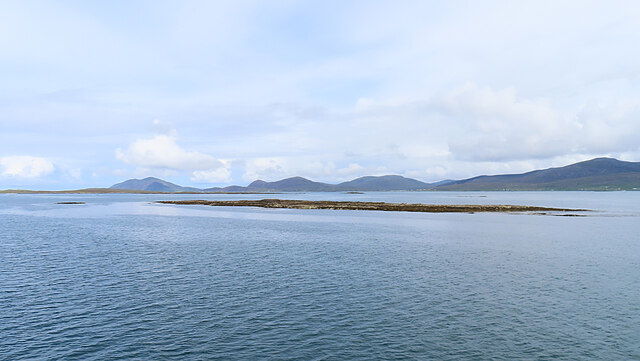
Vatem is a small island located in Inverness-shire, Scotland. Situated off the west coast of the Scottish Highlands, it is part of the Inner Hebrides archipelago. With a total land area of approximately 1 square mile, Vatem is a sparsely populated and secluded island.

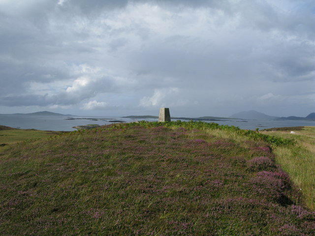
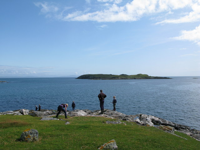
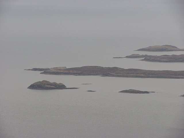
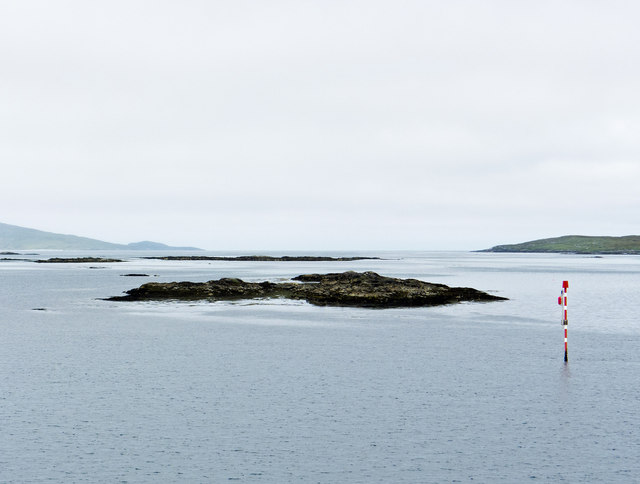
The landscape of Vatem is characterized by rugged coastlines, rocky cliffs, and rolling hills. The island boasts breathtaking natural beauty, with stunning views of the surrounding sea and neighboring islands. It is a haven for wildlife enthusiasts, as the island is home to a variety of bird species, including puffins and gannets, as well as seals and otters that can often be spotted along the coastline.

Despite its small size, Vatem has a rich history. It is believed to have been inhabited since prehistoric times, and evidence of ancient settlements can still be found on the island. The remains of a medieval chapel can also be explored, providing a glimpse into the island's past.

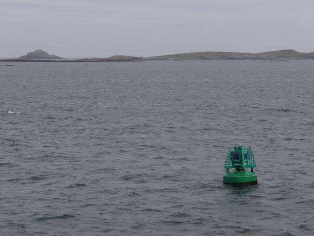
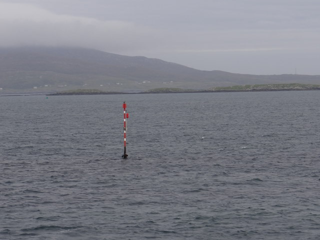
Due to its remote location, Vatem offers a peaceful and tranquil retreat for those seeking solitude and relaxation. The island is accessible by boat, with regular ferry services connecting it to the mainland. Visitors can enjoy leisurely walks along the island's coastal paths, explore its rugged terrain, or simply take in the stunning natural surroundings.

Vatem is a hidden gem in the Scottish Highlands, offering a unique and untouched experience for nature lovers and history enthusiasts alike.

If you have any feedback on the listing, please let us know in the comments section below.
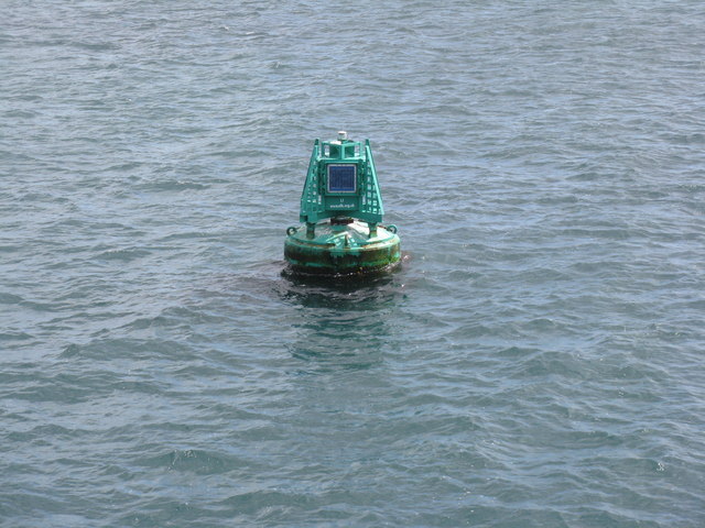
Vatem Images

Images are sourced within 2km of 57.707098/-7.03043 or Grid Reference NG0079. Thanks to Geograph Open Source API. All images are credited.

Grodhaigh, in the Sound of Harris Fish farming off one of the larger islands in the sound. Seen from the ferry to Berneray.
Grodhaigh, in the Sound of Harris
Fish farming off one of the larger islands in the sound. Seen from the ferry to Berneray.
Looking northwest to the trig point on Grodhaigh
South easterly tip of Grodhaigh looking towards Lingeigh
Gilsaigh An island at the eastern side of the Sound of Harris.
Gilsaigh
An island at the eastern side of the Sound of Harris.
Grodhaigh One of the largest of the many islets in the Sound of Harris.
Grodhaigh
One of the largest of the many islets in the Sound of Harris.
Gilsaigh An island at the east end of the Sound of Harris.
Gilsaigh
An island at the east end of the Sound of Harris.
Lingeigh The west side of the island.
Lingeigh
The west side of the island.
Sgarabhaigh Sheep grazing on the small island at the east end of the Sound of Harris.
Sgarabhaigh
Sheep grazing on the small island at the east end of the Sound of Harris.
Gousman Only the nearest part of this skerry is in square. In the distance is the Isle of Skye.
Gousman
Only the nearest part of this skerry is in square. In the distance is the Isle of Skye.
Gousman One of the many skerries in the Sound of Harris.
Gousman
One of the many skerries in the Sound of Harris.
L1 Starboard Lateral Buoy This green buoy marks the first of the buoys leading to Leverburgh and is located in the area where the buoyage changes.  Now the green buoys are to starboard when previously, on leaving Berneray, the red buoys were to starboard.  The buoy emits two green flashes every five seconds at night.
L1 Starboard Lateral Buoy
This green buoy marks the first of the buoys leading to Leverburgh and is located in the area where the buoyage changes. Now the green buoys are to starboard when previously, on leaving Berneray, the red buoys were to starboard. The buoy emits two green flashes every five seconds at night.
Sgeir Chruaidh Port Channel Marker Red and white pole which emits a flashing red light every five seconds at night.
Sgeir Chruaidh Port Channel Marker
Red and white pole which emits a flashing red light every five seconds at night.
Marker buoy for the Harris to Berneray ferry Unsure the direction of the image.
Marker buoy for the Harris to Berneray ferry
Unsure the direction of the image.
Buoy L1 off Sgeir Chruaidh In the Sound of Harris en route to Berneray.
Buoy L1 off Sgeir Chruaidh
In the Sound of Harris en route to Berneray.
Sgeir Chruaidh
Sgeir Chruaidh
Near Gousman in the Sound of Harris Taken from Loch Portain, the ferry that operates between Harris and Berneray.  Skye is the dominant landmass in the distance.
Near Gousman in the Sound of Harris
Taken from Loch Portain, the ferry that operates between Harris and Berneray. Skye is the dominant landmass in the distance.
Sgeir Chruaidh Sgeir Chruaidh is the skerry in the foreground. The distant island is Ceileagraigh (Killegray).
Sgeir Chruaidh
Sgeir Chruaidh is the skerry in the foreground. The distant island is Ceileagraigh (Killegray).
Sgeir Chruaidh Sgeir Chruaidh is a tidal skerry. In the background are the hills of South Harris.
Sgeir Chruaidh
Sgeir Chruaidh is a tidal skerry. In the background are the hills of South Harris.
Show me another place!

Vatem is located at Grid Ref: NG0079 (Lat: 57.707098, Lng: -7.03043)

Unitary Authority: Na h-Eileanan an Iar

Police Authority: Highlands and Islands

What 3 Words

///worthy.disband.burns. Near Leverburgh, Na h-Eileanan Siar

Nearby Locations

Vatem Grodhaigh

Related Wikis

Sgarabhaigh

Sgarabhaigh (formerly anglicised Scaravay) is a small uninhabited island in the eastern end of the Sound of Harris, Outer Hebrides, Scotland. It is approximately...

South Lewis, Harris and North Uist National Scenic Area

South Lewis, Harris and North Uist is a large national scenic area (NSA) in the Western Isles of Scotland. It is one of 40 such areas in Scotland, which...

Killegray

Killegray is an island in the Sound of Harris in the Outer Hebrides of Scotland. == Geography == Situated in the Sound of Harris, a channel of water between...

Rodel

Rodel (Scottish Gaelic: Roghadal) is a village on the south-eastern coast of Harris, an island in the Scottish Outer Hebrides. Rodel is situated in the...

St Clement's Church, Rodel

St Clement's Church (Scottish Gaelic: Tùr Chliamhainn, meaning Clement's Tower) is a late fifteenth-century or early sixteenth-century church in Rodel...

Hermetray

Hermetray (Scottish Gaelic: Theàrnatraigh) is an uninhabited island off North Uist, in the Outer Hebrides of Scotland. == Geography and geology == Hermetray...

Tahay

Tahay (Scottish Gaelic: Taghaigh) is an island in the Outer Hebrides of Scotland. The name originates from the Old Norse tagg-øy meaning island with a...

Sursaigh

Sursaigh (Scottish Gaelic: Sursaigh) is an island off North Uist in the Sound of Harris, Scotland. It lies 8 kilometres (5.0 mi) northeast of the village...

Nearby Amenities

Located within 500m of 57.707098,-7.03043
Source: PGS
Lat/Long: 57.7053361/-7.0298621
Source: PGS
Lat/Long: 57.7061679/-7.030903
Source: PGS
Lat/Long: 57.706366/-7.0308758
Source: PGS
Lat/Long: 57.7064696/-7.0307992
Source: PGS
Lat/Long: 57.7070969/-7.0314443
Source: PGS
Lat/Long: 57.7072496/-7.0314692
Source: PGS
Lat/Long: 57.7074996/-7.031024
Source: PGS
Lat/Long: 57.7078541/-7.0312113
Source: PGS
Lat/Long: 57.707499/-7.029399
Source: PGS
Lat/Long: 57.7069596/-7.0298192
Source: PGS
Lat/Long: 57.7061896/-7.0293792
Source: PGS
Lat/Long: 57.7056696/-7.0291692
The data included in this document is from www.openstreetmap.org. The data is made available under ODbL.

Have you been to Vatem?

Leave your review of Vatem below (or comments, questions and feedback).