Eilean a' Ghobha

Island in Inverness-shire

Scotland

Eilean a' Ghobha

Ruined buildings at Buaile-mhòr
Ruined buildings at Buaile-mhòr Credit: Toby Speight

Eilean a' Ghobha, also known as Island of the Smith, is a small island located in Inverness-shire, Scotland. Situated in Loch Broom, the island is approximately 30 acres in size and lies about a mile off the coast of Ullapool.

The island gets its name from the Gaelic word "Gobha," meaning "smith," which suggests that it may have been a place where blacksmiths once resided or where ironworking took place. Eilean a' Ghobha is uninhabited today, but it is believed to have been populated in the past due to the remnants of stone structures and burial cairns found on the island.

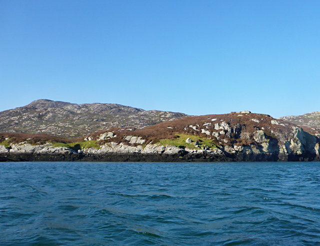
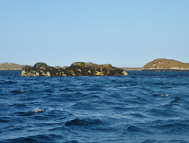
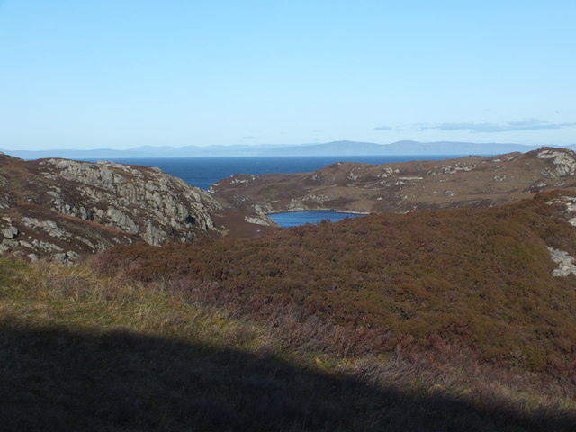
The island boasts stunning natural beauty, with rugged cliffs, rocky shores, and grassy slopes. It is a haven for birdwatchers, as various seabirds, including gulls and cormorants, can be spotted nesting on the cliffs. The surrounding waters are also home to seals, which can often be seen basking on the rocks.

Eilean a' Ghobha is accessible by boat, and visitors can explore the island's walking trails and enjoy breathtaking views of the surrounding landscape. It is a popular spot for picnicking, wildlife photography, and nature enthusiasts looking to immerse themselves in Scotland's natural wonders.

Overall, Eilean a' Ghobha is a picturesque island in Inverness-shire, offering visitors a glimpse into the region's history and a chance to experience the tranquility and beauty of the Scottish countryside.

If you have any feedback on the listing, please let us know in the comments section below.

Eilean a' Ghobha Images

Images are sourced within 2km of 57.493729/-7.2108961 or Grid Reference NF8756. Thanks to Geograph Open Source API. All images are credited.

Ruined buildings at Buaile-mhòr
Rubh' an t-Sagairt
Rubh' an t-Sagairt
Eilean na Hoe
Eilean na Hoe
Eilean Buidhe
Eilean Buidhe
Eilean nan Gearr The background hill is Eabhal.
Eilean nan Gearr
The background hill is Eabhal.
Islet off Eilean Dubh an Uan
Gearraidh Dubh Looking over the shore near Gearraidh Dubh towards Eabhal.
Gearraidh Dubh
Looking over the shore near Gearraidh Dubh towards Eabhal.
Loch na Faoileag on Grimsay One of many small islets on Loch na Faoileag on the Isle of Grimsay
Loch na Faoileag on Grimsay
One of many small islets on Loch na Faoileag on the Isle of Grimsay
Loch na Faoileag Shoreline A view along the shoreline to north west finger on Loch na Faoileag (Isle of Grimsay) .Taken on the opposite bank from the roadside.
Loch na Faoileag Shoreline
A view along the shoreline to north west finger on Loch na Faoileag (Isle of Grimsay) .Taken on the opposite bank from the roadside.
Loch na Faoileag Cairn A small cairn situated at the south-eastern end of Loch na Faoileag.
Loch na Faoileag Cairn
A small cairn situated at the south-eastern end of Loch na Faoileag.
Bagh Sgotbheinn Not all Hebridean buildings fall into disrepair. I note that Dave Fergusson's 2007 photograph includes this small building, but now, twelve years later it has a new roof and is looking well cared for.
Bagh Sgotbheinn
Not all Hebridean buildings fall into disrepair. I note that Dave Fergusson's 2007 photograph includes this small building, but now, twelve years later it has a new roof and is looking well cared for.
Kallin Harbour, Grimsay
Old harbour, Grimsay A crofthouse sitting on a reclaimed piece of land at Baymore (Bagh mor) which was the main harbour on the island before the Kallin (Ceallan) development.  The harbour is littered with lots of old creels and other flotsam and there are many old stone piers.
Old harbour, Grimsay
A crofthouse sitting on a reclaimed piece of land at Baymore (Bagh mor) which was the main harbour on the island before the Kallin (Ceallan) development. The harbour is littered with lots of old creels and other flotsam and there are many old stone piers.
The summit region of Grimsay Grimsay is a low island between North Uist and Benbecula. It is difficult to be certain of its highest point, but this eminence, 25m or so above Mean Sea Level, is a good contender.
The summit region of Grimsay
Grimsay is a low island between North Uist and Benbecula. It is difficult to be certain of its highest point, but this eminence, 25m or so above Mean Sea Level, is a good contender.
Kallin Harbour The smaller vessels in the harbour are inshore lobster boats which use creels to trap crabs and lobsters.  The larger vessels are offshore prawn boats which use trawl nets to catch the shellfish.
Kallin Harbour
The smaller vessels in the harbour are inshore lobster boats which use creels to trap crabs and lobsters. The larger vessels are offshore prawn boats which use trawl nets to catch the shellfish.
Cottage on Ronay Ronay
Cottage on Ronay
Ronay
Isle of Ronay View of the Isle of Skye across the Minch.
Isle of Ronay
View of the Isle of Skye across the Minch.
Isle of Ronay View towards North Uist
Isle of Ronay
View towards North Uist
Show me another place!

Eilean a' Ghobha is located at Grid Ref: NF8756 (Lat: 57.493729, Lng: -7.2108961)

Unitary Authority: Na h-Eileanan an Iar

Police Authority: Highlands and Islands

What 3 Words

///volunteered.direction.blossom. Near Balivanich, Na h-Eileanan Siar

Related Wikis

Grimsay

Grimsay (Scottish Gaelic: Griomasaigh) is a tidal island in the Outer Hebrides of Scotland. == Geography == Grimsay is the largest of the low-lying stepping...

Ronay

Ronay (Scottish Gaelic: Rònaigh) is an island in the Outer Hebrides of Scotland, which lies a short distance off the east coast of Grimsay. == Geography... ==

Fraoch-Eilean

Fraoch-eilean is a small island with an uncertain population north of Benbecula in the Outer Hebrides of Scotland. It is about 55 hectares (140 acres...

Baile Glas

Baile Glas or Ballaglasa (Scottish Gaelic: Am Baile Glas) is a settlement on Grimsay in the Outer Hebrides, Scotland. Ballaglasa is within the parish of...

Nearby Amenities

Located within 500m of 57.493729,-7.2108961
Bàgh Mhic Rath
Natural: bay
Lat/Long: 57.4961227/-7.2144771
The data included in this document is from www.openstreetmap.org. The data is made available under ODbL.

Have you been to Eilean a' Ghobha?

Leave your review of Eilean a' Ghobha below (or comments, questions and feedback).