Sgeir a' Bhanca

Island in Inverness-shire

Scotland

Sgeir a' Bhanca

Eriskay, seen from Rubha Mealabhaig on South Uist Eriskay is a fairly small island, perhaps best known as the location of "Whisky Galore". Its summit is Beinn Sciathan, 185m in <a href="https://www.geograph.org.uk/gridref/NF7911">NF7911</a>. The causeway from South Uist can be seen on the right, and beyond Eriskay is the island of Barra.
Eriskay, seen from Rubha Mealabhaig on South Uist Credit: Michael Earnshaw

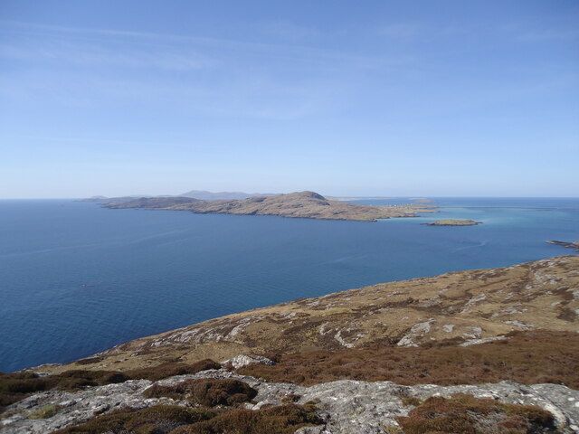
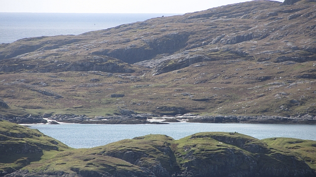
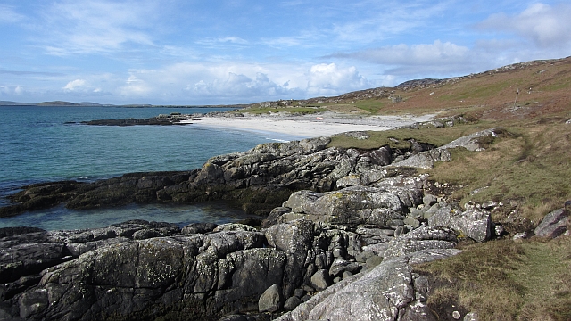
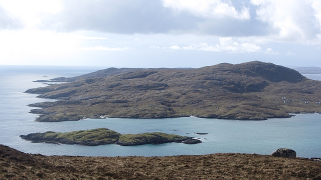
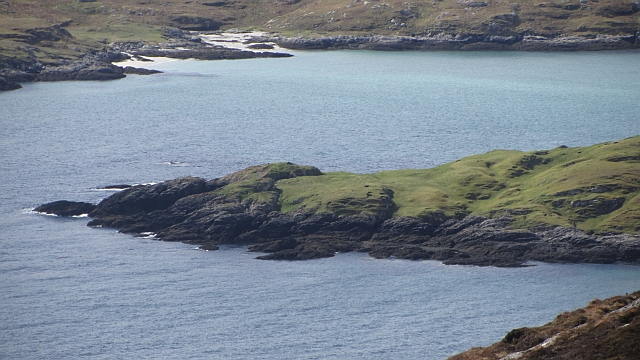
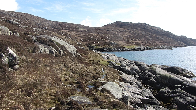
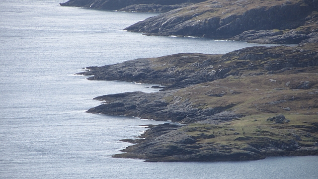
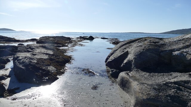
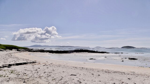
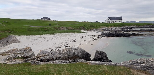
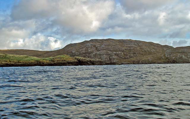
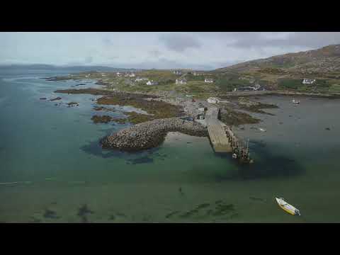
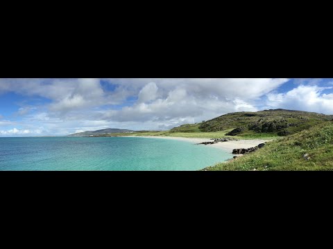
Sgeir a' Bhanca is a small, uninhabited island located off the coast of Inverness-shire in Scotland. It is situated in the innermost part of Loch Eriboll, a scenic sea loch on the country's northwestern coast. The island is roughly 0.14 hectares in size and is known for its distinctive rocky terrain and abundant wildlife.

The name Sgeir a' Bhanca translates to "the rock of the bench" in Gaelic, which aptly describes the island's appearance. It is primarily composed of rugged, exposed rocks that jut out from the surrounding water, creating a unique and picturesque landscape. The rocks are covered in various types of marine vegetation, contributing to the island's ecological diversity.

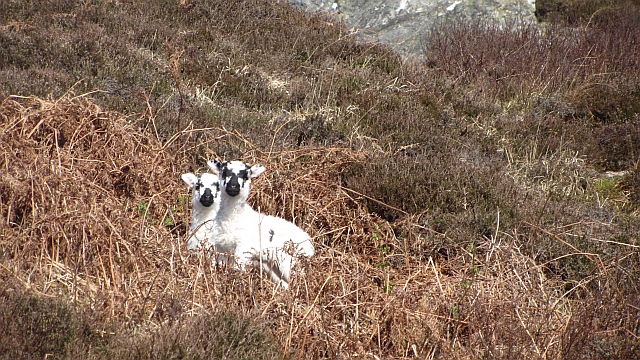
Despite its small size, Sgeir a' Bhanca is an important site for seabirds. The island's cliffs and ledges provide nesting grounds for species such as guillemots, razorbills, and kittiwakes. These birds can often be seen perched on the rocks or diving into the water in search of food.

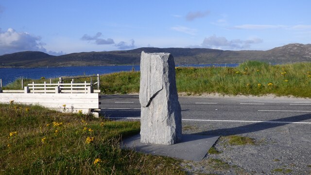
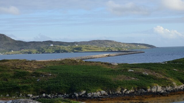
Visitors to Sgeir a' Bhanca can access the island by boat, as there are no regular ferry services or accommodations available. It is a popular destination for birdwatchers and nature enthusiasts who appreciate the island's remote and untouched beauty. However, it is important to note that Sgeir a' Bhanca is a protected area, so visitors should adhere to any restrictions or guidelines in place to preserve the island's fragile ecosystem.

If you have any feedback on the listing, please let us know in the comments section below.

Sgeir a' Bhanca Images

Images are sourced within 2km of 57.092767/-7.2932741 or Grid Reference NF7912. Thanks to Geograph Open Source API. All images are credited.

Eriskay, seen from Rubha Mealabhaig on South Uist Eriskay is a fairly small island, perhaps best known as the location of "Whisky Galore". Its summit is Beinn Sciathan, 185m in <a href="https://www.geograph.org.uk/gridref/NF7911">NF7911</a>. The causeway from South Uist can be seen on the right, and beyond Eriskay is the island of Barra.
Eriskay, seen from Rubha Mealabhaig on South Uist
Eriskay is a fairly small island, perhaps best known as the location of "Whisky Galore". Its summit is Beinn Sciathan, 185m in NF7911. The causeway from South Uist can be seen on the right, and beyond Eriskay is the island of Barra.
Sound of Eriskay shoreline The south coast of South Uist: low down the vegetation is a mix of heather and bracken with quite a few brambles.
Sound of Eriskay shoreline
The south coast of South Uist: low down the vegetation is a mix of heather and bracken with quite a few brambles.
Ròisinis Caolas Eirisgeigh, the Sound of Eriskay with a view over Calbhaigh (the island where the whisky exporting SS Politician ended up) from South Uist.  Ròisinis has several ruins and a path in from the now inhabited part of Eriskay.
Ròisinis
Caolas Eirisgeigh, the Sound of Eriskay with a view over Calbhaigh (the island where the whisky exporting SS Politician ended up) from South Uist. Ròisinis has several ruins and a path in from the now inhabited part of Eriskay.
Southern shore of South Uist White sandy beach and gneiss outcrops on the Sound of Eriskay.
Southern shore of South Uist
White sandy beach and gneiss outcrops on the Sound of Eriskay.
Southern shore of South Uist Gneiss outcropping on the Sound of Eriskay.
Southern shore of South Uist
Gneiss outcropping on the Sound of Eriskay.
Calbhaigh and  Caolas Eirisgeigh The small island between Eriskay and South Uist was the last resting place of the SS Politician and a large, but rapidly diminishing cargo of whisky. A view from Roineabhal on South Uist of the sea east of the Eriskay Causeway.
Calbhaigh and Caolas Eirisgeigh
The small island between Eriskay and South Uist was the last resting place of the SS Politician and a large, but rapidly diminishing cargo of whisky. A view from Roineabhal on South Uist of the sea east of the Eriskay Causeway.
Calbhaigh The eastern side of the island.
Calbhaigh
The eastern side of the island.
Path, south coast of South Uist A faint path speeds progress along the coast.
Path, south coast of South Uist
A faint path speeds progress along the coast.
Blackface lambs Moorland grazing on the south coast of South Uist.
Blackface lambs
Moorland grazing on the south coast of South Uist.
Fishbox Washed up on the shores of the Sound of Eriskay, a Royal Greenland fishbox, property of the government of Kalaallit Nunaat.  There were quite a few here from several places.
Fishbox
Washed up on the shores of the Sound of Eriskay, a Royal Greenland fishbox, property of the government of Kalaallit Nunaat. There were quite a few here from several places.
Ròisinis The northeastern corner of Eriskay.
Ròisinis
The northeastern corner of Eriskay.
Beinn Sciathan on Eriskay/Eiriosgaigh View from South Uist.
Beinn Sciathan on Eriskay/Eiriosgaigh
View from South Uist.
Rear of Stone Commemorating opening of Eriskay Causeway in 2002
Causeway between Eriskay and South Uist View from South Uist.
Causeway between Eriskay and South Uist
View from South Uist.
Tide turning on an Eriskay beach The tide is just lapping at the outer rocks on the beach.
Tide turning on an Eriskay beach
The tide is just lapping at the outer rocks on the beach.
Tide creeping up on an Eriskay shoreline The same rocky gully as in <a href="https://www.geograph.org.uk/photo/7246878">NF7811 : Tide turning on an Eriskay beach</a> two hours later, after an outdoor meal at the local restaurant. Just enough breeze to keep the midges away.
Tide creeping up on an Eriskay shoreline
The same rocky gully as in NF7811 : Tide turning on an Eriskay beach two hours later, after an outdoor meal at the local restaurant. Just enough breeze to keep the midges away.
Rubha Chlaidh on Eriskay Translating as 'the headland of the graveyard' it's easy to see why as the graveyard is on the top of the grassy rise.  This beach is the one Peter May, in his book "The Lewis Man", calls Charlie's Beach. See also  <a href="https://www.geograph.org.uk/photo/4543351">NF7811 : Rubha Chlaidh</a> for another view of the beach.
Rubha Chlaidh on Eriskay
Translating as 'the headland of the graveyard' it's easy to see why as the graveyard is on the top of the grassy rise. This beach is the one Peter May, in his book "The Lewis Man", calls Charlie's Beach. See also NF7811 : Rubha Chlaidh for another view of the beach.
Beach at Rubha Chlaidh
Show me another place!

Sgeir a' Bhanca is located at Grid Ref: NF7912 (Lat: 57.092767, Lng: -7.2932741)

Unitary Authority: Na h-Eileanan an Iar

Police Authority: Highlands and Islands

What 3 Words

///exotic.pump.mountain. Near Lochboisdale, Na h-Eileanan Siar

Related Wikis

St Michael's Church, Eriskay

St Michael's Church (also known as St Michael's of the Sea) is a Category C listed building in Eriskay, South Uist, Scotland. Of Roman Catholic denomination...

Beinn Sciathan

Ben Scrien, is the highest point on the Outer Hebridean island of Eriskay. Described as an apparently "uninspiring lump" (Michael Fitzpatrick, 2012) it...

Calvay

Calvay (Scottish Gaelic: Calbhaigh) is a currently uninhabited island situated in the Sound of Eriskay in the Outer Hebrides, at grid reference NF810126...

SS Politician

SS Politician was a cargo ship that ran aground off the coast of the Hebridean island of Eriskay in 1941. Her cargo included 22,000 cases of scotch whisky...

Related Videos

HIking the Hebridean Way - Day 2 Eriskay to Daliburgh

Day 2 of 12 hiking the Hebridean Way #Hebrideanway.

Eriskay 💚🏴󠁧󠁢󠁳󠁣󠁴󠁿💚

Music - Mauve - Here Comes The Sun.

Coast And Beaches On History Visit To Island Of Eriskay Outer Hebrides Of Scotland

Tour Scotland short travel video clip, with Scottish music, of the coast and beaches on ancestry, genealogy, history visit to Island of ...

Nearby Amenities

Located within 500m of 57.092767,-7.2932741
Power: pole
Lat/Long: 57.0888942/-7.2961476
Power: pole
Lat/Long: 57.0890553/-7.2953845
Power: pole
Lat/Long: 57.0889766/-7.2946738
Power: pole
Lat/Long: 57.0888709/-7.2938758
Power: pole
Lat/Long: 57.089279/-7.2928512
Power: pole
Lat/Long: 57.0890786/-7.2930349
Power: pole
Lat/Long: 57.0887915/-7.2932951
Power: pole
Lat/Long: 57.0884825/-7.2932857
Generator Method: photovoltaic
Generator Source: solar
Generator Type: solar_photovoltaic_panel
Power: generator
Lat/Long: 57.0887019/-7.2960363
Barrier: cattle_grid
Lat/Long: 57.0886534/-7.2956474
Bàgh na h-Aibhne Duibhe
Natural: bay
Lat/Long: 57.0904285/-7.2879268
Turning Circle
Lat/Long: 57.0893601/-7.2970038
An Sgeir Mhòr
Alt Name: Sgeir na h-Aibhne Duibhe
Place: locality
Lat/Long: 57.0901011/-7.2893494
Port Phàdruig
Natural: bay
Lat/Long: 57.090082/-7.2950468
A' Chreag Liath
Place: locality
Lat/Long: 57.0909681/-7.293725
The data included in this document is from www.openstreetmap.org. The data is made available under ODbL.

Have you been to Sgeir a' Bhanca?

Leave your review of Sgeir a' Bhanca below (or comments, questions and feedback).