Pòrt Phadruig

Bay in Inverness-shire

Scotland

Pòrt Phadruig

Eriskay, seen from Rubha Mealabhaig on South Uist Eriskay is a fairly small island, perhaps best known as the location of "Whisky Galore". Its summit is Beinn Sciathan, 185m in <a href="https://www.geograph.org.uk/gridref/NF7911">NF7911</a>. The causeway from South Uist can be seen on the right, and beyond Eriskay is the island of Barra.
Eriskay, seen from Rubha Mealabhaig on South Uist Credit: Michael Earnshaw

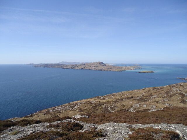
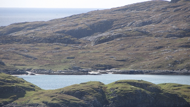
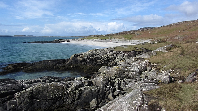
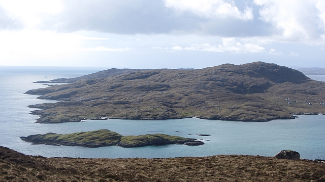
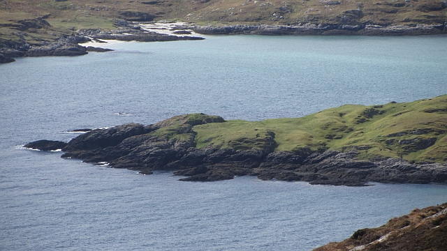
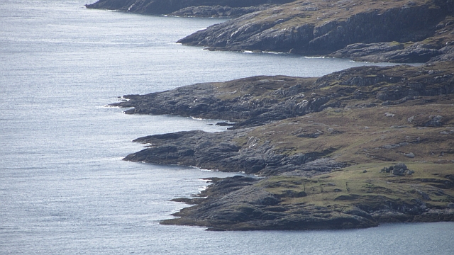
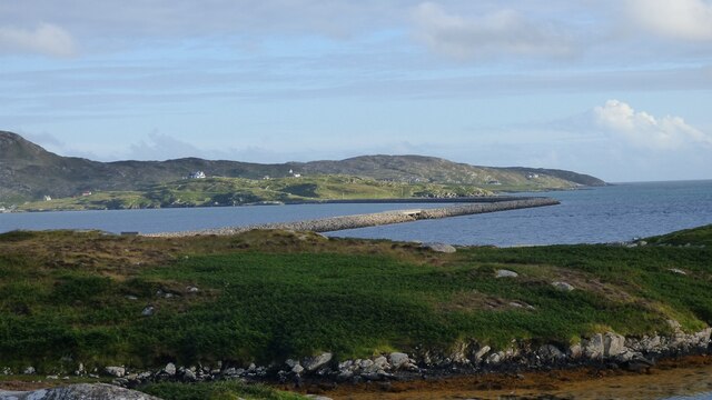
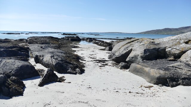
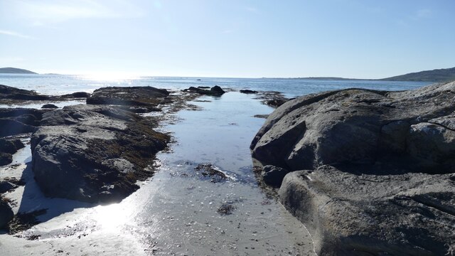
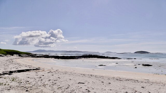
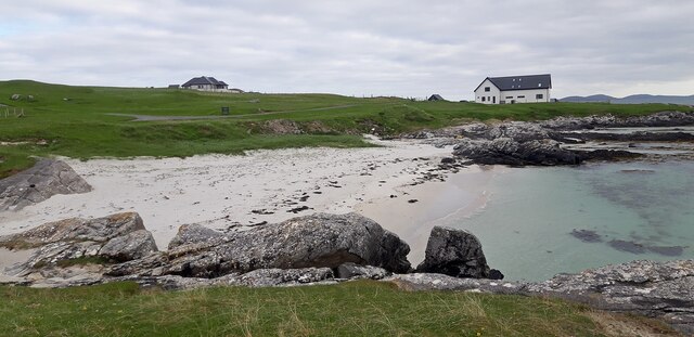
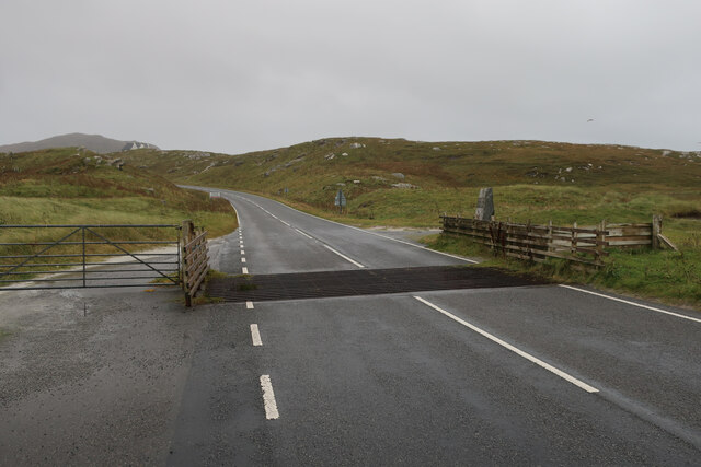
Port Phadruig, also known as Pòrt Phadruig in Scottish Gaelic, is a small bay located in Inverness-shire, Scotland. Situated on the rugged west coast of the Scottish Highlands, Port Phadruig is known for its stunning natural beauty and tranquil atmosphere.

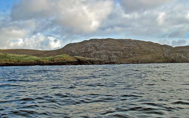
The bay is surrounded by dramatic cliffs and rolling hills, providing a picturesque backdrop for visitors to enjoy. The crystal-clear waters of the bay are often calm and peaceful, making it a popular spot for swimming, kayaking, and other water activities.

Port Phadruig is also a great place for wildlife enthusiasts, as the bay is home to a variety of seabirds and marine life. Visitors may spot seals basking on the rocks or dolphins playing in the surf.

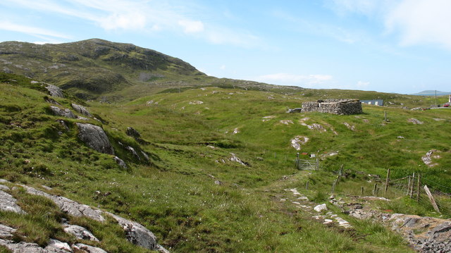
In addition to its natural beauty, Port Phadruig has a rich history and cultural significance. The bay was once a thriving fishing port, and remnants of old fishing huts and boats can still be seen along the shore.

Overall, Port Phadruig is a hidden gem in the Scottish Highlands, offering visitors a peaceful retreat from the hustle and bustle of everyday life. Whether you come to relax on the beach or explore the surrounding countryside, Port Phadruig is sure to leave a lasting impression on all who visit.

If you have any feedback on the listing, please let us know in the comments section below.

Pòrt Phadruig Images

Images are sourced within 2km of 57.090875/-7.2943922 or Grid Reference NF7912. Thanks to Geograph Open Source API. All images are credited.

Eriskay, seen from Rubha Mealabhaig on South Uist Eriskay is a fairly small island, perhaps best known as the location of "Whisky Galore". Its summit is Beinn Sciathan, 185m in <a href="https://www.geograph.org.uk/gridref/NF7911">NF7911</a>. The causeway from South Uist can be seen on the right, and beyond Eriskay is the island of Barra.
Eriskay, seen from Rubha Mealabhaig on South Uist
Eriskay is a fairly small island, perhaps best known as the location of "Whisky Galore". Its summit is Beinn Sciathan, 185m in NF7911. The causeway from South Uist can be seen on the right, and beyond Eriskay is the island of Barra.
Ròisinis Caolas Eirisgeigh, the Sound of Eriskay with a view over Calbhaigh (the island where the whisky exporting SS Politician ended up) from South Uist.  Ròisinis has several ruins and a path in from the now inhabited part of Eriskay.
Ròisinis
Caolas Eirisgeigh, the Sound of Eriskay with a view over Calbhaigh (the island where the whisky exporting SS Politician ended up) from South Uist. Ròisinis has several ruins and a path in from the now inhabited part of Eriskay.
Southern shore of South Uist White sandy beach and gneiss outcrops on the Sound of Eriskay.
Southern shore of South Uist
White sandy beach and gneiss outcrops on the Sound of Eriskay.
Calbhaigh and  Caolas Eirisgeigh The small island between Eriskay and South Uist was the last resting place of the SS Politician and a large, but rapidly diminishing cargo of whisky. A view from Roineabhal on South Uist of the sea east of the Eriskay Causeway.
Calbhaigh and Caolas Eirisgeigh
The small island between Eriskay and South Uist was the last resting place of the SS Politician and a large, but rapidly diminishing cargo of whisky. A view from Roineabhal on South Uist of the sea east of the Eriskay Causeway.
Calbhaigh The eastern side of the island.
Calbhaigh
The eastern side of the island.
Ròisinis The northeastern corner of Eriskay.
Ròisinis
The northeastern corner of Eriskay.
Beinn Sciathan on Eriskay/Eiriosgaigh View from South Uist.
Beinn Sciathan on Eriskay/Eiriosgaigh
View from South Uist.
Rear of Stone Commemorating opening of Eriskay Causeway in 2002
Causeway between Eriskay and South Uist View from South Uist.
Causeway between Eriskay and South Uist
View from South Uist.
Tide turning on an Eriskay beach The tide is just lapping at the outer rocks on the beach.
Tide turning on an Eriskay beach
The tide is just lapping at the outer rocks on the beach.
Tide creeping up on an Eriskay shoreline The same rocky gully as in <a href="https://www.geograph.org.uk/photo/7246878">NF7811 : Tide turning on an Eriskay beach</a> two hours later, after an outdoor meal at the local restaurant. Just enough breeze to keep the midges away.
Tide creeping up on an Eriskay shoreline
The same rocky gully as in NF7811 : Tide turning on an Eriskay beach two hours later, after an outdoor meal at the local restaurant. Just enough breeze to keep the midges away.
Rubha Chlaidh on Eriskay Translating as 'the headland of the graveyard' it's easy to see why as the graveyard is on the top of the grassy rise.  This beach is the one Peter May, in his book "The Lewis Man", calls Charlie's Beach. See also  <a href="https://www.geograph.org.uk/photo/4543351">NF7811 : Rubha Chlaidh</a> for another view of the beach.
Rubha Chlaidh on Eriskay
Translating as 'the headland of the graveyard' it's easy to see why as the graveyard is on the top of the grassy rise. This beach is the one Peter May, in his book "The Lewis Man", calls Charlie's Beach. See also NF7811 : Rubha Chlaidh for another view of the beach.
Beach at Rubha Chlaidh
Road onto Eriskay
Road onto Eriskay
Rosinish, Eriskay A rather soggy path leading through the old settlement at Rosinish.
Rosinish, Eriskay
A rather soggy path leading through the old settlement at Rosinish.
Ruined croft at Rosinish. Maybe this was once a traditional 'black house', though the windows look a trifle large. Note that the photographer's rather dated OS map shows the Anglicised 'Rosinish', whereas the up to date map extract on the website shows the Gaelic form [Roisinis].
Ruined croft at Rosinish.
Maybe this was once a traditional 'black house', though the windows look a trifle large. Note that the photographer's rather dated OS map shows the Anglicised 'Rosinish', whereas the up to date map extract on the website shows the Gaelic form [Roisinis].
The small island of Calbhaigh This attractive island is set in Caolas Eirisgeigh (Sound of Eriskay).
The small island of Calbhaigh
This attractive island is set in Caolas Eirisgeigh (Sound of Eriskay).
Beinn Sciathan from Rubha Basadearn
Show me another place!

Pòrt Phadruig is located at Grid Ref: NF7912 (Lat: 57.090875, Lng: -7.2943922)

Unitary Authority: Na h-Eileanan an Iar

Police Authority: Highlands and Islands

What 3 Words

///grandson.beaks.incursion. Near Lochboisdale, Na h-Eileanan Siar

Related Wikis

St Michael's Church, Eriskay

St Michael's Church (also known as St Michael's of the Sea) is a Category C listed building in Eriskay, South Uist, Scotland. Of Roman Catholic denomination...

Beinn Sciathan

Ben Scrien, is the highest point on the Outer Hebridean island of Eriskay. Described as an apparently "uninspiring lump" (Michael Fitzpatrick, 2012) it...

Calvay

Calvay (Scottish Gaelic: Calbhaigh) is a currently uninhabited island situated in the Sound of Eriskay in the Outer Hebrides, at grid reference NF810126...

SS Politician

SS Politician was a cargo ship that ran aground off the coast of the Hebridean island of Eriskay in 1941. Her cargo included 22,000 cases of scotch whisky...

Nearby Amenities

Located within 500m of 57.090875,-7.2943922
Passing Place
Lat/Long: 57.0881038/-7.2980769
Barrier: cattle_grid
Lat/Long: 57.0878025/-7.2971044
Bun a' Mhuilinn
Place: hamlet
Lat/Long: 57.0880934/-7.2910533
Power: pole
Lat/Long: 57.0871986/-7.2965392
Power: pole
Lat/Long: 57.0878056/-7.297014
Power: pole
Lat/Long: 57.0884636/-7.2975156
Power: pole
Lat/Long: 57.0888942/-7.2961476
Power: pole
Lat/Long: 57.0890553/-7.2953845
Power: pole
Lat/Long: 57.0889766/-7.2946738
Power: pole
Lat/Long: 57.0888709/-7.2938758
Power: pole
Lat/Long: 57.089279/-7.2928512
Power: pole
Lat/Long: 57.0890786/-7.2930349
Power: pole
Lat/Long: 57.0887915/-7.2932951
Power: pole
Lat/Long: 57.0884825/-7.2932857
Power: pole
Lat/Long: 57.0882056/-7.293271
Power: pole
Lat/Long: 57.0879688/-7.2932509
Power: pole
Lat/Long: 57.0875331/-7.2932361
Power: pole
Lat/Long: 57.0882647/-7.2882941
Power: pole
Lat/Long: 57.0880847/-7.2892061
Power: pole
Lat/Long: 57.0878668/-7.290279
Power: pole
Lat/Long: 57.0876977/-7.2911775
Power: pole
Lat/Long: 57.0874995/-7.2921002
Power: pole
Lat/Long: 57.086695/-7.2961544
Power: pole
Lat/Long: 57.0868772/-7.2952129
Power: pole
Lat/Long: 57.0870878/-7.2942138
Power: pole
Lat/Long: 57.0872824/-7.2932053
Generator Method: photovoltaic
Generator Source: solar
Generator Type: solar_photovoltaic_panel
Power: generator
Lat/Long: 57.0887019/-7.2960363
Barrier: cattle_grid
Lat/Long: 57.0871527/-7.2974264
Barrier: cattle_grid
Lat/Long: 57.0886534/-7.2956474
Passing Place
Lat/Long: 57.088131/-7.2899068
Passing Place
Lat/Long: 57.088526/-7.2873571
Bàgh na h-Aibhne Duibhe
Natural: bay
Lat/Long: 57.0904285/-7.2879268
Turning Circle
Lat/Long: 57.0893601/-7.2970038
Bun a' Mhuilinn
Traffic Sign: city_limit
Traffic Sign Direction: backward
Lat/Long: 57.0882468/-7.2972797
Haunn
Name En: Haun
Name Gd: Haunn
Traffic Sign: city_limit
Traffic Sign Direction: forward
Lat/Long: 57.0882508/-7.2972611
An Sgeir Mhòr
Alt Name: Sgeir na h-Aibhne Duibhe
Place: locality
Lat/Long: 57.0901011/-7.2893494
Rubha Fhraoich
Natural: cape
Lat/Long: 57.0886261/-7.2982941
Port Dhùghaill Eachainn
Natural: bay
Lat/Long: 57.0878529/-7.2992139
Port Phàdruig
Natural: bay
Lat/Long: 57.090082/-7.2950468
A' Chreag Liath
Place: locality
Lat/Long: 57.0909681/-7.293725
The data included in this document is from www.openstreetmap.org. The data is made available under ODbL.

Have you been to Pòrt Phadruig?

Leave your review of Pòrt Phadruig below (or comments, questions and feedback).