Eilean Poll Roinach

Island in Inverness-shire

Scotland

Eilean Poll Roinach

Loch Aineort
Loch Aineort Credit: Gordon Brown

Eilean Poll Roinach is a small island located in Inverness-shire, Scotland. It is situated in the picturesque Loch Maree, which is surrounded by beautiful mountains and forests. The island is approximately 0.6 hectares in size and is known for its stunning natural beauty and rich wildlife.

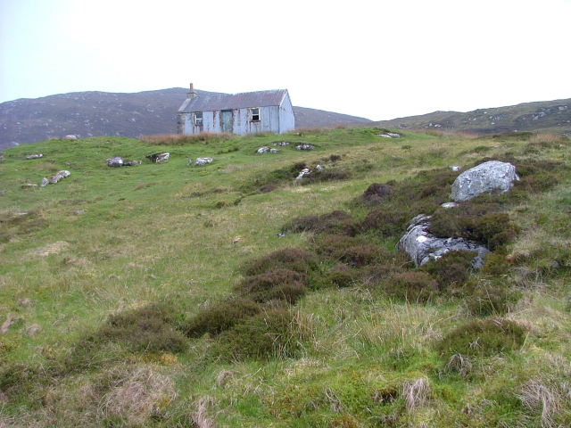
The island is predominantly covered in vegetation, with a mix of grasses, shrubs, and scattered trees. It provides a habitat for a variety of bird species, including the rare black-throated diver, as well as otters and other small mammals.

Eilean Poll Roinach has a long history, with evidence of human presence dating back to prehistoric times. The island is home to the ruins of an ancient chapel, which is believed to have been built in the early medieval period. The chapel is a popular destination for visitors, who can enjoy the peaceful surroundings and learn about the island's history.

Access to Eilean Poll Roinach is mainly by boat, as there are no bridges connecting it to the mainland. Visitors can hire boats or join guided tours to explore the island and its surroundings. The crystal-clear waters of Loch Maree make it a popular spot for fishing, and there are also opportunities for kayaking and other water-based activities.

Overall, Eilean Poll Roinach offers a tranquil and idyllic setting for nature lovers and those seeking a peaceful retreat. Its natural beauty, rich wildlife, and historical significance make it a must-visit destination in Inverness-shire.

If you have any feedback on the listing, please let us know in the comments section below.

Eilean Poll Roinach Images

Images are sourced within 2km of 57.229425/-7.3506553 or Grid Reference NF7728. Thanks to Geograph Open Source API. All images are credited.
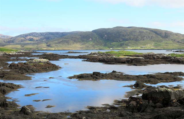
Loch Aineort
Loch Aineort
The path to Bagh Lathach The owner of this croft has done a superb job in constructing a series of good paths, picnic and rest areas etc, and has also planted a wide variety of native and exotic plants. This is the main path that leads from the road end towards Bagh Lathach.
The path to Bagh Lathach
The owner of this croft has done a superb job in constructing a series of good paths, picnic and rest areas etc, and has also planted a wide variety of native and exotic plants. This is the main path that leads from the road end towards Bagh Lathach.
View towards Beinn Mhor Taken from the tiny 'harbour' in a corner of Loch Aineort with the southern flanks of Beinn Mhor rising steeply in the background. This was an unusual afternoon for weather conditions, for while much of the island was rather grey and misty, the mountains broke up the cloud and made Loch Aineort a sun trap.
View towards Beinn Mhor
Taken from the tiny 'harbour' in a corner of Loch Aineort with the southern flanks of Beinn Mhor rising steeply in the background. This was an unusual afternoon for weather conditions, for while much of the island was rather grey and misty, the mountains broke up the cloud and made Loch Aineort a sun trap.
Afternoon snooze time Grey seals saving energy on a rocky reef in Loch Aineort.
Afternoon snooze time
Grey seals saving energy on a rocky reef in Loch Aineort.
Small boats, Loch Aineort Loch Aineort runs halfway across South Uist with a sheltered entrance from the Minch. The view is across the loch towards Stulabhal [374m] which is the highest of the hills in this shot.
Small boats, Loch Aineort
Loch Aineort runs halfway across South Uist with a sheltered entrance from the Minch. The view is across the loch towards Stulabhal [374m] which is the highest of the hills in this shot.
Looking out into Loch Aineort The view near the head of the sea loch looking towards where it begins to widen.
Looking out into Loch Aineort
The view near the head of the sea loch looking towards where it begins to widen.
The north Loch Aineort road Heading south east towards the second of two causeways across arms of this complex sea loch.
The north Loch Aineort road
Heading south east towards the second of two causeways across arms of this complex sea loch.
Head of Loch Aineort At this point one is only 4km from the west coast, but this long and convoluted sea loch is one that has its mouth on the east side of the island.
Head of Loch Aineort
At this point one is only 4km from the west coast, but this long and convoluted sea loch is one that has its mouth on the east side of the island.
Skerries in Loch Aineort
South Uist scene This view at Taobh a Deas, looking South-east - a former 'black house' which had been modernised, but is now roofless, can be seen in the distance
South Uist scene
This view at Taobh a Deas, looking South-east - a former 'black house' which had been modernised, but is now roofless, can be seen in the distance
Peat cuttings near Unasary The road along the southern side of Loch Eynort ends at Unasary.  Similar peat cuttings are a frequent roadside sight in South Uist.
Peat cuttings near Unasary
The road along the southern side of Loch Eynort ends at Unasary. Similar peat cuttings are a frequent roadside sight in South Uist.
Lazybeds by Loch Aineort Lazybeds are the traditional way of growing crops in small patches of soil. My thanks to Angus Campbell, who tells me that these ones were made by his father Neil, and that his father still cultivates them in 2008, albeit not on this site. <a href="https://www.geograph.org.uk/photo/1340713">NF7728 : Former Lazybeds by Loch Aineort</a> shows the same piece of land in 2008. Only potatoes can be grown, and Neil always plants Kerrs Pink. He starts by spreading seaweed on the ground in February, and then turns the soil to create the lazybeds. The seed potatoes are planted in April, and the crop is harvested from September onwards, depending on the weather. Angus also makes lazybeds, but he says they are not as good as his father's ones.
Lazybeds by Loch Aineort
Lazybeds are the traditional way of growing crops in small patches of soil. My thanks to Angus Campbell, who tells me that these ones were made by his father Neil, and that his father still cultivates them in 2008, albeit not on this site. NF7728 : Former Lazybeds by Loch Aineort shows the same piece of land in 2008. Only potatoes can be grown, and Neil always plants Kerrs Pink. He starts by spreading seaweed on the ground in February, and then turns the soil to create the lazybeds. The seed potatoes are planted in April, and the crop is harvested from September onwards, depending on the weather. Angus also makes lazybeds, but he says they are not as good as his father's ones.
Head of Loch Aineort
Deserted Corrugated House In the early 1900's, many houses were constructed using corrugated iron then v-lined inside with wood.
Deserted Corrugated House
In the early 1900's, many houses were constructed using corrugated iron then v-lined inside with wood.
Croft Building At the head of Loch Aineort.
Croft Building
At the head of Loch Aineort.
Loch Aineort From Airidh nam Ban.
Loch Aineort
From Airidh nam Ban.
Ruin by the loch. An excellent path leads from the road end on the north side of Loch Aineort to a ruined croft above the loch. Recent path improvements have included the provision of a 'stone settee' for those who wish to sit and admire the view.
Ruin by the loch.
An excellent path leads from the road end on the north side of Loch Aineort to a ruined croft above the loch. Recent path improvements have included the provision of a 'stone settee' for those who wish to sit and admire the view.
Small jetty by Loch Aineort Not shown on the OS map, this small jetty appears to be for private use.
Small jetty by Loch Aineort
Not shown on the OS map, this small jetty appears to be for private use.
Show me another place!

Eilean Poll Roinach is located at Grid Ref: NF7728 (Lat: 57.229425, Lng: -7.3506553)

Unitary Authority: Na h-Eileanan an Iar

Police Authority: Highlands and Islands

What 3 Words

///rentals.costs.downs. Near Lochboisdale, Na h-Eileanan Siar

Related Wikis

Milton (South Uist)

Milton (Scottish Gaelic: Geàrraidh Bhailteas) is the name of a tack or tenant farm on the island of South Uist in the Outer Hebrides, Scotland. It was...

Bornish

Bornish (Scottish Gaelic: Bòrnais) is a village and community council area on South Uist in the Outer Hebrides, Scotland. Bornish is also within the civil...

South Uist

South Uist (Scottish Gaelic: Uibhist a Deas, [ˈɯ.ɪʃtʲ ə ˈtʲes̪] ; Scots: Sooth Uist) is the second-largest island of the Outer Hebrides in Scotland. At...

Beinn Mhòr (South Uist)

Beinn Mhòr is a mountain on the island of South Uist in the Outer Hebrides of Scotland. With a height of 620 metres (2,034 ft), it is the highest point...

Nearby Amenities

Located within 500m of 57.229425,-7.3506553
Created By: dmgroom_coastlines
Lat/Long: 57.22873/-7.34766
Taobh a Deas Loch Aineort
Name En: South Locheynort
Name Gd: Taobh a Deas Loch Aineort
Place: hamlet
Lat/Long: 57.2299293/-7.3551
Barrier: cattle_grid
Lat/Long: 57.2255251/-7.3504445
Power: pole
Lat/Long: 57.2257705/-7.3518115
Power: pole
Lat/Long: 57.2268304/-7.3525545
Power: pole
Lat/Long: 57.2264079/-7.3522434
Power: pole
Lat/Long: 57.2273226/-7.3528978
Generator Method: wind_turbine
Generator Source: wind
Generator Type: horizontal_axis
Power: generator
Lat/Long: 57.2270453/-7.3536059
Barrier: cattle_grid
Lat/Long: 57.2272994/-7.3524392
Power: pole
Lat/Long: 57.2279226/-7.3533283
Power: pole
Lat/Long: 57.228503/-7.3537481
Power: pole
Lat/Long: 57.2290373/-7.3538902
Power: pole
Lat/Long: 57.2296078/-7.3540431
Power: pole
Lat/Long: 57.2302786/-7.3545957
Power: pole
Lat/Long: 57.2308883/-7.3550731
Power: pole
Lat/Long: 57.23144/-7.3555317
Power: pole
Lat/Long: 57.232613/-7.3564947
Power: pole
Lat/Long: 57.2322181/-7.3561379
Power: pole
Lat/Long: 57.225024/-7.350374
Power: pole
Lat/Long: 57.2251388/-7.3513476
Rubha Roinich
Natural: cape
Lat/Long: 57.2274744/-7.3439723
The data included in this document is from www.openstreetmap.org. The data is made available under ODbL.

Have you been to Eilean Poll Roinach?

Leave your review of Eilean Poll Roinach below (or comments, questions and feedback).