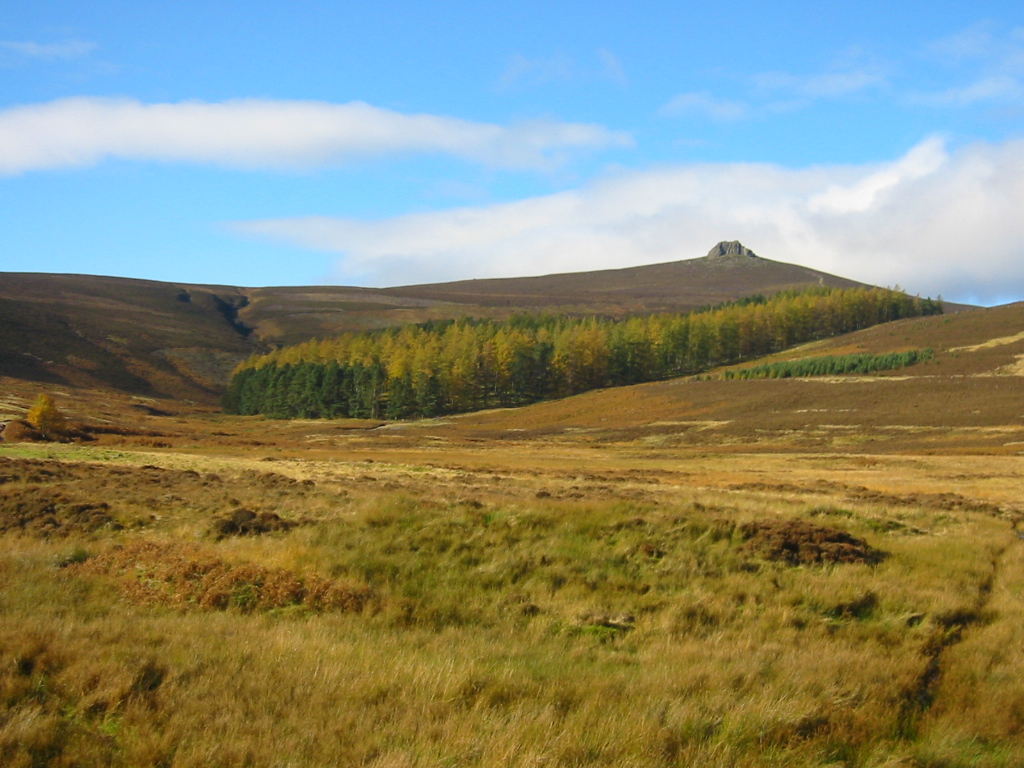
Corriereoch

Corrie (Glacial Valley) in Kincardineshire

Scotland

Corriereoch

Kettock Burn Kettock Burn is immediately below.  Hazly Grain joins it below Wolf Hill.  Clouds are touching the summit of Mount Battock in the distance.  A few minutes earlier a lone deer had been startled by my arrival from downwind and had taken off at high speed.
Kettock Burn Credit: Nigel Corby

Corriereoch, also known as Corrie (Glacial Valley), is a small village located in the region of Kincardineshire, Scotland. Situated in the northeastern part of the country, Corriereoch is surrounded by stunning natural landscapes and offers a tranquil and picturesque setting.

The village derives its name from the Gaelic term "corrie," which means a glacial valley, reflecting the area's geographical features. Nestled amidst rolling hills and green countryside, Corriereoch boasts breathtaking views of the surrounding mountains and is a haven for nature enthusiasts.

Despite its small size, Corriereoch is home to a close-knit community that takes pride in its rich heritage and local traditions. The village has a long history, with evidence of human occupation dating back centuries. Today, it retains its traditional charm, with well-preserved stone buildings, quaint cottages, and a peaceful atmosphere.

Corriereoch offers a range of outdoor activities for visitors and locals alike. The area is renowned for its excellent hiking trails, allowing explorers to immerse themselves in the stunning Scottish countryside. The nearby glacial valleys and mountain ranges provide ample opportunities for climbing, biking, and wildlife spotting.

While Corriereoch may be a tranquil escape, it is also conveniently located near larger towns and cities. Nearby attractions include historical sites, museums, and coastal areas, offering a variety of experiences for those looking to explore beyond the village's borders.

In summary, Corriereoch is a captivating village nestled in the glacial valleys of Kincardineshire, Scotland. With its natural beauty, friendly community, and range of outdoor activities, it is a hidden gem for those seeking a peaceful retreat in the Scottish countryside.

If you have any feedback on the listing, please let us know in the comments section below.

Corriereoch Images

Images are sourced within 2km of 56.922203/-2.6487278 or Grid Reference NO6081. Thanks to Geograph Open Source API. All images are credited.

Kettock Burn Kettock Burn is immediately below.  Hazly Grain joins it below Wolf Hill.  Clouds are touching the summit of Mount Battock in the distance.  A few minutes earlier a lone deer had been startled by my arrival from downwind and had taken off at high speed.
Kettock Burn
Kettock Burn is immediately below. Hazly Grain joins it below Wolf Hill. Clouds are touching the summit of Mount Battock in the distance. A few minutes earlier a lone deer had been startled by my arrival from downwind and had taken off at high speed.
Waird of Kettock Heather covered hillside.
Waird of Kettock
Heather covered hillside.
Wolf Hill
Wolf Hill
Glen Dye The landrover track & Water of Dye at Patons Heugh.  The landrover tracks in this area are very good probably put in place to service the hunting business on the estate.
Glen Dye
The landrover track & Water of Dye at Patons Heugh. The landrover tracks in this area are very good probably put in place to service the hunting business on the estate.
No room at the  inn An old stable block adjacent to the Water of Charr. Very wet inside on the day of my visit but would provide shelter if the need arose. The path shown leads to the summit of Meluncart.
No room at the inn
An old stable block adjacent to the Water of Charr. Very wet inside on the day of my visit but would provide shelter if the need arose. The path shown leads to the summit of Meluncart.
Charr At Charr in Glen Dye mid afternoon in January just before the sun went behind the hills.  The building on the right contains the bothy which walkers can use.
Charr
At Charr in Glen Dye mid afternoon in January just before the sun went behind the hills. The building on the right contains the bothy which walkers can use.
Water of Dye Looking downstream towards an area of weathered granite.
Water of Dye
Looking downstream towards an area of weathered granite.
Road by Water of Dye The local granite weathers into a good road surface gravel.
Road by Water of Dye
The local granite weathers into a good road surface gravel.
Tussocks below Rough Bank Rough moorland south of Glen Dye with a view towards Mount Battock.
Tussocks below Rough Bank
Rough moorland south of Glen Dye with a view towards Mount Battock.
View towards Mount Battock Miles of moorland, but probable that there will be wind turbines here by the time you read this.
View towards Mount Battock
Miles of moorland, but probable that there will be wind turbines here by the time you read this.
White Shank Hills covered in deep peat, much of which will soon be carbon dioxide after the bog is dug up for wind turbines.
White Shank
Hills covered in deep peat, much of which will soon be carbon dioxide after the bog is dug up for wind turbines.
Cross at your peril! This footbridge over the Water of Charr has had its day and would not look out of place on the set of an Indianan Jones film. The landrover track next to the Water of Charr has now been extended to a roofless ruin shown on the OS maps at ref. 605 796
Cross at your peril!
This footbridge over the Water of Charr has had its day and would not look out of place on the set of an Indianan Jones film. The landrover track next to the Water of Charr has now been extended to a roofless ruin shown on the OS maps at ref. 605 796
Beautiful wintery day in Glen Dye Approaching the confluence of Water of Dye and Water of Charr. The stand of pine trees, bridge and roof of the bothy are visible
Beautiful wintery day in Glen Dye
Approaching the confluence of Water of Dye and Water of Charr. The stand of pine trees, bridge and roof of the bothy are visible
Looking up Water of Charr from Charr Bothy Charr Bothy is a well maintained MBA managed bothy open to all for overnight use. The small building beyond is a rough animal shelter.
Looking up Water of Charr from Charr Bothy
Charr Bothy is a well maintained MBA managed bothy open to all for overnight use. The small building beyond is a rough animal shelter.
View from inside Charr Bothy Looking up the Water of Charr over the bridge and past the small stand of pine trees.
View from inside Charr Bothy
Looking up the Water of Charr over the bridge and past the small stand of pine trees.
Scots Pine near Charr Bothy One of the few areas of trees in the glen, which is almost exclusively grouse moor (and threatened by wind farm developers).
Scots Pine near Charr Bothy
One of the few areas of trees in the glen, which is almost exclusively grouse moor (and threatened by wind farm developers).
Looking down the Water of Dye
The path to Charr bothy Glen Dye was deserted on a perfect June day apart from a wedding party at Charr bothy visible in the distance.   The bothy is the remnant of a township abandoned in the 19th Century; see Canmore record 36156 for more: <span class="nowrap"><a title="https://canmore.org.uk/site/36156/charr" rel="nofollow ugc noopener" href="https://canmore.org.uk/site/36156/charr">Link</a><img style="margin-left:2px;" alt="External link" title="External link - shift click to open in new window" src="https://s1.geograph.org.uk/img/external.png" width="10" height="10"/></span> .
The path to Charr bothy
Glen Dye was deserted on a perfect June day apart from a wedding party at Charr bothy visible in the distance. The bothy is the remnant of a township abandoned in the 19th Century; see Canmore record 36156 for more: LinkExternal link .
Show me another place!

Corriereoch is located at Grid Ref: NO6081 (Lat: 56.922203, Lng: -2.6487278)

Unitary Authority: Aberdeenshire

Police Authority: North East

What 3 Words

///trending.charm.formal. Near Laurencekirk, Aberdeenshire

Nearby Locations

Corriereoch

Related Wikis

Cairn O' Mounth

Cairn O' Mounth/Cairn O' Mount (Scottish Gaelic: Càrn Mhon) is a high mountain pass in Aberdeenshire, Scotland. The place name is a survival of the ancient...

Clachnaben

Clachnaben (archaically "Cloch-na'bain"; Scottish Gaelic: "Clach na Beinne") is a 589-metre hill in Glen Dye, Aberdeenshire, Scotland. It is a distinctive...

Colmeallie stone circle

The Colmeallie stone circle is a recumbent stone circle in Glen Esk, Angus, Scotland. It is located 8 km north of Edzell at Colmeallie Farm, adjacent to...

Mount Battock

Mount Battock (778 m) is a mountain in the Mounth on the eastern edge of the Scottish Highlands, on the border between Aberdeenshire and Angus. A rounded...

Milden, Angus

Milden is a hamlet, estate and farmstead in Glenesk, Angus, Scotland. It is situated in the upper course of the Glen Esk valley, where the Burn of Turret...

Fasque House

Fasque, also known as Fasque House or Fasque Castle, is a mansion in Aberdeenshire, Scotland, situated near the village of Fettercairn, in the former county...

Fettercairn distillery

Fettercairn distillery is a whisky distillery in Fettercairn. Situated under the Grampian foothills in the Howe of Mearns, Fettercairn town’s name is...

Drumtochty Forest

Drumtochty Forest is a coniferous woodland in Kincardineshire, Scotland. In earlier times this forest was associated with Drumtochty Castle. Other notable...

Have you been to Corriereoch?

Leave your review of Corriereoch below (or comments, questions and feedback).