Corrie Breac

Corrie (Glacial Valley) in Angus

Scotland

Corrie Breac

View from hectad NO57 to hectad NO58 A view from West Wirren across the northern section of hectad NO57 (hopefully to be completed today, weather permitting) to Mount Battock - the highest point in adjacent hectad NO58. West Wirren and Mount Battock are roughly "one hectad's width" apart, providing a nice example of scale "map to ground". The image was taken in early August, with heather in bloom, flowering earlier and more vigorously on upper, south facing slopes.
View from hectad NO57 to hectad NO58 Credit: William Starkey

Corrie Breac, located in the Angus region of Scotland, is a picturesque glacial valley known for its stunning natural beauty and unique geological formations. Also referred to as Corrie, this area is characterized by its rugged landscape, steep slopes, and deep hollows, all carved out by glacial ice during the last Ice Age.

Nestled amidst the Grampian Mountains, Corrie Breac offers visitors a glimpse into the powerful forces of nature that shaped the Scottish countryside. The valley is surrounded by towering peaks, including Mount Keen, which stands as the highest peak in the area. The valley itself is a result of glacial erosion, with its U-shaped profile and steep sides creating a dramatic and awe-inspiring scenery.

Corrie Breac is also home to several small lochs and waterfalls, adding to its charm and tranquility. These bodies of water, fed by mountain streams, create a soothing ambiance and offer a habitat for various aquatic species.

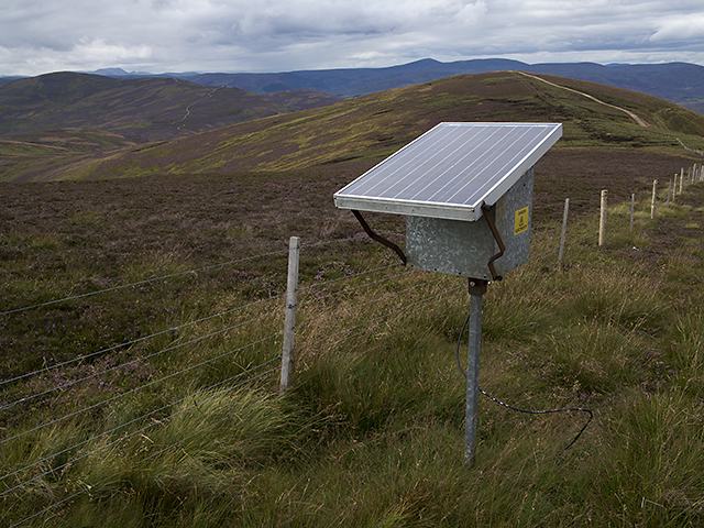
This region is a haven for outdoor enthusiasts and nature lovers alike. Hiking and mountaineering are popular activities, with numerous trails and paths to explore. The panoramic views from the valley provide a breathtaking backdrop for photographers and artists seeking inspiration.

In addition to its natural beauty, Corrie Breac boasts a rich biodiversity. The valley supports a variety of plant and animal species, including rare alpine plants, birds of prey, and mammals such as red deer and mountain hares.

Corrie Breac offers a unique opportunity to experience the raw power and beauty of Scotland's glacial past. Whether seeking adventure or simply a peaceful retreat, this glacial valley promises an unforgettable experience for all who visit.

If you have any feedback on the listing, please let us know in the comments section below.

Corrie Breac Images

Images are sourced within 2km of 56.861311/-2.7907515 or Grid Reference NO5174. Thanks to Geograph Open Source API. All images are credited.

View from hectad NO57 to hectad NO58 A view from West Wirren across the northern section of hectad NO57 (hopefully to be completed today, weather permitting) to Mount Battock - the highest point in adjacent hectad NO58. West Wirren and Mount Battock are roughly "one hectad's width" apart, providing a nice example of scale "map to ground". The image was taken in early August, with heather in bloom, flowering earlier and more vigorously on upper, south facing slopes.
View from hectad NO57 to hectad NO58
A view from West Wirren across the northern section of hectad NO57 (hopefully to be completed today, weather permitting) to Mount Battock - the highest point in adjacent hectad NO58. West Wirren and Mount Battock are roughly "one hectad's width" apart, providing a nice example of scale "map to ground". The image was taken in early August, with heather in bloom, flowering earlier and more vigorously on upper, south facing slopes.
Track servicing grouse butts above Auchowrie near Brechin Position is approximate as the track does not appear on the map but obviously runs fairly close to the butts which are marked.
Track servicing grouse butts above Auchowrie near Brechin
Position is approximate as the track does not appear on the map but obviously runs fairly close to the butts which are marked.
Heather slope above Auchowrie near Brechin Miles and miles of managed grouse moor in the background.
Heather slope above Auchowrie near Brechin
Miles and miles of managed grouse moor in the background.
Hide by track above Auchowrie in Glen Lethnot near Brechin Not sure whether it is a hide from the grouse or the weather - more likely a two-faced butt though, as it is not of an age with the track whose builders would not have tolerated such poor accommodation anyway.
Hide by track above Auchowrie in Glen Lethnot near Brechin
Not sure whether it is a hide from the grouse or the weather - more likely a two-faced butt though, as it is not of an age with the track whose builders would not have tolerated such poor accommodation anyway.
A full-blooded butt in its prime above Auchowrie near Brechin A rather picturesque trench.
A full-blooded butt in its prime above Auchowrie near Brechin
A rather picturesque trench.
Heather slope to the north-east of new track above Auchowrie near Brechin
Top pasture above Auchowrie near Brechin How much more of this hillside could be this colour? If sheep could fly low and fast I wonder if heather would be relegated to the flower border?
Top pasture above Auchowrie near Brechin
How much more of this hillside could be this colour? If sheep could fly low and fast I wonder if heather would be relegated to the flower border?
Track end above Auchowrie near Brechin Again an approximation as there is no track mapped.
Track end above Auchowrie near Brechin
Again an approximation as there is no track mapped.
Grouse moor but prime real-estate for rabbits above Auchowrie near Brechin
Boulder on slope above Auchowrie near Brechin
North side of Hill of Wirren View out to West Wirren.
North side of Hill of Wirren
View out to West Wirren.
Craigangower Looking towards Craigangower. New bulldozed track all the way to the summit from Hill of Wirren.
Craigangower
Looking towards Craigangower. New bulldozed track all the way to the summit from Hill of Wirren.
Road and butts on Hill of Wirren Looking up Glen Esk towards Mount Keen.
Road and butts on Hill of Wirren
Looking up Glen Esk towards Mount Keen.
Looking across the steep-sided Darnich valley The Hill of Wirren (678m in <a href="https://www.geograph.org.uk/gridref/NO5273">NO5273</a>) is at the valley head.
Looking across the steep-sided Darnich valley
The Hill of Wirren (678m in NO5273) is at the valley head.
Hill of Wirren Moorland and boggy ground east of the summit cairn on the Hill of Wirren. Cultivated farmland can be seen in the distance, together with the Montrose Basin and the North Sea.
Hill of Wirren
Moorland and boggy ground east of the summit cairn on the Hill of Wirren. Cultivated farmland can be seen in the distance, together with the Montrose Basin and the North Sea.
Moorland between Black Hill and West Wirren Heather growing on steep ground between Black Hill and West Wirren, with one of many shooting butts visible in the centre of the image. East Knock and West Knock can be seen in the distance.
Moorland between Black Hill and West Wirren
Heather growing on steep ground between Black Hill and West Wirren, with one of many shooting butts visible in the centre of the image. East Knock and West Knock can be seen in the distance.
Moorland west of Black Hill The western flank of Black Hill, viewed over the course of the Burn of Keenie, with East and West Knock Hills visible in the distance.
Moorland west of Black Hill
The western flank of Black Hill, viewed over the course of the Burn of Keenie, with East and West Knock Hills visible in the distance.
The Electric Shepherd The Electric Shepherd, which appears to be a solar powered charging device for electric fencing.
The Electric Shepherd
The Electric Shepherd, which appears to be a solar powered charging device for electric fencing.
Show me another place!

Corrie Breac is located at Grid Ref: NO5174 (Lat: 56.861311, Lng: -2.7907515)

Unitary Authority: Angus

Police Authority: Tayside

What 3 Words

///passports.magpie.grinning. Near Brechin, Angus

Nearby Locations

Corrie Breac West Wirren

Related Wikis

Milden, Angus

Milden is a hamlet, estate and farmstead in Glenesk, Angus, Scotland. It is situated in the upper course of the Glen Esk valley, where the Burn of Turret...

Tarfside

Tarfside is a small hamlet in Angus, Scotland. It is situated in Glen Esk, on the upper course of the River North Esk, around 8 miles north of Edzell,...

Colmeallie stone circle

The Colmeallie stone circle is a recumbent stone circle in Glen Esk, Angus, Scotland. It is located 8 km north of Edzell at Colmeallie Farm, adjacent to...

Edzell Castle

Edzell Castle is a ruined 16th-century castle, with an early-17th-century walled garden. It is located close to Edzell, and is around 5 miles (8 km) north...

Caterthun

Caterthun, or the Caterthuns, is a ridge of hills near the city of Brechin in Angus, Scotland. The Caterthuns are notable for being the site of two Iron...

Invermark Castle

Invermark Castle is an oblong tower house dating from the 16th century, at the east of Loch Lee, Angus, Scotland. It is near the head of Glen Esk. ��2...

Five Glens of Angus

The Five Glens of Angus are the five Highland glens located in the western portion of the Angus region of Scotland. The five glens from westernmost to...

Have you been to Corrie Breac?

Leave your review of Corrie Breac below (or comments, questions and feedback).