Corrie of Wester Lethnot
Corrie (Glacial Valley) in Angus
Scotland
Corrie of Wester Lethnot

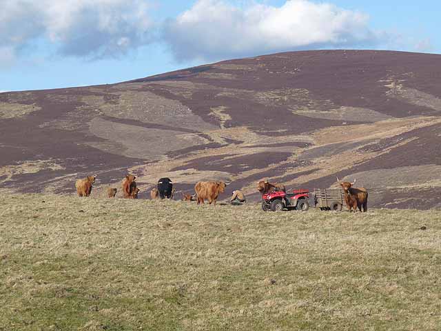
Corrie of Wester Lethnot is a glacial valley located in Angus, Scotland. Nestled within the picturesque Cairngorms National Park, this natural wonder showcases the stunning beauty of the Scottish Highlands. The corrie, also known as a cirque or a cwm, is a bowl-shaped hollow at the head of a glen, formed by glacial erosion.
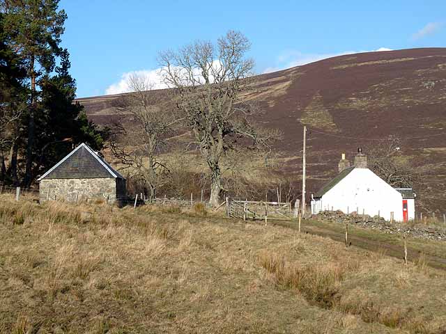
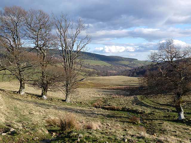
Surrounded by towering peaks and rugged cliffs, Corrie of Wester Lethnot is a popular destination for nature enthusiasts and hikers. The valley is accessible via several hiking trails, providing visitors with the opportunity to explore its awe-inspiring landscape. The terrain is characterized by steep slopes, rocky outcrops, and remnants of ancient glaciers.
The corrie is home to a variety of flora and fauna, including heather, mosses, and mountain birds such as ptarmigan and golden eagles. The valley also features a small loch, adding to its scenic charm. In addition to its natural beauty, Corrie of Wester Lethnot holds significant geological importance, providing valuable insights into Scotland's glacial history.
Visitors to Corrie of Wester Lethnot can enjoy breathtaking panoramic views, tranquil surroundings, and the chance to immerse themselves in the rugged beauty of the Scottish Highlands. The area offers opportunities for hiking, photography, birdwatching, and simply appreciating the serenity of nature. Whether exploring the valley's trails or simply taking in the awe-inspiring landscape, Corrie of Wester Lethnot is a remarkable destination for those seeking a true Scottish wilderness experience.
If you have any feedback on the listing, please let us know in the comments section below.
Corrie of Wester Lethnot Images
Images are sourced within 2km of 56.765442/-3.0395514 or Grid Reference NO3664. Thanks to Geograph Open Source API. All images are credited.


Corrie of Wester Lethnot is located at Grid Ref: NO3664 (Lat: 56.765442, Lng: -3.0395514)
Unitary Authority: Angus
Police Authority: Tayside
What 3 Words
///habits.monkey.dominate. Near Kirriemuir, Angus
Nearby Locations
Related Wikis

Mile Hill, Dykehead
There is another Mile Hill nearby which is a MarilynMile Hill is located in Angus, Scotland, 1000 metres west of Dykehead. It is a circular hill rising...

Cortachy
Cortachy is a village in Angus, Scotland. It lies in at the mouth of Glen Clova, on the River South Esk, four miles north of Kirriemuir. Nearby lies Cortachy...

Cat Law
Cat Law (671 m) is a hill in the southern Mounth of Scotland, north of Kirriemuir in Angus. A rounded peak, it lies above Strathmore in the south and offers...

Cortachy Castle
Cortachy Castle is a castellated mansion House at Cortachy, Angus, Scotland, some four miles north of Kirriemuir. The present building dates from the 15th...

Ascreavie
Ascreavie is a country house in Angus, Scotland. It is located 2 kilometres (1.2 mi) north of Kirkton of Kingoldrum, and 6 kilometres (3.7 mi) north-west...

Inverquharity Castle
Inverquharity Castle is a 15th-century tower house in Angus, Scotland. It lies around 4.5 kilometres (2.8 mi) north-east of Kirriemuir near the River South...

Inverquharity
Inverquharity is a Roman fortlet in Scotland, close to the Highland Line about 5 miles (8 km) north of Kirriemuir, Angus. Although very little archaeological...

Memus
Memus is a small village in Angus, Scotland, north of Kirriemuir. It is home to the Drovers Pub. A story is told of a kelpie at Shielhill Bridge, leaving...
Have you been to Corrie of Wester Lethnot?
Leave your review of Corrie of Wester Lethnot below (or comments, questions and feedback).