Coire Grealach
Corrie (Glacial Valley) in Banffshire
Scotland
Coire Grealach

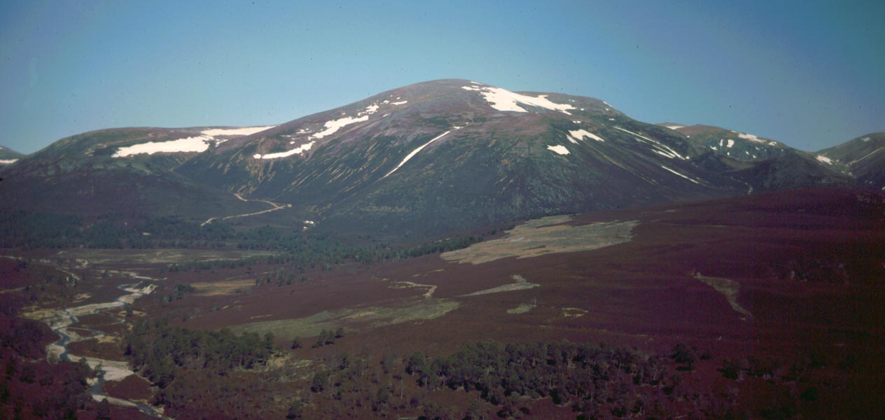
Coire Grealach, also known as Corrie, is a stunning glacial valley located in Banffshire, Scotland. Nestled amidst the majestic Cairngorms National Park, it is a popular destination for nature enthusiasts, hikers, and photographers, offering breathtaking views and a tranquil atmosphere.
This picturesque corrie is characterized by its steep, U-shaped valley walls, which were sculpted by the movement of glaciers during the last ice age. It is situated at an elevation of approximately 1,000 meters, providing visitors with a sense of awe-inspiring grandeur.
The valley is adorned with lush greenery and dotted with scattered boulders, remnants of the glacial activity that once dominated the landscape. The surrounding hillsides are covered in heather, giving the area a vibrant purple hue during the blooming season.
A crystal-clear stream flows through Coire Grealach, originating from the melting snow and glaciers atop the nearby mountains. This stream cascades down the valley, creating small waterfalls and adding to the serenity and charm of the area.
Coire Grealach offers a variety of outdoor activities for visitors to enjoy. Hiking trails wind their way through the valley, providing opportunities to explore the surrounding peaks and take in the breathtaking views. The corrie is also a popular spot for birdwatching, with various species of birds, including golden eagles, often spotted soaring above the rugged cliffs.
Overall, Coire Grealach is a remarkable natural wonder that showcases the raw beauty of Scotland's landscape. Its tranquil ambiance, stunning vistas, and diverse flora and fauna make it a must-visit destination for those seeking an unforgettable experience in the Cairngorms National Park.
If you have any feedback on the listing, please let us know in the comments section below.
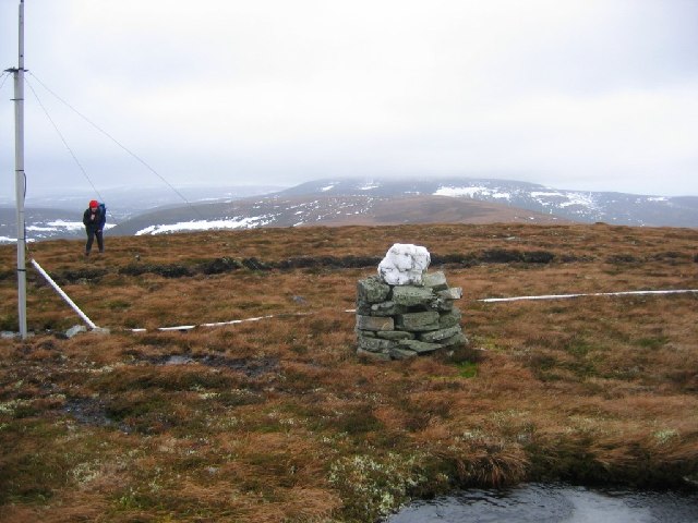
Coire Grealach Images
Images are sourced within 2km of 57.152556/-3.4136576 or Grid Reference NJ1407. Thanks to Geograph Open Source API. All images are credited.


Coire Grealach is located at Grid Ref: NJ1407 (Lat: 57.152556, Lng: -3.4136576)
Unitary Authority: Moray
Police Authority: North East
What 3 Words
///resources.prepare.divisible. Near Inverey, Aberdeenshire
Nearby Locations
Related Wikis

Ben Avon
Ben Avon (Scottish Gaelic: Beinn Athfhinn, 'mountain of the Avon') is a mountain in the Cairngorms of Scotland. It is a sprawling mountain with a broad...

Delnadamph Lodge
Delnadamph Lodge was located on the Balmoral Estate about 8 miles (13 km) north of the castle. The lodge and its estate lands were bought by Queen Elizabeth...
Beinn a' Bhùird
Beinn a' Bhùird is a Munro in the Cairngorm mountain range of Scotland. In Watson (1975) the author suggests the mountain should be named Beinn Bòrd -...
Have you been to Coire Grealach?
Leave your review of Coire Grealach below (or comments, questions and feedback).