Coire na Coise
Corrie (Glacial Valley) in Banffshire
Scotland
Coire na Coise

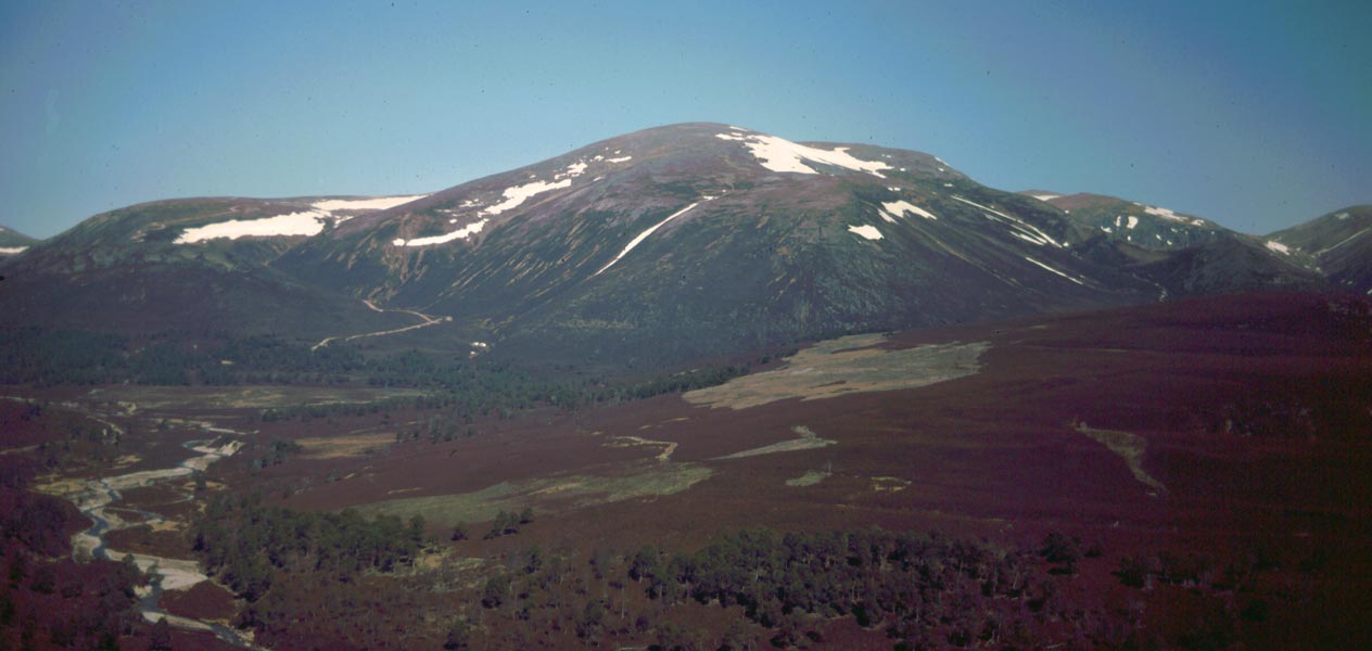
Coire na Coise, also known as Corrie, is a glacial valley located in Banffshire, Scotland. Situated in the northeastern region of the country, it is part of the stunning Cairngorms National Park. The valley is nestled amidst the magnificent Scottish Highlands, offering visitors breathtaking views and a tranquil atmosphere.
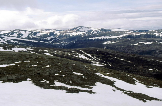
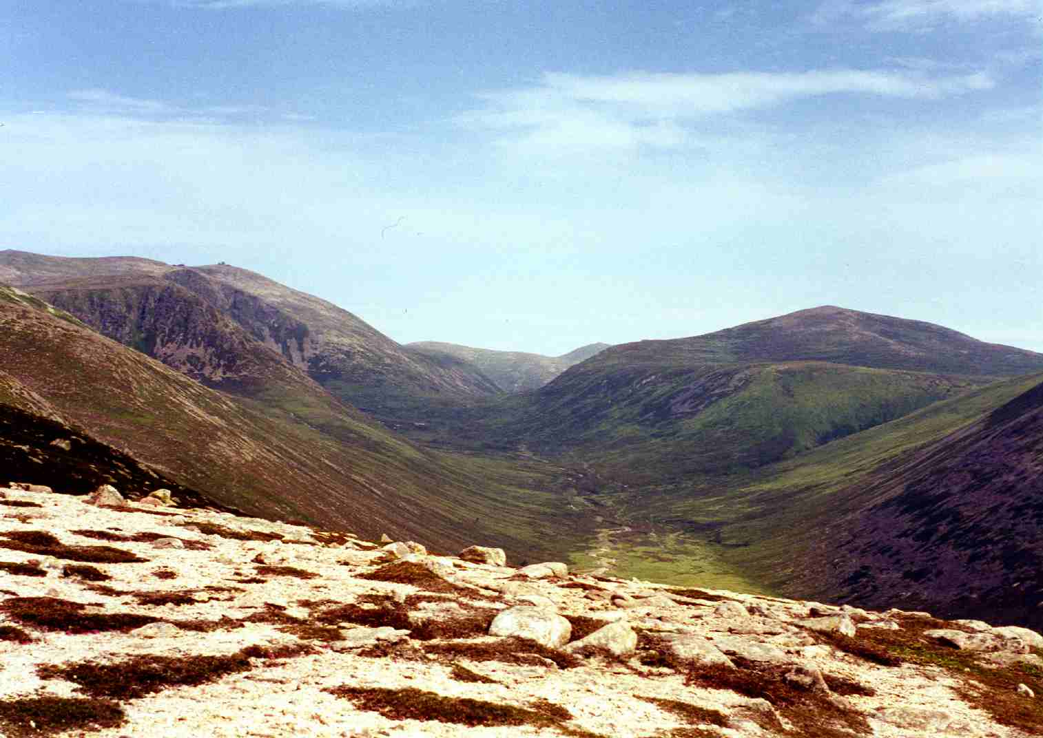
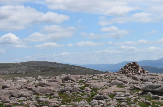
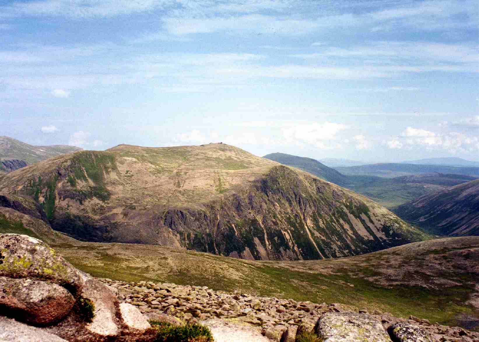
Coire na Coise is a classic example of a corrie, which is a semicircular hollow formed by glacial erosion. The valley is surrounded by steep and rugged slopes, creating a dramatic and awe-inspiring landscape. The terrain is characterized by loose scree, boulders, and remnants of glacial activity, showcasing the power of nature's forces.
The valley is home to a diverse range of flora and fauna, including rare alpine plants and various bird species. The surrounding hills and mountains provide a habitat for mountain hares, reindeer, and golden eagles, among other wildlife. This makes Coire na Coise a popular destination for nature enthusiasts, birdwatchers, and hikers.
There are several walking trails and paths that allow visitors to explore the beauty of Coire na Coise. These routes cater to different levels of difficulty, ensuring that both experienced hikers and casual walkers can enjoy the area. The valley is also a popular spot for winter sports, such as skiing and snowboarding, due to its snowy peaks and slopes.
Coire na Coise offers a unique opportunity to immerse oneself in the natural wonders of the Scottish Highlands. Its stunning vistas, diverse ecosystems, and outdoor activities make it a must-visit destination for those seeking an unforgettable experience in Banffshire.
If you have any feedback on the listing, please let us know in the comments section below.
Coire na Coise Images
Images are sourced within 2km of 57.11903/-3.4665685 or Grid Reference NJ1104. Thanks to Geograph Open Source API. All images are credited.


Coire na Coise is located at Grid Ref: NJ1104 (Lat: 57.11903, Lng: -3.4665685)
Unitary Authority: Moray
Police Authority: North East
What 3 Words
///tasteful.surfacing.spreads. Near Inverey, Aberdeenshire
Nearby Locations
Related Wikis

Ben Avon
Ben Avon (Scottish Gaelic: Beinn Athfhinn, 'mountain of the Avon') is a mountain in the Cairngorms of Scotland. It is a sprawling mountain with a broad...
Beinn a' Bhùird
Beinn a' Bhùird is a Munro in the Cairngorm mountain range of Scotland. In Watson (1975) the author suggests the mountain should be named Beinn Bòrd -...
Beinn a' Chaorainn (Cairngorms)
Beinn a' Chaorainn is a Scottish mountain in the heart of the Cairngorms range. It is quite a remote hill, being located roughly 19 kilometres south east...

Bynack More
Bynack More (Scottish Gaelic: A' Bheithneag Mhòr or Beinn Bheithneag) is a Scottish Mountain that is situated in the Cairngorms range, 16 kilometres east...

Lairig an Laoigh
The Lairig an Laoigh ( LAR-ig ən LOO-ee; Scottish Gaelic: Làirig Laoigh) is a mountain pass through the Highlands of Scotland. In speech and sometimes...
Beinn Bhreac (Glen Derry)
Beinn Bhreac is a twin-peaked Scottish mountain located above Glen Derry in the Cairngorm Mountains approximately 11 kilometres (7 mi) north-west of Braemar...
Beinn Mheadhoin (Cairngorms)
Beinn Mheadhoin or Beinn Meadhain (Scottish Gaelic for 'middle mountain') is a mountain in the Highlands of Scotland. It is a Munro with a height of 1...

Culardoch
Culardoch (900 m) is a mountain in the Cairngorms of Scotland, located northeast of Braemar in Aberdeenshire. A smooth and heathery peak southeast of the...
Have you been to Coire na Coise?
Leave your review of Coire na Coise below (or comments, questions and feedback).