Coire nan Gall

Corrie (Glacial Valley) in Inverness-shire

Scotland

Coire nan Gall

Summit cairn of Carn Liath
Summit cairn of Carn Liath Credit: Steven Brown

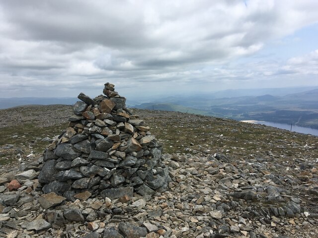
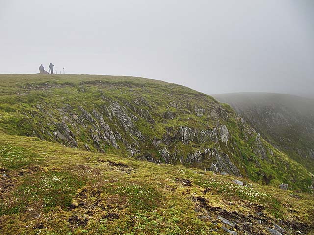
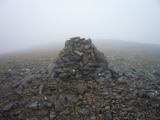
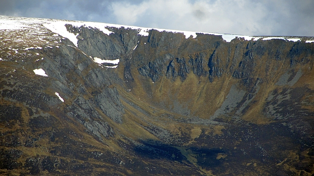
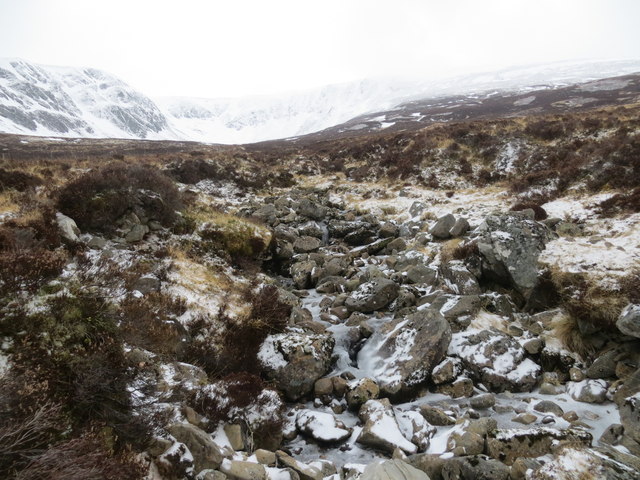
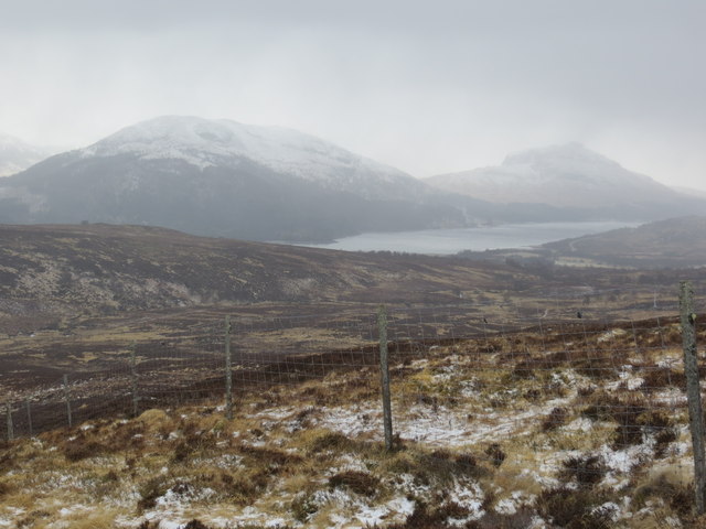
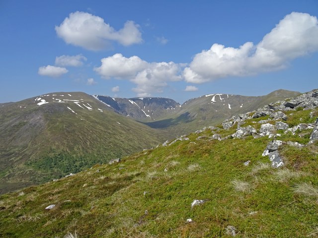
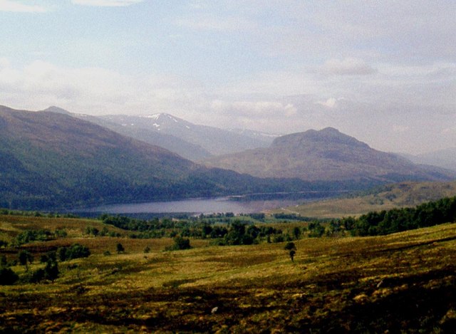
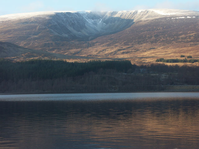
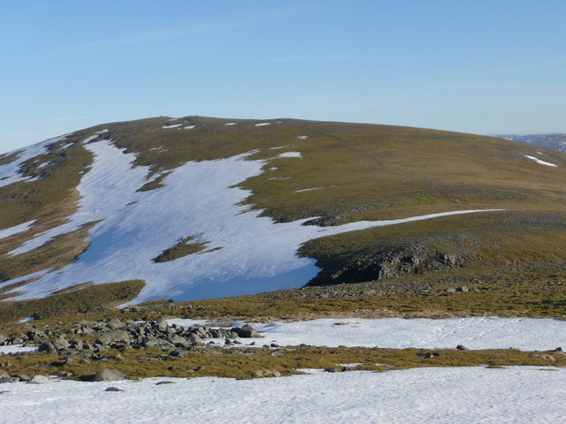
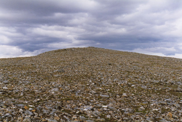
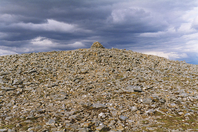
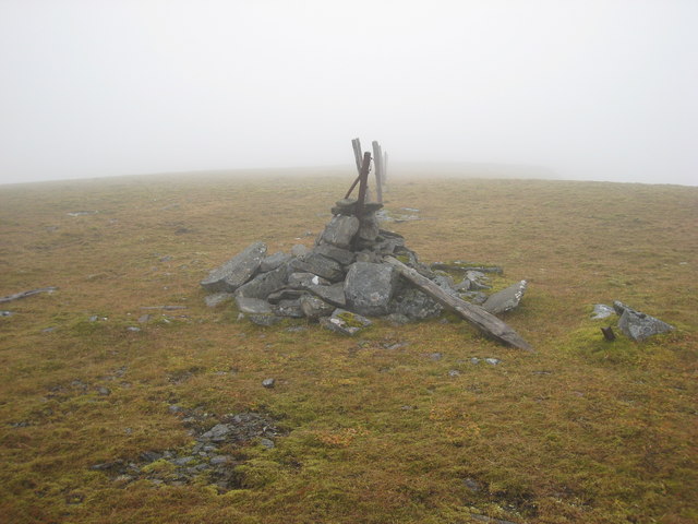
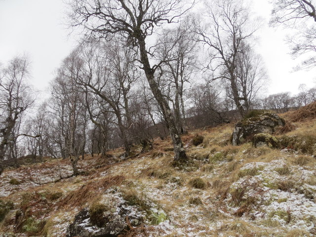
Coire nan Gall is a stunning glacial valley located in Inverness-shire, Scotland. This corrie, or cirque, was formed during the last Ice Age when glaciers carved out the landscape, leaving behind steep cliffs and a deep, U-shaped valley. The valley is situated within the Cairngorms National Park, known for its rugged beauty and diverse wildlife.

Surrounded by towering mountains, Coire nan Gall offers breathtaking views of the surrounding peaks and valleys. The valley is home to a variety of plant and animal species, including rare alpine flora and bird species such as golden eagles and ptarmigan.

Visitors to Coire nan Gall can enjoy hiking, birdwatching, and photography in this remote and pristine wilderness. The valley is a popular destination for outdoor enthusiasts seeking a challenging hike or a peaceful retreat in nature.

Access to Coire nan Gall is primarily by foot, with several hiking trails leading into the valley from nearby villages. The remote location and rugged terrain of the valley make it a popular destination for experienced hikers and mountaineers looking for a true wilderness adventure.

If you have any feedback on the listing, please let us know in the comments section below.

Coire nan Gall Images

Images are sourced within 2km of 56.983722/-4.4905018 or Grid Reference NN4890. Thanks to Geograph Open Source API. All images are credited.

Summit cairn of Carn Liath
Stob Coire Dubh  summit
Stob Coire Dubh summit
Carn Liath summit cairn looms out of the mist It was a test of navigational skills to locate this on the featureless plateau in the low cloud.
Carn Liath summit cairn looms out of the mist
It was a test of navigational skills to locate this on the featureless plateau in the low cloud.
Coire nan Gall A textbook corrie on the south side of the great Corrieardair ridge. The nearest summit of note is Carn Liath. The view is quite a distant one from Ardverikie Forest on a hot but clear day.
Coire nan Gall
A textbook corrie on the south side of the great Corrieardair ridge. The nearest summit of note is Carn Liath. The view is quite a distant one from Ardverikie Forest on a hot but clear day.
Allt Coire nan Gall
Allt Coire nan Gall
Deer fence and moorland beside the Allt Coire nan Gall Loch Laggan in the background
Deer fence and moorland beside the Allt Coire nan Gall
Loch Laggan in the background
Coire Ardair View On the southern slopes of the munro Carn Liath looking straight across to the dramatic Coire Ardair of Creag Meagaidh. A muggy and still summers day - so hot red deer were lying in patches of snow on the opposite hillside.
Coire Ardair View
On the southern slopes of the munro Carn Liath looking straight across to the dramatic Coire Ardair of Creag Meagaidh. A muggy and still summers day - so hot red deer were lying in patches of snow on the opposite hillside.
Moorland above Coille Coire Chrannaig Loch Laggan below.
Moorland above Coille Coire Chrannaig
Loch Laggan below.
The summit cairn on Carn Liath. This Munro has a very flat and stony summit plateau.
The summit cairn on Carn Liath.
This Munro has a very flat and stony summit plateau.
Coire Nan Gall Taken from the opposite bank of Loch Laggan on a cold winter's afternoon.
Coire Nan Gall
Taken from the opposite bank of Loch Laggan on a cold winter's afternoon.
Carn Liath The approach to Carn Liath from the west
Carn Liath
The approach to Carn Liath from the west
On Carn Liath's summit plateau Showing the stony nature of the ground.
On Carn Liath's summit plateau
Showing the stony nature of the ground.
The summit of Carn Liath
Stob Coire Dubh A subsidiary top of Carn Liath
Stob Coire Dubh
A subsidiary top of Carn Liath
Coire nan Gall A summer shot of the winter climb Crampoff Corner (I think!). Does it go right or left at the fork? For the climbers amongst you.
Coire nan Gall
A summer shot of the winter climb Crampoff Corner (I think!). Does it go right or left at the fork? For the climbers amongst you.
Cairn at spot height 903metres Between Carn Dubh and Stob Coire Dubh
Cairn at spot height 903metres
Between Carn Dubh and Stob Coire Dubh
A frozen Allt Coire Chrannaig
Birch wood in Coille Coire Chrannaig
Show me another place!

Coire nan Gall is located at Grid Ref: NN4890 (Lat: 56.983722, Lng: -4.4905018)

Unitary Authority: Highland

Police Authority: Highlands and Islands

What 3 Words

///ascendant.sounding.appealing. Near Newtonmore, Highland

Related Wikis

A86 road

The A86 is a major road in Scotland. It runs from the Great Glen at Spean Bridge to Kingussie and the Cairngorms National Park via Loch Laggan. It is a...
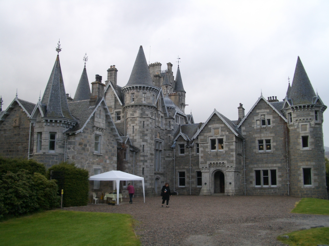
Ardverikie House

Ardverikie House is a 19th-century Scottish baronial house in Kinloch Laggan, Newtonmore, Inverness-shire, Scottish Highlands. The house was made famous...

Loch Laggan

Loch Laggan is a freshwater loch situated approximately 6+1⁄2 mi (10.5 km) west of Dalwhinnie in the Scottish Highlands. The loch has an irregular shape...

East Highland Way

The East Highland Way (Scottish Gaelic: Slighe Gaidhealtachd an Ear) is a long-distance walking route in Scotland that connects Fort William (56.8178°N...

Have you been to Coire nan Gall?

Leave your review of Coire nan Gall below (or comments, questions and feedback).