Coire Eughain

Corrie (Glacial Valley) in Stirlingshire

Scotland

Coire Eughain

Beinn Dubh. Summit of Beinn Dubh, a boggy moorland hill rising from the Trossachs forests. View Northwest to Beinn Uamha. This is a cloud inversion. A pool of cold air in the glen is not mixing with warmer air above, the water has condensed below, giving a foggy day in the glens, and a sunny one on the hill.
Beinn Dubh. Credit: Richard Webb

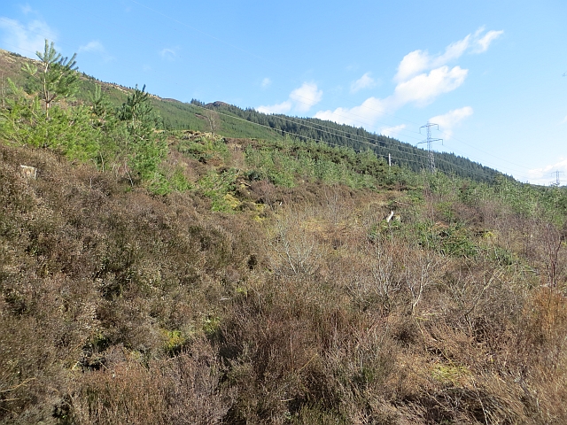
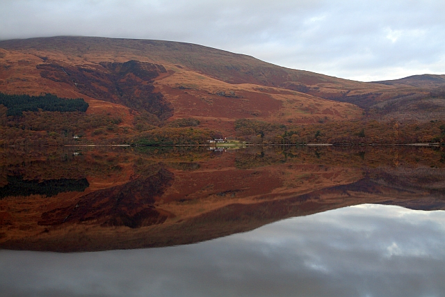
Coire Eughain is a prominent glacial valley located in Stirlingshire, Scotland. Also known as a corrie, it is situated in the southern part of the Scottish Highlands, near the village of Balquhidder. The valley is nestled between the towering peaks of the Trossachs National Park, showcasing breathtaking natural scenery.

With its steep-sided slopes and a distinct U-shaped form, Coire Eughain is a testament to the glacial activity that shaped the landscape millions of years ago. The valley was carved out by the movement of glaciers during the last Ice Age, resulting in its characteristic appearance. The surrounding mountains, including Ben More and Stob Binnein, add to the dramatic beauty of the area.

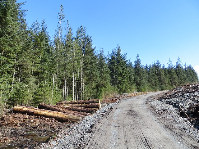
Coire Eughain is a popular destination for outdoor enthusiasts and nature lovers alike. Hiking and mountaineering opportunities abound, with various trails catering to different skill levels. The valley offers stunning panoramic views, especially from its higher elevations, rewarding visitors with sweeping vistas of the surrounding peaks and glens.

The area is also home to a diverse range of flora and fauna. Lush vegetation, including heather and grasses, carpets the valley floor, while hardy alpine plants cling to the rocky slopes. Wildlife such as red deer, mountain hares, and golden eagles can be spotted in the vicinity, adding to the allure of the region.

Coire Eughain is not only a natural wonder but also holds historical significance. It has been a site of human activity for centuries, with remains of ancient settlements and burial sites found in the area. Archaeological exploration continues to shed light on the past inhabitants and their way of life.

In summary, Coire Eughain is a mesmerizing glacial valley in Stirlingshire, offering visitors a chance to immerse themselves in the stunning beauty of the Scottish Highlands. Its geological and historical significance, coupled with the wide range of outdoor activities available, make it a must-visit destination

If you have any feedback on the listing, please let us know in the comments section below.

Coire Eughain Images

Images are sourced within 2km of 56.194348/-4.5916852 or Grid Reference NN3903. Thanks to Geograph Open Source API. All images are credited.

Beinn Dubh. Summit of Beinn Dubh, a boggy moorland hill rising from the Trossachs forests. View Northwest to Beinn Uamha. This is a cloud inversion. A pool of cold air in the glen is not mixing with warmer air above, the water has condensed below, giving a foggy day in the glens, and a sunny one on the hill.
Beinn Dubh.
Summit of Beinn Dubh, a boggy moorland hill rising from the Trossachs forests. View Northwest to Beinn Uamha. This is a cloud inversion. A pool of cold air in the glen is not mixing with warmer air above, the water has condensed below, giving a foggy day in the glens, and a sunny one on the hill.
Dead Bracken Sun came out briefly and caught this dead bracken at the side of the track. You can see the lower slopes of Ben Lomond and Cruinn a' Bheinn in the distance.
Dead Bracken
Sun came out briefly and caught this dead bracken at the side of the track. You can see the lower slopes of Ben Lomond and Cruinn a' Bheinn in the distance.
Beinn Bhan above the Forestry The small hill of Beinn Bhann above forestry in Gleann Dubh east of Ben Lomond.
Beinn Bhan above the Forestry
The small hill of Beinn Bhann above forestry in Gleann Dubh east of Ben Lomond.
Southern Flank of Beinn Dubh The hillside has recently been cleared of trees.  Only a small patch remains to be harvested.
Southern Flank of Beinn Dubh
The hillside has recently been cleared of trees. Only a small patch remains to be harvested.
Loch Dubh Loch Dubh with Ben Lomond to the right
Loch Dubh
Loch Dubh with Ben Lomond to the right
Duchray Water Duchray Water just downstream of Loch Dubh
Duchray Water
Duchray Water just downstream of Loch Dubh
Loch Dubh Ben Lomond is in the background.
Loch Dubh
Ben Lomond is in the background.
Loch Ard Forest An old logging track, now overgrown, climbs through Scots pines. Recently competing self seeded Sitka spruce has been thinned out.
Loch Ard Forest
An old logging track, now overgrown, climbs through Scots pines. Recently competing self seeded Sitka spruce has been thinned out.
Logging road, Loch Ard Forest The mapped fences are now missing, some of the woodland has been allowed to revert to birch wood.
Logging road, Loch Ard Forest
The mapped fences are now missing, some of the woodland has been allowed to revert to birch wood.
Bridge over Duchray Water Newish concrete bridge over the river on a logging road. The next bridge downstream has been replaced by a footbridge.
Bridge over Duchray Water
Newish concrete bridge over the river on a logging road. The next bridge downstream has been replaced by a footbridge.
Duchray Water View up Gleann Dubh towards Cruinn a' Bheinn.
Duchray Water
View up Gleann Dubh towards Cruinn a' Bheinn.
Loch Dubh Duchray Water leaving Loch Dubh, north of Ben Lomond.
Loch Dubh
Duchray Water leaving Loch Dubh, north of Ben Lomond.
Young Scots pines Self seeded Sitka spruce has just been removed from this replanted block in Gleann Dubh.
Young Scots pines
Self seeded Sitka spruce has just been removed from this replanted block in Gleann Dubh.
Birches, Loch Ard Forest Birches, once surrounded by fencing.
Birches, Loch Ard Forest
Birches, once surrounded by fencing.
Clear felled slope, Gleann Dubh Loch Ard Forest on the slopes of Mulan an t-Sagairt. Some of the hillside is now covered in young Scots pines. There is an unplanted strip for the power line.
Clear felled slope, Gleann Dubh
Loch Ard Forest on the slopes of Mulan an t-Sagairt. Some of the hillside is now covered in young Scots pines. There is an unplanted strip for the power line.
Gleann Dubh View across the glen towards Beinn Dubh.
Gleann Dubh
View across the glen towards Beinn Dubh.
Logging road, Loch Ard Forest The block on the right had just been felled.
Logging road, Loch Ard Forest
The block on the right had just been felled.
Loch Dubh Loch and wetland in Gleann Dubh beneath Ben Lomond.
Loch Dubh
Loch and wetland in Gleann Dubh beneath Ben Lomond.
Show me another place!

Coire Eughain is located at Grid Ref: NN3903 (Lat: 56.194348, Lng: -4.5916852)

Unitary Authority: Stirling

Police Authority: Forth Valley

What 3 Words

///arming.broth.zaps. Near Garelochhead, Argyll & Bute

Nearby Locations

Gleann Dubh Coire Eughain

Related Wikis

Loch Dubh (Loch Ard Forest)

Loch Dubh ("Black Loch") is a lochan on the Duchray Water in the western part of Loch Ard Forest in the Central Highlands of Scotland. == Location == Loch...

Ben Lomond

Ben Lomond (Scottish Gaelic: Beinn Laomainn, 'Beacon Mountain'), 974 metres (3,196 ft), is a mountain in the Scottish Highlands. Situated on the eastern...

Loch Chon

Loch Chon is a freshwater loch situated west of the village of Aberfoyle, near the small village of Kinlochard, Stirling, Scotland, UK. Loch Chon lies...

Rowardennan

Rowardennan (Gaelic: Rubha Aird EĆ²nain) is a small rural community on the eastern shore of Loch Lomond in Stirling council, Scotland. It is mainly known...

Nearby Amenities

Located within 500m of 56.194348,-4.5916852
Coire Eughain
Place: locality
Lat/Long: 56.194243/-4.5933332
Gleann Dudh
Place: locality
Lat/Long: 56.1980393/-4.5944061
The data included in this document is from www.openstreetmap.org. The data is made available under ODbL.

Have you been to Coire Eughain?

Leave your review of Coire Eughain below (or comments, questions and feedback).