Gleann Dubh

Valley in Stirlingshire

Scotland

Gleann Dubh

Beinn Dubh. Summit of Beinn Dubh, a boggy moorland hill rising from the Trossachs forests. View Northwest to Beinn Uamha. This is a cloud inversion. A pool of cold air in the glen is not mixing with warmer air above, the water has condensed below, giving a foggy day in the glens, and a sunny one on the hill.
Beinn Dubh. Credit: Richard Webb

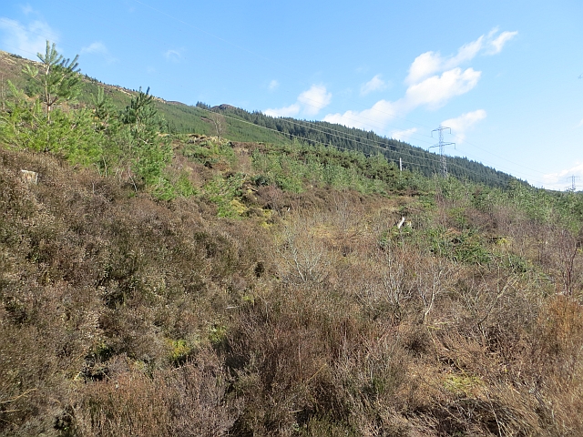
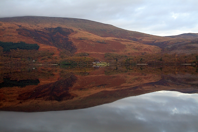
Gleann Dubh is a picturesque valley located in Stirlingshire, Scotland. Nestled between the towering peaks of the Scottish Highlands, this valley stretches for several miles, offering breathtaking views and a serene atmosphere.

The name Gleann Dubh translates to "Black Valley" in Gaelic, which is fitting due to the dark, rich soil that characterizes the area. The valley is surrounded by lush greenery, including dense forests and rolling hills, creating a stunning backdrop for nature enthusiasts and hikers alike.

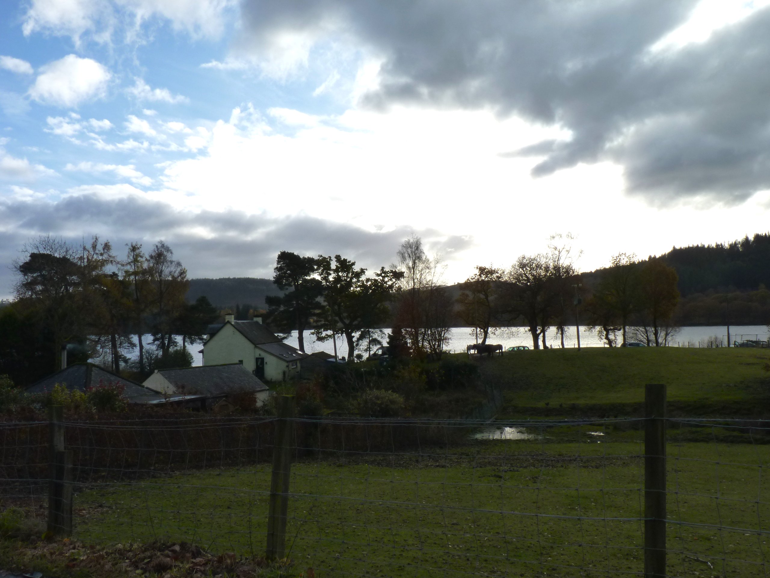
The River Forth flows through Gleann Dubh, adding to the valley's scenic beauty. The river not only provides a source of freshwater but also contributes to the diverse ecosystem found here. The valley is home to a variety of wildlife, including native birds, deer, and occasionally, elusive otters.

Gleann Dubh is also steeped in history, with several ancient ruins and archaeological sites scattered throughout the area. These remnants of the past tell the story of the valley's rich cultural heritage, with evidence of settlements dating back thousands of years.

Visitors to Gleann Dubh can enjoy a range of outdoor activities, such as hiking, fishing, and wildlife spotting. The valley is also a popular destination for those seeking tranquility and a break from the hustle and bustle of city life.

In conclusion, Gleann Dubh is a captivating valley in Stirlingshire, offering breathtaking natural beauty, a diverse ecosystem, and a glimpse into Scotland's fascinating history.

If you have any feedback on the listing, please let us know in the comments section below.

Gleann Dubh Images

Images are sourced within 2km of 56.196264/-4.5809002 or Grid Reference NN3903. Thanks to Geograph Open Source API. All images are credited.

Beinn Dubh. Summit of Beinn Dubh, a boggy moorland hill rising from the Trossachs forests. View Northwest to Beinn Uamha. This is a cloud inversion. A pool of cold air in the glen is not mixing with warmer air above, the water has condensed below, giving a foggy day in the glens, and a sunny one on the hill.
Beinn Dubh.
Summit of Beinn Dubh, a boggy moorland hill rising from the Trossachs forests. View Northwest to Beinn Uamha. This is a cloud inversion. A pool of cold air in the glen is not mixing with warmer air above, the water has condensed below, giving a foggy day in the glens, and a sunny one on the hill.
Pylon Reflected 244,000 volts reflected in the puddles of forestry track.
Pylon Reflected
244,000 volts reflected in the puddles of forestry track.
Solitary Birch A solitary birch in an area of clear fell with an electricity pylon the only other object standing.
Solitary Birch
A solitary birch in an area of clear fell with an electricity pylon the only other object standing.
Dead Bracken Sun came out briefly and caught this dead bracken at the side of the track. You can see the lower slopes of Ben Lomond and Cruinn a' Bheinn in the distance.
Dead Bracken
Sun came out briefly and caught this dead bracken at the side of the track. You can see the lower slopes of Ben Lomond and Cruinn a' Bheinn in the distance.
Beinn Bhan above the Forestry The small hill of Beinn Bhann above forestry in Gleann Dubh east of Ben Lomond.
Beinn Bhan above the Forestry
The small hill of Beinn Bhann above forestry in Gleann Dubh east of Ben Lomond.
Southern Flank of Beinn Dubh The hillside has recently been cleared of trees.  Only a small patch remains to be harvested.
Southern Flank of Beinn Dubh
The hillside has recently been cleared of trees. Only a small patch remains to be harvested.
Loch Dubh Loch Dubh with Ben Lomond to the right
Loch Dubh
Loch Dubh with Ben Lomond to the right
Duchray Water Duchray Water just downstream of Loch Dubh
Duchray Water
Duchray Water just downstream of Loch Dubh
Track in Loch Ard Forest
Multi Coloured Moss Multi coloured beside a track in Loch Ard Forest
Multi Coloured Moss
Multi coloured beside a track in Loch Ard Forest
Log Piles in Loch Ard Forest
Duchray Water and Ben Lomond
Track in Loch Ard Forest Ben Lomond is visible to the left.
Track in Loch Ard Forest
Ben Lomond is visible to the left.
Loch Ard Forest Adjacent to track leading to Cailness
Loch Ard Forest
Adjacent to track leading to Cailness
Dyke, Ballimore This once surrounded a field at Ballimore where older maps show a house.
Dyke, Ballimore
This once surrounded a field at Ballimore where older maps show a house.
Loch Dubh Ben Lomond is in the background.
Loch Dubh
Ben Lomond is in the background.
Loch Ard Forest An old logging track, now overgrown, climbs through Scots pines. Recently competing self seeded Sitka spruce has been thinned out.
Loch Ard Forest
An old logging track, now overgrown, climbs through Scots pines. Recently competing self seeded Sitka spruce has been thinned out.
Logging road, Loch Ard Forest The mapped fences are now missing, some of the woodland has been allowed to revert to birch wood.
Logging road, Loch Ard Forest
The mapped fences are now missing, some of the woodland has been allowed to revert to birch wood.
Show me another place!

Gleann Dubh is located at Grid Ref: NN3903 (Lat: 56.196264, Lng: -4.5809002)

Unitary Authority: Stirling

Police Authority: Forth Valley

What 3 Words

///toned.frog.turntable. Near Garelochhead, Argyll & Bute

Nearby Locations

Gleann Dubh Coire Eughain

Related Wikis

Loch Dubh (Loch Ard Forest)

Loch Dubh ("Black Loch") is a lochan on the Duchray Water in the western part of Loch Ard Forest in the Central Highlands of Scotland. == Location == Loch...

Loch Chon

Loch Chon is a freshwater loch situated west of the village of Aberfoyle, near the small village of Kinlochard, Stirling, Scotland, UK. Loch Chon lies...

Ben Lomond

Ben Lomond (Scottish Gaelic: Beinn Laomainn, 'Beacon Mountain'), 974 metres (3,196 ft), is a mountain in the Scottish Highlands. Situated on the eastern...

Kinlochard

Kinlochard is a village in Stirling, Scotland. It lies to the western end of Loch Ard. Children in Kinlochard attend Aberfoyle Primary School and eventually...

Rowardennan

Rowardennan (Gaelic: Rubha Aird Eònain) is a small rural community on the eastern shore of Loch Lomond in Stirling council, Scotland. It is mainly known...

Loch Arklet

Loch Arklet is a freshwater loch and reservoir in the Trossachs area of the Scottish Highlands. It is within the historic county and registration county...

Loch Lomond and The Trossachs National Park

Loch Lomond and The Trossachs National Park (Scottish Gaelic: Pàirc Nàiseanta Loch Laomainn is nan Tròisichean) is a national park in Scotland centred...

Eilean nan Deargannan

Eilean nan Deargannan (sometimes written as Eilean Deargannan) is a small island in Loch Lomond, in west central Scotland. It lies between Rowardennan...

Nearby Amenities

Located within 500m of 56.196264,-4.5809002
Gleann Dubh
Place: locality
Lat/Long: 56.1971524/-4.5835388
Design: barrel
Power: tower
Source: Bing
Lat/Long: 56.1989417/-4.576927
The data included in this document is from www.openstreetmap.org. The data is made available under ODbL.

Have you been to Gleann Dubh?

Leave your review of Gleann Dubh below (or comments, questions and feedback).