Coire Carach

Corrie (Glacial Valley) in Inverness-shire

Scotland

Coire Carach

Path up Mullach nan Coirean
Path up Mullach nan Coirean Credit: Steven Brown

The requested URL returned error: 429 Too Many Requests

If you have any feedback on the listing, please let us know in the comments section below.
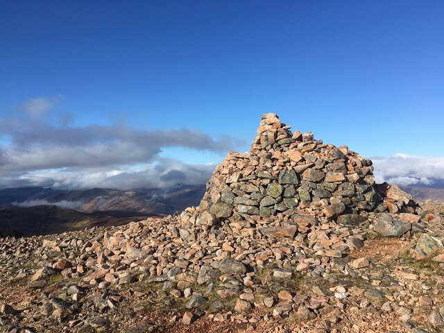
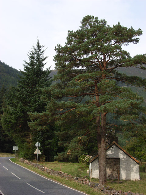
Coire Carach Images

Images are sourced within 2km of 56.741409/-5.0740635 or Grid Reference NN1265. Thanks to Geograph Open Source API. All images are credited.

Path up Mullach nan Coirean
Summit cairn on Mullach nan Coirean
West Highland Way at Lairigmor
Tigh-na-Sleubhaich and the West Highland Way
Lairigmòr (ruin) The sad ruins of Lairigmòr on the West Highland Way.
Lairigmòr (ruin)
The sad ruins of Lairigmòr on the West Highland Way.
The west ridge of Stob Ban Looking towards the SE top of Mullach nan Coirean
The west ridge of Stob Ban
Looking towards the SE top of Mullach nan Coirean
View towards Stob Bàn Looking towards the imposing promontory on the north west side of the minor top which lies between Stob Bàn and Mullach nan Coirean, with Stob Bàn itself just visible on the left. Seen from the north east ridge of Mullach nan Coirean.
View towards Stob Bàn
Looking towards the imposing promontory on the north west side of the minor top which lies between Stob Bàn and Mullach nan Coirean, with Stob Bàn itself just visible on the left. Seen from the north east ridge of Mullach nan Coirean.
Ridge between Mullach nan Coirean and Stob Ban Looking towards Ben Nevis (centre left), Aonach Mor and Aonach Beag.
Ridge between Mullach nan Coirean and Stob Ban
Looking towards Ben Nevis (centre left), Aonach Mor and Aonach Beag.
Ridge between Mullach nan Coirean and Stob Ban Looking towards Mullach nan Coirean <a href="https://www.geograph.org.uk/gridref/NN1266">NN1266</a>.
Ridge between Mullach nan Coirean and Stob Ban
Looking towards Mullach nan Coirean NN1266.
Ridge between Mullach nan Coirean and Stob Ban Looking towards Stob Ban <a href="https://www.geograph.org.uk/gridref/NN1465">NN1465</a>, with Sgurr a' Mhaim <a href="https://www.geograph.org.uk/gridref/NN1666">NN1666</a> beyond to the left.
Ridge between Mullach nan Coirean and Stob Ban
Looking towards Stob Ban NN1465, with Sgurr a' Mhaim NN1666 beyond to the left.
Coire Dearg Looking towards Stob Ban <a href="https://www.geograph.org.uk/gridref/NN1465">NN1465</a> from Mullach nan Coirean. The pink rock of the intervening ridge shows the reason for the corrie's name. Sgurr a' Mhaim <a href="https://www.geograph.org.uk/gridref/NN1666">NN1666</a> is in the left distance.
Coire Dearg
Looking towards Stob Ban NN1465 from Mullach nan Coirean. The pink rock of the intervening ridge shows the reason for the corrie's name. Sgurr a' Mhaim NN1666 is in the left distance.
Abandoned cottages at Tigh-na-sleubhaich On the West Highland Way. Stob Ban <a href="https://www.geograph.org.uk/gridref/NN1465">NN1465</a> is behind.
Abandoned cottages at Tigh-na-sleubhaich
On the West Highland Way. Stob Ban NN1465 is behind.
East along the Mamores Looking east from the subsidiary top of Mullach nan Coirean to Stob Ban and Sgurr a'Mhaim
East along the Mamores
Looking east from the subsidiary top of Mullach nan Coirean to Stob Ban and Sgurr a'Mhaim
Coire Dearg Looking towards Mullach nan Coirean <a href="https://www.geograph.org.uk/gridref/NN1266">NN1266</a> from the ridge west of Stob Ban.
Coire Dearg
Looking towards Mullach nan Coirean NN1266 from the ridge west of Stob Ban.
Ridge west of Stob Ban Looking WSW towards Beinn a' Bheithir (centre left) and Loch Linnhe.
Ridge west of Stob Ban
Looking WSW towards Beinn a' Bheithir (centre left) and Loch Linnhe.
Ridge between Mullach nan Coirean and Stob Ban Looking towards Stob Ban (centre right) <a href="https://www.geograph.org.uk/gridref/NN1465">NN1465</a>, and Sgurr a' Mhaim (centre left) <a href="https://www.geograph.org.uk/gridref/NN1666">NN1666</a>.
Ridge between Mullach nan Coirean and Stob Ban
Looking towards Stob Ban (centre right) NN1465, and Sgurr a' Mhaim (centre left) NN1666.
NE ridge of Mullach nan Coirean Overlooking Coire Dearg, with Ben Nevis in the background.
NE ridge of Mullach nan Coirean
Overlooking Coire Dearg, with Ben Nevis in the background.
SW from Mullach nan Coirean Looking towards Beinn a' Bheithir (centre left) and Loch Linnhe, with Mull in the far distance.
SW from Mullach nan Coirean
Looking towards Beinn a' Bheithir (centre left) and Loch Linnhe, with Mull in the far distance.
Show me another place!

Coire Carach is located at Grid Ref: NN1265 (Lat: 56.741409, Lng: -5.0740635)

Unitary Authority: Highland

Police Authority: Highlands and Islands

What 3 Words

///skippers.gagging.chambers. Near Glencoe, Highland

Nearby Locations

Coire Carach

Related Wikis

Mullach nan Coirean

Mullach nan Coirean (Scottish Gaelic for 'summit of the corries') or Sgùrr a' Chaorainn ('peak of the rowan') is one of the Mamores mountains in the Scottish...

Stob Bàn (Mamores)

Stob Bàn is a Scottish mountain situated at the western end of the Mamores ridge, five and a half kilometres north-west of Kinlochleven. With a height...

Mam na Gualainn

Mam na Gualainn (797 m) is a mountain in the Grampian Mountains, Scotland. It lies above Loch Leven near the village of Kinlochleven in Lochaber. The mountain...

Achriabhach

Achriabhach (Scottish Gaelic: An t-Achadh Riabhach) is a hamlet in Glen Nevis, Lochaber, Highland, Scotland.Achriabhach is adjacent to the Ben Nevis Site...

Nearby Amenities

Located within 500m of 56.741409,-5.0740635
Coire Carach
Place: locality
Lat/Long: 56.7416088/-5.0752254
The data included in this document is from www.openstreetmap.org. The data is made available under ODbL.

Have you been to Coire Carach?

Leave your review of Coire Carach below (or comments, questions and feedback).