Coireachan Leacach

Corrie (Glacial Valley) in Inverness-shire

Scotland

Coireachan Leacach
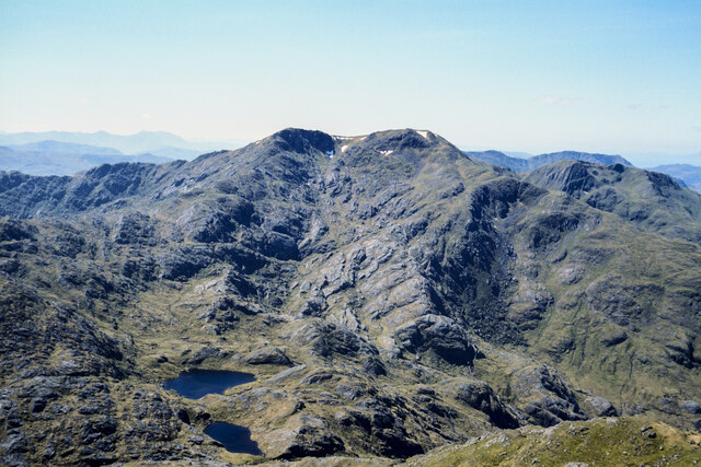
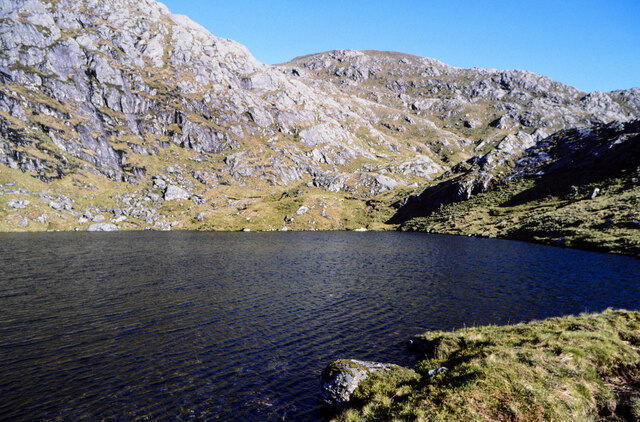
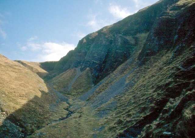
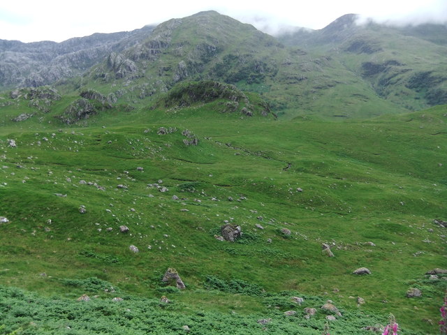
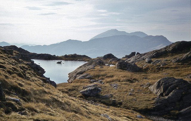
Lochan between Luinne Bheinn and Meall Buidhe The nearer lochan of the two feeds its water into the Allt a' Choire Odhair, the groove of which is seen at the bottom of the image.
The larger, farther water is Lochan an Talamh Dheirg; above both of them rises Meall Buidhe.
Lochan between Luinne Bheinn and Meall Buidhe Credit: Trevor Littlewood

The requested URL returned error: 429 Too Many Requests

If you have any feedback on the listing, please let us know in the comments section below.

Coireachan Leacach Images

Images are sourced within 2km of 57.03632/-5.5341023 or Grid Reference NM8599. Thanks to Geograph Open Source API. All images are credited.
Lochan between Luinne Bheinn and Meall Buidhe The nearer lochan of the two feeds its water into the Allt a' Choire Odhair, the groove of which is seen at the bottom of the image.
The larger, farther water is Lochan an Talamh Dheirg; above both of them rises Meall Buidhe.
Lochan between Luinne Bheinn and Meall Buidhe
The nearer lochan of the two feeds its water into the Allt a' Choire Odhair, the groove of which is seen at the bottom of the image. The larger, farther water is Lochan an Talamh Dheirg; above both of them rises Meall Buidhe.
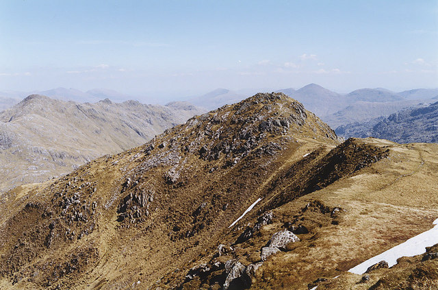
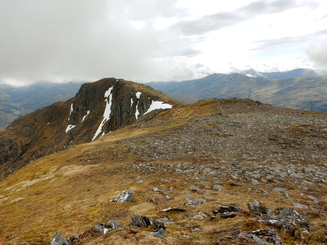
Ridge connecting tops of Meall Buidhe Meall Buidhe has two tops of a similar height: the ridge connects the summit at 946 m. with the lower south-eastern top, 942 m..
Sgùrr na Ciche is the distant cone beyond the farther top.
Ridge connecting tops of Meall Buidhe
Meall Buidhe has two tops of a similar height: the ridge connects the summit at 946 m. with the lower south-eastern top, 942 m.. Sgùrr na Ciche is the distant cone beyond the farther top.
Lochan an Talamh Dheirg The lochan lies between the Knoydart Munros Meall Buidhe and Luinne Bheinn. It's assumed that the steeply rock-plated slope to the left rises to Meall Coire na Gaoithe'n Ear, and that Druim Leac a' Shith is the distant mountain dome.
Lochan an Talamh Dheirg
The lochan lies between the Knoydart Munros Meall Buidhe and Luinne Bheinn. It's assumed that the steeply rock-plated slope to the left rises to Meall Coire na Gaoithe'n Ear, and that Druim Leac a' Shith is the distant mountain dome.
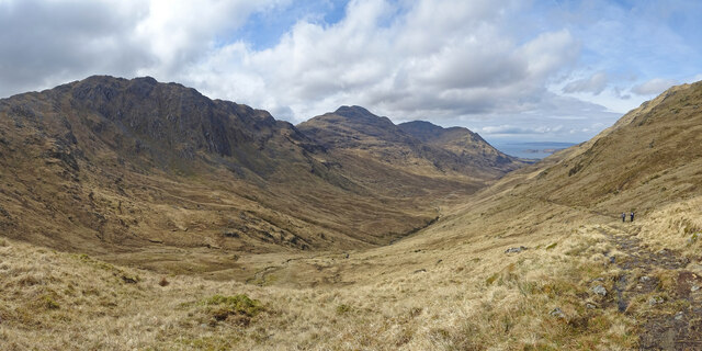
Gleann Meadail Approaching the high pass of Mam Meadail this is the view back down the glen on a fine spring day. The Corbett of Beinne Bhuidhe is in the centre of the picture and the rugged Meall Bhasiter is on the left.
Gleann Meadail
Approaching the high pass of Mam Meadail this is the view back down the glen on a fine spring day. The Corbett of Beinne Bhuidhe is in the centre of the picture and the rugged Meall Bhasiter is on the left.
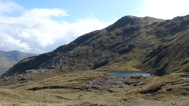
Coire Na Gaoithe'n Ear After the Bealach from Corrie Odhar is this lochan, it heralds the start of a very rough descent strewn with massive boulders and ravines.
Coire Na Gaoithe'n Ear
After the Bealach from Corrie Odhar is this lochan, it heralds the start of a very rough descent strewn with massive boulders and ravines.
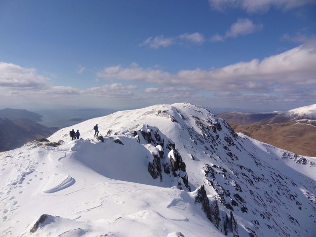
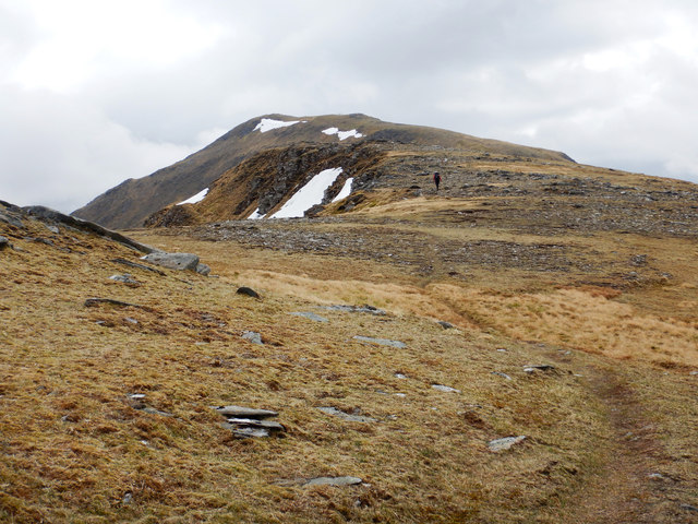
Winter Ridge Walk Superb winter conditions in spring setting off along the ridge between the south east and main summits of Meall Buidhe in Knoydart. The Isle of Rhum is just visible above the figures.
Winter Ridge Walk
Superb winter conditions in spring setting off along the ridge between the south east and main summits of Meall Buidhe in Knoydart. The Isle of Rhum is just visible above the figures.
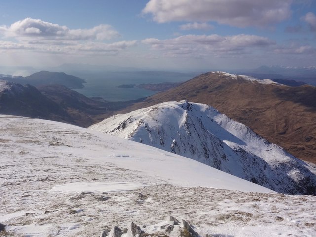
Bothy Bound Descending west from the summit of Meall Buidhe looking across the lower top of An t-Uiriollach to Inverie Bay, Skye, Rhum and some of the heath fires burning near Mallaig. Druim bothy and the evenings entertainment are quickening our step.
Bothy Bound
Descending west from the summit of Meall Buidhe looking across the lower top of An t-Uiriollach to Inverie Bay, Skye, Rhum and some of the heath fires burning near Mallaig. Druim bothy and the evenings entertainment are quickening our step.
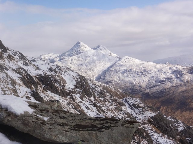
Above the Mam Meadail After a stiff climb up to the bealach of the Mam Meadail from Druim bothy, the view across to the wintry peaks of Sgurr na Ciche and Garbh Chioch Mor make it worthwhile.
Above the Mam Meadail
After a stiff climb up to the bealach of the Mam Meadail from Druim bothy, the view across to the wintry peaks of Sgurr na Ciche and Garbh Chioch Mor make it worthwhile.
The last rise to Màm Meadail Over-shadowed by the cliffs of Creag Mhòr
The last rise to Màm Meadail
Over-shadowed by the cliffs of Creag Mhòr
The east top of Luinne Bheinn Looking along the almost level summit ridge to the east top, from close to the mountain's summit. There is very little difference between the heights of all three tops.
The east top of Luinne Bheinn
Looking along the almost level summit ridge to the east top, from close to the mountain's summit. There is very little difference between the heights of all three tops.
Ladhar Bheinn seen from Luinne Bheinn Looking over the Màm Barrisdale to the Aonach Sgoilte, with Ladhar Bheinn rising up behind.
Ladhar Bheinn seen from Luinne Bheinn
Looking over the Màm Barrisdale to the Aonach Sgoilte, with Ladhar Bheinn rising up behind.
Mam Barrisdale
Mam Barrisdale
Close to the summit cairn of Luinne Bheinn
On the path between Carnoch and Inverie
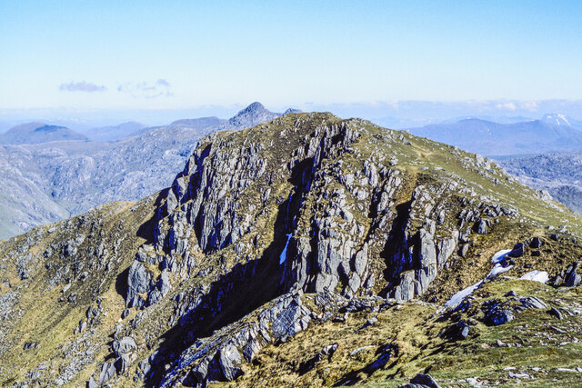
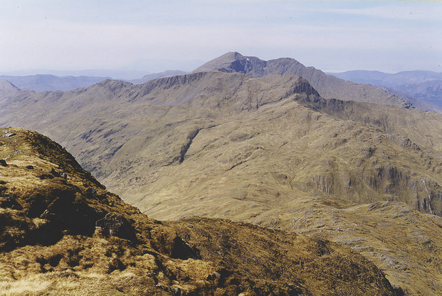
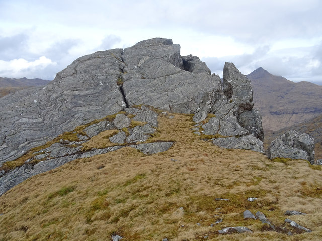
Rock Formation Interesting geology on the ridge between Luinne Bheinn and Meall Buidhe with Sgurr na Ciche in the background.
Rock Formation
Interesting geology on the ridge between Luinne Bheinn and Meall Buidhe with Sgurr na Ciche in the background.
Meall Coire na Gaoithe'n Ear
Climbing An t-Uiriollach towards Meall Bhuidhe Once the west ridge on Meall Bhuidhe has been gained after a steep and generally pathless ascent of its southern flank above Gleann Meadail, a path materialises and becomes increasingly distinct as height is gained. Here the going is pretty easy, as we approach the 826m west top above Torc-choire. Those who are not supremely fit (yes, this was me) will find the 60m drop beyond this point, to Bealach an Torc-choire (whose name is somewhat misplaced on both the 1:50000 and 1:25000 OS maps) with its inevitable reascent, somewhat distressing.
Climbing An t-Uiriollach towards Meall Bhuidhe
Once the west ridge on Meall Bhuidhe has been gained after a steep and generally pathless ascent of its southern flank above Gleann Meadail, a path materialises and becomes increasingly distinct as height is gained. Here the going is pretty easy, as we approach the 826m west top above Torc-choire. Those who are not supremely fit (yes, this was me) will find the 60m drop beyond this point, to Bealach an Torc-choire (whose name is somewhat misplaced on both the 1:50000 and 1:25000 OS maps) with its inevitable reascent, somewhat distressing.
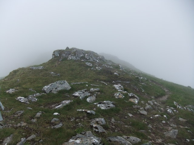
The connecting ridge east from Meall Bhuidhe The two summits of Meall Bhuidhe differ in height by only 4m and with the east top having a rockier aspect than the true summit, it would be easy, coming from the east, to miss the actual Munro. Ascending the west ridge, the summit seems obvious enough, and the way on to the east top is an easy trek with little loss of height. There's a fairly clear path here, but ahead, most people seem to have continued the traverse from the 942m top by going northeast to Luinne Bheinn, so the path onwards to Sgurr Sgeithe and a way down to Mam Meadail, is faint and requires a bit of care. The path soon evaporates completely and one is left to pick one's own way between the outcrops and defiles to reach easier ground and a traverse across the slopes back to the col. Lots of ankle-breaking haggis traps await the unwary.
The connecting ridge east from Meall Bhuidhe
The two summits of Meall Bhuidhe differ in height by only 4m and with the east top having a rockier aspect than the true summit, it would be easy, coming from the east, to miss the actual Munro. Ascending the west ridge, the summit seems obvious enough, and the way on to the east top is an easy trek with little loss of height. There's a fairly clear path here, but ahead, most people seem to have continued the traverse from the 942m top by going northeast to Luinne Bheinn, so the path onwards to Sgurr Sgeithe and a way down to Mam Meadail, is faint and requires a bit of care. The path soon evaporates completely and one is left to pick one's own way between the outcrops and defiles to reach easier ground and a traverse across the slopes back to the col. Lots of ankle-breaking haggis traps await the unwary.
Show me another place!

Coireachan Leacach is located at Grid Ref: NM8599 (Lat: 57.03632, Lng: -5.5341023)

Unitary Authority: Highland

Police Authority: Highlands and Islands

What 3 Words

///panic.report.wiggling. Near Glenelg, Highland

Nearby Locations

Coireachan Leacach

Related Wikis

Meall Buidhe, Knoydart

Meall Buidhe (946 m) is a mountain in the Northwest Highlands, Scotland. It lies on the Knoydart peninsula in Lochaber. A rocky mountain, Meall Buidhe...

Luinne Bheinn

Luinne Bheinn (939 m) is a mountain in the Northwest Highlands of Scotland, on the Knoydart Peninsula in Lochaber. The mountain is rough and rocky. The...

Ben Aden

Ben Aden (887m) is a mountain in the Northwest Highlands of Scotland. It lies on the Knoydart peninsula in Lochaber. Regarded as one of the finest Corbetts...

Sgùrr a' Choire-bheithe

Sgùrr a' Choire-bleithe is a 913-m mountain in the remote Knoydart area of Lochaber, Northwest Highlands, Scotland. It is one of highest Corbetts at 913...

Nearby Amenities

Located within 500m of 57.03632,-5.5341023
Bealach Ile Coire
Ele: 712
Natural: saddle
Lat/Long: 57.0333045/-5.5295563
The data included in this document is from www.openstreetmap.org. The data is made available under ODbL.

Have you been to Coireachan Leacach?

Leave your review of Coireachan Leacach below (or comments, questions and feedback).