Stretton, Lower

Settlement in Cheshire

England

Stretton, Lower

The entrance to Grimsditch Hall
The entrance to Grimsditch Hall Credit: Ian Greig

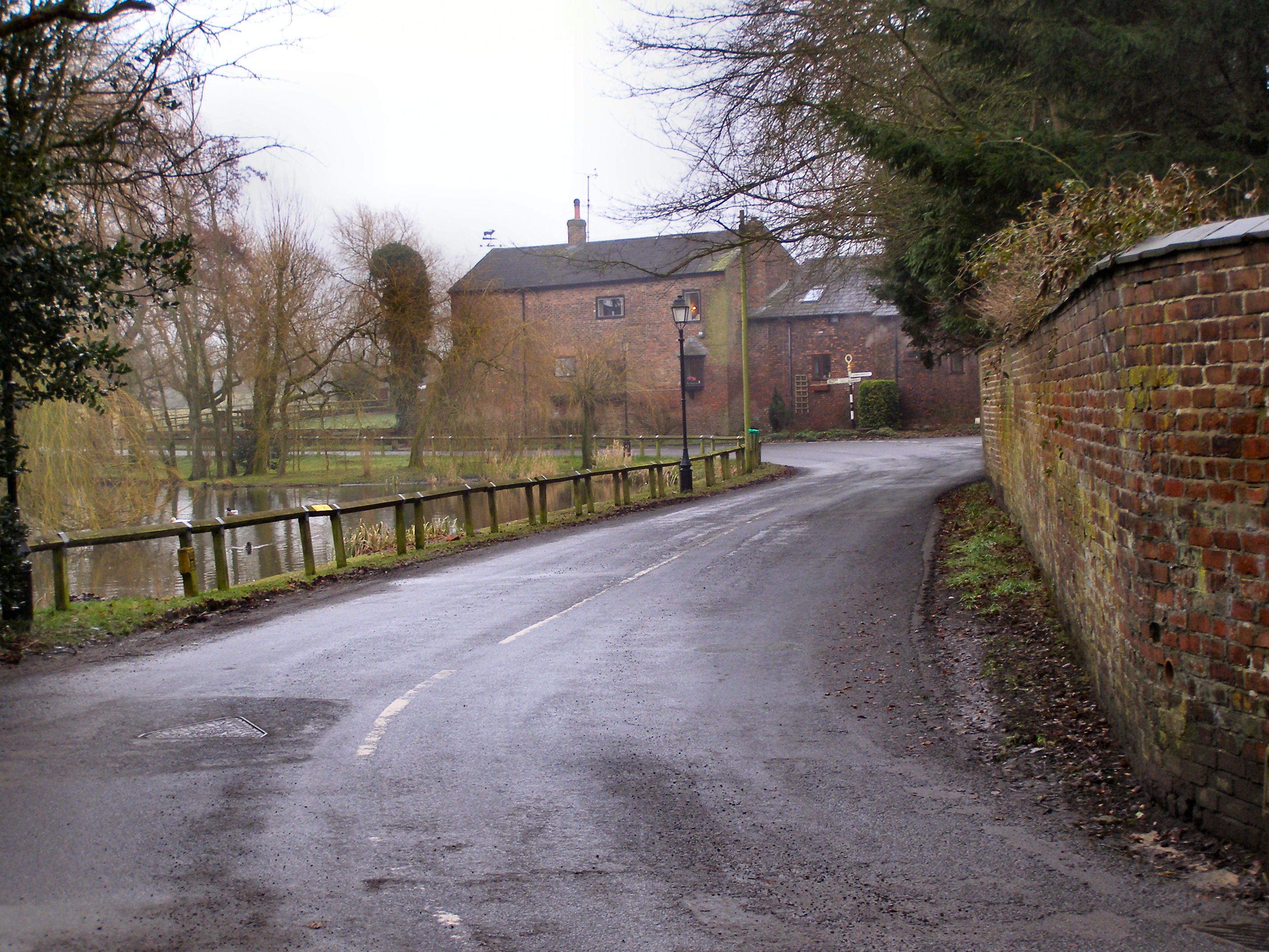
Stretton, Lower is a small village located in the county of Cheshire, England. Situated in the northwestern part of the county, it is part of the borough of Cheshire West and Chester. The village is nestled in a rural setting, surrounded by picturesque countryside and farmland.

Stretton, Lower has a population of around 500 residents, giving it a close-knit and friendly community atmosphere. The village is known for its charming character, with traditional stone-built houses and well-maintained gardens lining the streets.

Despite its small size, Stretton, Lower offers a range of amenities to its residents. There is a local pub, The Red Lion, which serves as a popular gathering spot for locals. The village also has a primary school, providing education for the younger members of the community.

For those who enjoy outdoor activities, Stretton, Lower offers easy access to beautiful walking trails and cycling routes. The village is surrounded by stunning natural landscapes, including the nearby Delamere Forest, which is a popular spot for outdoor enthusiasts.

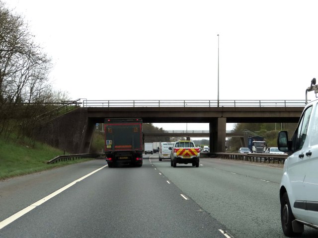
In terms of transport links, Stretton, Lower is conveniently located near major road networks, with the A49 and A556 passing nearby. The village is also within close proximity to larger towns and cities, with the city of Chester located approximately 8 miles to the east.

Overall, Stretton, Lower is a peaceful and idyllic village, offering a tranquil lifestyle in a beautiful countryside setting.

If you have any feedback on the listing, please let us know in the comments section below.

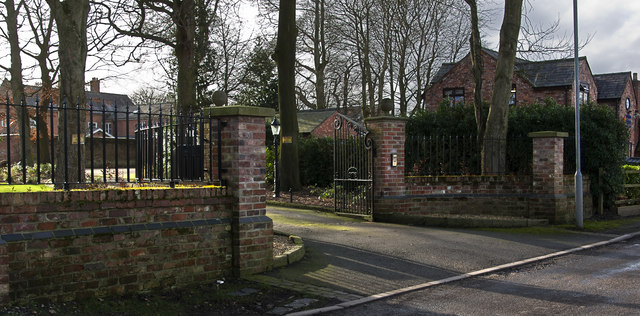
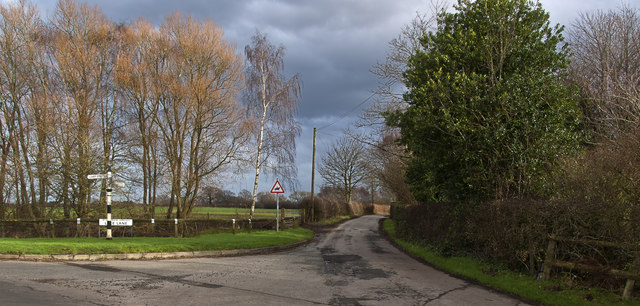
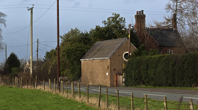
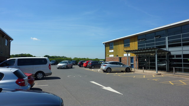
Stretton, Lower Images

Images are sourced within 2km of 53.33048/-2.569812 or Grid Reference SJ6281. Thanks to Geograph Open Source API. All images are credited.

The entrance to Grimsditch Hall
Grimsditch Lane at its junction with Greenhill Lane
Reflections in the pond at Higher Whitley
Bentley Farm
Bentley Farm
Lake Lane
Lake Lane
A small barn on Knutsford Road
A willow overlooks the pond at Higher Whitley
A49 Tarporley Road Passing Brookside Fisheries The A49 is a major road that runs for 158 miles from Bamber Bridge, near Preston, to Ross-on-Wye.

The section north of Warrington is mostly a non-primary road for local traffic, having been largely superseded by the M6 motorway. South of Warrington, the route traverses the Welsh Marches region <span class="nowrap"><a title="https://en.wikipedia.org/wiki/Welsh_Marches" rel="nofollow ugc noopener" href="https://en.wikipedia.org/wiki/Welsh_Marches">Link</a><img style="margin-left:2px;" alt="External link" title="External link - shift click to open in new window" src="https://s1.geograph.org.uk/img/external.png" width="10" height="10"/></span>  , following the hills along the English/Welsh borders although it never actually enters Wales; usually running around ten miles away from the border as it winds its way through Cheshire, Shropshire and Herefordshire although it comes within a couple of miles near Whitchurch. The road is all primary but mainly single carriageway, which means that traffic queues sometimes build up behind tractors or slow-moving goods vehicles.  The stretch between the A5 at Shrewsbury and Ross-on-Wye is a trunk road, maintained by the national Highways England.
<span class="nowrap"><a title="http://www.sabre-roads.org.uk/wiki/index.php?title=A49" rel="nofollow ugc noopener" href="http://www.sabre-roads.org.uk/wiki/index.php?title=A49">Link</a><img style="margin-left:2px;" alt="External link" title="External link - shift click to open in new window" src="https://s1.geograph.org.uk/img/external.png" width="10" height="10"/></span>  SABRE
A49 Tarporley Road Passing Brookside Fisheries
The A49 is a major road that runs for 158 miles from Bamber Bridge, near Preston, to Ross-on-Wye. The section north of Warrington is mostly a non-primary road for local traffic, having been largely superseded by the M6 motorway. South of Warrington, the route traverses the Welsh Marches region LinkExternal link , following the hills along the English/Welsh borders although it never actually enters Wales; usually running around ten miles away from the border as it winds its way through Cheshire, Shropshire and Herefordshire although it comes within a couple of miles near Whitchurch. The road is all primary but mainly single carriageway, which means that traffic queues sometimes build up behind tractors or slow-moving goods vehicles. The stretch between the A5 at Shrewsbury and Ross-on-Wye is a trunk road, maintained by the national Highways England. LinkExternal link SABRE
A49 Approaching Crossroads at Chapelhouse Farm The A49 is a major road that runs for 158 miles from Bamber Bridge, near Preston, to Ross-on-Wye.

The section north of Warrington is mostly a non-primary road for local traffic, having been largely superseded by the M6 motorway. South of Warrington, the route traverses the Welsh Marches region <span class="nowrap"><a title="https://en.wikipedia.org/wiki/Welsh_Marches" rel="nofollow ugc noopener" href="https://en.wikipedia.org/wiki/Welsh_Marches">Link</a><img style="margin-left:2px;" alt="External link" title="External link - shift click to open in new window" src="https://s1.geograph.org.uk/img/external.png" width="10" height="10"/></span>  , following the hills along the English/Welsh borders although it never actually enters Wales; usually running around ten miles away from the border as it winds its way through Cheshire, Shropshire and Herefordshire although it comes within a couple of miles near Whitchurch. The road is all primary but mainly single carriageway, which means that traffic queues sometimes build up behind tractors or slow-moving goods vehicles.  The stretch between the A5 at Shrewsbury and Ross-on-Wye is a trunk road, maintained by the national Highways England.
<span class="nowrap"><a title="http://www.sabre-roads.org.uk/wiki/index.php?title=A49" rel="nofollow ugc noopener" href="http://www.sabre-roads.org.uk/wiki/index.php?title=A49">Link</a><img style="margin-left:2px;" alt="External link" title="External link - shift click to open in new window" src="https://s1.geograph.org.uk/img/external.png" width="10" height="10"/></span>  SABRE
A49 Approaching Crossroads at Chapelhouse Farm
The A49 is a major road that runs for 158 miles from Bamber Bridge, near Preston, to Ross-on-Wye. The section north of Warrington is mostly a non-primary road for local traffic, having been largely superseded by the M6 motorway. South of Warrington, the route traverses the Welsh Marches region LinkExternal link , following the hills along the English/Welsh borders although it never actually enters Wales; usually running around ten miles away from the border as it winds its way through Cheshire, Shropshire and Herefordshire although it comes within a couple of miles near Whitchurch. The road is all primary but mainly single carriageway, which means that traffic queues sometimes build up behind tractors or slow-moving goods vehicles. The stretch between the A5 at Shrewsbury and Ross-on-Wye is a trunk road, maintained by the national Highways England. LinkExternal link SABRE
Old Milepost by the A49 in Stretton Cast iron post by the A49, in parish of Stretton (Warrington District), Pewterspear, half mile North of Stretton Cross Roads, in pavement, back to low brick wall. Cast iron CCC1896, erected by the County Council in the 19th century. 

Inscription reads:-
: GREAT BUDWORTH / 5 MILES / NORTHWICH 8 : : CHESHIRE / 1896 / COUNTY COUNCIL : : STOCKTON HEATH / 1¾ MILES / WARRINGTON 3 : 
Maker:-
: W H SMITH & CO / MAKERS / WHITCHURCH:

Grade II listed.
List Entry Number: 1392450 <span class="nowrap"><a title="https://historicengland.org.uk/listing/the-list/list-entry/1392450" rel="nofollow ugc noopener" href="https://historicengland.org.uk/listing/the-list/list-entry/1392450">Link</a><img style="margin-left:2px;" alt="External link" title="External link - shift click to open in new window" src="https://s1.geograph.org.uk/img/external.png" width="10" height="10"/></span>

Milestone Society National ID: CH_WANW03
Old Milepost by the A49 in Stretton
Cast iron post by the A49, in parish of Stretton (Warrington District), Pewterspear, half mile North of Stretton Cross Roads, in pavement, back to low brick wall. Cast iron CCC1896, erected by the County Council in the 19th century. Inscription reads:- : GREAT BUDWORTH / 5 MILES / NORTHWICH 8 : : CHESHIRE / 1896 / COUNTY COUNCIL : : STOCKTON HEATH / 1¾ MILES / WARRINGTON 3 : Maker:- : W H SMITH & CO / MAKERS / WHITCHURCH: Grade II listed. List Entry Number: 1392450 LinkExternal link Milestone Society National ID: CH_WANW03
Flooded field, Grimsditch The following winter and spring were also wet.
Flooded field, Grimsditch
The following winter and spring were also wet.
Norman's Lane Near Higher Whitley.
Norman's Lane
Near Higher Whitley.
Walnut Tree Business Centre, Off Northwich Road
The M56 runs under a footbridge
The M56 heading west
The M56 runs under Tarporley Road
The M56 heading west
The M56 runs under Pillmoss Lane
Show me another place!

Stretton, Lower is located at Grid Ref: SJ6281 (Lat: 53.33048, Lng: -2.569812)

Unitary Authority: Warrington

Police Authority: Cheshire

What 3 Words

///slugs.sung.bead. Near Stretton, Cheshire

Related Wikis

Stretton, Warrington

Stretton is a village and civil parish in the Borough of Warrington, Cheshire, England. The parish includes the village of Lower Stretton. It is at the...

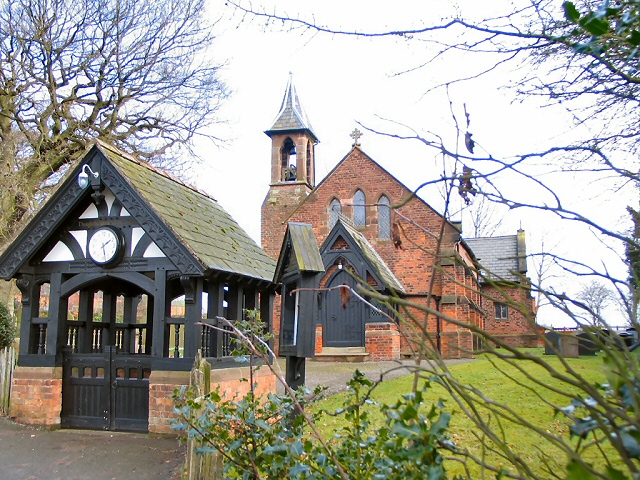
St Matthew's Church, Stretton

St Matthew's Church is in the village of Stretton, Cheshire, England. The church is recorded in the National Heritage List for England as a designated...

Higher Whitley

Higher Whitley is a village and former civil parish, now in the parish of Whitley, in the unitary authority area of Cheshire West and Chester, in the ceremonial...

Whitley, Cheshire

Whitley is a civil parish in the unitary authority of Cheshire West and Chester and the ceremonial county of Cheshire, England. It is surrounded by the...

Nearby Amenities

Located within 500m of 53.33048,-2.569812
Barrier: stile
Foot: yes
Lat/Long: 53.33028/-2.570902
Barrier: stile
Foot: yes
Lat/Long: 53.330868/-2.568297
Crossing: informal
Lat/Long: 53.3311418/-2.5760363
Pub
Partridge
Addr City: Warrington
Addr Country: GB
Addr Postcode: WA4 4LX
Addr Street: Tarporley Road
Check Date: 2024-02-10
Fhrs Id: 977174
Internet Access: wlan
Internet Access Fee: no
Old Name: The Hollow Tree
Opening Hours: Mo-Fr 07:00-23:00; Sa 08:00-23:00; Su,PH 08:00-22:00
Payment Cash: yes
Payment Credit Cards: yes
Payment Debit Cards: yes
Phone: 01925730848
Source Addr: FHRS Open Data
Website: https://www.thepartridgestretton.co.uk/
Lat/Long: 53.3333245/-2.5752072
Phone
Check Date: 2023-11-12
Emergency: phone
Ref: 8334 A
Lat/Long: 53.3345452/-2.5711249
Phone
Emergency: phone
Ref: 8334 B
Lat/Long: 53.334852/-2.571255
Traffic Signals
Traffic Signals: part_time
Lat/Long: 53.3344681/-2.5699688
Traffic Signals
Traffic Signals: part_time
Lat/Long: 53.3345008/-2.5701673
Traffic Calming: island
Lat/Long: 53.333546/-2.5699814
Traffic Calming: island
Lat/Long: 53.3326197/-2.5692788
Direction: forward
Traffic Calming: choker
Lat/Long: 53.3321236/-2.5688867
Traffic Calming: choker
Lat/Long: 53.3306614/-2.5681135
Traffic Calming: island
Lat/Long: 53.3285647/-2.5664976
Parking
Access: customers
Lat/Long: 53.3320999/-2.5684485
Turning Loop
Lat/Long: 53.3320518/-2.5714144
Lower Stretton
Is In: Stretton
Place: quarter
Lat/Long: 53.3299448/-2.5683494
The Hollies
Shop: farm
Lat/Long: 53.3280212/-2.5683804
Crossing
Crossing: uncontrolled
Crossing Island: no
Tactile Paving: no
Lat/Long: 53.3344457/-2.5700134
Crossing
Crossing: unmarked
Crossing Island: yes
Tactile Paving: yes
Lat/Long: 53.3338947/-2.5702399
Crossing
Crossing: unmarked
Crossing Island: yes
Tactile Paving: yes
Lat/Long: 53.33382/-2.5703732
Crossing
Crossing: unmarked
Lat/Long: 53.3336338/-2.5713518
Crossing
Crossing: unmarked
Tactile Paving: no
Lat/Long: 53.3336639/-2.5716029
Crossing
Crossing: unmarked
Crossing Island: no
Tactile Paving: no
Lat/Long: 53.3340899/-2.5722769
Bus Stop
Ring O Bells
Bench: yes
Bus: yes
Departures Board: timetable
Naptan AtcoCode: 069000023205
Naptan Bearing: NW
Naptan CommonName: Ring O Bells
Naptan Crossing: Summit Close
Naptan Indicator: opp
Naptan Landmark: Ring O Bells
Naptan LocalityName: Lower Stretton
Naptan NaptanCode: wrgdjtd
Naptan ShortCommonName: Ring O Bells
Naptan Street: Northwich Road
Public Transport: platform
Shelter: yes
Source: naptan_import
Lat/Long: 53.333083/-2.5697535
Bus Stop
Ring O Bells
Bus: yes
Departures Board: no
Naptan AtcoCode: 069000013680
Naptan Bearing: S
Naptan CommonName: Ring O Bells
Naptan Crossing: Hall Lane
Naptan Indicator: o/s
Naptan Landmark: Ring O Bells
Naptan LocalityName: Lower Stretton
Naptan NaptanCode: wrgdjtg
Naptan ShortCommonName: Ring O Bells
Naptan Street: Northwich Road
Public Transport: platform
Shelter: no
Source: naptan_import
Lat/Long: 53.3329512/-2.5694091
Bench
Backrest: yes
Material: wood
Lat/Long: 53.3331694/-2.5698153
Crossing
Crossing: unmarked
Crossing Island: no
Tactile Paving: yes
Lat/Long: 53.3332698/-2.5696714
Crossing
Crossing: unmarked
Crossing Island: no
Tactile Paving: yes
Lat/Long: 53.3327428/-2.5694932
Barrier: kerb
Lat/Long: 53.3328606/-2.5693275
Post Box
Brand: Royal Mail
Brand Wikidata: Q638098
Operator: Royal Mail
Operator Wikidata: Q638098
Post Box Type: lamp
Ref: WA4 80
Royal Cypher: EIIR
Lat/Long: 53.3319897/-2.5686814
Give Way
Direction: forward
Lat/Long: 53.3322005/-2.5689461
Bus Stop
Hall Lane
Bus: yes
Departures Board: no
Public Transport: platform
Shelter: no
Lat/Long: 53.3320613/-2.5746898
Waste Basket
Colour: #000000
Material: plastic
Lat/Long: 53.3321383/-2.574472
Bus Stop
Hall Lane
Bus: yes
Departures Board: no
Public Transport: platform
Shelter: no
Lat/Long: 53.3324466/-2.5727427
Waste Basket
Colour: #000000
Material: plastic
Lat/Long: 53.3324419/-2.572756
The data included in this document is from www.openstreetmap.org. The data is made available under ODbL.

Have you been to Stretton, Lower?

Leave your review of Stretton, Lower below (or comments, questions and feedback).