Reedland Marshes

Coastal Marsh, Saltings in Suffolk East Suffolk

England

Reedland Marshes

Looking across Dingle Marshes to Dingle Stone House
Looking across Dingle Marshes to Dingle Stone House Credit: Chris Holifield

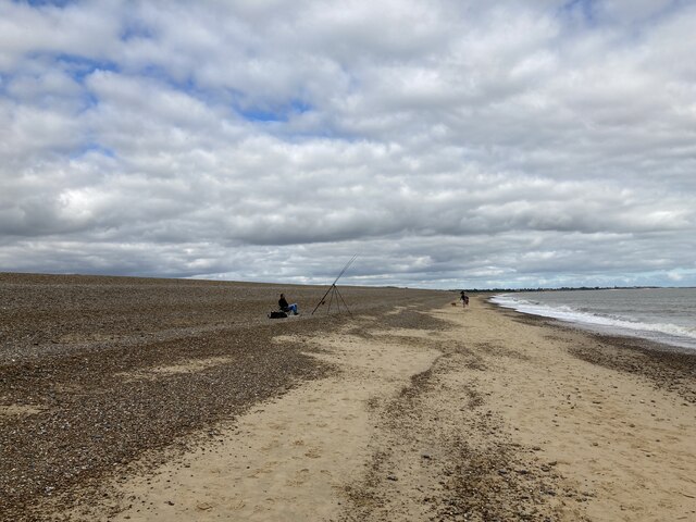
Reedland Marshes, located in Suffolk, England, is a coastal marshland area known for its unique natural features and diverse wildlife. Covering an area of approximately 500 hectares, the marshes are situated along the coast of the North Sea, adjacent to the towns of Walberswick and Southwold.

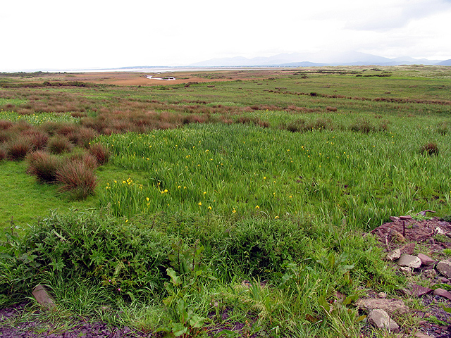
The main characteristic of Reedland Marshes is the presence of extensive salt marshes and saltings, which are formed by the tidal activity of the sea. These marshes act as a vital habitat for a wide variety of plant and animal species. The dominant vegetation in the area is reed beds, which provide shelter and nesting sites for numerous bird species, including bitterns, marsh harriers, and bearded tits.

The salt marshes themselves consist of low-lying, waterlogged areas that are regularly flooded by the tides. They are home to a diverse range of salt-tolerant plant species, such as sea lavender, samphire, and sea purslane. These plants not only contribute to the natural beauty of the marshes but also help stabilize the soil and provide a crucial feeding ground for various invertebrates and wading birds.

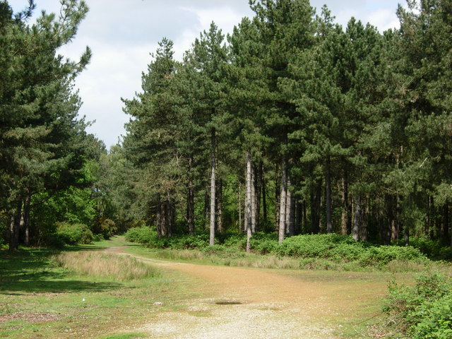
Reedland Marshes are a designated Site of Special Scientific Interest (SSSI) due to their ecological importance. They are managed by various conservation organizations and local authorities to ensure the preservation of their unique ecosystem. Visitors to the area can enjoy guided walks, birdwatching, and nature photography, with several viewing platforms and trails providing access to the marshland.

Overall, Reedland Marshes in Suffolk offer a remarkable opportunity to experience and appreciate the natural wonders of a coastal marsh ecosystem, making it a must-visit destination for nature enthusiasts and those seeking tranquility in a picturesque setting.

If you have any feedback on the listing, please let us know in the comments section below.

Reedland Marshes Images

Images are sourced within 2km of 52.288525/1.6377621 or Grid Reference TM4871. Thanks to Geograph Open Source API. All images are credited.

Looking across Dingle Marshes to Dingle Stone House
Fisherman on the beach at Dunwich
The ruins of Greyfriars through an ancient archway
Dingle Marshes Looking towards Sandymount Covert
Dingle Marshes
Looking towards Sandymount Covert
Dunwich beach, Suffolk After the storm. Four feet of gravel scoured off the beach by a storm a couple of days earlier. It always returns eventually.
Dunwich beach, Suffolk
After the storm. Four feet of gravel scoured off the beach by a storm a couple of days earlier. It always returns eventually.
Daffodils in Greyfriars Wood The wood is noted for its spring flowers. The snowdrops have just finished and now the daffs are out.
Daffodils in Greyfriars Wood
The wood is noted for its spring flowers. The snowdrops have just finished and now the daffs are out.
Dunwich River at Walberswick Mill Sluice A marsh drainage outlet into the main river.
An Environment Agency site.
Dunwich River at Walberswick Mill Sluice
A marsh drainage outlet into the main river. An Environment Agency site.
Dunwich, The Ferns According to the OS benchmark database there is a benchmark cut into a post amongst this roadside hedge. The vegetation was too thick to find anything.
Dunwich, The Ferns
According to the OS benchmark database there is a benchmark cut into a post amongst this roadside hedge. The vegetation was too thick to find anything.
Dunwich, Sea View The benchmark is cut into the right of the front fascia of the property. It is on the south side of the road.
Dunwich, Sea View
The benchmark is cut into the right of the front fascia of the property. It is on the south side of the road.
Dunwich, Sea View There is a benchmark cut into the right brickwork of the front facia of the property. It is on the south side of the road.
Dunwich, Sea View
There is a benchmark cut into the right brickwork of the front facia of the property. It is on the south side of the road.
Dunwich, St James' church The benchmark is cut into the north-east facing buttress of the church tower.
Dunwich, St James' church
The benchmark is cut into the north-east facing buttress of the church tower.
Dunwich, St James' church There is a benchmark cut into the north-east facing buttress of the church tower.
Dunwich, St James' church
There is a benchmark cut into the north-east facing buttress of the church tower.
Dunwich, Bridge Cottage The benchmark is cut into the right side of the gable end of the cottage, which faces onto the road.
Dunwich, Bridge Cottage
The benchmark is cut into the right side of the gable end of the cottage, which faces onto the road.
Dunwich, Bridge Cottage There is a benchmark cut into the right side of the gable end of the cottage, which faces onto the road.
Dunwich, Bridge Cottage
There is a benchmark cut into the right side of the gable end of the cottage, which faces onto the road.
Dunwich, High Street The OS Flush Bracket 016S is embedded into a brick wall which divides the Old Stables from No 6 High Street. This is on the south side of the road.
Dunwich, High Street
The OS Flush Bracket 016S is embedded into a brick wall which divides the Old Stables from No 6 High Street. This is on the south side of the road.
Dunwich, Beehive Cottage The benchmark is cut into the east facing wall of the cottage. It is partially obscured from sight after a new brick gatepost has been erected adjoining the cottage.
Dunwich, Beehive Cottage
The benchmark is cut into the east facing wall of the cottage. It is partially obscured from sight after a new brick gatepost has been erected adjoining the cottage.
Dunwich, Beehive Cottage There is a benchmark cut into the east facing wall of the cottage. It is partially obscured from sight after a new brick gatepost supporting a high wooden gate has been erected adjoining the cottage.
Dunwich, Beehive Cottage
There is a benchmark cut into the east facing wall of the cottage. It is partially obscured from sight after a new brick gatepost supporting a high wooden gate has been erected adjoining the cottage.
Show me another place!

Reedland Marshes is located at Grid Ref: TM4871 (Lat: 52.288525, Lng: 1.6377621)

Administrative County: Suffolk

District: East Suffolk

Police Authority: Suffolk

What 3 Words

///prancing.regular.proud. Near Southwold, Suffolk

Nearby Locations

Reedland Marshes

Related Wikis

Dingle Marshes

Dingle Marshes is a 93-hectare (230-acre) wildlife reserve on the North Sea coast of the English county of Suffolk. The reserve is located between Dunwich...

Dunwich Forest

Dunwich Forest is an area of forest and lowland heath around 1 mile (1.6 km) north-west of the village of Dunwich in the English county of Suffolk. The...

Dunwich

Dunwich () is a village and civil parish in Suffolk, England. It is in the Suffolk Coast and Heaths AONB around 92 miles (148 km) north-east of London...
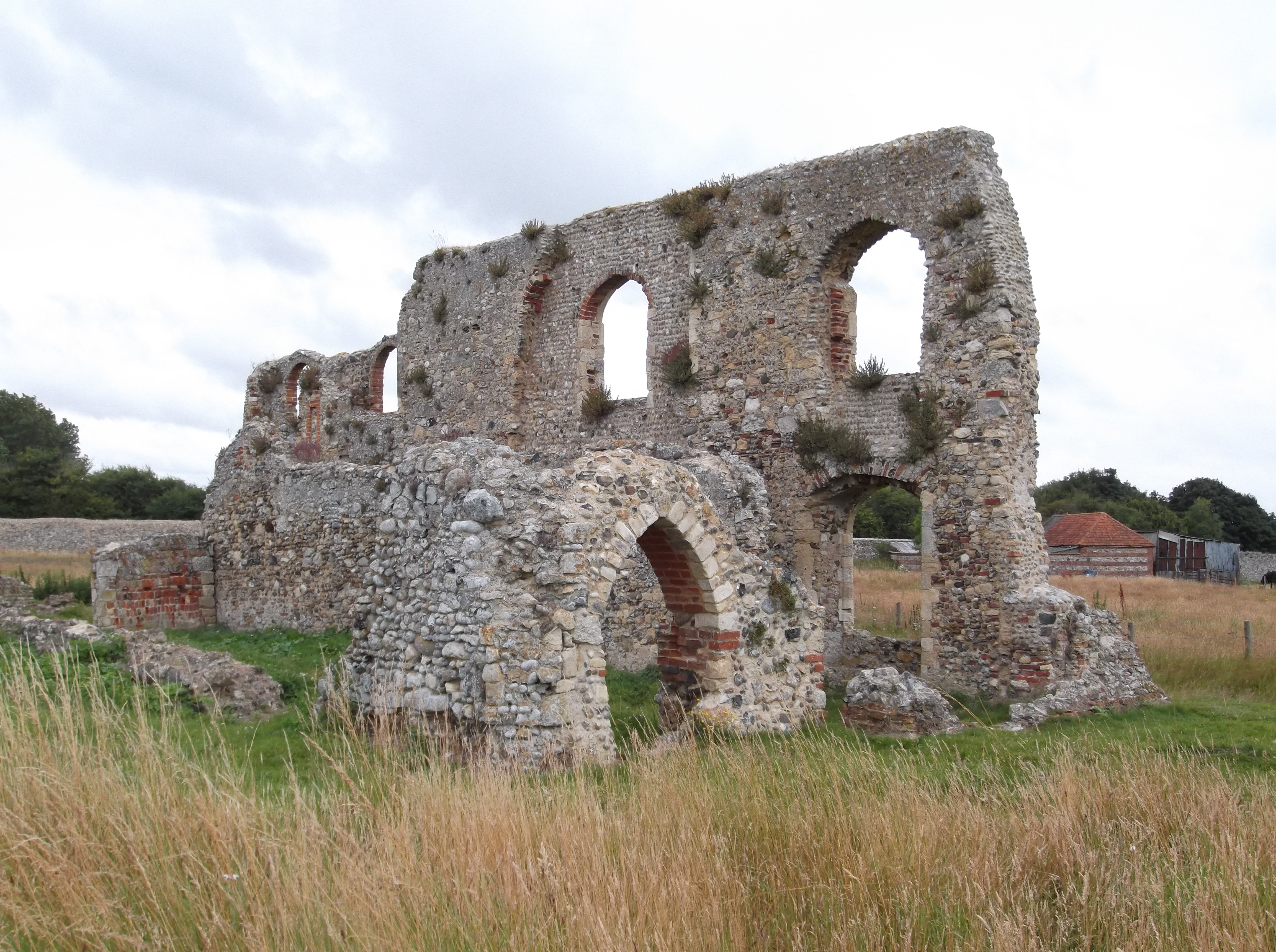
Greyfriars, Dunwich

Greyfriars, Dunwich was a Franciscan friary in Dunwich in the English county of Suffolk. The friary was founded before 1277 by Richard FitzJohn and his...

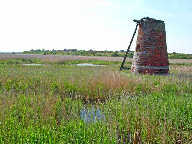
Westwood Marshes Mill, Walberswick

Westwood Marshes Mill is a Grade II listed tower mill at Walberswick, Suffolk, England which is derelict. == History == Westwood Marshes Mill was built...

Potton Hall Fields, Westleton

Potton Hall Fields, Westleton is a 16.7-hectare (41-acre) biological Site of Special Scientific Interest ((SSSI) west of Dunwich in Suffolk. It is in the...

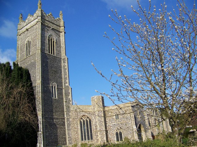
St Andrew's Church, Walberswick

St Andrew's Church is a Grade I listed building in Walberswick, Suffolk. It is an active parish church in the Church of England. == History == The church...

Suffolk Coast National Nature Reserve

Suffolk Coast National Nature Reserve is a wildlife reserve on the North Sea coast of the English county of Suffolk. It is located around the village of...

Nearby Amenities

Located within 500m of 52.288525,1.6377621
Created By: almien_coastlines
Source: PGS
Lat/Long: 52.284453/1.637165
Created By: almien_coastlines
Source: PGS
Lat/Long: 52.28626/1.638363
Created By: almien_coastlines
Source: PGS
Lat/Long: 52.288068/1.639561
Created By: almien_coastlines
Source: PGS
Lat/Long: 52.290649/1.641154
The data included in this document is from www.openstreetmap.org. The data is made available under ODbL.

Have you been to Reedland Marshes?

Leave your review of Reedland Marshes below (or comments, questions and feedback).