Tinker's Marshes

Coastal Marsh, Saltings in Suffolk East Suffolk

England

Tinker's Marshes

Footpath across Southwold Town Marshes Looking across the Town Marshes towards the footpath that crosses the marshes.
Walberswick and church in the distance.
Boxing Day walk.
Footpath across Southwold Town Marshes Credit: ruth e

Tinker's Marshes, located in Suffolk, England, is a picturesque coastal marshland known for its unique landscape and diverse wildlife. Spanning over an area of approximately 500 acres, the marshes are situated along the Suffolk coast, adjacent to the North Sea.

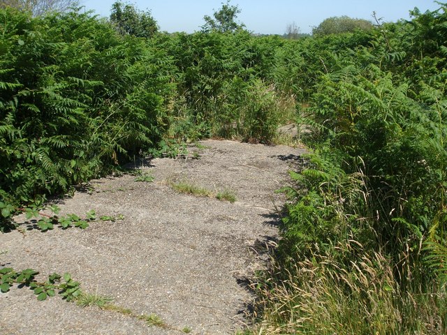
The marshes are characterized by their extensive salt marshes and saltings, which are formed by a combination of tidal action and deposition of sediment carried by rivers. These marshes serve as an important habitat for a wide range of plant and animal species. The vegetation found in Tinker's Marshes includes various species of salt-tolerant grasses, reeds, and saltwort.

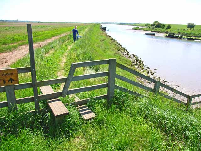
The marshes are particularly renowned for their bird population, attracting numerous species throughout the year. Birdwatchers flock to Tinker's Marshes to catch a glimpse of rare and migratory birds such as avocets, curlews, redshanks, and marsh harriers. The area is also home to other wildlife, including seals, otters, and various species of fish.

Tinker's Marshes offer visitors a peaceful and tranquil environment, ideal for nature walks and birdwatching. The marshes are intersected by footpaths, allowing visitors to explore the area while enjoying the stunning views of the surrounding landscape. The marshes also provide opportunities for recreational activities such as fishing and photography.

As an important coastal marshland, Tinker's Marshes play a vital role in protecting the coastline from erosion and storm surges. The marshes act as a natural buffer, absorbing the energy of waves and helping to maintain the stability of the coastline.

Overall, Tinker's Marshes in Suffolk is a captivating destination for nature enthusiasts, offering a rich variety of flora and fauna within its beautiful coastal marshland setting.

If you have any feedback on the listing, please let us know in the comments section below.

Tinker's Marshes Images

Images are sourced within 2km of 52.325929/1.6391008 or Grid Reference TM4875. Thanks to Geograph Open Source API. All images are credited.

Footpath across Southwold Town Marshes Looking across the Town Marshes towards the footpath that crosses the marshes.
Walberswick and church in the distance.
Boxing Day walk.
Footpath across Southwold Town Marshes
Looking across the Town Marshes towards the footpath that crosses the marshes. Walberswick and church in the distance. Boxing Day walk.
The  Harbour  Inn  on  Ferry  Road  Southwold  Harbour Yacht Club the building on the right
The Harbour Inn on Ferry Road Southwold Harbour
Yacht Club the building on the right
Boats  moored  on  the  River  Blyth  Southwold  Harbour
Boats moored on the River Blyth Southwold Harbour
Footbridge  over  the  River  Blyth  closed  for  repair This bridge is also on the Suffolk Coastal Path. The diversion is the ferry further downriver across to Walberswick
Footbridge over the River Blyth closed for repair
This bridge is also on the Suffolk Coastal Path. The diversion is the ferry further downriver across to Walberswick
Over  Reydon  Marshes  from  flood  bank  footpath Part of a circular walk around Southwold
Over Reydon Marshes from flood bank footpath
Part of a circular walk around Southwold
Easy  walking  over  Reydon  Marshes
Easy walking over Reydon Marshes
Southwold Harbour, 1 Looking east towards the sea.
Southwold Harbour, 1
Looking east towards the sea.
Southwold Harbour, 2 Looking across the channel towards the Harbour Inn.
The nearer side is lined with private moorings.
Southwold Harbour, 2
Looking across the channel towards the Harbour Inn. The nearer side is lined with private moorings.
Private mooring Clearly not over-used.
Private mooring
Clearly not over-used.
Old wind pump by the River Blyth The distinctive building in the distance is Quay House.
Old wind pump by the River Blyth
The distinctive building in the distance is Quay House.
Walberswick Common, 1 One of the many silver birches in scrubland.
Walberswick Common, 1
One of the many silver birches in scrubland.
Walberswick Common, 2 The afternoon sun is gently lighting the late autumn scrub.
Walberswick Common, 2
The afternoon sun is gently lighting the late autumn scrub.
Walberswick Common, 3 Old carvings of love picked out in the gentle late autumn sunlight.
Walberswick Common, 3
Old carvings of love picked out in the gentle late autumn sunlight.
Robinson's Marshes, Walberswick, 1 View towards the Harbour Inn across the rich marshes.
Robinson's Marshes, Walberswick, 1
View towards the Harbour Inn across the rich marshes.
Robinson's Marshes, Walberswick, 2 View towards the Harbour Inn across the rich marshes.
Robinson's Marshes, Walberswick, 2
View towards the Harbour Inn across the rich marshes.
Wonky Electrical Pole In the fields at Walberswick. Taken from the old single track rail line Halesworth to Southwold
Wonky Electrical Pole
In the fields at Walberswick. Taken from the old single track rail line Halesworth to Southwold
Harbour Master's Office The harbour master has a black wooden shed, like a lot of other people along here.
Harbour Master's Office
The harbour master has a black wooden shed, like a lot of other people along here.
Old Boat on the Mud In need of attention, as they say.
Old Boat on the Mud
In need of attention, as they say.
Show me another place!

Tinker's Marshes is located at Grid Ref: TM4875 (Lat: 52.325929, Lng: 1.6391008)

Administrative County: Suffolk

District: East Suffolk

Police Authority: Suffolk

What 3 Words

///alive.issuer.mailboxes. Near Southwold, Suffolk

Related Wikis

Walberswick railway station

Walberswick railway station was located in Walberswick, Suffolk, England. It closed in 1929, 50 years after it had opened for passenger traffic. ��2�...

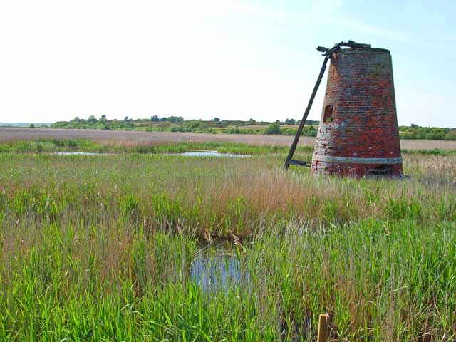
Blackshore Mill, Reydon

Blackshore Mill is a Grade II listed tower mill at Reydon, Suffolk, England which has been conserved. == History == Blackshore Mill was built c1890 by...

Hen Reedbeds

Hen Reedbeds is a 55 hectare nature reserve near the North Sea coast of the English county of Suffolk. The reserve is located in the Blyth valley between...
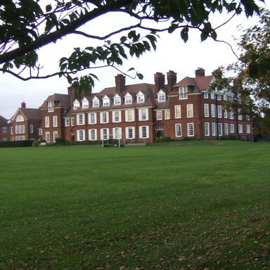
Saint Felix School

Saint Felix School is a 2–18 mixed, private, day and boarding school in Reydon, Southwold, Suffolk, England. The school was founded in 1897 as a school...
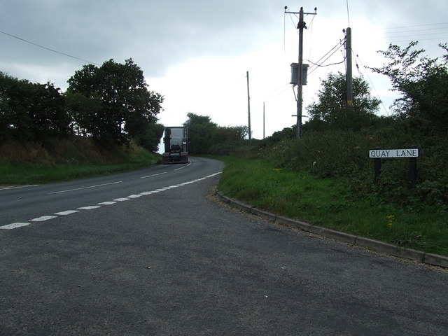
A1095 road

The A1095 road is an A road in the English county of Suffolk. It runs from Southwold on the North Sea coast to the A12 London to Lowestoft road at Henham...

Suffolk Coast National Nature Reserve

Suffolk Coast National Nature Reserve is a wildlife reserve on the North Sea coast of the English county of Suffolk. It is located around the village of...

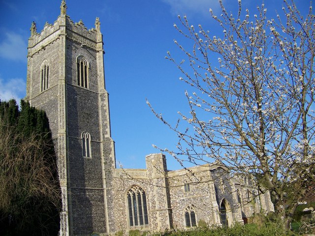
St Andrew's Church, Walberswick

St Andrew's Church is a Grade I listed building in Walberswick, Suffolk. It is an active parish church in the Church of England. == History == The church...
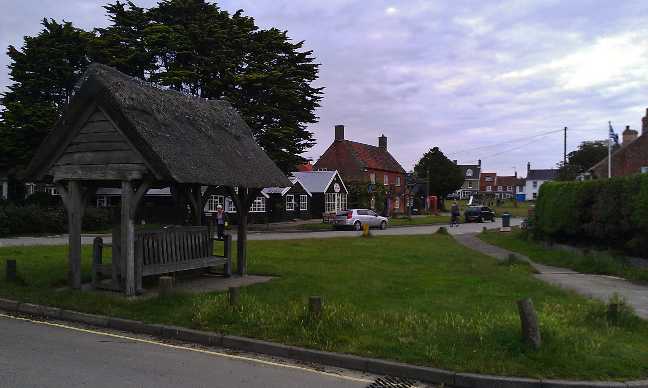
Walberswick

Walberswick is a village and civil parish on the Suffolk coast in England. It is at the mouth of the River Blyth on the south side of the river. The town...

Nearby Amenities

Located within 500m of 52.325929,1.6391008
Source: Landsat photo
Lat/Long: 52.3303973/1.6390351
Source: Landsat photo
Lat/Long: 52.3293865/1.6349743
Source: Landsat photo
Lat/Long: 52.3290647/1.6342938
Source: Landsat photo
Lat/Long: 52.3287636/1.634882
Source: Landsat photo
Lat/Long: 52.3287944/1.6371479
Source: Landsat photo
Lat/Long: 52.3296939/1.6369012
Source: Landsat photo
Lat/Long: 52.3302381/1.6371801
Source: Landsat photo
Lat/Long: 52.3303597/1.6390888
Source: Landsat photo
Lat/Long: 52.3298146/1.6404126
Source: Landsat photo
Lat/Long: 52.3295558/1.6412771
Source: Landsat photo
Lat/Long: 52.3294236/1.6421533
Source: Landsat photo
Lat/Long: 52.3293206/1.6438515
Source: Landsat photo
Lat/Long: 52.3285667/1.6446816
Source: Landsat photo
Lat/Long: 52.3287921/1.6436515
Source: Landsat photo
Lat/Long: 52.3289173/1.6426762
Source: Landsat photo
Lat/Long: 52.3290925/1.6412132
Source: Landsat photo
Lat/Long: 52.3294358/1.6399004
Source: Landsat photo
Lat/Long: 52.3298033/1.639062
The data included in this document is from www.openstreetmap.org. The data is made available under ODbL.

Have you been to Tinker's Marshes?

Leave your review of Tinker's Marshes below (or comments, questions and feedback).