Belton Marshes
Coastal Marsh, Saltings in Suffolk Great Yarmouth
England
Belton Marshes

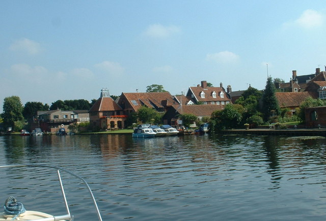
Belton Marshes, located in Suffolk, England, is a captivating coastal marshland and saltings area that spans a significant area of approximately 250 hectares. Nestled along the eastern edge of the Waveney Valley, it boasts a diverse range of habitats, making it a haven for a wide variety of wildlife and plant species.
The marshes are characterized by their vast expanses of salt marshes, intertidal mudflats, reed beds, and freshwater ditches. These habitats provide a critical breeding ground and feeding area for numerous bird species, including avocets, marsh harriers, waders, and wildfowl. Moreover, the marshes are renowned for being a breeding site for the rare bittern, a secretive heron-like bird.
Visitors to Belton Marshes can explore the area through a network of footpaths and boardwalks, allowing them to immerse themselves in the stunning natural surroundings. The diverse flora includes towering reeds, sea lavender, sea aster, and samphire, which create a beautiful tapestry of colors throughout the year.
In addition to its wildlife and scenic beauty, Belton Marshes also play a crucial role in flood prevention and coastal erosion control. The salt marshes act as a natural buffer, absorbing the force of tides and storms, thereby protecting nearby communities.
Managed by the Suffolk Wildlife Trust, Belton Marshes offers educational programs, guided walks, and birdwatching opportunities for visitors of all ages. It serves as a valuable educational resource, promoting an understanding and appreciation of the importance of wetland habitats and environmental conservation.
Overall, Belton Marshes in Suffolk is a stunning coastal marshland, rich in biodiversity and ecological significance, offering a unique opportunity to witness nature's wonders in an unspoiled setting.
If you have any feedback on the listing, please let us know in the comments section below.
Belton Marshes Images
Images are sourced within 2km of 52.56556/1.6398561 or Grid Reference TG4602. Thanks to Geograph Open Source API. All images are credited.


Belton Marshes is located at Grid Ref: TG4602 (Lat: 52.56556, Lng: 1.6398561)
Administrative County: Norfolk
District: Great Yarmouth
Police Authority: Norfolk
What 3 Words
///lateral.attracts.drizzly. Near Bradwell, Norfolk
Nearby Locations
Related Wikis
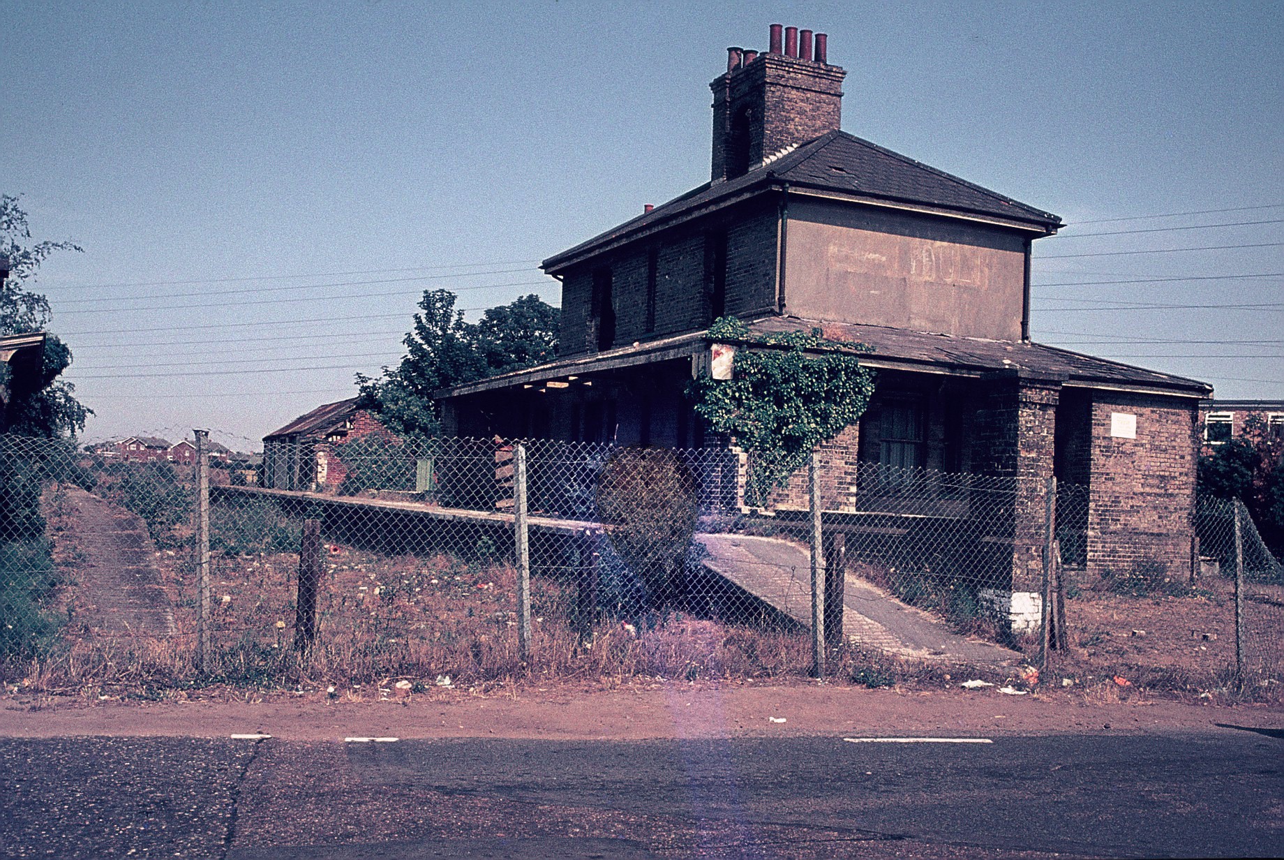
Belton and Burgh railway station
Belton & Burgh (originally Belton) was a railway station serving the Norfolk villages of Belton and Burgh Castle. It once saw trains on the main line from...
Belton with Browston
Belton with Browston is a civil parish in the English county of Norfolk. Historically part of Suffolk, the parish consists of the villages of Belton and...
River Waveney
The River Waveney is a river which forms the boundary between Suffolk and Norfolk, England, for much of its length within The Broads. The "ey" part of...
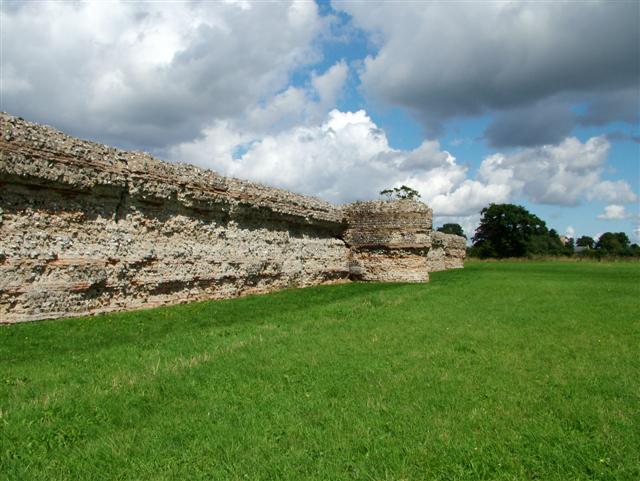
Gariannonum
Gariannonum, or Gariannum, was a Roman Saxon Shore fort in Norfolk, England. The Notitia Dignitatum, a Roman Army "order of battle" from about AD 400,...

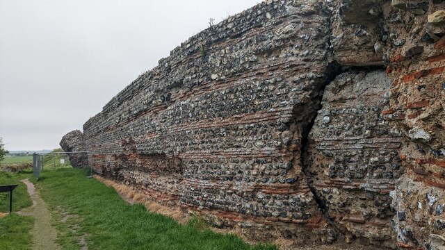
Burgh Castle (Roman fortification)
Burgh Castle is the site of one of nine Roman Saxon Shore forts constructed in England around the 3rd century AD, to hold troops as a defence against Saxon...

Berney Marshes & Breydon Water RSPB reserve
Berney Marshes and Breydon Water RSPB reserve is a nature reserve managed by the Royal Society for the Protection of Birds (RSPB). Berney Marshes is situated...
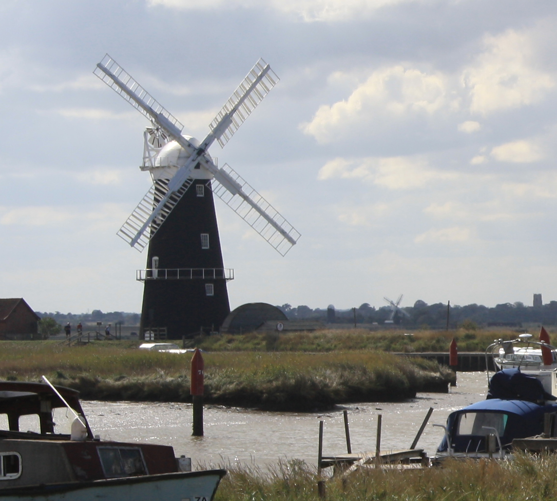
Berney Arms Windmill
Berney Arms Windmill is a tower mill located at Berney Arms alongside the River Yare at the south-western end of Breydon Water in the English county of...

Burgh Castle
Burgh Castle is a village and civil parish in the English county of Norfolk. It is situated on the east bank of the River Waveney, some 3.7 miles (6.0...
Have you been to Belton Marshes?
Leave your review of Belton Marshes below (or comments, questions and feedback).