Erwarton Ness

Coastal Marsh, Saltings in Suffolk Babergh

England

Erwarton Ness

Small bridge and bend, lane towards Harkstead
Small bridge and bend, lane towards Harkstead Credit: Robin Webster

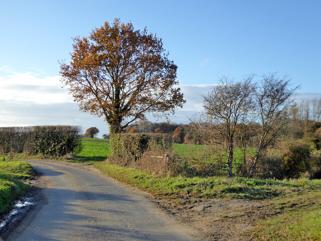
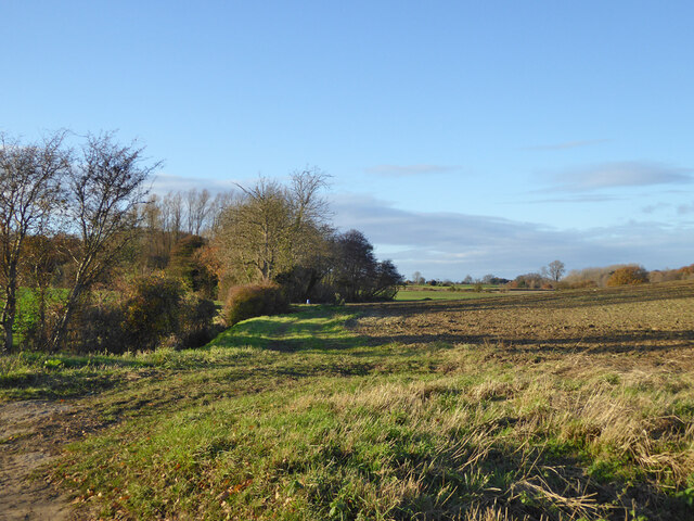
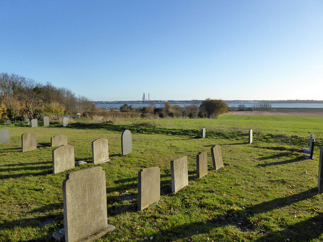
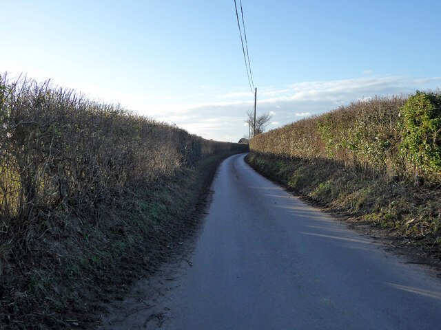
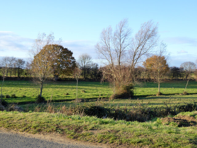
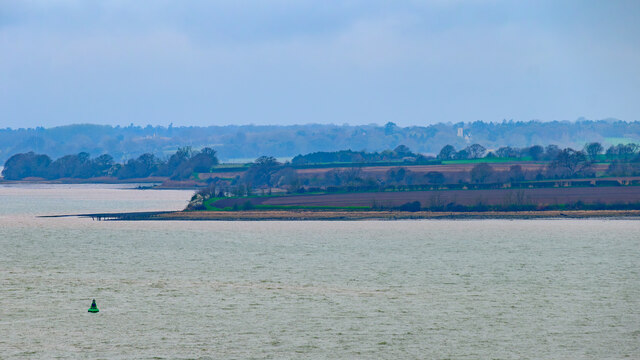
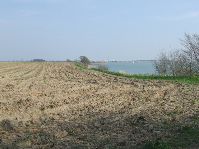
Erwarton Ness is a stunning coastal marsh and salting located in Suffolk, England. This unique and picturesque area is situated on a peninsula that extends into the River Stour, offering breathtaking views of the surrounding landscape.

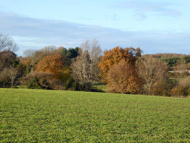
The marshland at Erwarton Ness is characterized by its vast expanse of saltmarshes and tidal mudflats. These habitats are rich in biodiversity, attracting a wide variety of plant and animal species. The area is particularly important for birds, serving as a vital feeding and nesting ground for numerous species. Visitors to Erwarton Ness can expect to spot a range of birdlife, including wading birds such as redshanks, curlews, and oystercatchers.

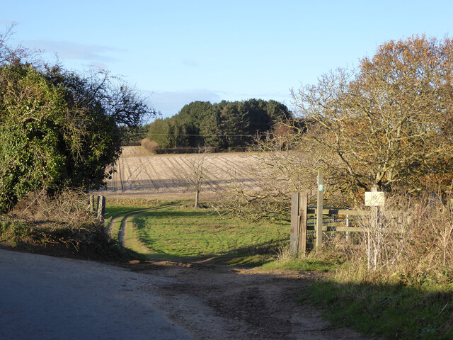
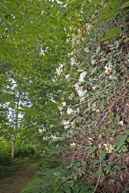
The landscape of Erwarton Ness is ever-changing due to the constant ebb and flow of the tides. This dynamic environment creates a unique ecosystem where salt-tolerant plants thrive, giving the marshland its distinct character. The saltmarshes are home to a variety of flora, including sea lavender, sea aster, and sea purslane, which paint the landscape with vibrant colors during the blooming season.

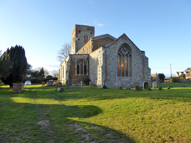
In addition to its natural beauty, Erwarton Ness is also steeped in history. The area is home to the ruins of a medieval church, believed to date back to the 13th century. The church, dedicated to St. Mary, provides a hauntingly beautiful backdrop to the marshland, adding to the overall charm and allure of the site.

Overall, Erwarton Ness is a captivating destination for nature lovers and history enthusiasts alike. Its stunning coastal marshes, diverse wildlife, and rich historical significance make it a must-visit location in Suffolk.

If you have any feedback on the listing, please let us know in the comments section below.

Erwarton Ness Images

Images are sourced within 2km of 51.953002/1.2193949 or Grid Reference TM2133. Thanks to Geograph Open Source API. All images are credited.

Small bridge and bend, lane towards Harkstead
Fields along stream valley Country east of Harkstead.
Fields along stream valley
Country east of Harkstead.
Erwarton church St. Mary's is a grade I listed building, oldest parts 15th century.
Erwarton church
St. Mary's is a grade I listed building, oldest parts 15th century.
View from Erwarton churchyard Towards Parkeston Quay.
View from Erwarton churchyard
Towards Parkeston Quay.
The Queens Head, Erwarton (closed), 2017 It had been closed for some years, with rumours of reopening from time to time, with no result.  Evidently lived in, however.
The Queens Head, Erwarton (closed), 2017
It had been closed for some years, with rumours of reopening from time to time, with no result. Evidently lived in, however.
Rat Hill towards Shop Corner
Field gateway off Rat Hill Footpaths go straight on and right here.
Field gateway off Rat Hill
Footpaths go straight on and right here.
Late autumn trees Along a stream north of Rat Hill.
Late autumn trees
Along a stream north of Rat Hill.
Small stream valley The stream along this valley drains to Johnny All Alone Creek, on the Stour.
Small stream valley
The stream along this valley drains to Johnny All Alone Creek, on the Stour.
Trackwork, industrial sidings, Parkeston Quay See also <a href="https://www.geograph.org.uk/photo/7156271">TM2232 : Petroleum tankers, Parkeston Quay</a> for a view of rolling stock further down the siding.
Trackwork, industrial sidings, Parkeston Quay
See also TM2232 : Petroleum tankers, Parkeston Quay for a view of rolling stock further down the siding.
Petroleum tankers, Parkeston Quay See also <a href="https://www.geograph.org.uk/photo/7156267">TM2332 : Trackwork, industrial sidings, Parkeston Quay</a> for a view of where the points switch to this siding.
Petroleum tankers, Parkeston Quay
See also TM2332 : Trackwork, industrial sidings, Parkeston Quay for a view of where the points switch to this siding.
Erwarton Ness
Erwarton Ness
Suffolk Coastal & Heaths Path A small part of the Suffolk Coastal & Heaths Path with the River Stour south of Harkstead Suffolk.
Suffolk Coastal & Heaths Path
A small part of the Suffolk Coastal & Heaths Path with the River Stour south of Harkstead Suffolk.
Drift Wood Closeup of the remains of a tree beached on the shore of the River Stour along with many others washed and bleached by the weather south of Harkstead Suffolk.
Drift Wood
Closeup of the remains of a tree beached on the shore of the River Stour along with many others washed and bleached by the weather south of Harkstead Suffolk.
Hide on the edge of Copperas Bay A quiet and remote spot yet easily walkable from Wrabness station, the facilities, apart from walking trails and a nature reserve is this roofless bird-watching hide.  There was plenty of evidence of waders and other estuarial birds around here.
Hide on the edge of Copperas Bay
A quiet and remote spot yet easily walkable from Wrabness station, the facilities, apart from walking trails and a nature reserve is this roofless bird-watching hide. There was plenty of evidence of waders and other estuarial birds around here.
Shoreline south of Nether Hall As is also the case on the opposite bank, <a href="https://www.geograph.org.uk/photo/646135">TM2031 : Horizontal woodland along the Stour</a>, the northern banks of the Stour are also scattered with fallen trees that once grew nearby.
Shoreline south of Nether Hall
As is also the case on the opposite bank, TM2031 : Horizontal woodland along the Stour, the northern banks of the Stour are also scattered with fallen trees that once grew nearby.
Seaweed-festooned old jetty Heading south from Needle Corner in <a href="https://www.geograph.org.uk/gridref/TM1934">TM1934</a>, past the abandoned Sparrow Hall, you reach the Orwell at this point, where an old jetty stands, long since abandoned.  It is not alone: <a href="https://www.geograph.org.uk/photo/660274">TM2133 : Abandoned jetty at Erwarton Ness</a>, just a little further east.
Seaweed-festooned old jetty
Heading south from Needle Corner in TM1934, past the abandoned Sparrow Hall, you reach the Orwell at this point, where an old jetty stands, long since abandoned. It is not alone: TM2133 : Abandoned jetty at Erwarton Ness, just a little further east.
Fallen soldier by abandoned jetty Lying next to <a href="https://www.geograph.org.uk/photo/661371">TM1933 : Seaweed-festooned old jetty</a>, this long-dead tree has been swung around by the tide to face the opposite direction to the one it presumably faced when it fell from a nearby bank.
Fallen soldier by abandoned jetty
Lying next to TM1933 : Seaweed-festooned old jetty, this long-dead tree has been swung around by the tide to face the opposite direction to the one it presumably faced when it fell from a nearby bank.
Show me another place!

Erwarton Ness is located at Grid Ref: TM2133 (Lat: 51.953002, Lng: 1.2193949)

Administrative County: Suffolk

District: Babergh

Police Authority: Suffolk

What 3 Words

///fits.overgrown.turned. Near Shotley Gate, Suffolk

Nearby Locations

Erwarton Ness

Related Wikis

River Stour, Suffolk

The River Stour (, pronounced rhyming with either "tour" or "sour") is a major river in East Anglia, England. It is 47 miles (76 km) long and forms most...

Erwarton

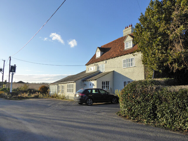
Erwarton or Arwarton is a small village and civil parish in the Babergh district of Suffolk, England. The parish includes the hamlet of Shop Corner. Located...

Harwich refinery

Harwich refinery is a 500,000 tonnes per year refining, processing, blending and storage facility near the port of Harwich in the UK. The refinery was...

Copperas Wood

Copperas Wood is a 13.8-hectare (34-acre) nature reserve between Ramsey and Wrabness in Essex. It is owned and managed by the Essex Wildlife Trust, and...

Related Videos

Pub On A Cub. We visited the Shotely Rose in Suffolk.

We stayed at the Shotely Rose, the cost for our small tents was £5 a night. The land lady was extremely helpful. the food was OK.

Travelling from England to NETHERLAND, by ferry | VLOG 91

We travelled to Amsterdam from England, on a ferry. Kids enjoyed the journey as we got our own room and we also took our car If ...

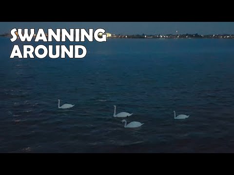
Four Large Birds Swanning Around

Four large birds drift on the current past me at Shotley Marina in Suffolk. View my dedicated hiking, walks and travel channel: ...

Nearby Amenities

Located within 500m of 51.953002,1.2193949
Seamark Beacon Cardinal Category: south
Seamark Beacon Cardinal Colour: yellow;black
Seamark Light Character: Q+LFl
Seamark Light Colour: white
Seamark Light Group: 6
Seamark Light Period: 15
Seamark Light Reference: A 2222.5
Seamark Name: Erwarton Ness
Seamark Type: beacon_cardinal
Source: US NGA Pub. 114. 2011-04-02
Lat/Long: 51.9518838/1.220525
The data included in this document is from www.openstreetmap.org. The data is made available under ODbL.

Have you been to Erwarton Ness?

Leave your review of Erwarton Ness below (or comments, questions and feedback).