Mulberry Middle

Coastal Marsh, Saltings in Suffolk East Suffolk

England

Mulberry Middle

Freston Tower A brick built towner probably dating from the 16th Century: <span class="nowrap"><a title="https://en.wikipedia.org/wiki/Freston_Tower" rel="nofollow ugc noopener" href="https://en.wikipedia.org/wiki/Freston_Tower">Link</a><img style="margin-left:2px;" alt="External link" title="External link - shift click to open in new window" src="https://s1.geograph.org.uk/img/external.png" width="10" height="10"/></span>. It now belongs to the Landmark Trust and can be rented as a holdiay home: <span class="nowrap"><a title="https://www.landmarktrust.org.uk/search-and-book/properties/freston-tower-7680/#Overview" rel="nofollow ugc noopener" href="https://www.landmarktrust.org.uk/search-and-book/properties/freston-tower-7680/#Overview">Link</a><img style="margin-left:2px;" alt="External link" title="External link - shift click to open in new window" src="https://s1.geograph.org.uk/img/external.png" width="10" height="10"/></span>
Freston Tower Credit: Chris Holifield

Mulberry Middle is a small coastal marsh located in Suffolk, England. Situated within the larger Suffolk Coastal Marshes, Mulberry Middle is characterized by its unique saltings ecosystem. Saltings are coastal areas where salt-tolerant vegetation thrives due to the presence of saltwater.

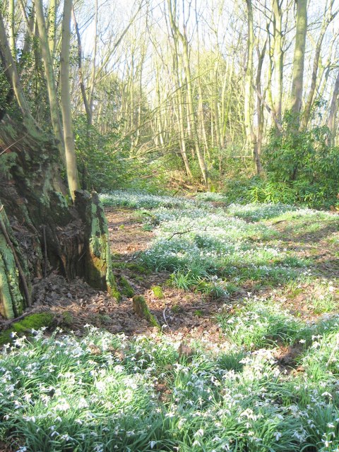
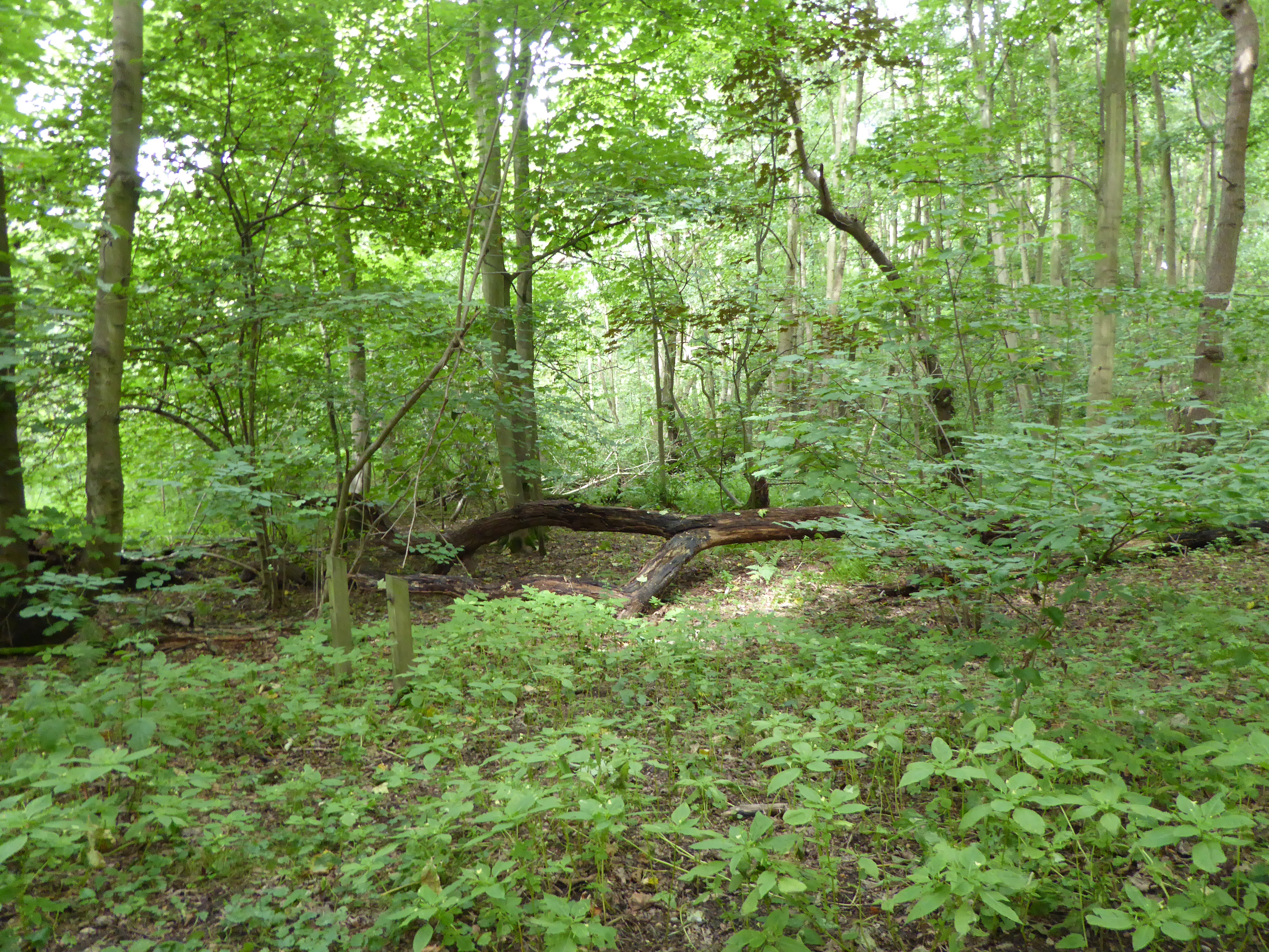
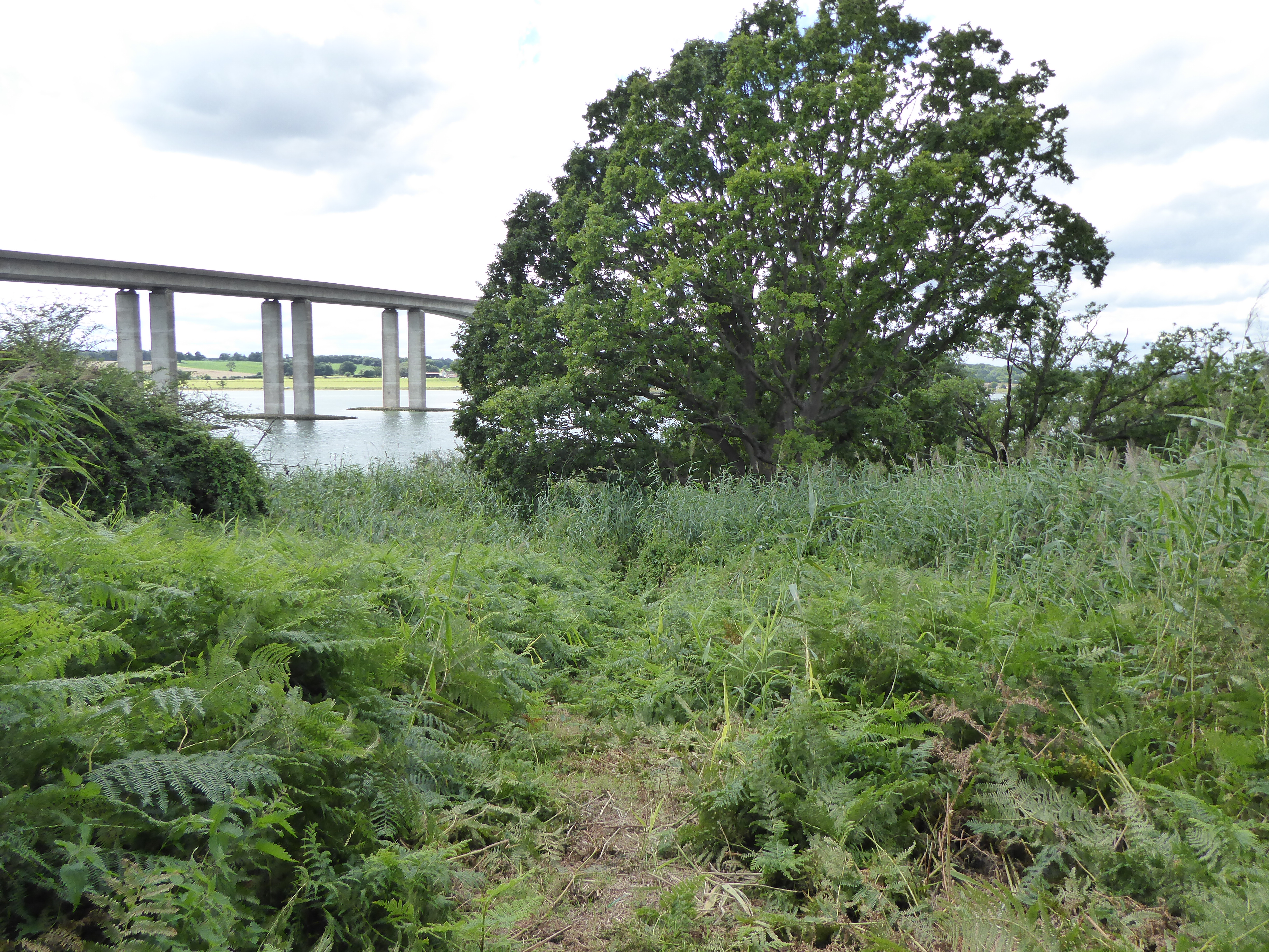
The marshland of Mulberry Middle is primarily composed of mudflats, salt marshes, creeks, and channels. These diverse habitats attract a wide range of flora and fauna, making it a significant area for wildlife conservation. The saltings are home to various species of salt-tolerant plants, including sea aster, sea lavender, and samphire, which add vibrant colors to the landscape.

Birdwatchers flock to Mulberry Middle to observe its abundant bird population. The marshes provide an ideal habitat for wading birds such as curlews, redshanks, and oystercatchers. During migration seasons, Mulberry Middle becomes a temporary home for numerous species of waterfowl, including Brent geese and teal.

The marshland is also important for its role in flood prevention and erosion control. The intricate network of creeks and channels helps absorb excess water during high tides and storm surges, protecting nearby coastal communities from flooding.

Mulberry Middle is a popular destination for nature enthusiasts, who can explore the marshes on foot through designated trails or go boating along the waterways. The Suffolk Coast and Heaths Area of Outstanding Natural Beauty, which encompasses Mulberry Middle, ensures the protection and conservation of this unique and ecologically significant environment.

If you have any feedback on the listing, please let us know in the comments section below.

Mulberry Middle Images

Images are sourced within 2km of 52.018307/1.1817373 or Grid Reference TM1840. Thanks to Geograph Open Source API. All images are credited.

Freston Tower A brick built towner probably dating from the 16th Century: <span class="nowrap"><a title="https://en.wikipedia.org/wiki/Freston_Tower" rel="nofollow ugc noopener" href="https://en.wikipedia.org/wiki/Freston_Tower">Link</a><img style="margin-left:2px;" alt="External link" title="External link - shift click to open in new window" src="https://s1.geograph.org.uk/img/external.png" width="10" height="10"/></span>. It now belongs to the Landmark Trust and can be rented as a holdiay home: <span class="nowrap"><a title="https://www.landmarktrust.org.uk/search-and-book/properties/freston-tower-7680/#Overview" rel="nofollow ugc noopener" href="https://www.landmarktrust.org.uk/search-and-book/properties/freston-tower-7680/#Overview">Link</a><img style="margin-left:2px;" alt="External link" title="External link - shift click to open in new window" src="https://s1.geograph.org.uk/img/external.png" width="10" height="10"/></span>
Freston Tower
A brick built towner probably dating from the 16th Century: LinkExternal link. It now belongs to the Landmark Trust and can be rented as a holdiay home: LinkExternal link
Woolverstone Marina
Woolverstone Marina
Woolverstone Marina Wolverstone Marina is the Home of many pleasure crafts.  It is also next to the “Cat House” where it was said that years ago was the home to a man who was sympathetic to boats carrying contraband along the river.  He had a pet cat which he loved.  When it died he had it stuffed and when he could see that no customs boats were patrolling the river put the cat in the window for any smugglers to see, signalling that all was well.
Woolverstone Marina
Wolverstone Marina is the Home of many pleasure crafts. It is also next to the “Cat House” where it was said that years ago was the home to a man who was sympathetic to boats carrying contraband along the river. He had a pet cat which he loved. When it died he had it stuffed and when he could see that no customs boats were patrolling the river put the cat in the window for any smugglers to see, signalling that all was well.
Freston Tower Freston Tower, owned by The Landmark Trust. We stayed there in October 2005!
Freston Tower
Freston Tower, owned by The Landmark Trust. We stayed there in October 2005!
A long drive Woolverstone Hall Woolverstone Suffolk.Now a school. More info see <span class="nowrap"><a title="http://en.wikipedia.org/wiki/Woolverstone_Hall" rel="nofollow ugc noopener" href="http://en.wikipedia.org/wiki/Woolverstone_Hall">Link</a><img style="margin-left:2px;" alt="External link" title="External link - shift click to open in new window" src="https://s1.geograph.org.uk/img/external.png" width="10" height="10"/></span>
A long drive
Woolverstone Hall Woolverstone Suffolk.Now a school. More info see LinkExternal link
Snowdrops in Woolverstone wood
St Michael's, Woolverstone Taken from the drive down to the marina.
St Michael's, Woolverstone
Taken from the drive down to the marina.
'The Boot' inn at Freston, Suffolk This inn stands on Freston Hill on the B.1456
'The Boot' inn at Freston, Suffolk
This inn stands on Freston Hill on the B.1456
The Lych Gate to St. Peter's church, Freston, Suffolk
Water Tower alongside the B.1080
Home Farm
Home Farm
Water Tower Water tower near to Woolverstone Suffolk.
Water Tower
Water tower near to Woolverstone Suffolk.
Please Drive Carefully Entrance sign to Freston just off the B1456 Suffolk.
Please Drive Carefully
Entrance sign to Freston just off the B1456 Suffolk.
Village Name And Speed Sign Village name and speed sign for Freston just off the B1456 Suffolk.
Village Name And Speed Sign
Village name and speed sign for Freston just off the B1456 Suffolk.
St.Peters Freston St.Peters church Freston Suffolk. For more info see <span class="nowrap"><a title="http://www.suffolkchurches.co.uk/freston.html" rel="nofollow ugc noopener" href="http://www.suffolkchurches.co.uk/freston.html">Link</a><img style="margin-left:2px;" alt="External link" title="External link - shift click to open in new window" src="https://s1.geograph.org.uk/img/external.png" width="10" height="10"/></span> and photo <a title="https://www.geograph.org.uk/photo/484426" href="https://www.geograph.org.uk/photo/484426">Link</a>
St.Peters Freston
St.Peters church Freston Suffolk. For more info see LinkExternal link and photo Link
The Wooden War Memorial This is a wooden war memorial in the churchyard of St. Peter's Church, Freston, Suffolk. For more info see <span class="nowrap"><a title="http://www.suffolkchurches.co.uk/freston.html" rel="nofollow ugc noopener" href="http://www.suffolkchurches.co.uk/freston.html">Link</a><img style="margin-left:2px;" alt="External link" title="External link - shift click to open in new window" src="https://s1.geograph.org.uk/img/external.png" width="10" height="10"/></span> and <a href="https://www.geograph.org.uk/photo/484419">TM1739 : St.Peters Freston</a>
The Wooden War Memorial
This is a wooden war memorial in the churchyard of St. Peter's Church, Freston, Suffolk. For more info see LinkExternal link and TM1739 : St.Peters Freston
Foreshore at Woolverstone Looking upstream from the end of the public footpath towards the Orwell Bridge.
Foreshore at Woolverstone
Looking upstream from the end of the public footpath towards the Orwell Bridge.
Cottage in a clearing Sympathetically extended cottage in a clearing in Woolverstone Woods.
Cottage in a clearing
Sympathetically extended cottage in a clearing in Woolverstone Woods.
Show me another place!

Mulberry Middle is located at Grid Ref: TM1840 (Lat: 52.018307, Lng: 1.1817373)

Administrative County: Suffolk

District: East Suffolk

Police Authority: Suffolk

What 3 Words

///sleep.uptown.sofas. Near Holbrook, Suffolk

Related Wikis

Bridge Wood

Bridge Wood is a 31 hectare Local Nature Reserve on the southern outskirts of Ipswich in Suffolk, England. It is owned and managed by Ipswich Borough Council...
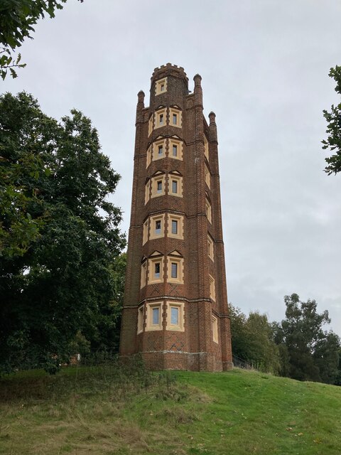
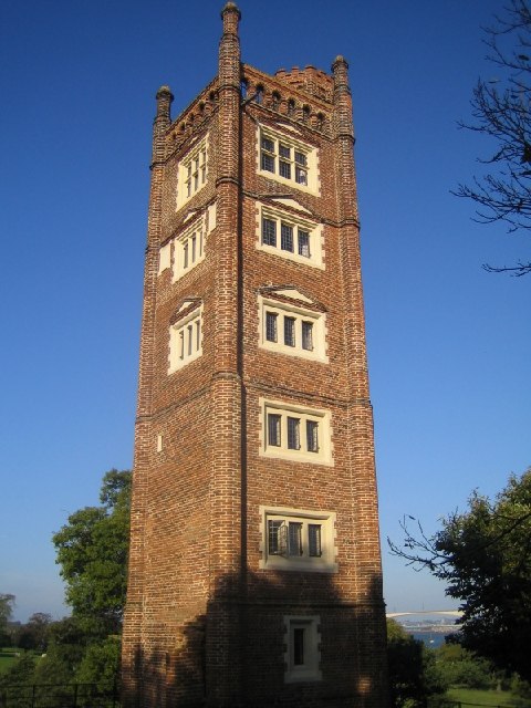
Freston Tower

Freston Tower is a six-storey red brick folly south of Ipswich, Suffolk in the village of Freston. It stands on the banks of the River Orwell. == History... ==

Alnesbourne Priory

Alnesbourne Priory, also known as Alnesbourn Priory, was a small Augustinian monastic house in the English county of Suffolk. It was located near Nacton...

Pipers Vale

Pipers Vale is a 19.7 hectare Local Nature Reserve on the southern outskirts of Ipswich in Suffolk. It is owned and managed by Ipswich Borough Council...

Nearby Amenities

Located within 500m of 52.018307,1.1817373
Created By: almien_coastlines
Source: PGS
Lat/Long: 52.0216816/1.1785333
Source: PGS
Lat/Long: 52.0212085/1.1792824
Source: PGS
Lat/Long: 52.0204426/1.1807522
Source: PGS
Lat/Long: 52.0199474/1.1818037
Source: PGS
Lat/Long: 52.0195249/1.1825332
Source: PGS
Lat/Long: 52.0191023/1.1829731
Source: PGS
Lat/Long: 52.0187458/1.1832735
Source: PGS
Lat/Long: 52.0177676/1.1839788
Source: PGS
Lat/Long: 52.017313/1.1844
Source: PGS
Lat/Long: 52.0168706/1.1848721
Source: PGS
Lat/Long: 52.0165603/1.1852798
Source: PGS
Lat/Long: 52.0162499/1.1857411
Source: PGS
Lat/Long: 52.0159264/1.1862669
Source: PGS
Lat/Long: 52.0157283/1.1866424
Source: PGS
Lat/Long: 52.0155302/1.1870822
Bench
Lat/Long: 52.0200989/1.1864212
Bench
Lat/Long: 52.0200883/1.1863011
Bench
Lat/Long: 52.02012/1.1865156
Bench
Lat/Long: 52.0198339/1.1826862
Artwork Type: sculpture
Tourism: artwork
Lat/Long: 52.0197213/1.1878617
Barrier: kissing_gate
Lat/Long: 52.0219836/1.1854365
Power: pole
Lat/Long: 52.0222633/1.1819021
Power: pole
Lat/Long: 52.0210701/1.1826127
Power: pole
Lat/Long: 52.0211757/1.1861022
Power: pole
Lat/Long: 52.0211014/1.1837124
Seamark Buoy Lateral Category: starboard
Seamark Buoy Lateral Colour: green
Seamark Buoy Lateral Shape: conical
Seamark Light Character: Fl
Seamark Light Colour: green
Seamark Light Period: 2.5
Seamark Name: Bridgewood
Seamark Type: buoy_lateral
Lat/Long: 52.0184403/1.1755587
Seamark Buoy Lateral Category: port
Seamark Buoy Lateral Colour: red
Seamark Buoy Lateral Shape: can
Seamark Buoy Lateral System: iala-a
Seamark Light Character: Q
Seamark Light Colour: red
Seamark Name: No. 8
Seamark Type: buoy_lateral
Lat/Long: 52.0155947/1.1791263
Seamark Buoy Lateral Category: starboard
Seamark Buoy Lateral Colour: green
Seamark Buoy Lateral Shape: conical
Seamark Buoy Lateral System: iala-a
Seamark Light Character: Q
Seamark Light Colour: green
Seamark Name: Priory
Seamark Type: buoy_lateral
Lat/Long: 52.0158487/1.1803923
Bench
Lat/Long: 52.0188712/1.1882396
The data included in this document is from www.openstreetmap.org. The data is made available under ODbL.

Have you been to Mulberry Middle?

Leave your review of Mulberry Middle below (or comments, questions and feedback).