Bridge Wood

Wood, Forest in Suffolk East Suffolk

England

Bridge Wood

Freston Tower A brick built towner probably dating from the 16th Century: <span class="nowrap"><a title="https://en.wikipedia.org/wiki/Freston_Tower" rel="nofollow ugc noopener" href="https://en.wikipedia.org/wiki/Freston_Tower">Link</a><img style="margin-left:2px;" alt="External link" title="External link - shift click to open in new window" src="https://s1.geograph.org.uk/img/external.png" width="10" height="10"/></span>. It now belongs to the Landmark Trust and can be rented as a holdiay home: <span class="nowrap"><a title="https://www.landmarktrust.org.uk/search-and-book/properties/freston-tower-7680/#Overview" rel="nofollow ugc noopener" href="https://www.landmarktrust.org.uk/search-and-book/properties/freston-tower-7680/#Overview">Link</a><img style="margin-left:2px;" alt="External link" title="External link - shift click to open in new window" src="https://s1.geograph.org.uk/img/external.png" width="10" height="10"/></span>
Freston Tower Credit: Chris Holifield

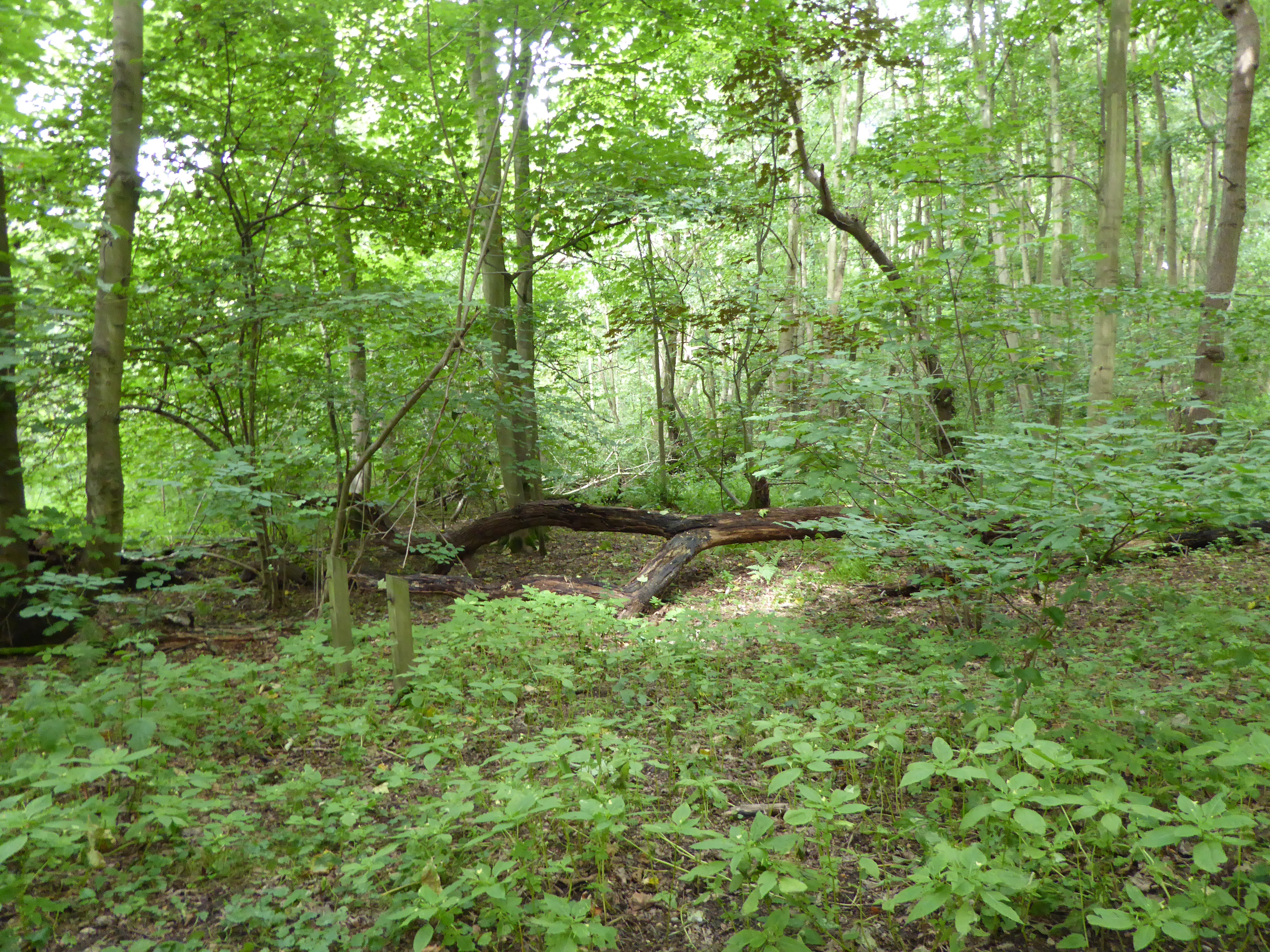
Bridge Wood is a picturesque forest located in the idyllic county of Suffolk, England. Covering an area of approximately 500 acres, it is a haven for nature lovers and outdoor enthusiasts. The wood is situated near the village of Bridge, hence its name, and is easily accessible from the nearby town of Ipswich.

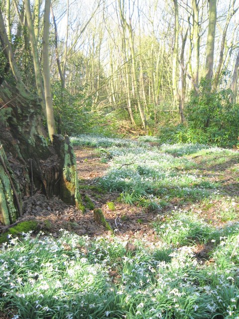
This ancient woodland boasts a diverse range of flora and fauna, making it a hotspot for wildlife enthusiasts. Majestic oak, beech, and ash trees dominate the landscape, creating a beautiful canopy that filters sunlight and provides a peaceful ambiance. The forest floor is adorned with a carpet of bluebells in the spring, creating a stunning display of color.

Bridge Wood is crisscrossed by a network of trails and footpaths, providing ample opportunities for walking, hiking, and exploring the natural wonders of the area. The paths wind their way through the forest, passing by tranquil streams and small ponds, adding to the charm of the wood.

For birdwatchers, Bridge Wood is a haven, with a wide variety of bird species calling the forest home. Woodpeckers, owls, and thrushes can often be spotted among the treetops, while smaller birds like robins and blue tits flit about in the undergrowth.

Visitors to Bridge Wood can also enjoy a picnic in one of the designated areas, or simply find a quiet spot to relax and soak in the serenity of the surroundings. The wood is a popular destination for families, providing a safe and enjoyable environment for children to explore and learn about nature.

Overall, Bridge Wood is a hidden gem in Suffolk, offering a peaceful retreat from the hustle and bustle of everyday life, and a chance to reconnect with nature in all its splendor.

If you have any feedback on the listing, please let us know in the comments section below.

Bridge Wood Images

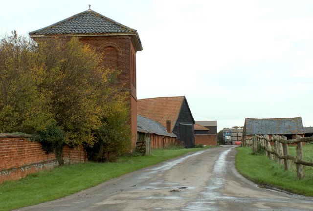
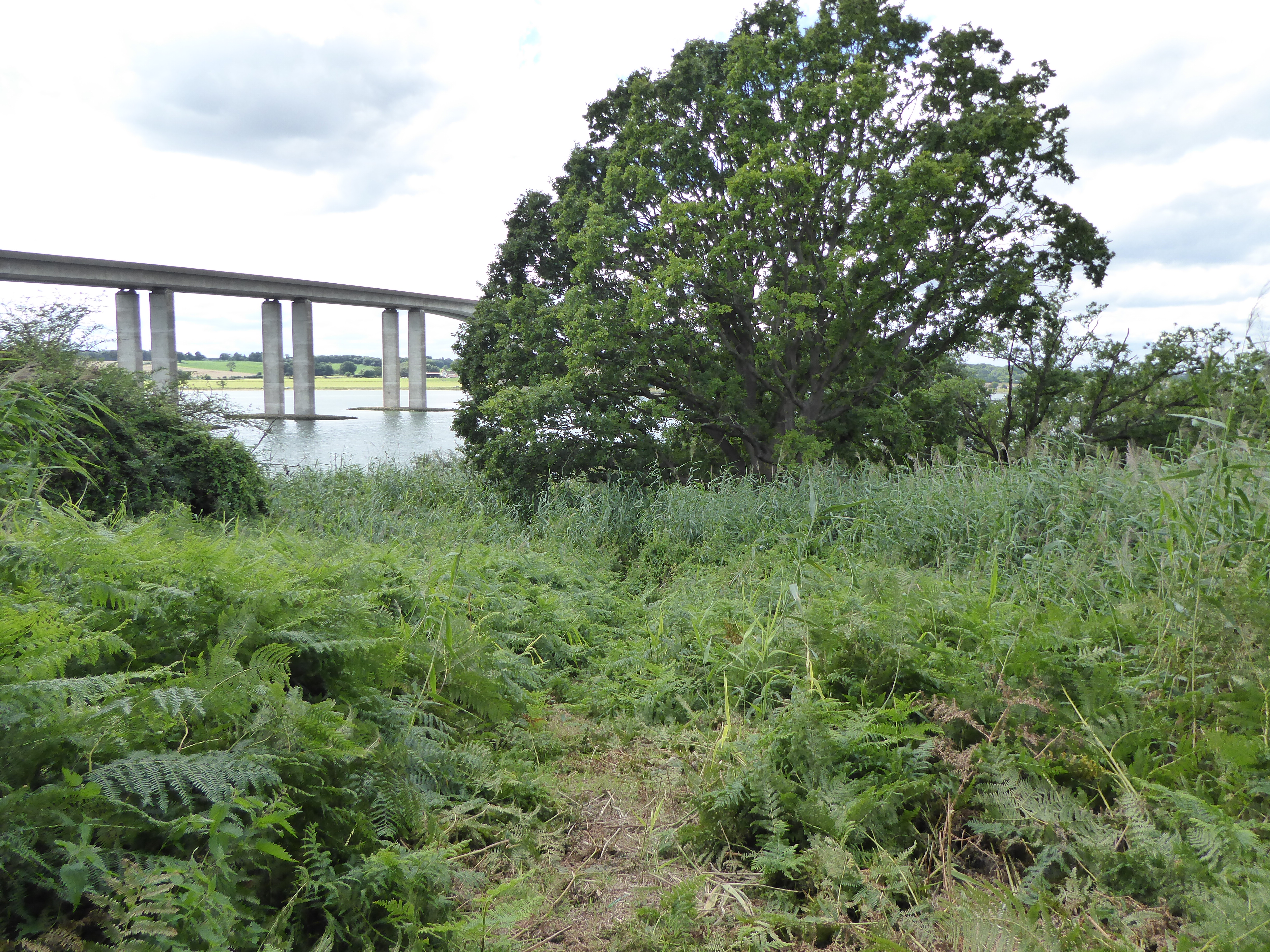
Images are sourced within 2km of 52.019979/1.1854276 or Grid Reference TM1840. Thanks to Geograph Open Source API. All images are credited.

Freston Tower A brick built towner probably dating from the 16th Century: <span class="nowrap"><a title="https://en.wikipedia.org/wiki/Freston_Tower" rel="nofollow ugc noopener" href="https://en.wikipedia.org/wiki/Freston_Tower">Link</a><img style="margin-left:2px;" alt="External link" title="External link - shift click to open in new window" src="https://s1.geograph.org.uk/img/external.png" width="10" height="10"/></span>. It now belongs to the Landmark Trust and can be rented as a holdiay home: <span class="nowrap"><a title="https://www.landmarktrust.org.uk/search-and-book/properties/freston-tower-7680/#Overview" rel="nofollow ugc noopener" href="https://www.landmarktrust.org.uk/search-and-book/properties/freston-tower-7680/#Overview">Link</a><img style="margin-left:2px;" alt="External link" title="External link - shift click to open in new window" src="https://s1.geograph.org.uk/img/external.png" width="10" height="10"/></span>
Freston Tower
A brick built towner probably dating from the 16th Century: LinkExternal link. It now belongs to the Landmark Trust and can be rented as a holdiay home: LinkExternal link
Woolverstone Marina
Woolverstone Marina
Woolverstone Marina Wolverstone Marina is the Home of many pleasure crafts.  It is also next to the “Cat House” where it was said that years ago was the home to a man who was sympathetic to boats carrying contraband along the river.  He had a pet cat which he loved.  When it died he had it stuffed and when he could see that no customs boats were patrolling the river put the cat in the window for any smugglers to see, signalling that all was well.
Woolverstone Marina
Wolverstone Marina is the Home of many pleasure crafts. It is also next to the “Cat House” where it was said that years ago was the home to a man who was sympathetic to boats carrying contraband along the river. He had a pet cat which he loved. When it died he had it stuffed and when he could see that no customs boats were patrolling the river put the cat in the window for any smugglers to see, signalling that all was well.
Freston Tower Freston Tower, owned by The Landmark Trust. We stayed there in October 2005!
Freston Tower
Freston Tower, owned by The Landmark Trust. We stayed there in October 2005!
Snowdrops in Woolverstone wood
St Michael's, Woolverstone Taken from the drive down to the marina.
St Michael's, Woolverstone
Taken from the drive down to the marina.
'The Boot' inn at Freston, Suffolk This inn stands on Freston Hill on the B.1456
'The Boot' inn at Freston, Suffolk
This inn stands on Freston Hill on the B.1456
Home Farm
Home Farm
St.Peters Freston St.Peters church Freston Suffolk. For more info see <span class="nowrap"><a title="http://www.suffolkchurches.co.uk/freston.html" rel="nofollow ugc noopener" href="http://www.suffolkchurches.co.uk/freston.html">Link</a><img style="margin-left:2px;" alt="External link" title="External link - shift click to open in new window" src="https://s1.geograph.org.uk/img/external.png" width="10" height="10"/></span> and photo <a title="https://www.geograph.org.uk/photo/484426" href="https://www.geograph.org.uk/photo/484426">Link</a>
St.Peters Freston
St.Peters church Freston Suffolk. For more info see LinkExternal link and photo Link
The Wooden War Memorial This is a wooden war memorial in the churchyard of St. Peter's Church, Freston, Suffolk. For more info see <span class="nowrap"><a title="http://www.suffolkchurches.co.uk/freston.html" rel="nofollow ugc noopener" href="http://www.suffolkchurches.co.uk/freston.html">Link</a><img style="margin-left:2px;" alt="External link" title="External link - shift click to open in new window" src="https://s1.geograph.org.uk/img/external.png" width="10" height="10"/></span> and <a href="https://www.geograph.org.uk/photo/484419">TM1739 : St.Peters Freston</a>
The Wooden War Memorial
This is a wooden war memorial in the churchyard of St. Peter's Church, Freston, Suffolk. For more info see LinkExternal link and TM1739 : St.Peters Freston
Foreshore at Woolverstone Looking upstream from the end of the public footpath towards the Orwell Bridge.
Foreshore at Woolverstone
Looking upstream from the end of the public footpath towards the Orwell Bridge.
Cottage in a clearing Sympathetically extended cottage in a clearing in Woolverstone Woods.
Cottage in a clearing
Sympathetically extended cottage in a clearing in Woolverstone Woods.
Woolverstone Marina Mdl owned Marina on the River Orwell
Woolverstone Marina
Mdl owned Marina on the River Orwell
River Orwell saltmarsh An area of saltmarsh at Freston, on the west bank of the River Orwell. The areas of saltmarsh - or 'saltings' - in the river have eroded considerably in recent decades. This may be partly due to the effect of wash from larger vessels using the port of Ipswich.
River Orwell saltmarsh
An area of saltmarsh at Freston, on the west bank of the River Orwell. The areas of saltmarsh - or 'saltings' - in the river have eroded considerably in recent decades. This may be partly due to the effect of wash from larger vessels using the port of Ipswich.
River Orwell foreshore On the Freston foreshore the saltings have eroded, leaving only remnants of slightly harder soil. These apparent 'rocks' are in fact lumps of hardened mud, which will probably disappear in time.
River Orwell foreshore
On the Freston foreshore the saltings have eroded, leaving only remnants of slightly harder soil. These apparent 'rocks' are in fact lumps of hardened mud, which will probably disappear in time.
River Orwell tributary This unnamed stream enters the River Orwell from Freston Park.
River Orwell tributary
This unnamed stream enters the River Orwell from Freston Park.
Freston Park The parkland extends to the river bank, by the line of gorse bushes. The River Orwell and the Orwell Bridge can be seen in the distance.
Freston Park
The parkland extends to the river bank, by the line of gorse bushes. The River Orwell and the Orwell Bridge can be seen in the distance.
Freston Park and Tower The parkland surrounds the tower and neighbouring farmhouse. The folly is owned by the Landmark Trust, and is rented out as one of their more unusual properties.
Freston Park and Tower
The parkland surrounds the tower and neighbouring farmhouse. The folly is owned by the Landmark Trust, and is rented out as one of their more unusual properties.
Show me another place!

Bridge Wood is located at Grid Ref: TM1840 (Lat: 52.019979, Lng: 1.1854276)

Administrative County: Suffolk

District: East Suffolk

Police Authority: Suffolk

What 3 Words

///media.likes.wealth. Near Holbrook, Suffolk

Related Wikis

Bridge Wood

Bridge Wood is a 31 hectare Local Nature Reserve on the southern outskirts of Ipswich in Suffolk, England. It is owned and managed by Ipswich Borough Council...

Alnesbourne Priory

Alnesbourne Priory, also known as Alnesbourn Priory, was a small Augustinian monastic house in the English county of Suffolk. It was located near Nacton...

Leighton Road Evangelical Church, Ipswich

Leighton Road Evangelical Church is a nonconformist independent evangelical church located on the Gainsborough estate, Ipswich in the English county of...
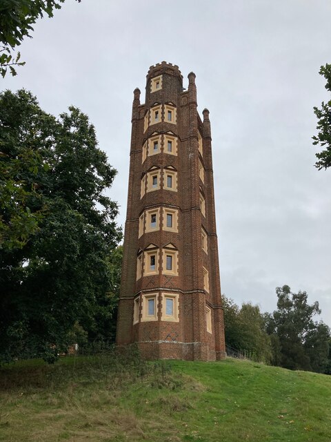
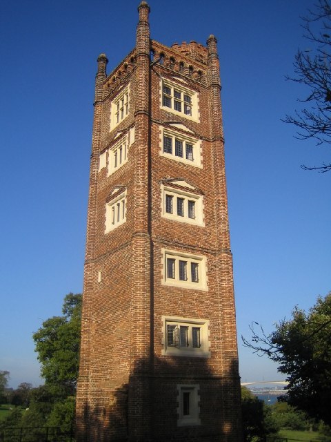
Freston Tower

Freston Tower is a six-storey red brick folly south of Ipswich, Suffolk in the village of Freston. It stands on the banks of the River Orwell. == History... ==

Pipers Vale

Pipers Vale is a 19.7 hectare Local Nature Reserve on the southern outskirts of Ipswich in Suffolk. It is owned and managed by Ipswich Borough Council...

Ravenswood, Ipswich

Ravenswood is a district within Ipswich, in the Ipswich district, in the county of Suffolk, England. It is sited on the old Ipswich Airport to the south...

Ipswich Gymnastics Centre

Ipswich Gymnastics Centre in Ipswich is one of only three fully London Organising Committee for the Olympic Games (LOCOG) accredited gymnastics facilities...

Ipswich Airport

Ipswich Airport (IATA: IPW, ICAO: EGSE) was an airfield on the outskirts of Ipswich, Suffolk England. It was known as RAF Nacton when No. 3619 Fighter...

Nearby Amenities

Located within 500m of 52.019979,1.1854276
Source: PGS
Lat/Long: 52.0212085/1.1792824
Source: PGS
Lat/Long: 52.0204426/1.1807522
Source: PGS
Lat/Long: 52.0199474/1.1818037
Source: PGS
Lat/Long: 52.0195249/1.1825332
Source: PGS
Lat/Long: 52.0191023/1.1829731
Source: PGS
Lat/Long: 52.0187458/1.1832735
Source: PGS
Lat/Long: 52.0177676/1.1839788
Source: PGS
Lat/Long: 52.017313/1.1844
Source: PGS
Lat/Long: 52.0168706/1.1848721
Source: PGS
Lat/Long: 52.0165603/1.1852798
Source: PGS
Lat/Long: 52.0162499/1.1857411
Source: PGS
Lat/Long: 52.0159264/1.1862669
Source: PGS
Lat/Long: 52.0157283/1.1866424
Fuel
Shell Petrol Station
Addr City: Ipswich
Addr Postcode: IP10 0JN
Addr Street: A14 West-bound
Brand: Shell
Brand Wikidata: Q110716465
Phone: +44 1473 321070
Ref Navads: NVDS353_10018971
Website: https://find.shell.com/gb/fuel/10018971-shell-orwell
Lat/Long: 52.0235347/1.1870107
Bench
Lat/Long: 52.0200989/1.1864212
Bench
Lat/Long: 52.0200883/1.1863011
Bench
Lat/Long: 52.02012/1.1865156
Bench
Lat/Long: 52.0198339/1.1826862
Artwork Type: sculpture
Tourism: artwork
Lat/Long: 52.0197213/1.1878617
Artwork Type: sculpture
Tourism: artwork
Lat/Long: 52.0223991/1.1874497
Barrier: kissing_gate
Lat/Long: 52.0219836/1.1854365
Post Box
Operator: Royal Mail
Operator Type: private
Operator Wikidata: Q638098
Post Box Mounting: pier
Post Box Type: lamp
Ref: IP10 1103
Royal Cypher: EIIR
Royal Cypher Wikidata: Q33102113
Lat/Long: 52.0227025/1.1907451
Power: pole
Lat/Long: 52.0211649/1.1886222
Power: pole
Lat/Long: 52.0222633/1.1819021
Power: pole
Lat/Long: 52.0210668/1.1879503
Power: pole
Lat/Long: 52.0210701/1.1826127
Power: pole
Lat/Long: 52.0232587/1.1817705
Power: pole
Lat/Long: 52.0211757/1.1861022
Power: pole
Lat/Long: 52.0211014/1.1837124
Power: pole
Lat/Long: 52.0214646/1.1871832
Bicycle Parking
Bicycle Parking: stands
Lat/Long: 52.0222427/1.1867414
Parcel Locker
Brand: Amazon Locker
Brand Wikidata: Q16974764
Lat/Long: 52.0236085/1.1867018
The data included in this document is from www.openstreetmap.org. The data is made available under ODbL.

Have you been to Bridge Wood?

Leave your review of Bridge Wood below (or comments, questions and feedback).