Reeveshall Marsh

Coastal Marsh, Saltings in Essex Colchester

England

Reeveshall Marsh

St. Edmund Church, East Mersea <span class="nowrap"><a title="https://en.wikipedia.org/wiki/East_Mersea" rel="nofollow ugc noopener" href="https://en.wikipedia.org/wiki/East_Mersea">Link</a><img style="margin-left:2px;" alt="External link" title="External link - shift click to open in new window" src="https://s1.geograph.org.uk/img/external.png" width="10" height="10"/></span>
St. Edmund Church, East Mersea Credit: PAUL FARMER

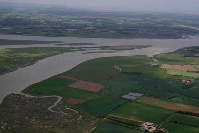
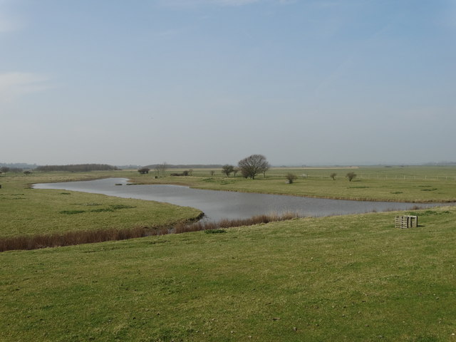
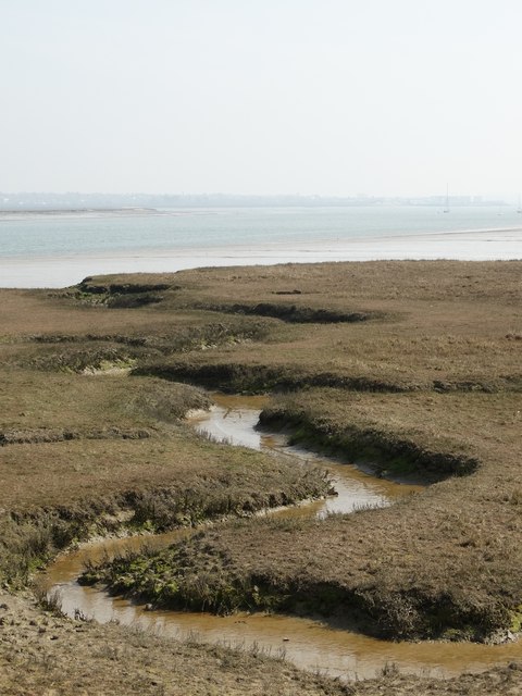
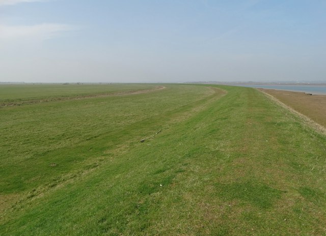
Reeveshall Marsh, located in Essex, is a coastal marsh that stretches across a vast area of picturesque landscape. This marsh is renowned for its unique and diverse ecosystem, making it a fascinating destination for nature enthusiasts and birdwatchers alike.

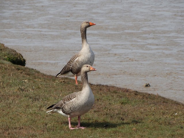
The marsh is situated adjacent to the North Sea, and its landscape consists of a combination of mudflats, salt marshes, and coastal saltings. These diverse habitats provide a perfect breeding ground and feeding area for a wide variety of bird species. Visitors to Reeveshall Marsh can spot an array of migratory birds, such as curlews, avocets, oystercatchers, and redshanks, especially during the spring and autumn months.

The marsh is also home to several plant species that have adapted to the saline conditions, including samphire, sea lavender, and sea purslane. These plants play a crucial role in stabilizing the marshland and providing food and shelter for numerous insects and small mammals.

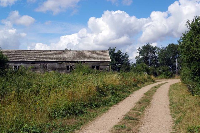
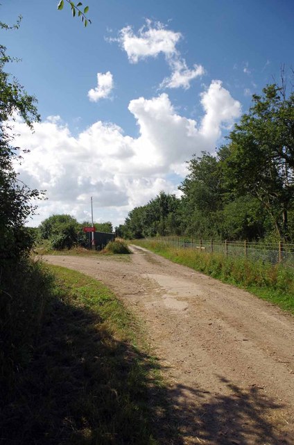
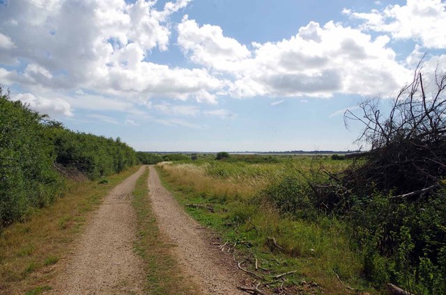
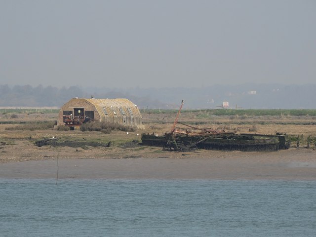
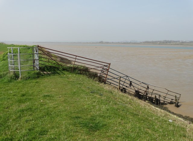
In addition to its ecological significance, Reeveshall Marsh offers stunning views of the surrounding coastal area. Visitors can enjoy long walks along the designated trails, taking in the breathtaking scenery and observing the ever-changing tides. The marsh is also a popular spot for fishing and is known for its abundance of sea trout and flounder.

Reeveshall Marsh is a true gem of Essex's natural heritage, providing a vital habitat for numerous species and offering visitors a chance to immerse themselves in the beauty of a coastal marsh ecosystem.

If you have any feedback on the listing, please let us know in the comments section below.

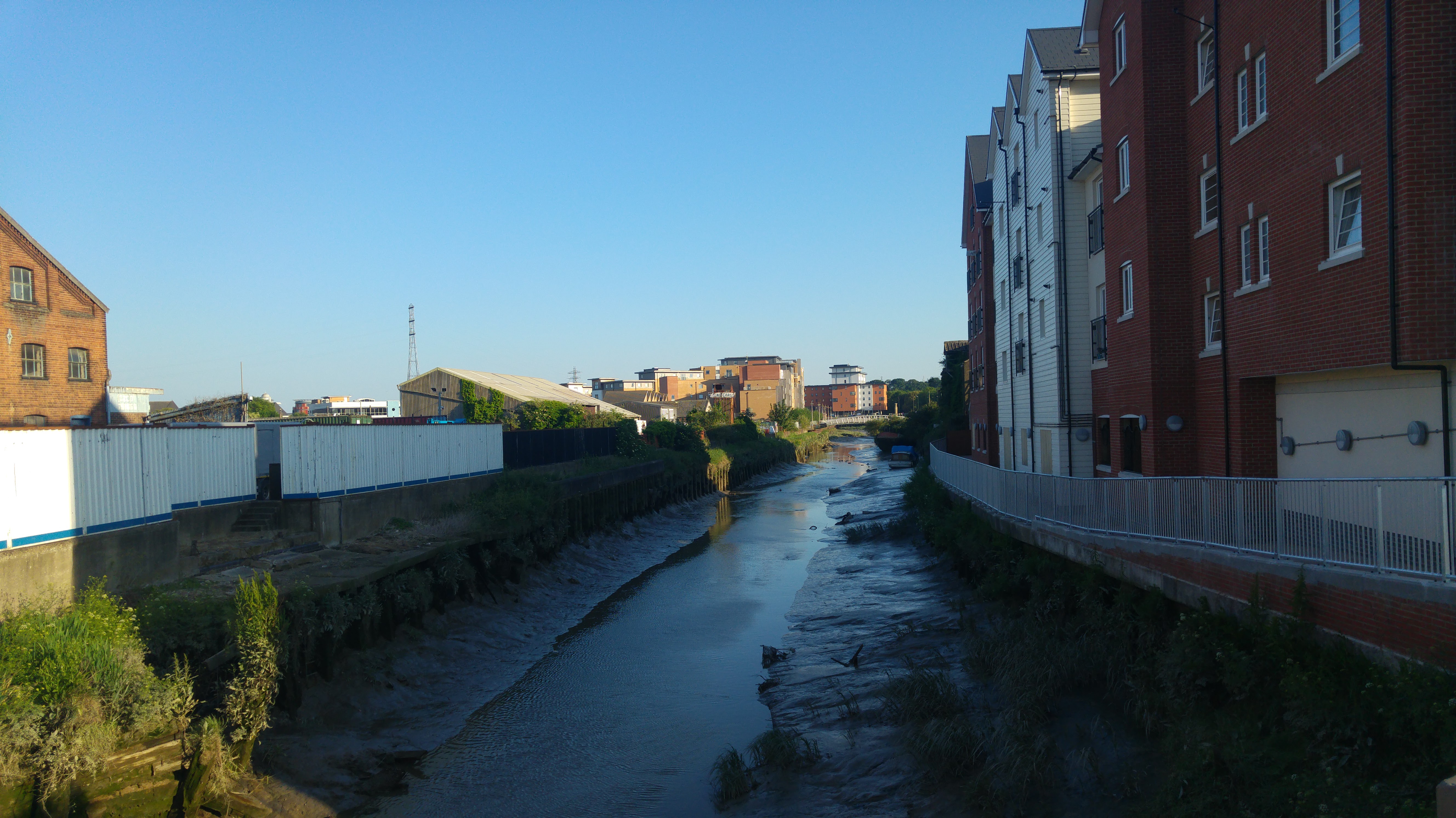
Reeveshall Marsh Images

Images are sourced within 2km of 51.805475/0.9641831 or Grid Reference TM0416. Thanks to Geograph Open Source API. All images are credited.

St. Edmund Church, East Mersea <span class="nowrap"><a title="https://en.wikipedia.org/wiki/East_Mersea" rel="nofollow ugc noopener" href="https://en.wikipedia.org/wiki/East_Mersea">Link</a><img style="margin-left:2px;" alt="External link" title="External link - shift click to open in new window" src="https://s1.geograph.org.uk/img/external.png" width="10" height="10"/></span>
St. Edmund Church, East Mersea
Aerial View of the Grid This view of the grid and surrounding grids shows how isolated this area is.
Aerial View of the Grid
This view of the grid and surrounding grids shows how isolated this area is.
Path & Old Hut on Fingringhoe Range For one day a year (the first Sunday of August) the guns of Fingringhoe Ranges fall silent for 
<a href="https://www.geograph.org.uk/photo/3585348">TM0218 : The Five Parishes Show</a> (Peldon, Abberton, Gt Wigborough, Langenhoe & Little Wigborough). The general public are allowed access to the Ranges, there is no prohibition against walking around on the formal paths. Straying from these could prove very unpleasant due to unexploded ordnance.
Path & Old Hut on Fingringhoe Range
For one day a year (the first Sunday of August) the guns of Fingringhoe Ranges fall silent for TM0218 : The Five Parishes Show (Peldon, Abberton, Gt Wigborough, Langenhoe & Little Wigborough). The general public are allowed access to the Ranges, there is no prohibition against walking around on the formal paths. Straying from these could prove very unpleasant due to unexploded ordnance.
Fork in a Path on Fingringhoe Range Both of these paths on <a href="https://www.geograph.org.uk/photo/3585351">TM0218 : Fingringhoe Ranges</a> eventually reach the sea wall on the Pyefleet Channel
Fork in a Path on Fingringhoe Range
Both of these paths on TM0218 : Fingringhoe Ranges eventually reach the sea wall on the Pyefleet Channel
Path to the Pyefleet Channel This track on <a href="https://www.geograph.org.uk/photo/3585351">TM0218 : Fingringhoe Ranges</a> eventually reaches the sea wall nearly 
opposite <a href="https://www.geograph.org.uk/photo/47503">TM0316 : Reeves Hall # 1</a> sluice on Mersea Island
Path to the Pyefleet Channel
This track on TM0218 : Fingringhoe Ranges eventually reaches the sea wall nearly opposite TM0316 : Reeves Hall # 1 sluice on Mersea Island
Parish church of St Edmund King and Martyr Seen from the carpark off Church Lane, it is grade I listed building dating from the 12th or 13th centuries 
<span class="nowrap"><a title="http://www.britishlistedbuildings.co.uk/en-417631-parish-church-of-st-edmund-king-and-mart" rel="nofollow ugc noopener" href="http://www.britishlistedbuildings.co.uk/en-417631-parish-church-of-st-edmund-king-and-mart">Link</a><img style="margin-left:2px;" alt="External link" title="External link - shift click to open in new window" src="https://s1.geograph.org.uk/img/external.png" width="10" height="10"/></span>
Parish church of St Edmund King and Martyr
Seen from the carpark off Church Lane, it is grade I listed building dating from the 12th or 13th centuries LinkExternal link
St Edmund's Church, East Mersea St Edmund, King and Martyr church in East Mersea was one of the few moated churches in the country, enclosing five acres, parts of the moat still remaining. The area is thought to have been the camp of the Viking Hasten, who spent two winters in Mersea and plundered the country as far as Chester.
St Edmund's Church, East Mersea
St Edmund, King and Martyr church in East Mersea was one of the few moated churches in the country, enclosing five acres, parts of the moat still remaining. The area is thought to have been the camp of the Viking Hasten, who spent two winters in Mersea and plundered the country as far as Chester.
The grave of Sarah Wrench (1833-1848) Tales of witchcraft surround this unfortunate girl but the truth is probably more prosaic involving perhaps a baby out of wedlock or suicide. Much has been written about her. She is interred to the north side of East Mersea church and her grave is unusually caged for protection. The cage is known as a mortsafe.
The grave of Sarah Wrench (1833-1848)
Tales of witchcraft surround this unfortunate girl but the truth is probably more prosaic involving perhaps a baby out of wedlock or suicide. Much has been written about her. She is interred to the north side of East Mersea church and her grave is unusually caged for protection. The cage is known as a mortsafe.
Easter window display in East Mersea Church
At East Mersea Looking westwards to the village hall
At East Mersea
Looking westwards to the village hall
Pub and next door cottage - East Mersea The pub is called "The Dog and Pheasant"
Pub and next door cottage - East Mersea
The pub is called "The Dog and Pheasant"
Barn in the Woods North of Mitchell's Farm. The property is known as "Fishponds".
Barn in the Woods
North of Mitchell's Farm. The property is known as "Fishponds".
Broad Fleet in April
View towards Pyefleet Channel From the seawall that protects the farming land still known as Reeveshall Marsh.
View towards Pyefleet Channel
From the seawall that protects the farming land still known as Reeveshall Marsh.
View of Pewit Island From the sea wall that defends Reeveshall Marsh. Pewit Island was once a little hive of industry with regard to oyster farming but that muddy island activity has now ceased.
View of Pewit Island
From the sea wall that defends Reeveshall Marsh. Pewit Island was once a little hive of industry with regard to oyster farming but that muddy island activity has now ceased.
On the sea wall north of Maydays Marsh Looking out to Pyefleet Channel as the tide comes in.
On the sea wall north of Maydays Marsh
Looking out to Pyefleet Channel as the tide comes in.
Reeveshall Marsh View Whilst walking on the sea wall path with Pyefleet Channel to the right.
Reeveshall Marsh View
Whilst walking on the sea wall path with Pyefleet Channel to the right.
Greylag geese by Pyefleet Channel
Show me another place!

Reeveshall Marsh is located at Grid Ref: TM0416 (Lat: 51.805475, Lng: 0.9641831)

Administrative County: Essex

District: Colchester

Police Authority: Essex

What 3 Words

///searcher.reassured.snooze. Near Brightlingsea, Essex

Related Wikis

Colne Estuary

Colne Estuary is a 2915 hectare biological and geological Site of Special Scientific Interest near Brightlingsea in Essex. It is also a Nature Conservation...

East Mersea

East Mersea is a village and civil parish on Mersea Island in the City of Colchester district of Essex, England. It was historically referred to as Mersea...

Mersea Island

Mersea Island is an island in Essex, England, in the Blackwater and Colne estuaries to the south-east of Colchester. Its name comes from the Old English...

Barrow Hill, Essex

Barrow Hill is a hamlet in Essex, England. It is located on Mersea Island, approximately 2 km (1.2 mi) north-northeast of West Mersea near to where the...

Mersea Fort

Mersea Fort, also known as Cudmore Grove Blockhouse, was an artillery fort established by Henry VIII on the East Mersea coast in 1543. It formed part of...

River Colne, Essex

The River Colne ( or ) is a small river that runs through Essex, England and passes through Colchester. It is not a tributary of any other river, instead...

Fingringhoe Wick

Fingringhoe Wick is a 48.6-hectare (120-acre) nature reserve in Fingringhoe in Essex. It is managed by the Essex Wildlife Trust, which runs a visitor centre...

Ray Island

Ray Island, also known as the Ray, is a 40.5-hectare (100-acre) nature reserve west of Mersea Island in Essex. It is owned by the National Trust, who bought...

Nearby Amenities

Located within 500m of 51.805475,0.9641831
Reeveshall Marsh
Place: locality
Source: OS_OpenData_StreetView
Lat/Long: 51.8066252/0.9642613
The data included in this document is from www.openstreetmap.org. The data is made available under ODbL.

Have you been to Reeveshall Marsh?

Leave your review of Reeveshall Marsh below (or comments, questions and feedback).