Pyefleet Channel

Sea, Estuary, Creek in Essex Colchester

England

Pyefleet Channel

Mersea is an Island #5: Polders in the Pyfleet Channel I believe the stakes in the mud are designed to allow the build up of silt etc to help prevent erosion of the sea wall.
See also <a href="https://www.geograph.org.uk/photo/7744460">TM0516 : Mersea is an Island #6: Coastal Squeeze in the Pyfleet Channel</a>
Mersea is an Island #5: Polders in the Pyfleet Channel Credit: Glyn Baker

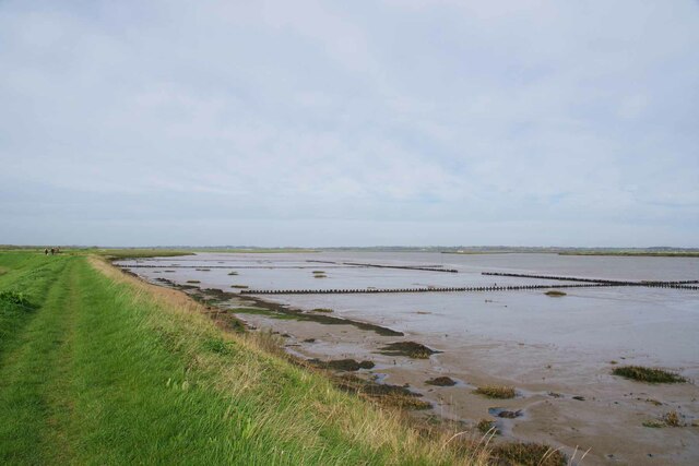
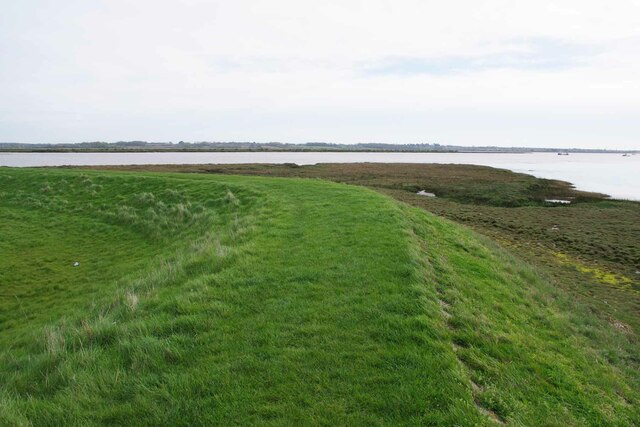
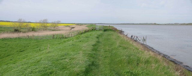
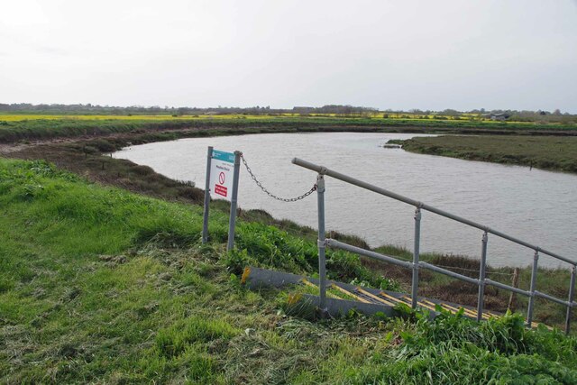
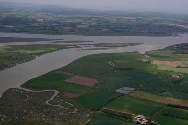
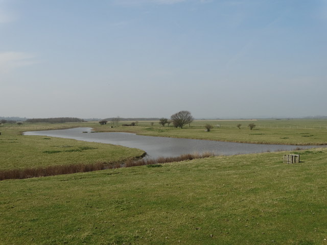
Pyefleet Channel is a prominent waterway located in Essex, England. It serves as a connecting route between the mainland and the Blackwater Estuary, creating a natural boundary between the mainland and Mersea Island. This channel is formed by the confluence of several rivers, including the River Colne and the Pye, which merge to create a wide and navigable water passage.

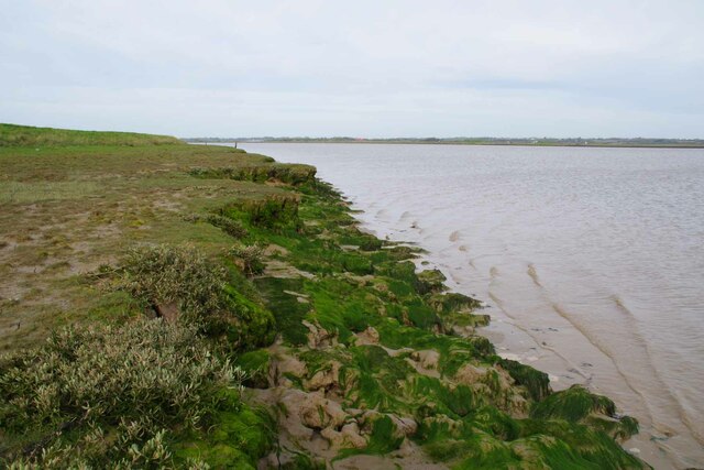
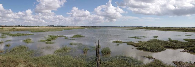
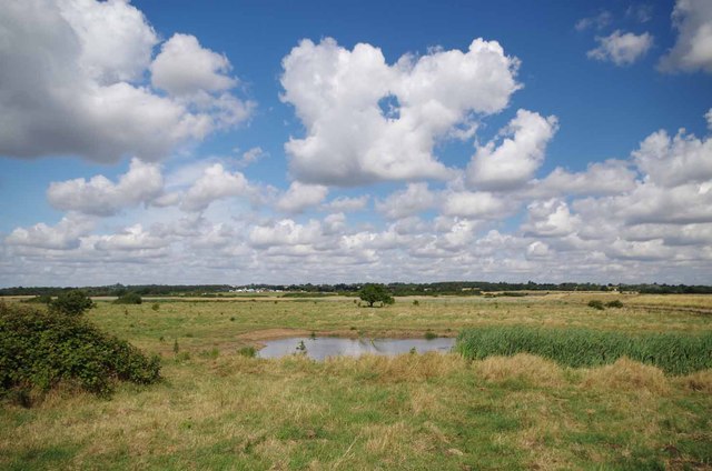
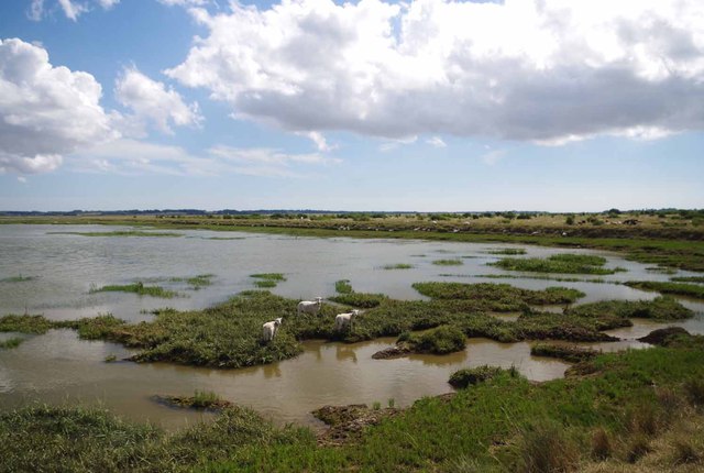
As a tidal estuary, Pyefleet Channel experiences significant variations in water levels throughout the day. During high tides, the channel becomes a deep and fast-flowing watercourse, accommodating small boats, yachts, and other recreational vessels. At low tide, the water level recedes, exposing vast mudflats and sandbanks that stretch across the channel.

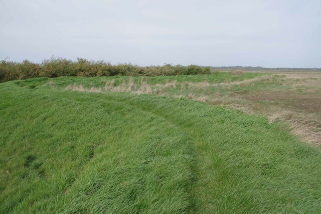
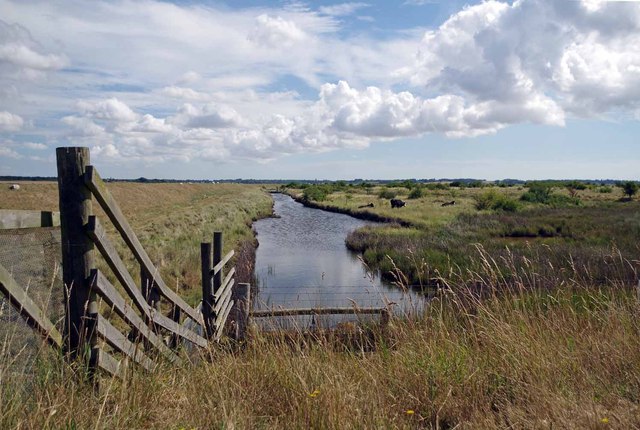
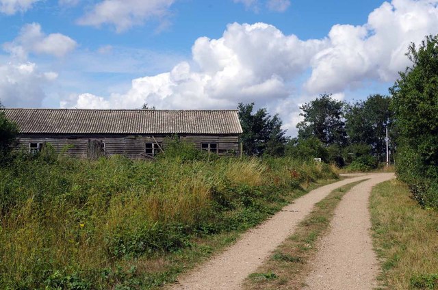
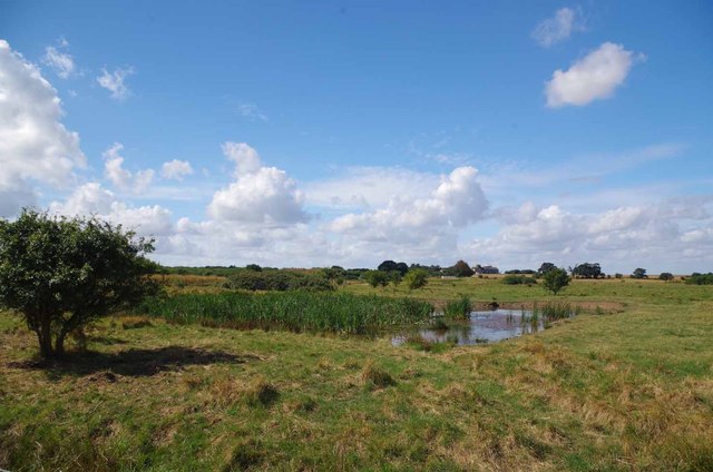
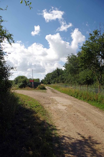
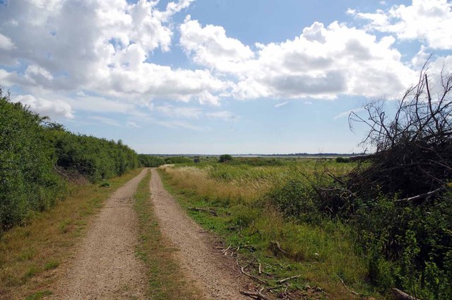
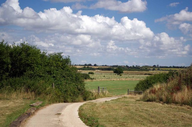
The surrounding area of Pyefleet Channel is characterized by picturesque marshlands and saltwater creeks. These habitats support a diverse range of flora and fauna, including various bird species, marine life, and vegetation adapted to the brackish environment.

Pyefleet Channel is a popular destination for water sports enthusiasts, such as sailors, windsurfers, and kayakers, who take advantage of the favorable winds and calm waters. The channel also offers excellent fishing opportunities, attracting anglers in search of various species, including bass, flounder, and mullet.

Additionally, Pyefleet Channel serves as an important transportation route for local fishermen and commercial vessels, facilitating the trade of goods and providing access to nearby towns and villages along the estuary. The channel is also vital for the local tourism industry, attracting visitors who appreciate its natural beauty and recreational opportunities. Overall, Pyefleet Channel is a significant and scenic waterway that plays a vital role in the local economy and provides a haven for nature enthusiasts.

If you have any feedback on the listing, please let us know in the comments section below.

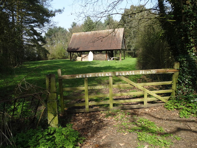
Pyefleet Channel Images

Images are sourced within 2km of 51.809732/0.95981955 or Grid Reference TM0416. Thanks to Geograph Open Source API. All images are credited.

Mersea is an Island #5: Polders in the Pyfleet Channel I believe the stakes in the mud are designed to allow the build up of silt etc to help prevent erosion of the sea wall.
See also <a href="https://www.geograph.org.uk/photo/7744460">TM0516 : Mersea is an Island #6: Coastal Squeeze in the Pyfleet Channel</a>
Mersea is an Island #5: Polders in the Pyfleet Channel
I believe the stakes in the mud are designed to allow the build up of silt etc to help prevent erosion of the sea wall. See also TM0516 : Mersea is an Island #6: Coastal Squeeze in the Pyfleet Channel
Mersea is an Island #6: Coastal Squeeze in the Pyfleet Channel The reclaiming of Reeveshall Marsh from the sea means the remaining salt marsh is squeezed against the sea wall that carries East Mersea Footpath 13
See also <a href="https://www.geograph.org.uk/photo/7744472">TM0416 : Mersea is an Island #7: Mud Shelf In the Pyfleet Channel</a>
Mersea is an Island #6: Coastal Squeeze in the Pyfleet Channel
The reclaiming of Reeveshall Marsh from the sea means the remaining salt marsh is squeezed against the sea wall that carries East Mersea Footpath 13 See also TM0416 : Mersea is an Island #7: Mud Shelf In the Pyfleet Channel
Mersea is an Island #7: Mud Shelf In the Pyfleet Channel About an hour and a half before high tide.
see also <a href="https://www.geograph.org.uk/photo/7744502">TM0316 : Mersea is an Island #8: East Meets West</a>
Mersea is an Island #7: Mud Shelf In the Pyfleet Channel
About an hour and a half before high tide. see also TM0316 : Mersea is an Island #8: East Meets West
Mersea is an Island #8: East Meets West Looking towards Maydays Marsh across the border between East & West Mersea where East Mersea Footpath 13 becomes West Mersea Footpath 7.
See also <a href="https://www.geograph.org.uk/photo/7744523">TM0315 : Mersea is an Island #9: Maydays Sluice Revisited</a>
Mersea is an Island #8: East Meets West
Looking towards Maydays Marsh across the border between East & West Mersea where East Mersea Footpath 13 becomes West Mersea Footpath 7. See also TM0315 : Mersea is an Island #9: Maydays Sluice Revisited
Mersea is an Island #9: Maydays Sluice Revisited The Environment Agency have made modifications to <a href="https://www.geograph.org.uk/photo/1276553">TM0315 : Maydays Sluice</a> since I last visited. 
See also <a href="https://www.geograph.org.uk/photo/7744561">TM0215 : Mersea is an Island #10: Kink in Footpath 7</a>
Mersea is an Island #9: Maydays Sluice Revisited
The Environment Agency have made modifications to TM0315 : Maydays Sluice since I last visited. See also TM0215 : Mersea is an Island #10: Kink in Footpath 7
Mersea is an Island #10: Kink in Footpath 7 For some reason there is a meander in the sea wall at this point in Maydays Marsh.
See also <a href="https://www.geograph.org.uk/photo/7744586">TM0115 : Mersea is an Island #11: Pyfleet Channel Saltmarsh</a>
Mersea is an Island #10: Kink in Footpath 7
For some reason there is a meander in the sea wall at this point in Maydays Marsh. See also TM0115 : Mersea is an Island #11: Pyfleet Channel Saltmarsh
Aerial View of the Grid This view of the grid and surrounding grids shows how isolated this area is.
Aerial View of the Grid
This view of the grid and surrounding grids shows how isolated this area is.
Dike on Fingringhoe Range For one day a year (the first Sunday of August) the guns of Fingringhoe Ranges fall silent for 
<a href="https://www.geograph.org.uk/photo/3585348">TM0218 : The Five Parishes Show</a> (Peldon, Abberton, Gt Wigborough, Langenhoe & Little Wigborough). The general public are allowed access to the Ranges, there is no prohibition against walking around on the formal paths. Straying from these could prove very unpleasant due to unexploded ordnance.
Dike on Fingringhoe Range
For one day a year (the first Sunday of August) the guns of Fingringhoe Ranges fall silent for TM0218 : The Five Parishes Show (Peldon, Abberton, Gt Wigborough, Langenhoe & Little Wigborough). The general public are allowed access to the Ranges, there is no prohibition against walking around on the formal paths. Straying from these could prove very unpleasant due to unexploded ordnance.
Path & Old Hut on Fingringhoe Range For one day a year (the first Sunday of August) the guns of Fingringhoe Ranges fall silent for 
<a href="https://www.geograph.org.uk/photo/3585348">TM0218 : The Five Parishes Show</a> (Peldon, Abberton, Gt Wigborough, Langenhoe & Little Wigborough). The general public are allowed access to the Ranges, there is no prohibition against walking around on the formal paths. Straying from these could prove very unpleasant due to unexploded ordnance.
Path & Old Hut on Fingringhoe Range
For one day a year (the first Sunday of August) the guns of Fingringhoe Ranges fall silent for TM0218 : The Five Parishes Show (Peldon, Abberton, Gt Wigborough, Langenhoe & Little Wigborough). The general public are allowed access to the Ranges, there is no prohibition against walking around on the formal paths. Straying from these could prove very unpleasant due to unexploded ordnance.
Pond on Fingeringhoe Range Taken during <a href="https://www.geograph.org.uk/photo/3585348">TM0218 : The Five Parishes Show</a>
Pond on Fingeringhoe Range
Geedon Creek Panorama This picture was taken during <a href="https://www.geograph.org.uk/photo/3585348">TM0218 : The Five Parishes Show</a> when there is public access to the <a href="https://www.geograph.org.uk/photo/3585351">TM0218 : Fingringhoe Ranges</a>
Geedon Creek Panorama
This picture was taken during TM0218 : The Five Parishes Show when there is public access to the TM0218 : Fingringhoe Ranges
Fork in a Path on Fingringhoe Range Both of these paths on <a href="https://www.geograph.org.uk/photo/3585351">TM0218 : Fingringhoe Ranges</a> eventually reach the sea wall on the Pyefleet Channel
Fork in a Path on Fingringhoe Range
Both of these paths on TM0218 : Fingringhoe Ranges eventually reach the sea wall on the Pyefleet Channel
Path to the Pyefleet Channel This track on <a href="https://www.geograph.org.uk/photo/3585351">TM0218 : Fingringhoe Ranges</a> eventually reaches the sea wall nearly 
opposite <a href="https://www.geograph.org.uk/photo/47503">TM0316 : Reeves Hall # 1</a> sluice on Mersea Island
Path to the Pyefleet Channel
This track on TM0218 : Fingringhoe Ranges eventually reaches the sea wall nearly opposite TM0316 : Reeves Hall # 1 sluice on Mersea Island
Path on Fingringhoe Range This photo was taken during <a href="https://www.geograph.org.uk/photo/3585348">TM0218 : The Five Parishes Show</a> which is held on the first Sunday each August.
Path on Fingringhoe Range
This photo was taken during TM0218 : The Five Parishes Show which is held on the first Sunday each August.
A Pond on the Ranges Another view of a <a href="https://www.geograph.org.uk/photo/3585328">TM0317 : Pond on Fingeringhoe Range</a>
A Pond on the Ranges
Geedon Creek Grazing Marsh A very traditional use for saltmarsh on <a href="https://www.geograph.org.uk/photo/3585351">TM0218 : Fingringhoe Ranges</a>
Geedon Creek Grazing Marsh
A very traditional use for saltmarsh on TM0218 : Fingringhoe Ranges
Barn in the Woods North of Mitchell's Farm. The property is known as "Fishponds".
Barn in the Woods
North of Mitchell's Farm. The property is known as "Fishponds".
Broad Fleet in April
Show me another place!

Pyefleet Channel is located at Grid Ref: TM0416 (Lat: 51.809732, Lng: 0.95981955)

Administrative County: Essex

District: Colchester

Police Authority: Essex

What 3 Words

///developed.internal.panel. Near Brightlingsea, Essex

Related Wikis

Colne Estuary

Colne Estuary is a 2915 hectare biological and geological Site of Special Scientific Interest near Brightlingsea in Essex. It is also a Nature Conservation...

Mersea Island

Mersea Island is an island in Essex, England, in the Blackwater and Colne estuaries to the south-east of Colchester. Its name comes from the Old English...

East Mersea

East Mersea is a village and civil parish on Mersea Island in the City of Colchester district of Essex, England. It was historically referred to as Mersea...

Barrow Hill, Essex

Barrow Hill is a hamlet in Essex, England. It is located on Mersea Island, approximately 2 km (1.2 mi) north-northeast of West Mersea near to where the...

Nearby Amenities

Located within 500m of 51.809732,0.95981955
Reeveshall Marsh
Place: locality
Source: OS_OpenData_StreetView
Lat/Long: 51.8066252/0.9642613
The data included in this document is from www.openstreetmap.org. The data is made available under ODbL.

Have you been to Pyefleet Channel?

Leave your review of Pyefleet Channel below (or comments, questions and feedback).