Morston Salt Marshes

Coastal Marsh, Saltings in Norfolk North Norfolk

England

Morston Salt Marshes

Accommodation block, Blakeney Point Full of bunkbeds.
Accommodation block, Blakeney Point Credit: Hugh Venables

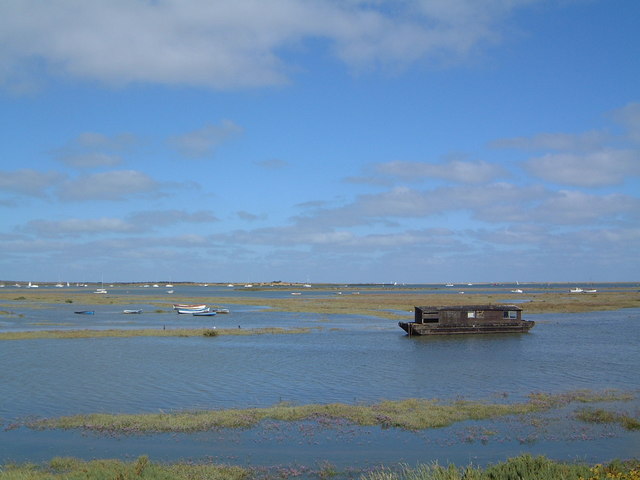
Morston Salt Marshes, located in Norfolk, England, is a coastal marshland renowned for its picturesque scenery and rich biodiversity. Stretching across an area of approximately 1,000 acres, this salt marsh ecosystem is a vital habitat for a variety of plant and animal species.

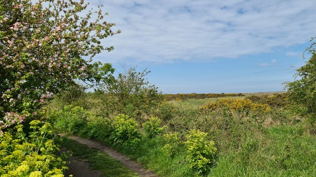
The marshes are dominated by salt-tolerant grasses, such as saltmarsh rush and sea purslane, which have adapted to the saline conditions of the area. They form extensive meadows that provide nesting sites for numerous bird species, including avocets, redshanks, lapwings, and oystercatchers. These birds are attracted to the marshes due to the abundance of invertebrates, such as worms, shrimps, and crabs, which thrive in the marshland mud.

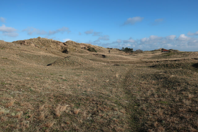
The salt marshes are crisscrossed by a network of tidal creeks and channels that are influenced by the ebb and flow of the tide. These channels support a diverse array of marine life, including fish, crabs, and shellfish. Additionally, the marshes act as a natural buffer, protecting the coastline from erosion and storm surges.

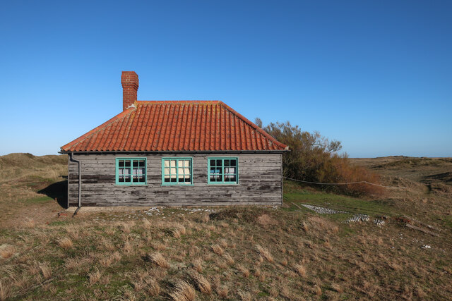
The Morston Salt Marshes are not only significant for their ecological value but also for their cultural and historical importance. The area has been utilized for centuries by local communities for grazing livestock and harvesting salt. The marshes are also a popular destination for nature enthusiasts, birdwatchers, and walkers, who can explore the beautiful landscape via a network of footpaths and boardwalks.

Efforts are underway to preserve and protect the Morston Salt Marshes, including the establishment of a nature reserve and the implementation of sustainable land management practices. These initiatives aim to ensure the continued existence of this unique coastal marshland and its diverse ecosystem for future generations to enjoy and appreciate.

If you have any feedback on the listing, please let us know in the comments section below.

Morston Salt Marshes Images

Images are sourced within 2km of 52.959669/0.99102528 or Grid Reference TG0044. Thanks to Geograph Open Source API. All images are credited.

Accommodation block, Blakeney Point Full of bunkbeds.
Accommodation block, Blakeney Point
Full of bunkbeds.
Blakeney Point
Blakeney Point
Morston Greens and Morston Meals
Tamarisk on Blakeney Point
Old Lifeboat Station, Blakeney Point Now a visitor centrea and wardens' accommodation, with a UCL study centre and public toilets to the right.
Old Lifeboat Station, Blakeney Point
Now a visitor centrea and wardens' accommodation, with a UCL study centre and public toilets to the right.
Dorm block, Blakeney Point
Accommodation block and tamarisk, Blakeney Point Used by University College London students in the summer. UCL have the Francis Wall Oliver Research Centre by the Old Lifeboat Station as a research and teaching facility on the point.
Accommodation block and tamarisk, Blakeney Point
Used by University College London students in the summer. UCL have the Francis Wall Oliver Research Centre by the Old Lifeboat Station as a research and teaching facility on the point.
Blakeney car park The car park gets covered by some spring tides, but they are either very early or late in the day, so always fine to park during the day (storm surges aside).
Blakeney car park
The car park gets covered by some spring tides, but they are either very early or late in the day, so always fine to park during the day (storm surges aside).
Blakeney Guildhall <span class="nowrap"><a title="https://historicengland.org.uk/listing/the-list/list-entry/1014237?section=official-listing" rel="nofollow ugc noopener" href="https://historicengland.org.uk/listing/the-list/list-entry/1014237?section=official-listing">Link</a><img style="margin-left:2px;" alt="External link" title="External link - shift click to open in new window" src="https://s1.geograph.org.uk/img/external.png" width="10" height="10"/></span>
Blakeney Guildhall
Sand dunes on Blakeney Point
Track on Blakeney Point
1-3 The Granary, High Street, Blakeney Grade II Listed late 17th century former granary now converted to shops and dwellings.
1-3 The Granary, High Street, Blakeney
Grade II Listed late 17th century former granary now converted to shops and dwellings.
5-6 The Granary, High Street, Blakeney Grade II Listed late 17th century former granary now converted to shops and dwellings.
5-6 The Granary, High Street, Blakeney
Grade II Listed late 17th century former granary now converted to shops and dwellings.
The White Horse, 4 High Street, Blakeney Grade II Listed early 19th century public house. Originally built in the 15th century it was rebuilt in the 17th century. It was still a private house in 1729. In 1794 it was advertised for sale and described as "A Well-known and Good-accustomed Inn". In November 1878 it was conveyed to Henry Bullard & John Boyce (Reepham Brewery -Bullard & Sons Ltd) and let to John Pye (incumbent) at an annual rent of £18. Bullards (acquired by Watney Mann Ltd. 1963) advised the Licensed Property Valuer that structural alterations were completed 1st May 1967. Apparently an adjoining cottage had been demolished to provide a car park in August 1962. In 1978 a 'smugglers' tunnel was discovered found to run to the site of the former Crown and Anchor in one direction and the area of the British Legion car park in the other. In 1980 the courtyard was  covered for a family room but it was removed in 1992 renovations, probably at the time it became a freehouse. In 1998 the courtyard was converted into conservatory. In September 2011 it became an Adnams Brewey house. Landlords include; 1789-1790 Frances Barrett; 1792 Benjamin Warner; 1794-1799 James Cletheroe; 1830-1839 William Thompson Storey; 1839 according to Pigot James Thompson Storey, but William died mid 1840; 1841-1850 Mrs Ann Storey; 1851 Henry Barcham; 1854 James Tuddenham; 1858-1883 John Pye; 1883-1892 John Forsdick; 1893 Alfred James Neave; 1895-1904 John William Scott; 1907-1912 Sarah Ann Varley (died mid 1915); 1916 Herbert Charles Long; 1965-1972 Walter F Long; 1973 Pat & Tom Burt; 1977 Beryl & Mick Burton; 1985-1987 Shelia & Mick Lake; 1997 Daniel Rees & Sue Catt; 2004 Martin Panter; October 2011 Francis Guildea.
The White Horse, 4 High Street, Blakeney
Grade II Listed early 19th century public house. Originally built in the 15th century it was rebuilt in the 17th century. It was still a private house in 1729. In 1794 it was advertised for sale and described as "A Well-known and Good-accustomed Inn". In November 1878 it was conveyed to Henry Bullard & John Boyce (Reepham Brewery -Bullard & Sons Ltd) and let to John Pye (incumbent) at an annual rent of £18. Bullards (acquired by Watney Mann Ltd. 1963) advised the Licensed Property Valuer that structural alterations were completed 1st May 1967. Apparently an adjoining cottage had been demolished to provide a car park in August 1962. In 1978 a 'smugglers' tunnel was discovered found to run to the site of the former Crown and Anchor in one direction and the area of the British Legion car park in the other. In 1980 the courtyard was covered for a family room but it was removed in 1992 renovations, probably at the time it became a freehouse. In 1998 the courtyard was converted into conservatory. In September 2011 it became an Adnams Brewey house. Landlords include; 1789-1790 Frances Barrett; 1792 Benjamin Warner; 1794-1799 James Cletheroe; 1830-1839 William Thompson Storey; 1839 according to Pigot James Thompson Storey, but William died mid 1840; 1841-1850 Mrs Ann Storey; 1851 Henry Barcham; 1854 James Tuddenham; 1858-1883 John Pye; 1883-1892 John Forsdick; 1893 Alfred James Neave; 1895-1904 John William Scott; 1907-1912 Sarah Ann Varley (died mid 1915); 1916 Herbert Charles Long; 1965-1972 Walter F Long; 1973 Pat & Tom Burt; 1977 Beryl & Mick Burton; 1985-1987 Shelia & Mick Lake; 1997 Daniel Rees & Sue Catt; 2004 Martin Panter; October 2011 Francis Guildea.
6 Ship Cottage and 6B Benbow Cottage, High Street, Blakeney Early 18th century Grade II Listed cottage with late 18th century rear wing. Both currently (2022) appear to be holiday lets.
6 Ship Cottage and 6B Benbow Cottage, High Street, Blakeney
Early 18th century Grade II Listed cottage with late 18th century rear wing. Both currently (2022) appear to be holiday lets.
10 Smugglers Den and 20 Marsh Haven, High Street, Blakeney Grade II Listed as one building including 18 Post Office and 20 Barclays Bank, indicating its previous use. The OS map appears to indicate the building as 18 and 20 Hollyhock cottage (that includes 20A) with 12, 14 and 16 behind. In 1994 planning was approved for the conversion of unified premises, 18-20 High Street, into seven cottages. This seems to account for the re-numbering. No.10 (previously 18) has a rear access with ground floor bedroom and first floor kitchen/lounge/dining room extending over the archway. Late in 1994 permission had been granted for conversion from shop to cottage. In a 1950s photo it is shown with a shop front and door to one (south) side. It was sold in 2020 and the name and number plaque seems to have been removed from the front suggesting its new owner wants to disassociate with its previous existence. No.20 in the 1950s photo had a shop front and centre door. In 1990 replacement of the shop front for a gift shop had been granted. It is now (2022) a holiday let.  The two bedroom 887 sq ft property was apparently sold in 2015 and in January 2016 it was advertised as recently having had a makeover. There seems to have been a further sale in March 2017.
10 Smugglers Den and 20 Marsh Haven, High Street, Blakeney
Grade II Listed as one building including 18 Post Office and 20 Barclays Bank, indicating its previous use. The OS map appears to indicate the building as 18 and 20 Hollyhock cottage (that includes 20A) with 12, 14 and 16 behind. In 1994 planning was approved for the conversion of unified premises, 18-20 High Street, into seven cottages. This seems to account for the re-numbering. No.10 (previously 18) has a rear access with ground floor bedroom and first floor kitchen/lounge/dining room extending over the archway. Late in 1994 permission had been granted for conversion from shop to cottage. In a 1950s photo it is shown with a shop front and door to one (south) side. It was sold in 2020 and the name and number plaque seems to have been removed from the front suggesting its new owner wants to disassociate with its previous existence. No.20 in the 1950s photo had a shop front and centre door. In 1990 replacement of the shop front for a gift shop had been granted. It is now (2022) a holiday let. The two bedroom 887 sq ft property was apparently sold in 2015 and in January 2016 it was advertised as recently having had a makeover. There seems to have been a further sale in March 2017.
Show me another place!

Morston Salt Marshes is located at Grid Ref: TG0044 (Lat: 52.959669, Lng: 0.99102528)

Administrative County: Norfolk

District: North Norfolk

Police Authority: Norfolk

What 3 Words

///bond.numeral.dragons. Near Wells-next-the-Sea, Norfolk

Related Wikis

Morston

Morston is a village and civil parish in the English county of Norfolk. It covers an area of 8.68 km2 (3.35 sq mi) and had a population of 86 in 42 households...

North Norfolk Coast Site of Special Scientific Interest

The North Norfolk Coast Site of Special Scientific Interest (SSSI) is an area of European importance for wildlife in Norfolk, England. It comprises 7,700...

Norfolk Coast National Landscape

The Norfolk Coast National Landscape or Norfolk Coast Protected Landscape is a protected National Landscape in Norfolk, England. It covers over 450 km2...
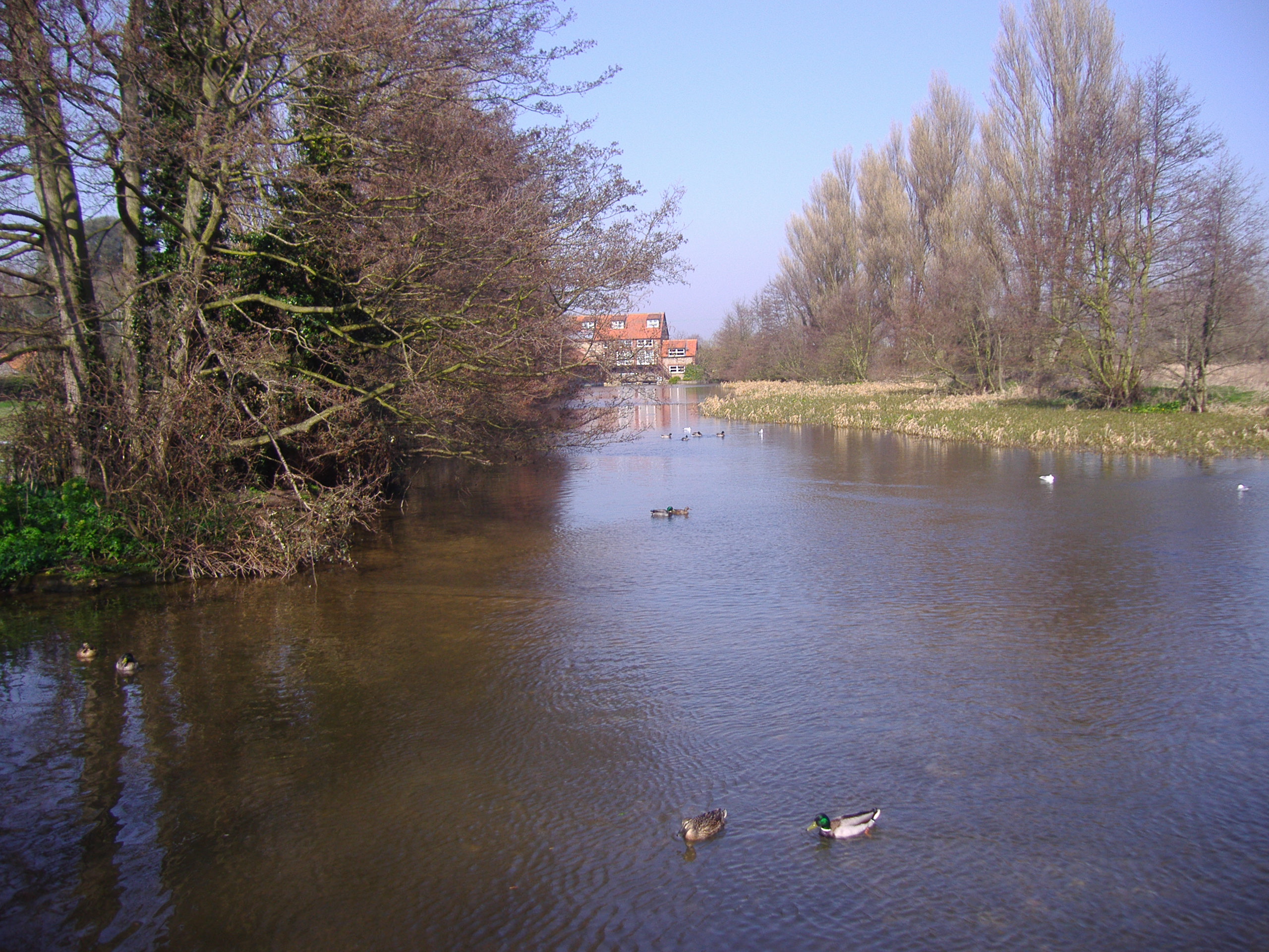
River Glaven

The River Glaven in the eastern English county of Norfolk is 10.5 mi (16.9 km) long and flows through picturesque North Norfolk countryside to the North...

Nearby Amenities

Located within 500m of 52.959669,0.99102528
Phone
Emergency: phone
Information: office
Tourism: information
Lat/Long: 52.957818/0.9857879
morston slip
Designation: tidal slipway prepare boat first on carpark
Leisure: slipway
Lat/Long: 52.958136/0.9866836
National Trust Lookout
Tourism: viewpoint
Lat/Long: 52.957826/0.985853
Fast Food
Cuisine: seafood
Lat/Long: 52.9577061/0.9861179
Bicycle Rental
Norfolketc
Lat/Long: 52.9568983/0.9859958
Bicycle Parking
Capacity: 6
Covered: no
Lat/Long: 52.9578536/0.9859256
Ferry Terminal
Lat/Long: 52.9580523/0.9859773
Leisure: picnic_table
Lat/Long: 52.9577659/0.9855904
Leisure: picnic_table
Lat/Long: 52.9577861/0.9855569
Leisure: picnic_table
Lat/Long: 52.9577894/0.9856173
Leisure: picnic_table
Lat/Long: 52.9577676/0.9856555
Leisure: picnic_table
Lat/Long: 52.9577764/0.9856997
Leisure: picnic_table
Lat/Long: 52.957707/0.9860592
Leisure: picnic_table
Lat/Long: 52.9577187/0.9861014
Leisure: picnic_table
Lat/Long: 52.9576888/0.9861021
Leisure: picnic_table
Lat/Long: 52.9576706/0.9860826
Leisure: picnic_table
Lat/Long: 52.9576391/0.9860732
Information: board
Tourism: information
Lat/Long: 52.9580911/0.9852786
Attraction: boat_ride
Description: Seal Viewing tours
Lat/Long: 52.9588828/0.9850869
Bench
Backrest: yes
Lat/Long: 52.9578773/0.9859753
Bench
Backrest: yes
Lat/Long: 52.957854/0.986049
Crossing
Lat/Long: 52.956915/0.9865938
The data included in this document is from www.openstreetmap.org. The data is made available under ODbL.

Have you been to Morston Salt Marshes?

Leave your review of Morston Salt Marshes below (or comments, questions and feedback).