Fleet Point
Coastal Marsh, Saltings in Essex Rochford
England
Fleet Point

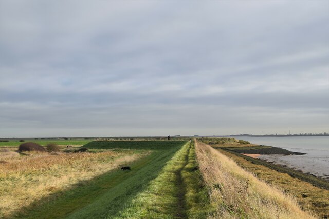
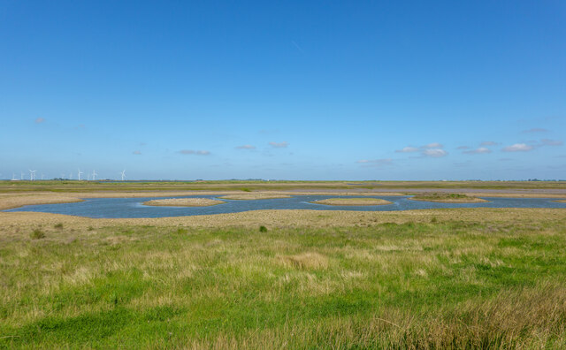
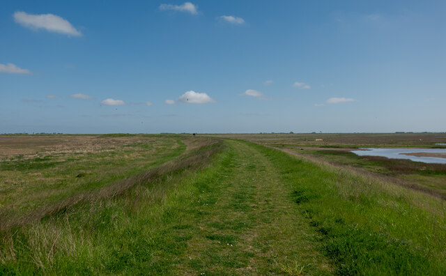
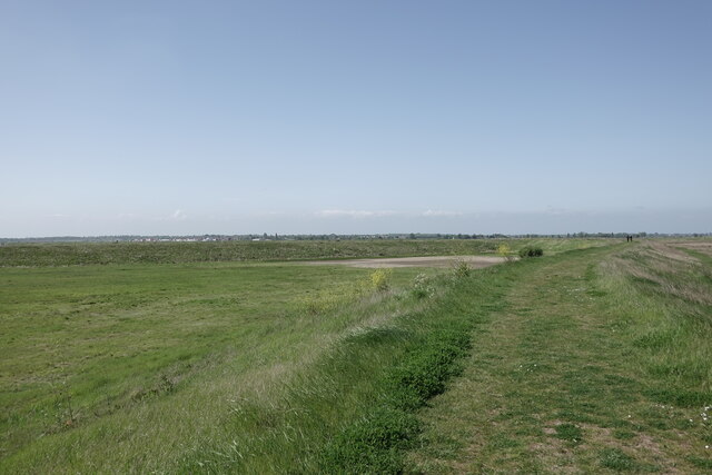
Fleet Point is a serene coastal marsh and saltings located in Essex, England. Situated along the eastern coast, it offers a picturesque landscape that is a haven for nature enthusiasts. Offering a blend of marshland and tidal salt flats, Fleet Point is a unique ecosystem that supports a diverse range of flora and fauna.
The marshland at Fleet Point is characterized by its vast stretches of reeds and grasses, providing a habitat for a variety of bird species. It serves as an important breeding ground for migratory birds, including avocets, redshanks, and curlews. Birdwatchers flock to this area to witness the spectacle of these birds in their natural habitat.
The tidal salt flats at Fleet Point add to its allure. These expansive mudflats are exposed during low tide and are teeming with marine life. They attract a plethora of wading birds, such as dunlins and oystercatchers, which feed on the rich food sources hidden within the mud.
Visitors to Fleet Point can explore the marshland and salt flats by following well-maintained footpaths and boardwalks, ensuring minimal disruption to the delicate ecosystem. The area also offers panoramic views of the estuary, where the marsh meets the sea, creating a stunning spectacle.
Fleet Point is not only a haven for wildlife but also a place of tranquility for visitors seeking solace in nature. It offers a unique opportunity to witness the beauty of a coastal marsh and saltings, making it a must-visit destination for nature lovers and bird enthusiasts alike.
If you have any feedback on the listing, please let us know in the comments section below.
Fleet Point Images
Images are sourced within 2km of 51.618507/0.83175649 or Grid Reference TQ9694. Thanks to Geograph Open Source API. All images are credited.


Fleet Point is located at Grid Ref: TQ9694 (Lat: 51.618507, Lng: 0.83175649)
Administrative County: Essex
District: Rochford
Police Authority: Essex
What 3 Words
///sprays.kilt.reap. Near Burnham-on-Crouch, Essex
Nearby Locations
Related Wikis

Royal Corinthian Yacht Club
The Royal Corinthian Yacht Club is a watersports organisation based at Burnham-on-Crouch, Essex. == History == === Early history === The club was founded...
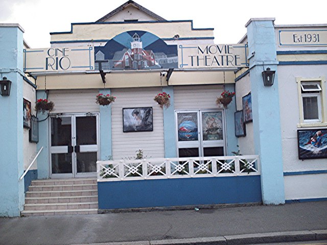
Rio Cinema (Burnham on Crouch)
The Rio Cinema is a purpose-built, two-screen, 280-seat cinema in Burnham on Crouch, Essex in the United Kingdom. The building dates from 1931. The Burnham...

Burnham-on-Crouch & District Museum
The Burnham-on-Crouch and District Museum, located in Burnham-on-Crouch, Essex, is a registered charity run by members of the Burnham History Society,...

Wallasea Wetlands
Wallasea Wetlands is a reclaimed wetlands area located in Essex, England. It has been created as part of a government-funded wetlands scheme to halt the...

Burnham-on-Crouch
Burnham-on-Crouch is a town and civil parish in the Maldon District of Essex, in the East of England; it lies on the north bank of the River Crouch. It...

Wallasea Island
Wallasea Island lies in Essex, England. It is bounded to the north by the River Crouch, to the south east by the River Roach, and to the west by Paglesham...
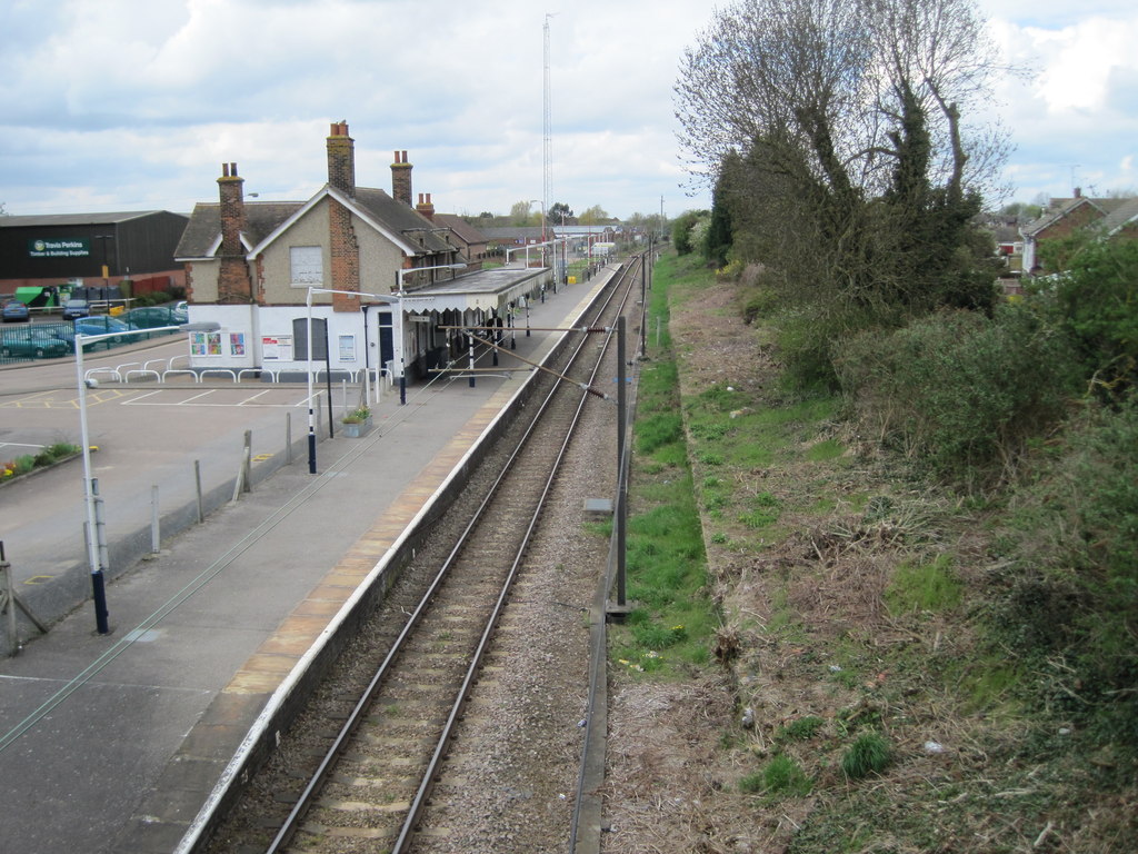
Burnham-on-Crouch railway station
Burnham-on-Crouch railway station is on the Crouch Valley Line in the East of England, serving the town of Burnham-on-Crouch, Essex. It is 43 miles 24...

St Mary's Church, Burnham on Crouch
St Mary's Church is a Church of England church in Burnham on Crouch, Essex. It is Grade II* listed == References ==
Nearby Amenities
Located within 500m of 51.618507,0.83175649Have you been to Fleet Point?
Leave your review of Fleet Point below (or comments, questions and feedback).