Shuckburgh, Lower

Settlement in Warwickshire Stratford-on-Avon

England

Shuckburgh, Lower

St John the Baptist Church
St John the Baptist Church Credit: Mark Percy

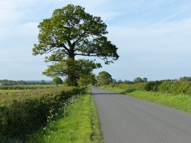
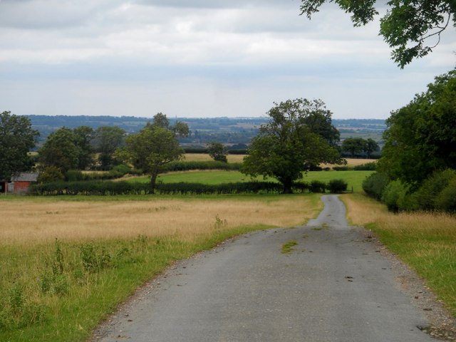
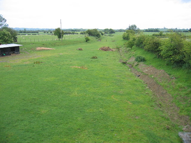
Shuckburgh is a small village located in the district of Lower Shuckburgh, Warwickshire, England. Situated about 6 miles south of Rugby, the village is nestled amidst picturesque countryside and offers a tranquil and scenic setting for its residents.

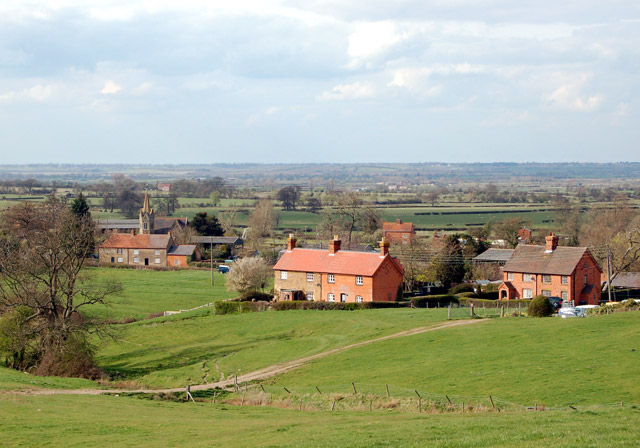
With a population of around 200 people, Shuckburgh is known for its tight-knit community and friendly atmosphere. The village is mostly residential, with a mix of charming cottages and modern houses scattered throughout the area. The architecture of the buildings reflects the village's rich history, with some properties dating back several centuries.

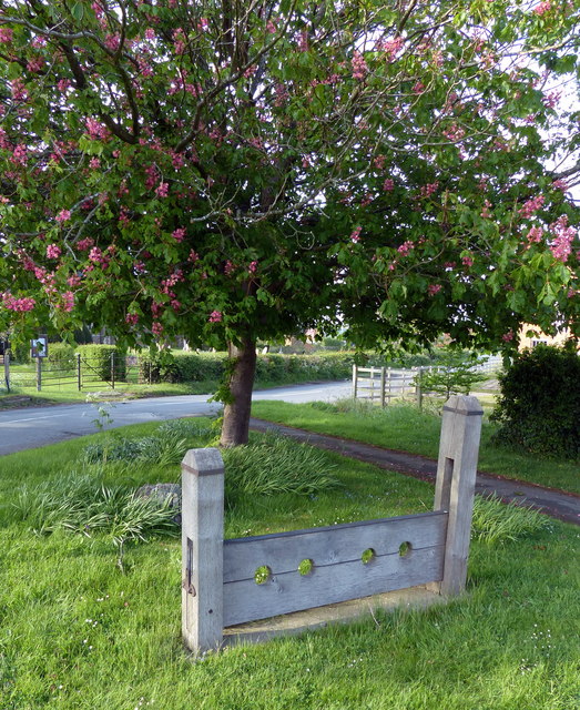
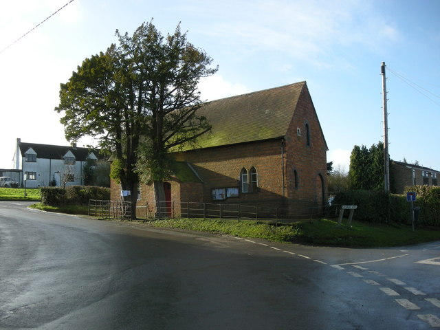
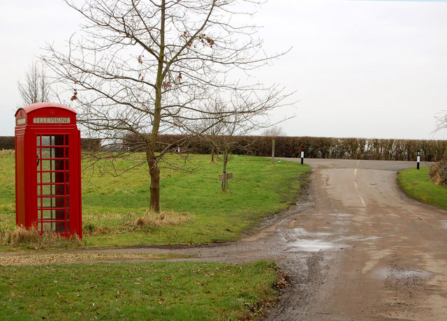
Despite its small size, Shuckburgh boasts a number of amenities and services for its residents. The village has a primary school, providing education for local children, and a village hall that serves as a hub for community events and activities. There are also several footpaths and bridleways in the surrounding countryside, offering opportunities for outdoor pursuits and leisurely walks.

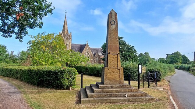
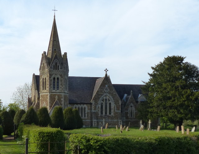
The village is also home to St. John the Baptist Church, a beautiful medieval building that stands as a testament to the area's heritage. The church hosts regular services and is an important focal point for the community.

While Shuckburgh may be a quiet and peaceful village, it benefits from its proximity to larger towns and cities. The nearby town of Rugby offers a wider range of amenities, including shopping centers, restaurants, and leisure facilities. Additionally, Shuckburgh benefits from good transportation links, with easy access to major road networks such as the M1 and M6 motorways.

Overall, Shuckburgh is a charming and idyllic village that offers a close-knit community, picturesque surroundings, and convenient access to nearby towns and cities.

If you have any feedback on the listing, please let us know in the comments section below.

Shuckburgh, Lower Images

Images are sourced within 2km of 52.260148/-1.280429 or Grid Reference SP4962. Thanks to Geograph Open Source API. All images are credited.

St John the Baptist Church
Lower Shuckburgh war memorial
A425 towards Lower Shuckburgh
Grand Union Canal (Oxford Canal Section) Viewed from Bridge 107: Garners Bridge, which carries the A425 across the canal.
Grand Union Canal (Oxford Canal Section)
Viewed from Bridge 107: Garners Bridge, which carries the A425 across the canal.
The A425 crossing the canal Bridge 107: Garners Bridge crossing the Grand Union Canal (Oxford Canal Section), near the village of Lower Shuckburgh.
The A425 crossing the canal
Bridge 107: Garners Bridge crossing the Grand Union Canal (Oxford Canal Section), near the village of Lower Shuckburgh.
The A425 in Lower Shuckburgh
Lower Shuckburgh war memorial And the Grade II listed church of St John the Baptist.
Lower Shuckburgh war memorial
And the Grade II listed church of St John the Baptist.
Wooden stocks in Lower Shuckburgh On a small green at the junction of the A425 and Lower Shuckburgh Road.
Wooden stocks in Lower Shuckburgh
On a small green at the junction of the A425 and Lower Shuckburgh Road.
St John the Baptist church in Lower Shuckburgh
Lower Shuckburgh Bridge crossing the canal Lower Shuckburgh Road crossing the Grand Union Canal (Oxford Canal Section), in the village of Lower Shuckburgh.
Lower Shuckburgh Bridge crossing the canal
Lower Shuckburgh Road crossing the Grand Union Canal (Oxford Canal Section), in the village of Lower Shuckburgh.
Boats moored along the Grand Union Canal (Oxford Canal Section) Looking west from Bridge 104: Lower Shuckburgh Bridge.
Boats moored along the Grand Union Canal (Oxford Canal Section)
Looking west from Bridge 104: Lower Shuckburgh Bridge.
North along Lower Shuckburgh Road
Entrance to Flecknoe House Farm
Bend in Lower Shuckburgh Road In the distance are the Railway Cottages.
Bend in Lower Shuckburgh Road
In the distance are the Railway Cottages.
Flecknoe Station Road towards Flecknoe
Minor road to Lower Shuckburgh
Sheep on gated road to Lower Shuckburgh
St John the Baptist in the Wilderness, Lower Shuckburgh Originally C13 but more or less completely rebuilt in C19.
St John the Baptist in the Wilderness, Lower Shuckburgh
Originally C13 but more or less completely rebuilt in C19.
Show me another place!

Shuckburgh, Lower is located at Grid Ref: SP4962 (Lat: 52.260148, Lng: -1.280429)

Administrative County: Warwickshire

District: Stratford-on-Avon

Police Authority: Warwickshire

What 3 Words

///sweeping.bounding.stoops. Near Stockton, Warwickshire

Related Wikis

Lower Shuckburgh

Lower Shuckburgh is a small village and former civil parish, now in the parish of Upper and Lower Shuckburgh, (which in the 2001 census had a population...
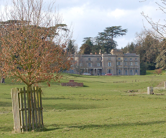
Shuckburgh Hall

Shuckburgh Hall is a privately owned country house mansion at Lower Shuckburgh, Warwickshire, near to Daventry in Northamptonshire. The estate has been...

Flecknoe railway station

Flecknoe was a railway station that served the village of Flecknoe in Warwickshire, England, on the Weedon to Leamington Spa branch line. The station was...

Flecknoe

Flecknoe is a village in the Rugby district of Warwickshire, England, one mile west of the border with Northamptonshire. The village is the largest settlement...

Ed Bishop

George Victor Bishop (11 June 1932 – 8 June 2005), known professionally as Ed Bishop or sometimes Edward Bishop, was an American actor, predominantly based...

Sawbridge

Sawbridge is a small hamlet in Warwickshire, England. It is 4 km north-west of Daventry and 8 km south of Rugby. It is within the civil parish of Wolfhampcote...

Napton on the Hill

Napton on the Hill, often referred to locally as just Napton, is a village and civil parish 3 miles (4.8 km) east of Southam in Warwickshire, England....

Catesby Priory

Catesby Priory was a priory of Cistercian nuns at Lower Catesby, Northamptonshire, England. It was founded in about 1175 and dissolved in 1536. == History... ==

Nearby Amenities

Located within 500m of 52.260148,-1.280429
Lower Shuckburgh
Is In: Warwickshire
Place: village
Wikidata: Q6693807
Lat/Long: 52.259272/-1.2834057
Jubilee Avenue
Naptan AtcoCode: 4200F041400
Naptan Bearing: E
Naptan BusStopType: CUS
Naptan CommonName: Jubilee Avenue
Naptan Indicator: Adj
Naptan NaptanCode: waratmaj
Naptan Street: Napton Road
Naptan Verified: no
Source: naptan_import
Lat/Long: 52.2593094/-1.2849565
Bus Stop
Shuckburgh Road
Bus: yes
Naptan AtcoCode: 4200F041401
Naptan Bearing: W
Naptan CommonName: Shuckburgh Road
Naptan Crossing: Jubilee Avenue
Naptan Indicator: Opp
Naptan NaptanCode: waratmam
Naptan Street: Shuckburgh Road
Naptan Verified: no
Public Transport: platform
Source: naptan_import
Lat/Long: 52.2592094/-1.2850243
War Memorial
Historic: memorial
Memorial: war_memorial
Source: survey
Lat/Long: 52.2594831/-1.284595
Bench
Source: survey
Lat/Long: 52.2593384/-1.2844705
Parking
Capacity: 5
Parking: layby
Lat/Long: 52.2614414/-1.2821643
Heritage: 2
Heritage Operator: Historic England
Historic: milepost
Listed Status: Grade II
Lat/Long: 52.2582938/-1.2802233
Post Box
Collection Times: Mo-Fr 16:00; Sa 08:00
Operator: Royal Mail
Operator Wikidata: Q638098
Post Box Type: lamp
Ref: NN11 332
Royal Cypher: EIIR
Royal Cypher Wikidata: Q33102113
Source: survey
Lat/Long: 52.2588297/-1.2816782
Stop
Source: Warwicks CC Aerial Imagery 2013
Lat/Long: 52.2592573/-1.2847049
Material: wood
Power: pole
Lat/Long: 52.2573428/-1.2844226
Material: wood
Power: pole
Transformer: distribution
Lat/Long: 52.2581223/-1.2838361
Material: wood
Power: pole
Lat/Long: 52.2569319/-1.2836839
Material: wood
Power: pole
Lat/Long: 52.256334/-1.2826346
Material: wood
Power: pole
Lat/Long: 52.2557653/-1.281633
Material: wood
Power: pole
Lat/Long: 52.2594744/-1.2829168
Material: wood
Power: pole
Lat/Long: 52.2601775/-1.2824077
Material: wood
Power: pole
Lat/Long: 52.2578536/-1.2822676
Material: wood
Power: pole
Lat/Long: 52.2578922/-1.2830242
Material: wood
Power: pole
Lat/Long: 52.2582852/-1.2844789
Material: wood
Power: pole
Lat/Long: 52.2584353/-1.2850673
Material: wood
Power: pole
Lat/Long: 52.2587026/-1.2851607
Material: wood
Power: pole
Lat/Long: 52.2591356/-1.2853172
Material: wood
Power: pole
Lat/Long: 52.2590168/-1.2856404
Material: wood
Power: pole
Lat/Long: 52.2588143/-1.2849502
Material: wood
Power: pole
Lat/Long: 52.2589432/-1.2846848
Material: wood
Power: pole
Lat/Long: 52.2593743/-1.284975
Material: wood
Power: pole
Lat/Long: 52.2604217/-1.282172
Material: wood
Power: pole
Lat/Long: 52.2597566/-1.2813013
Material: wood
Power: pole
Transformer: minor_distribution
Lat/Long: 52.2603404/-1.2840424
Material: wood
Power: pole
Lat/Long: 52.2603469/-1.2841981
Material: wood
Power: pole
Lat/Long: 52.2608408/-1.2845291
Material: wood
Power: pole
Lat/Long: 52.2608538/-1.2851803
Material: wood
Power: pole
Lat/Long: 52.2608853/-1.2858102
Material: wood
Power: pole
Lat/Long: 52.2609015/-1.286373
Material: wood
Power: pole
Lat/Long: 52.2612123/-1.2865411
Material: wood
Power: pole
Transformer: distribution
Lat/Long: 52.2593862/-1.2804201
Historic: stocks
Mapillary: https://mapillary.com/map/im/854979115054554
Lat/Long: 52.2593642/-1.2845112
Wharf Farm
Place: farm
Lat/Long: 52.2613087/-1.2832068
Blackboy Farm
Place: farm
Lat/Long: 52.2596634/-1.2839459
Red House Farm
Place: farm
Lat/Long: 52.2590724/-1.2802087
Glebe Farm
Place: farm
Lat/Long: 52.258999/-1.2849593
The data included in this document is from www.openstreetmap.org. The data is made available under ODbL.

Have you been to Shuckburgh, Lower?

Leave your review of Shuckburgh, Lower below (or comments, questions and feedback).