Deepdale Marsh

Coastal Marsh, Saltings in Norfolk King's Lynn and West Norfolk

England

Deepdale Marsh

Arable field on Deepdale Marsh The rest of this segment of reclaimed land is now grazing marsh.
Arable field on Deepdale Marsh Credit: Hugh Venables

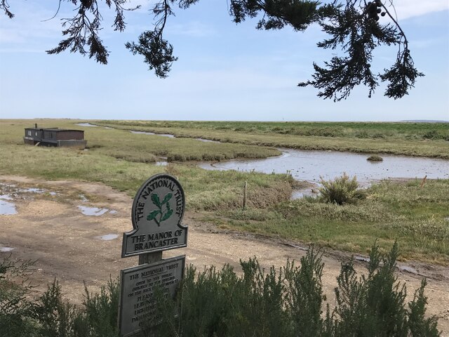
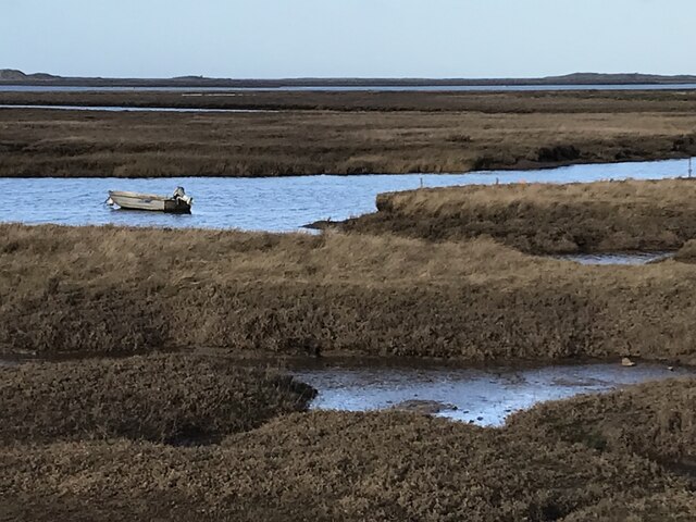
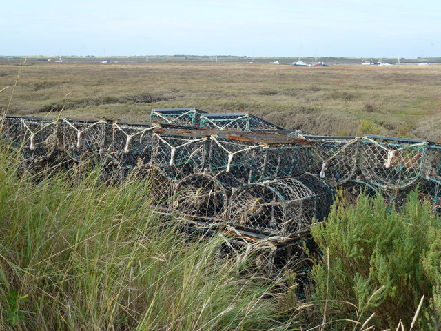
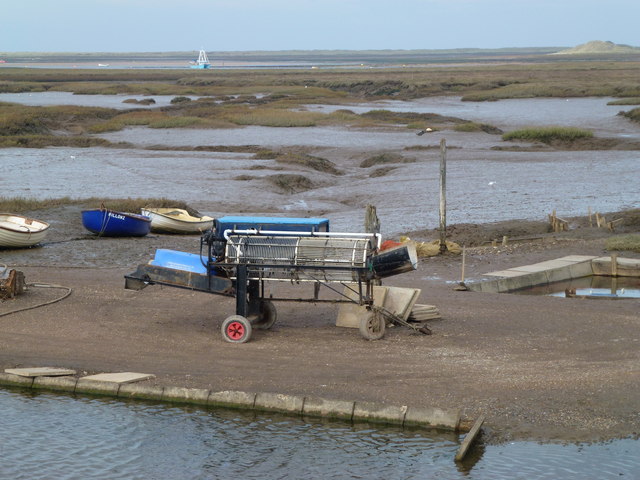
Deepdale Marsh is a picturesque coastal marsh located in Norfolk, England. Situated in the northwestern part of the county, it is part of the larger saltmarshes known as the Norfolk Coast Area of Outstanding Natural Beauty. The marsh spans across a vast area, offering breathtaking views of the surrounding landscape.

Covered in lush green grasses, reeds, and various salt-tolerant plants, Deepdale Marsh is a haven for a diverse range of wildlife. The area provides a vital habitat for numerous bird species, including wading birds like avocets, curlews, and redshanks. Rare and endangered species, such as the bittern and marsh harrier, also find sanctuary in this marshland.

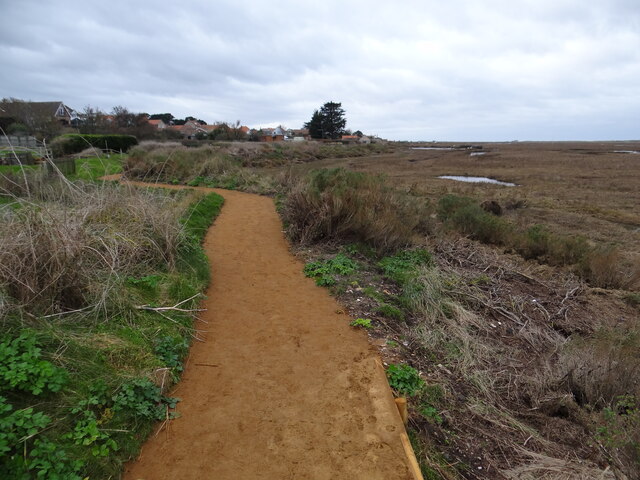
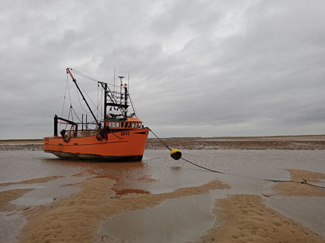
The marsh is interspersed with channels and creeks, which are influenced by the ebb and flow of the tide. This creates a dynamic environment, attracting a wealth of marine life. Crabs, shrimps, and small fish can be found within the shallow waters, while seals can be spotted basking on the sandbanks during low tide.

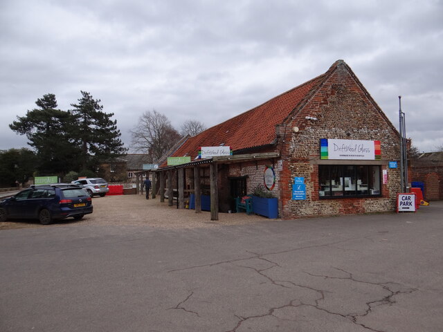
Visitors to Deepdale Marsh can enjoy a tranquil and serene atmosphere, perfect for nature lovers and birdwatchers. The marsh is accessible via footpaths and offers panoramic views of the surrounding countryside and coastline. The area is also a popular spot for hiking and walking, with several trails that lead through the marshland and connect to other nearby nature reserves.

Deepdale Marsh is not only a natural treasure but also an important site for scientific research and conservation efforts. Its unique ecosystem and diverse wildlife make it a truly remarkable destination for those seeking to immerse themselves in the beauty of nature.

If you have any feedback on the listing, please let us know in the comments section below.

Deepdale Marsh Images

Images are sourced within 2km of 52.969365/0.70277877 or Grid Reference TF8144. Thanks to Geograph Open Source API. All images are credited.

Arable field on Deepdale Marsh The rest of this segment of reclaimed land is now grazing marsh.
Arable field on Deepdale Marsh
The rest of this segment of reclaimed land is now grazing marsh.
Deepdale Camping and Rooms Nice place to spend a reasonably priced self-catering weekend with close friends in dormitory accommodation in the roof space, or park your tent/van round the back.  Free parking included and a shop next door!
<span class="nowrap"><a title="https://www.deepdalebackpackers.co.uk" rel="nofollow ugc noopener" href="https://www.deepdalebackpackers.co.uk">Link</a><img style="margin-left:2px;" alt="External link" title="External link - shift click to open in new window" src="https://s1.geograph.org.uk/img/external.png" width="10" height="10"/></span>
Deepdale Camping and Rooms
Nice place to spend a reasonably priced self-catering weekend with close friends in dormitory accommodation in the roof space, or park your tent/van round the back. Free parking included and a shop next door! LinkExternal link
Pleasant path Just about the most perfect surface for a footpath. Clean, well-defined, flat, firm but not too soft nor too hard, no mud, no puddles, no dog poop, no litter!
Pleasant path
Just about the most perfect surface for a footpath. Clean, well-defined, flat, firm but not too soft nor too hard, no mud, no puddles, no dog poop, no litter!
St Mary's Burnham Deepdale Taken from outside Dalegate Market <span class="nowrap"><a title="https://www.dalegatemarket.co.uk/" rel="nofollow ugc noopener" href="https://www.dalegatemarket.co.uk/">Link</a><img style="margin-left:2px;" alt="External link" title="External link - shift click to open in new window" src="https://s1.geograph.org.uk/img/external.png" width="10" height="10"/></span> . The OS symbol for a church with a tower seems inappropriate in these parts, where round-towered churches, as here, are common. The tower at St Mary's is thought to be Norman <span class="nowrap"><a title="http://www.saxonshorebenefice.co.uk/burnhamd.htm" rel="nofollow ugc noopener" href="http://www.saxonshorebenefice.co.uk/burnhamd.htm">Link</a><img style="margin-left:2px;" alt="External link" title="External link - shift click to open in new window" src="https://s1.geograph.org.uk/img/external.png" width="10" height="10"/></span> .
St Mary's Burnham Deepdale
Taken from outside Dalegate Market LinkExternal link . The OS symbol for a church with a tower seems inappropriate in these parts, where round-towered churches, as here, are common. The tower at St Mary's is thought to be Norman LinkExternal link .
The Manor of Brancaster - National Trust
Barn conversion in Burnham Norton
Saltmarsh and creeks, Brancaster Staithe A view from the car park of the White Horse
Saltmarsh and creeks, Brancaster Staithe
A view from the car park of the White Horse
Signpost in the garden of the White Horse, Brancaster Staithe The garden and car park abut the saltmarshes at this popular North Norfolk hostelry.
Signpost in the garden of the White Horse, Brancaster Staithe
The garden and car park abut the saltmarshes at this popular North Norfolk hostelry.
Grass field at Norton Street In the far distance can be seen the church of Burnham Norton.
Grass field at Norton Street
In the far distance can be seen the church of Burnham Norton.
St Mary's church, Burnham Deepdale The church has an eleventh century tower but most of the external detailing of the body of the church dates to the nineteenth century <span class="nowrap"><a title="https://historicengland.org.uk/listing/the-list/list-entry/1237969?section=official-list-entry" rel="nofollow ugc noopener" href="https://historicengland.org.uk/listing/the-list/list-entry/1237969?section=official-list-entry">Link</a><img style="margin-left:2px;" alt="External link" title="External link - shift click to open in new window" src="https://s1.geograph.org.uk/img/external.png" width="10" height="10"/></span>
St Mary's church, Burnham Deepdale
The church has an eleventh century tower but most of the external detailing of the body of the church dates to the nineteenth century LinkExternal link
Crab pots near Brancaster Staithe
Shell fish cleaning reel near Brancaster Staithe
Brancaster Marsh Looking across the extensive salt marsh from the car park of the White Horse.
Brancaster Marsh
Looking across the extensive salt marsh from the car park of the White Horse.
A149 at The White Horse, Brancaster Staithe
Sea Dog in The Hole at Brancaster Harbour The last time I geographed this beam trawler was when it motored along The Haven near Boston in 2009 <a href="https://www.geograph.org.uk/photo/1430819">TF3838 : Back to Boston</a>.  This photo was taken at, or very close to, low tide that day.
Sea Dog in The Hole at Brancaster Harbour
The last time I geographed this beam trawler was when it motored along The Haven near Boston in 2009 TF3838 : Back to Boston. This photo was taken at, or very close to, low tide that day.
Shelter on the Peddars Way / Norfolk Coast Path Interesting bench that might need a bit of work on it as it has deteriorated somewhat since 2018 <a href="https://www.geograph.org.uk/photo/6453296">TF7944 : A  seat  boat  or  a  boat  seat</a>.

Check out the flood mark on the blackboard behind the bench.
Shelter on the Peddars Way / Norfolk Coast Path
Interesting bench that might need a bit of work on it as it has deteriorated somewhat since 2018 TF7944 : A seat boat or a boat seat. Check out the flood mark on the blackboard behind the bench.
House on the coast road in Brancaster Staithe, Norfolk
Saltmarsh near the White Horse, Brancaster Staithe in Norfolk
Show me another place!

Deepdale Marsh is located at Grid Ref: TF8144 (Lat: 52.969365, Lng: 0.70277877)

Administrative County: Norfolk

District: King's Lynn and West Norfolk

Police Authority: Norfolk

What 3 Words

///respect.roughness.actor. Near Wells-next-the-Sea, Norfolk

Related Wikis

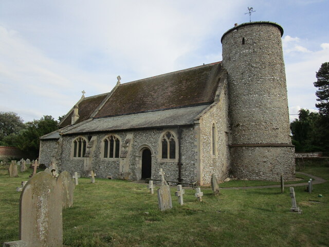
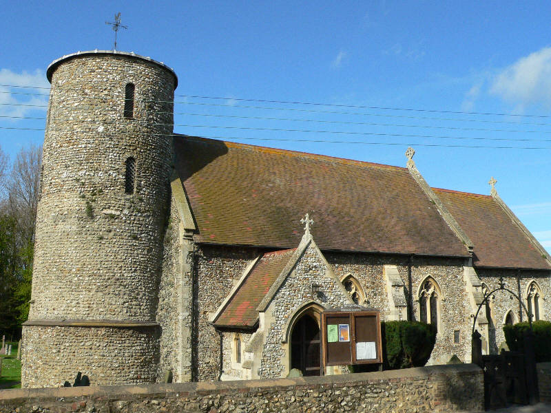
St Mary's Church, Burnham Deepdale

St Mary's Church is a round-tower church in Burnham Deepdale, Norfolk, England. Its round tower and some other parts of the building date from the 11th...

Scolt Head Island

Scolt Head Island is an offshore barrier island between Brancaster and Wells-next-the-Sea in north Norfolk. It is in the parish of Burnham Norton and is...

Burnham Norton

Burnham Norton is a village and civil parish in the English county of Norfolk, one of the Burnhams, an adjacent group in the northernmost part of Norfolk...

Burnham Deepdale

Burnham Deepdale is a village and former civil parish, now in the parish of Brancaster, in the King's Lynn and West Norfolk district, on the north coast...

Brancaster Staithe

Brancaster Staithe is a village on the north coast of the English county of Norfolk. Brancaster Staithe merges with Burnham Deepdale, forming one village...
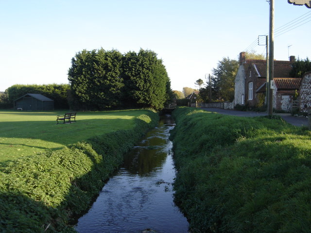
River Burn, Norfolk

The River Burn (also known as "Nelsons River") is a river in the northwest of the County of Norfolk, in the East of England. From its source to its mouth...

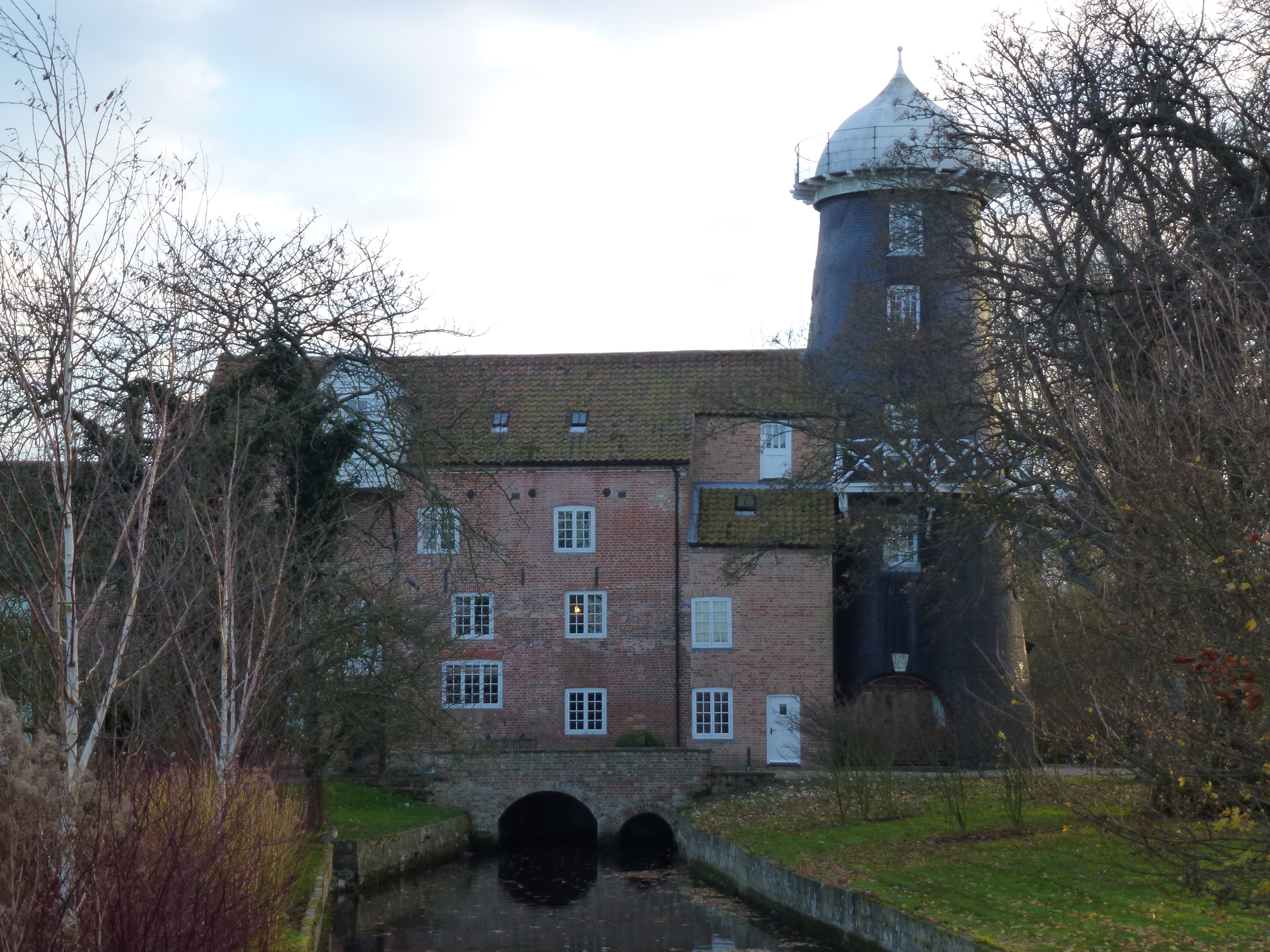
Union Mills, Burnham Overy

Union Mills or Roy's Mills are a Grade II listed combined tower mill and watermill at Burnham Overy, Norfolk, England which has been converted to residential...

Burnham Overy Staithe Windmill

Burnham Overy Staithe Windmill is a Grade II* listed building tower mill at Burnham Overy Staithe, Norfolk, England which has been converted to holiday...

Have you been to Deepdale Marsh?

Leave your review of Deepdale Marsh below (or comments, questions and feedback).