Cockle Bight

Coastal Marsh, Saltings in Norfolk King's Lynn and West Norfolk

England

Cockle Bight

Arable field on Deepdale Marsh The rest of this segment of reclaimed land is now grazing marsh.
Arable field on Deepdale Marsh Credit: Hugh Venables

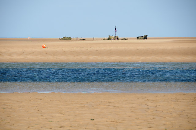
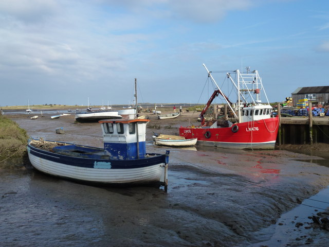
Cockle Bight is a coastal marsh and saltings located in Norfolk, England. It is situated along the eastern coastline, nestled between the North Sea and the villages of Cockley Cley and Cockley Beck. The area covers approximately 10 square kilometers and is known for its unique ecosystem and diverse wildlife.

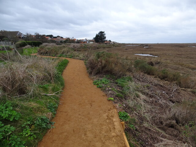
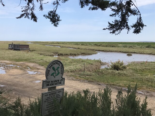
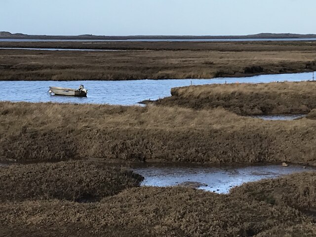
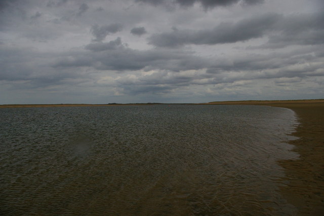
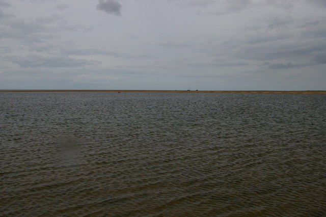
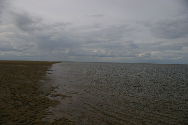
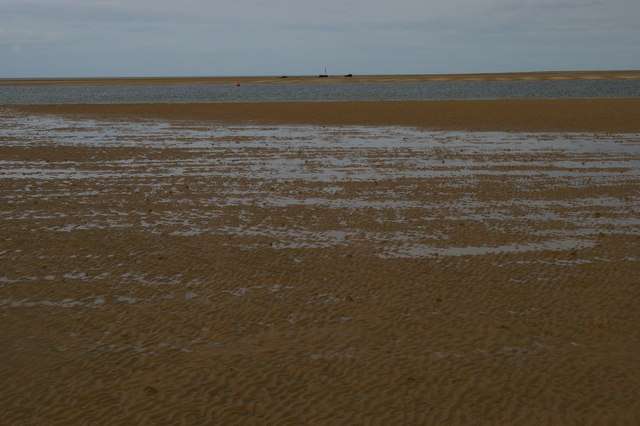
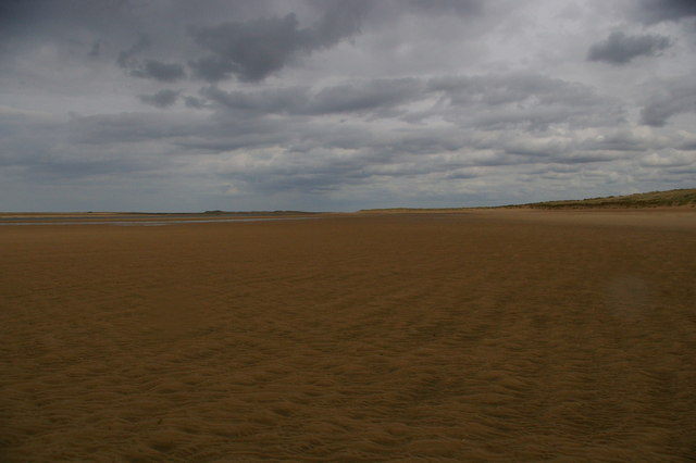
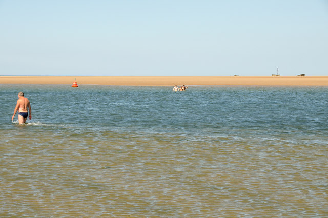
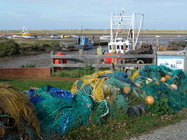
The marshland at Cockle Bight is characterized by its extensive mudflats, salt marshes, and intertidal habitats. These habitats are shaped by the regular ebb and flow of the tides, resulting in a dynamic landscape that supports a rich variety of plant and animal species.

The salt marshes at Cockle Bight are home to a wide range of salt-tolerant vegetation, including samphire, cordgrass, and glasswort. These plants provide important nesting and foraging grounds for numerous bird species, such as waders, ducks, and geese. The area is particularly renowned for its large population of migratory birds, which visit during the winter months.

In addition to its avian inhabitants, Cockle Bight is also frequented by various marine creatures. The mudflats and shallow waters are teeming with life, including shellfish, crabs, and small fish. These invertebrates and fish serve as a vital food source for both resident and visiting bird species.

Cockle Bight is not only a haven for wildlife but also a popular destination for nature enthusiasts and birdwatchers. The area offers numerous walking trails and bird hides, allowing visitors to observe the diverse array of species in their natural habitat. It is important to note that some parts of the marsh may be inaccessible during high tide, so it is advisable to check the tidal timetable before planning a visit.

If you have any feedback on the listing, please let us know in the comments section below.
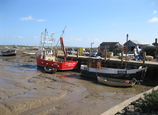
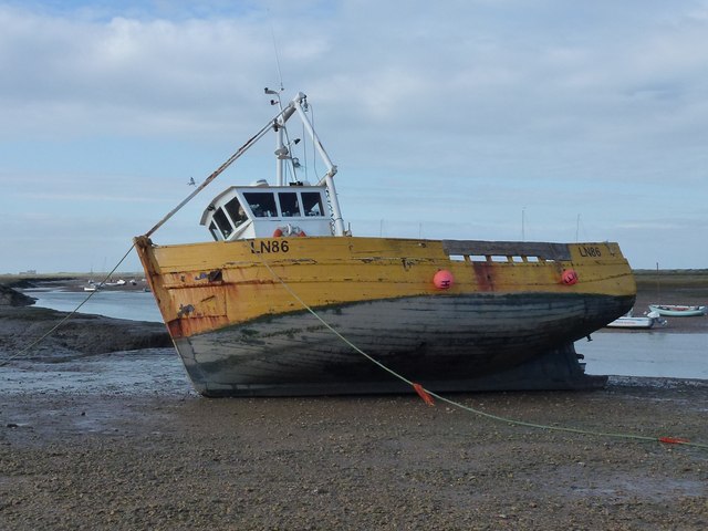
Cockle Bight Images

Images are sourced within 2km of 52.983777/0.67627885 or Grid Reference TF7946. Thanks to Geograph Open Source API. All images are credited.

Arable field on Deepdale Marsh The rest of this segment of reclaimed land is now grazing marsh.
Arable field on Deepdale Marsh
The rest of this segment of reclaimed land is now grazing marsh.
Pleasant path Just about the most perfect surface for a footpath. Clean, well-defined, flat, firm but not too soft nor too hard, no mud, no puddles, no dog poop, no litter!
Pleasant path
Just about the most perfect surface for a footpath. Clean, well-defined, flat, firm but not too soft nor too hard, no mud, no puddles, no dog poop, no litter!
The Manor of Brancaster - National Trust
Saltmarsh and creeks, Brancaster Staithe A view from the car park of the White Horse
Saltmarsh and creeks, Brancaster Staithe
A view from the car park of the White Horse
Signpost in the garden of the White Horse, Brancaster Staithe The garden and car park abut the saltmarshes at this popular North Norfolk hostelry.
Signpost in the garden of the White Horse, Brancaster Staithe
The garden and car park abut the saltmarshes at this popular North Norfolk hostelry.
Brancaster Beach looking east
Brancaster Harbour, with a wreck in the distance
Brancaster Harbour
Brancaster Harbour
Brancaster Harbour, distant wreck
Brancaster Beach looking east
Outflow channel & SS Vina This is the outflow channel you have to cross to visit the shipwreck. On low tides it is possible, but be warned the tide can easily cut you off.
Outflow channel & SS Vina
This is the outflow channel you have to cross to visit the shipwreck. On low tides it is possible, but be warned the tide can easily cut you off.
Outflow channel, Brancaster Bay Some children nearly missed getting back across the outflow channel before the tide came in. They are up to their chests.
Outflow channel, Brancaster Bay
Some children nearly missed getting back across the outflow channel before the tide came in. They are up to their chests.
Western Brancaster Harbour, Brancaster Bay Taken from the south of the outflow channel at a very low tide. Ship wreck SS Vina and Scolt Head Island can be seen in the distance. When you walk there, they are a lot further away than you imagined. Also, the beach undulates a lot and for this reason you need to be careful, as it is easy to caught out by the tide.

The camera location was fixed using a Nikon GP-1 GPS unit attached to the camera. This is embedded in the EXIF data.
Western Brancaster Harbour, Brancaster Bay
Taken from the south of the outflow channel at a very low tide. Ship wreck SS Vina and Scolt Head Island can be seen in the distance. When you walk there, they are a lot further away than you imagined. Also, the beach undulates a lot and for this reason you need to be careful, as it is easy to caught out by the tide. The camera location was fixed using a Nikon GP-1 GPS unit attached to the camera. This is embedded in the EXIF data.
SS Vina - The Brancaster Wreck To get to the ship wreck, it would have meant crossing the outflow channel. With the tide coming in, it is both deep and dangerous.
SS Vina - The Brancaster Wreck
To get to the ship wreck, it would have meant crossing the outflow channel. With the tide coming in, it is both deep and dangerous.
Brancaster Staithe Quay The quay was renovated in 2007 and is used regularly by fishing vessels.
Brancaster Staithe Quay
The quay was renovated in 2007 and is used regularly by fishing vessels.
High and dry at Brancaster Staithe Fishing boat LN86 waiting for the next tide
High and dry at Brancaster Staithe
Fishing boat LN86 waiting for the next tide
Fishing boats at low tide, Brancaster Staithe Fishing boats and the new steel and concrete quay built in 2007 to replace the timber one.
Fishing boats at low tide, Brancaster Staithe
Fishing boats and the new steel and concrete quay built in 2007 to replace the timber one.
All the colours of the rainbow at Brancaster Staithe Fishing nets and boats near the quay in this tiny fishing harbour
All the colours of the rainbow at Brancaster Staithe
Fishing nets and boats near the quay in this tiny fishing harbour
Show me another place!

Cockle Bight is located at Grid Ref: TF7946 (Lat: 52.983777, Lng: 0.67627885)

Administrative County: Norfolk

District: King's Lynn and West Norfolk

Police Authority: Norfolk

What 3 Words

///grove.clipped.scars. Near Wells-next-the-Sea, Norfolk

Nearby Locations

Felters Hill Cockle Bight

Related Wikis

Brancaster Staithe

Brancaster Staithe is a village on the north coast of the English county of Norfolk. Brancaster Staithe merges with Burnham Deepdale, forming one village...

Scolt Head Island

Scolt Head Island is an offshore barrier island between Brancaster and Wells-next-the-Sea in north Norfolk. It is in the parish of Burnham Norton and is...

St Mary's Church, Burnham Deepdale

St Mary's Church is a round-tower church in Burnham Deepdale, Norfolk, England. Its round tower and some other parts of the building date from the 11th...

Burnham Deepdale

Burnham Deepdale is a village and former civil parish, now in the parish of Brancaster, in the King's Lynn and West Norfolk district, on the north coast...

Branodunum

Branodunum was an ancient Roman fort to the east of the modern English village of Brancaster in Norfolk. Its Roman name derives from the local Celtic language...

Royal West Norfolk Golf Club

Royal West Norfolk Golf Club is a golf club in Brancaster, Norfolk, England, about 7 miles (11 km) east of Hunstanton, between Brancaster Bay and the salt...

Brancaster

Brancaster is a village and civil parish on the north coast of the English county of Norfolk. The civil parish of Brancaster comprises Brancaster itself...

Burnham Norton

Burnham Norton is a village and civil parish in the English county of Norfolk, one of the Burnhams, an adjacent group in the northernmost part of Norfolk...

Nearby Amenities

Located within 500m of 52.983777,0.67627885
Source: PGS
Lat/Long: 52.9856627/0.6822731
Source: PGS
Lat/Long: 52.9849239/0.6817423
Source: PGS
Lat/Long: 52.9853279/0.6820362
Source: PGS
Lat/Long: 52.9858159/0.6825797
Source: PGS
Lat/Long: 52.985869/0.6827433
Source: PGS
Lat/Long: 52.9857344/0.682385
Source: PGS
Lat/Long: 52.9855826/0.6821993
Source: PGS
Lat/Long: 52.9847745/0.6816784
Source: PGS
Lat/Long: 52.9844567/0.6817247
Source: PGS
Lat/Long: 52.9843726/0.6817082
Source: PGS
Lat/Long: 52.9842528/0.6815938
Source: PGS
Lat/Long: 52.9842258/0.6815058
Source: PGS
Lat/Long: 52.9842222/0.6814083
Source: PGS
Lat/Long: 52.9842352/0.6811251
Source: PGS
Lat/Long: 52.9842085/0.6810575
Source: PGS
Lat/Long: 52.9841004/0.6808905
Source: PGS
Lat/Long: 52.9839659/0.6807688
Source: PGS
Lat/Long: 52.9839321/0.6807681
Source: PGS
Lat/Long: 52.9839036/0.6807871
Source: PGS
Lat/Long: 52.983883/0.6808243
Source: PGS
Lat/Long: 52.9838711/0.6809056
Source: PGS
Lat/Long: 52.9839168/0.6811059
Source: PGS
Lat/Long: 52.9840695/0.6815072
Source: PGS
Lat/Long: 52.9840254/0.6813668
Source: PGS
Lat/Long: 52.984005/0.6807888
Source: PGS
Lat/Long: 52.9842452/0.6811904
Source: PGS
Lat/Long: 52.9843034/0.6816634
Source: PGS
Lat/Long: 52.9865064/0.6803481
Source: PGS
Lat/Long: 52.9863956/0.6802544
The data included in this document is from www.openstreetmap.org. The data is made available under ODbL.

Have you been to Cockle Bight?

Leave your review of Cockle Bight below (or comments, questions and feedback).