Bentinck Marsh

Coastal Marsh, Saltings in Norfolk King's Lynn and West Norfolk

England

Bentinck Marsh

The Partridge, Clenchwarton: mid-September 2022 During a great walking week-end in Norfolk with two friends from my school days (1972 - 1979) there were times when I nipped off in the car to look at churches and other historical features: these are they!
The Partridge, Clenchwarton: mid-September 2022 Credit: Basher Eyre

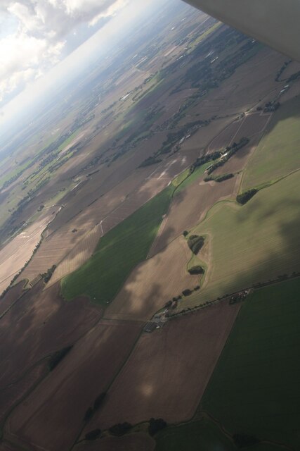
Bentinck Marsh, located in Norfolk, England, is a picturesque coastal marshland known for its unique ecosystem and stunning natural beauty. Stretching along the Norfolk coast, this marshland is characterized by its vast expanse of salt marshes and saltings.

The marsh is predominantly formed by the deposition of sediment carried by tidal waters, resulting in the creation of low-lying areas with marshy vegetation. These marshes serve as vital habitats for a variety of plant and animal species, making it an important site for conservation and wildlife preservation.

Bentinck Marsh is home to a diverse range of bird species, including waders, ducks, and geese. The abundance of food sources and nesting sites provided by the marsh attracts numerous migratory birds during the breeding season. Birdwatchers and nature enthusiasts flock to Bentinck Marsh to witness the spectacular sight of these birds in their natural habitat.

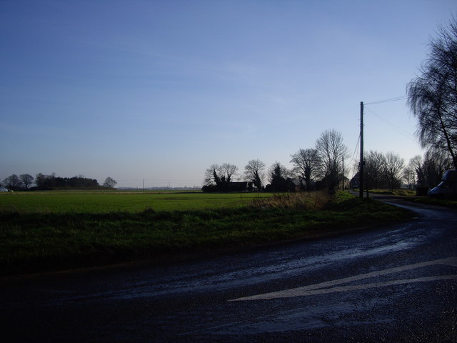
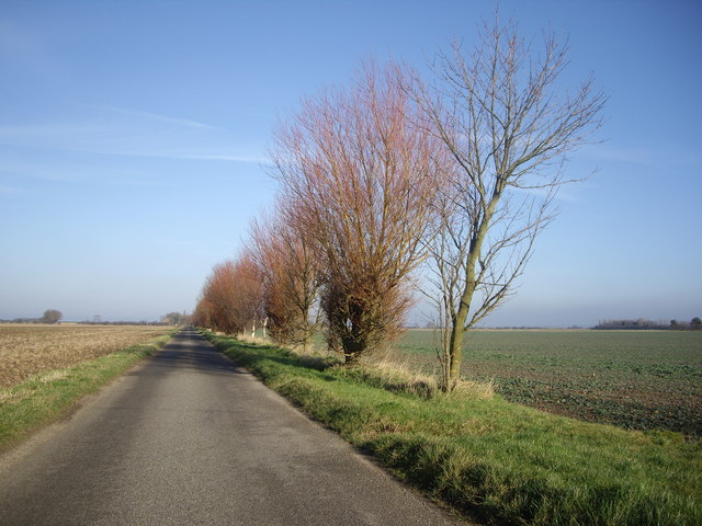
The marshland also supports a rich array of plant life, with various species of grasses, sedges, and herbs flourishing in the damp and saline conditions. These plants play a crucial role in stabilizing the marshland, preventing erosion, and providing shelter and food for the resident and migratory wildlife.

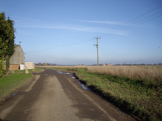
Aside from its ecological significance, Bentinck Marsh offers visitors a tranquil and serene environment to explore. The vast, open marshland dotted with tidal creeks and channels provides breathtaking views and opportunities for leisurely walks, cycling, and photography.

In conclusion, Bentinck Marsh is a remarkable coastal marshland in Norfolk, offering a diverse range of habitats for wildlife and providing visitors with a unique and enchanting natural experience.

If you have any feedback on the listing, please let us know in the comments section below.

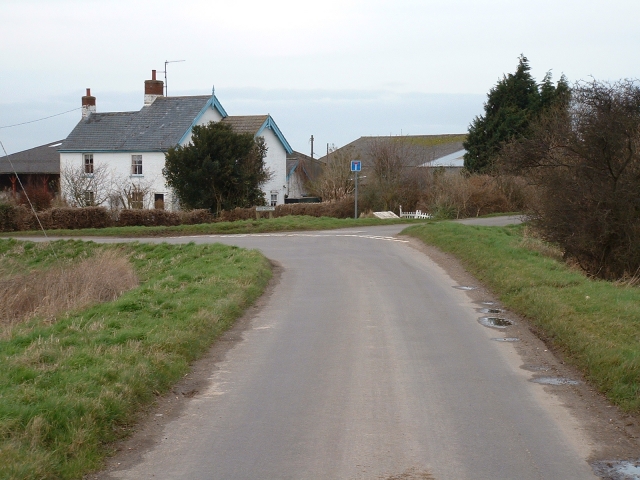
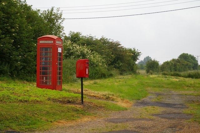
Bentinck Marsh Images

Images are sourced within 2km of 52.772415/0.32787457 or Grid Reference TF5721. Thanks to Geograph Open Source API. All images are credited.

The Partridge, Clenchwarton: mid-September 2022 During a great walking week-end in Norfolk with two friends from my school days (1972 - 1979) there were times when I nipped off in the car to look at churches and other historical features: these are they!
The Partridge, Clenchwarton: mid-September 2022
During a great walking week-end in Norfolk with two friends from my school days (1972 - 1979) there were times when I nipped off in the car to look at churches and other historical features: these are they!
Bentinck Marsh, Terrington St Clement: aerial 2023 Terrington Marsh.
Bentinck Marsh, Terrington St Clement: aerial 2023
Terrington Marsh.
Rhoon Road Nr Terrington St Clement <span class="nowrap"><a title="http://www.hetkasteelvanrhoon.nl/" rel="nofollow ugc noopener" href="http://www.hetkasteelvanrhoon.nl/">Link</a><img style="margin-left:2px;" alt="External link" title="External link - shift click to open in new window" src="https://s1.geograph.org.uk/img/external.png" width="10" height="10"/></span>
Rhoon is a village that borders Rotterdam, any links?
Rhoon Road Nr Terrington St Clement
LinkExternal link Rhoon is a village that borders Rotterdam, any links?
Old New Marsh What a name for a marsh!
Old New Marsh
What a name for a marsh!
Road Near The Laurels Farm Yet again, the roads round these parts live true to their legend!
Road Near The Laurels Farm
Yet again, the roads round these parts live true to their legend!
Road Close to Pierrepont Farm Ok, so I was on a Geograph mission to get these squares! I do think these trees make a great contrast with the blue sky though!
Road Close to Pierrepont Farm
Ok, so I was on a Geograph mission to get these squares! I do think these trees make a great contrast with the blue sky though!
Greenmarsh Lane, Terrington St Clement A pleasant 19th century cottage marks the junction of two lanes on the outskirts of Terrington St Clement.
Greenmarsh Lane, Terrington St Clement
A pleasant 19th century cottage marks the junction of two lanes on the outskirts of Terrington St Clement.
The Laurels, Terrington St Clement This beautifully maintained house and gardens sit in a field of vegetables.
The Laurels, Terrington St Clement
This beautifully maintained house and gardens sit in a field of vegetables.
Wheat field and houses on Sandygate Lane
Apple orchards at Banklands View to the north, seaward, side of the Sea Bank lane near Clenchwarton.
Apple orchards at Banklands
View to the north, seaward, side of the Sea Bank lane near Clenchwarton.
Wheat south of Hall Road, Clenchwarton
Terrington fire station Terrington fire station, Benns Lane, Terrington St Clement, Norfolk, which seems to be used as a play park by the local youngsters.
Terrington fire station
Terrington fire station, Benns Lane, Terrington St Clement, Norfolk, which seems to be used as a play park by the local youngsters.
By Rhoon Road Next to the telephone box and post box, a byway leads to Green Bank Farm.  Interestingly, this post box appears in Royal Mail's list as "Marshes School".
By Rhoon Road
Next to the telephone box and post box, a byway leads to Green Bank Farm. Interestingly, this post box appears in Royal Mail's list as "Marshes School".
Footpath to Banklands This track is part of the Clenchwarton Parish Walk.
Footpath to Banklands
This track is part of the Clenchwarton Parish Walk.
Old Milestone Old milestone near to Churchwarton, Norfolk. For overall view see <a title="https://www.geograph.org.uk/photo/1186806" href="https://www.geograph.org.uk/photo/1186806">Link</a>
Old Milestone
Old milestone near to Churchwarton, Norfolk. For overall view see Link
To Kings Lynn 4 Old milestone near to Clenchwarton, Norfolk. For close up view see <a title="https://www.geograph.org.uk/photo/1186800" href="https://www.geograph.org.uk/photo/1186800">Link</a>
To Kings Lynn 4
Old milestone near to Clenchwarton, Norfolk. For close up view see Link
Track leading to Banklands north of Clenchwarton
Country lane on an old sea bank north of Clenchwarton
Show me another place!

Bentinck Marsh is located at Grid Ref: TF5721 (Lat: 52.772415, Lng: 0.32787457)

Administrative County: Norfolk

District: King's Lynn and West Norfolk

Police Authority: Norfolk

What 3 Words

///surfacing.pulled.poses. Near Terrington St Clement, Norfolk

Related Wikis

St Clement's High School

St Clement's High School is a coeducational secondary school with academy status, located in the village of Terrington St Clement, in the English county...

Clenchwarton

Clenchwarton is a village, civil parish and electoral ward in the English county of Norfolk. It is located about 1+1⁄4 miles (2 km) west of the River Great...

Clenchwarton railway station

Clenchwarton Railway Station is a former train station in Clenchwarton, Norfolk. It was part of the Midland and Great Northern Joint Railway line from...

Terrington St Clement

Terrington St Clement is a village and civil parish in King's Lynn and West Norfolk borough and district in Norfolk, England. It is in the drained marshlands...

Nearby Amenities

Located within 500m of 52.772415,0.32787457
Bentinck Marsh
Place: locality
Lat/Long: 52.7756322/0.3279552
The data included in this document is from www.openstreetmap.org. The data is made available under ODbL.

Have you been to Bentinck Marsh?

Leave your review of Bentinck Marsh below (or comments, questions and feedback).