Beckces

Settlement in Cumberland Eden

England

Beckces

Old course of A66
Old course of A66 Credit: N Chadwick

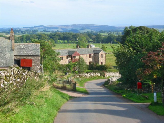
Beckces is a small village located in the county of Cumberland, in the northwest region of England. Situated amidst breathtaking natural beauty, this rural settlement is nestled in the picturesque countryside of the Lake District National Park.

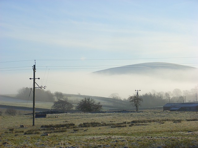
The village of Beckces exudes a tranquil and idyllic atmosphere, making it a popular destination for nature enthusiasts and those seeking a peaceful retreat. Surrounded by lush green fields, rolling hills, and charming woodlands, it offers a perfect setting for outdoor activities such as hiking, cycling, and birdwatching. The nearby Beckces Lake is a notable feature of the area, attracting visitors with its serene waters and opportunities for fishing and boating.

The village itself is characterized by its quaint cottages made of local stone, showcasing traditional English architecture. Beckces is home to a close-knit community, with a small population of friendly and welcoming residents. The village boasts a few local amenities, including a village hall, a cozy pub serving traditional cuisine, and a small convenience store for everyday needs.

Although Beckces is a quiet and peaceful village, it is conveniently located near several larger towns and cities. The vibrant city of Carlisle is just a short drive away, offering a range of cultural attractions, shopping centers, and entertainment options.

In summary, Beckces in Cumberland is a charming and picturesque village that offers a peaceful escape amidst stunning natural scenery. With its close proximity to the Lake District National Park and easy access to nearby towns, it is a hidden gem for those seeking a tranquil getaway.

If you have any feedback on the listing, please let us know in the comments section below.
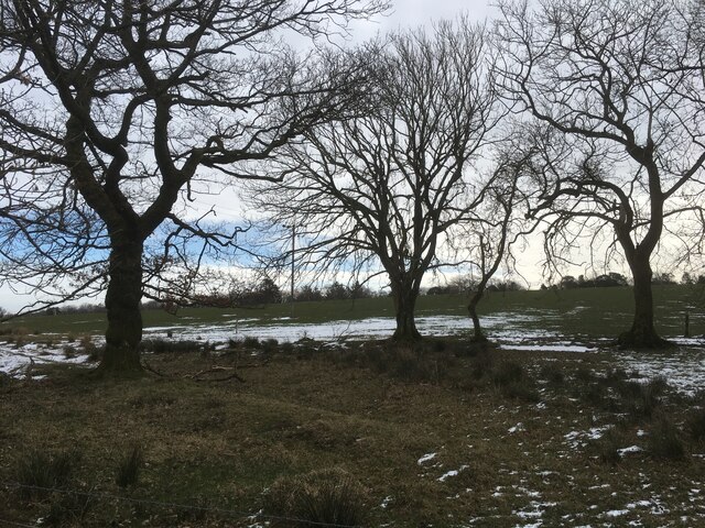
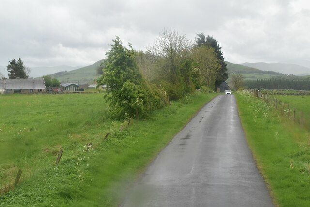
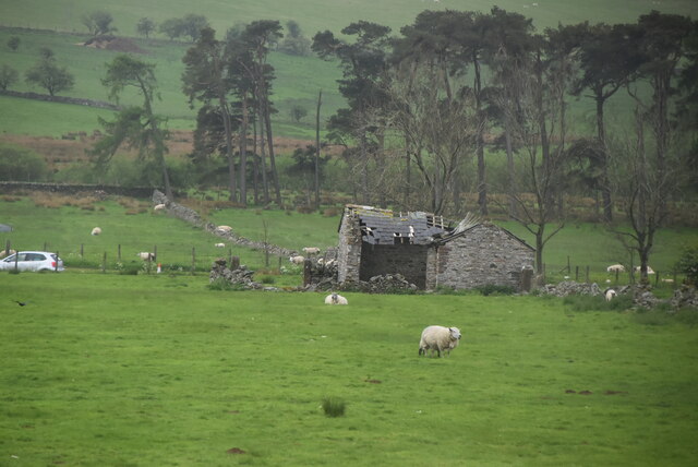
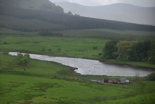
Beckces Images

Images are sourced within 2km of 54.634658/-2.9155446 or Grid Reference NY4127. Thanks to Geograph Open Source API. All images are credited.

Old course of A66
Old course of A66
Old course of A66
Old course of A66
Clump of trees
Clump of trees
Route of old railway line near Troutbeck
Track at Cocklakes Track at Cocklakes.
Track at Cocklakes
Track at Cocklakes.
Stream through a field near Troutbeck
Trees at field edge near Berrier
Fields with farm roads beside Whitbarrow Village Whitbarrow Village is a holiday development near to Penruddock. The image shows farmland to the east of the main building on the site, the view being to the east.
The hills of the north Pennines are on the horizon.
Fields with farm roads beside Whitbarrow Village
Whitbarrow Village is a holiday development near to Penruddock. The image shows farmland to the east of the main building on the site, the view being to the east. The hills of the north Pennines are on the horizon.
Minor road near Penruddock
Ruined barn
Ruined barn
Large barn
Large barn
Lake near Cocklakes
Lake near Cocklakes
A66 The A66 is a major road in northern England running from near Middlesbrough to Workington. The section between Scotch Corner and Penrith is a Trans-Pennine route between the A1 and M6, following an old Roman Road.
Wikipedia: <span class="nowrap"><a title="http://en.wikipedia.org/wiki/A66_road" rel="nofollow ugc noopener" href="http://en.wikipedia.org/wiki/A66_road">Link</a><img style="margin-left:2px;" alt="External link" title="External link - shift click to open in new window" src="https://s1.geograph.org.uk/img/external.png" width="10" height="10"/></span>
A66
The A66 is a major road in northern England running from near Middlesbrough to Workington. The section between Scotch Corner and Penrith is a Trans-Pennine route between the A1 and M6, following an old Roman Road. Wikipedia: LinkExternal link
Cocklakes House
Cocklakes House
Rural traffic, A66 The A66 is a major road in northern England running from near Middlesbrough to Workington. The section between Scotch Corner and Penrith is a Trans-Pennine route between the A1 and M6, following an old Roman Road.
Wikipedia: <span class="nowrap"><a title="http://en.wikipedia.org/wiki/A66_road" rel="nofollow ugc noopener" href="http://en.wikipedia.org/wiki/A66_road">Link</a><img style="margin-left:2px;" alt="External link" title="External link - shift click to open in new window" src="https://s1.geograph.org.uk/img/external.png" width="10" height="10"/></span>
Rural traffic, A66
The A66 is a major road in northern England running from near Middlesbrough to Workington. The section between Scotch Corner and Penrith is a Trans-Pennine route between the A1 and M6, following an old Roman Road. Wikipedia: LinkExternal link
A66 looking east The A66 is a major road in northern England running from near Middlesbrough to Workington. The section between Scotch Corner and Penrith is a Trans-Pennine route between the A1 and M6, following an old Roman Road.
Wikipedia: <span class="nowrap"><a title="http://en.wikipedia.org/wiki/A66_road" rel="nofollow ugc noopener" href="http://en.wikipedia.org/wiki/A66_road">Link</a><img style="margin-left:2px;" alt="External link" title="External link - shift click to open in new window" src="https://s1.geograph.org.uk/img/external.png" width="10" height="10"/></span>
A66 looking east
The A66 is a major road in northern England running from near Middlesbrough to Workington. The section between Scotch Corner and Penrith is a Trans-Pennine route between the A1 and M6, following an old Roman Road. Wikipedia: LinkExternal link
Tarn Moss Nature Reserve
Moorland with rushes south of Troutbeck The moorland is on the east side of the A5091 south of Troutbeck. The trees to the left of the image do not appear currently (March 2016), on OS maps.
Moorland with rushes south of Troutbeck
The moorland is on the east side of the A5091 south of Troutbeck. The trees to the left of the image do not appear currently (March 2016), on OS maps.
Show me another place!

Beckces is located at Grid Ref: NY4127 (Lat: 54.634658, Lng: -2.9155446)

Administrative County: Cumbria

District: Eden

Police Authority: Cumbria

What 3 Words

///seabirds.deferring.hasten. Near Penrith, Cumbria

Nearby Locations

Black Hill Beckces

Related Wikis

Beckces

Beckces is a hamlet approximately 800 yards (750 metres) west of Penruddock railway station on the former Cockermouth, Keswick & Penrith Railway within...

Penruddock railway station

Penruddock railway station was situated on the Cockermouth, Keswick and Penrith Railway between Penrith and Cockermouth in Cumberland (now in Cumbria)...

Berrier

Berrier is a hamlet in Cumbria, England. It is in the civil parish of Mungrisdale, which is made up of eight hamlets and had a population of 297 in the...

Great Mell Fell

Great Mell Fell (Bare hill, with the later additions of both "Fell" and "Great") is an isolated hill or fell in the English Lake District, north of Ullswater...

Troutbeck railway station

Troutbeck railway station was situated on the Cockermouth, Keswick and Penrith Railway between Penrith and Cockermouth in Cumberland (now in Cumbria),...
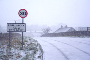
Penruddock

Penruddock is a small village in Cumbria, England, 5.5 miles to the west of Penrith. It forms part of the civil parish of Hutton. == History == The name...

Hutton, Cumbria

Hutton is a small civil parish about 6 miles (9.7 km) west of Penrith in the English county of Cumbria. The parish contains the small mansion and former...

Troutbeck, Hutton

Troutbeck is a hamlet within Cumbria, England, a few miles to the west of Penrith. It was previously in the county of Cumberland. It lies within the Lake...

Nearby Amenities

Located within 500m of 54.634658,-2.9155446
Swinescales
Place: locality
Lat/Long: 54.6359395/-2.9087761
Brownhow Hill
Ele: 305
Natural: peak
Lat/Long: 54.6307078/-2.918144
Stoddah
Place: locality
Lat/Long: 54.6336487/-2.9082015
Power: pole
Lat/Long: 54.6367854/-2.9091903
Power: pole
Lat/Long: 54.6366285/-2.9109448
Power: pole
Lat/Long: 54.636482/-2.9125892
Power: pole
Lat/Long: 54.6363113/-2.9142871
Power: pole
Lat/Long: 54.6361475/-2.9160357
Power: pole
Lat/Long: 54.6359958/-2.9174716
Power: pole
Lat/Long: 54.635882/-2.918675
Power: pole
Lat/Long: 54.6357251/-2.9202538
Power: pole
Lat/Long: 54.6355251/-2.9222884
The data included in this document is from www.openstreetmap.org. The data is made available under ODbL.

Have you been to Beckces?

Leave your review of Beckces below (or comments, questions and feedback).