New Marsh
Coastal Marsh, Saltings in Norfolk South Holland
England
New Marsh

New Marsh in Norfolk is a coastal marsh located along the North Sea in eastern England. It is an important area for wildlife conservation, as it is home to a variety of bird species, including wading birds, ducks, and geese. The marsh is characterized by its muddy tidal flats, salt marshes, and freshwater pools, which provide habitats for a diverse range of plants and animals.
The salt marshes of New Marsh are formed by the deposition of sediment carried by the tides, creating a unique ecosystem that is adapted to the high salinity levels of the water. These marshes are home to a variety of plant species, such as samphire and sea lavender, which thrive in the salty conditions.
In addition to its ecological importance, New Marsh is also a popular destination for birdwatchers and nature enthusiasts, who come to observe the diverse range of bird species that inhabit the area. The marsh is part of the Norfolk Coast Area of Outstanding Natural Beauty, which aims to protect and preserve the natural beauty of the region for future generations to enjoy.
If you have any feedback on the listing, please let us know in the comments section below.
New Marsh Images
Images are sourced within 2km of 52.748961/0.20582997 or Grid Reference TF4819. Thanks to Geograph Open Source API. All images are credited.


New Marsh is located at Grid Ref: TF4819 (Lat: 52.748961, Lng: 0.20582997)
Administrative County: Lincolnshire
District: South Holland
Police Authority: Lincolnshire
What 3 Words
///tidying.hush.stilted. Near Sutton Bridge, Lincolnshire
Nearby Locations
Related Wikis
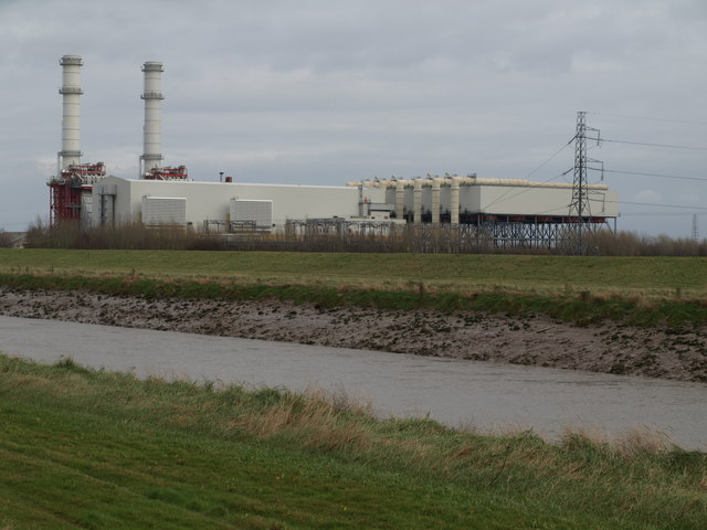
Sutton Bridge Power Station
Sutton Bridge Power Station is an 819 MW gas-fired power station in Sutton Bridge in the south-east of Lincolnshire in South Holland, England. It is situated...

RAF Sutton Bridge
Royal Air Force Sutton Bridge or more simply RAF Sutton Bridge is a former Royal Air Force station found next to the village of Sutton Bridge in the south...

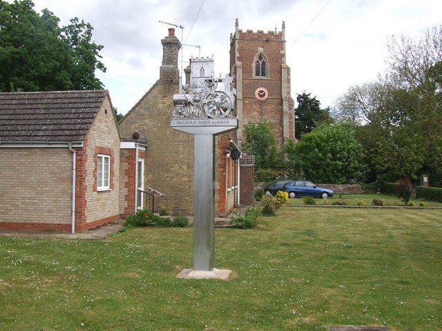
St Andrew's Church, Walpole
St Andrew's Church is a redundant Anglican church in the village of Walpole, Norfolk, England. It is recorded in the National Heritage List for England...

Cross Keys Bridge
Cross Keys Bridge is a swing bridge that carries the busy single carriageway A17 road which runs from Newark in Nottinghamshire to King's Lynn in Norfolk...
Nearby Amenities
Located within 500m of 52.748961,0.20582997Have you been to New Marsh?
Leave your review of New Marsh below (or comments, questions and feedback).