Gedney Marsh

Coastal Marsh, Saltings in Lincolnshire South Holland

England

Gedney Marsh

Slight chicane The footpath looks as if it's headed towards the wooded area, but the sign points left so you walk on the metalled road instead.
Slight chicane Credit: Ian Paterson

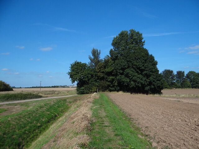
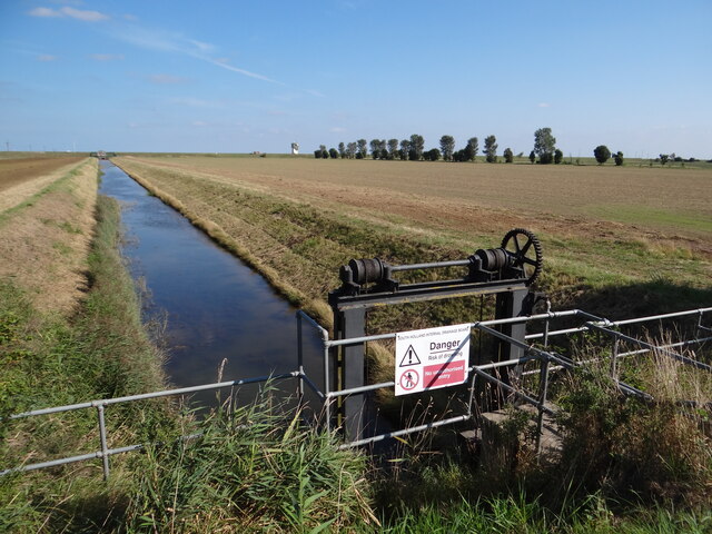
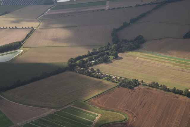
Gedney Marsh is a coastal marsh located in the county of Lincolnshire, England. Situated on the east coast, it forms part of the extensive salt marshes and saltings that characterize this region. The marsh is renowned for its rich biodiversity and unique ecosystem.

Covering an area of approximately 2,000 hectares, Gedney Marsh is predominantly made up of salt-tolerant grasses and plants, such as samphire and sea lavender, which thrive in the brackish water and muddy soil. These plants provide an important habitat for a variety of bird species, including wading birds like curlews, redshanks, and oystercatchers. The marsh is also a haven for migratory birds, attracting species such as pink-footed geese, brent geese, and various ducks.

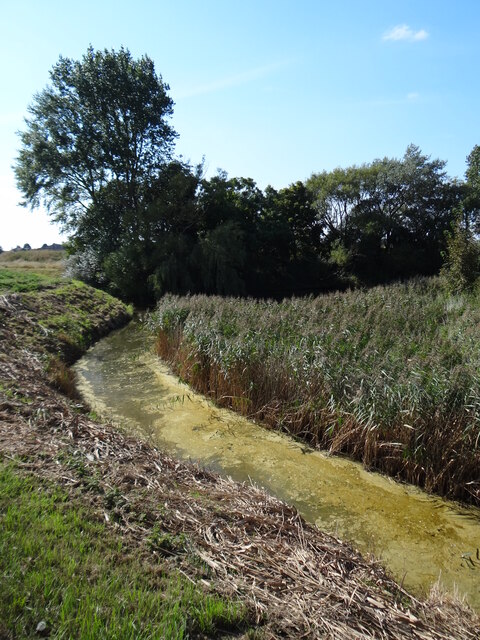
The marshland is crisscrossed by a network of tidal creeks and channels, which are influenced by the ebb and flow of the nearby North Sea. These tidal movements create a dynamic environment, constantly changing the landscape and providing feeding grounds for fish and invertebrates.

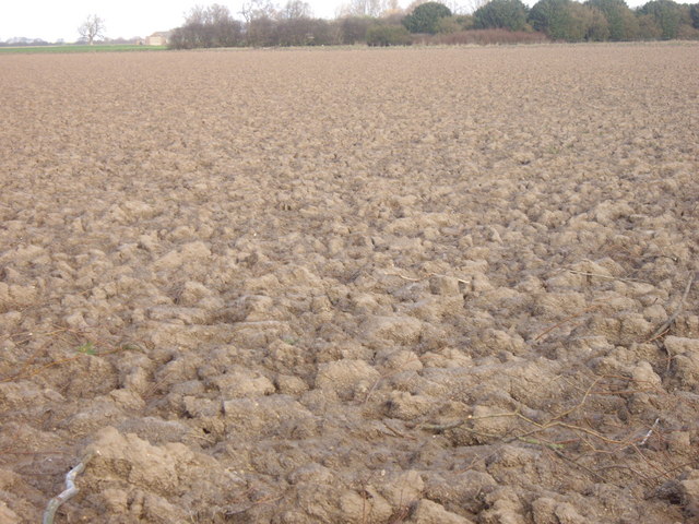
Gedney Marsh is not only ecologically significant but also holds historical value. It has been used for centuries as grazing land for livestock and has played a role in the local agricultural economy. Today, the marsh is managed by conservation organizations and government agencies to ensure its preservation and protection.

Visitors to Gedney Marsh can enjoy its natural beauty by walking along designated footpaths and birdwatching hides. The marsh provides an opportunity for nature enthusiasts to observe its diverse wildlife and appreciate the unique coastal ecosystem that it represents.

If you have any feedback on the listing, please let us know in the comments section below.

Gedney Marsh Images

Images are sourced within 2km of 52.845015/0.14244523 or Grid Reference TF4429. Thanks to Geograph Open Source API. All images are credited.

Slight chicane The footpath looks as if it's headed towards the wooded area, but the sign points left so you walk on the metalled road instead.
Slight chicane
The footpath looks as if it's headed towards the wooded area, but the sign points left so you walk on the metalled road instead.
Pumpkin picking Boxes and boxes of pumpkins for many kids to carve up and throw away all the good stuff inside.  Maybe with the predicted shortage of labour and many crops having to be left to rot in the ground upicked even after attractive wage increases, 2021 might be the year we have to eat pumkpipn pie for Hallowe'en!
Pumpkin picking
Boxes and boxes of pumpkins for many kids to carve up and throw away all the good stuff inside. Maybe with the predicted shortage of labour and many crops having to be left to rot in the ground upicked even after attractive wage increases, 2021 might be the year we have to eat pumkpipn pie for Hallowe'en!
There's orangey! Not jaffas, but a field of plump pumpkins ready to have their flesh torn out and discarded in readiness for Hallowe'en events all around the country, and I don't mean America.   Bring back the neep lantern!
There's orangey!
Not jaffas, but a field of plump pumpkins ready to have their flesh torn out and discarded in readiness for Hallowe'en events all around the country, and I don't mean America. Bring back the neep lantern!
On golden pond The surface of the water at this reservoir has a rather golden hue about it.
On golden pond
The surface of the water at this reservoir has a rather golden hue about it.
South Holland Internal Drainage Board property View along the drain towards one of the lookout towers at RAF Holbeach.
South Holland Internal Drainage Board property
View along the drain towards one of the lookout towers at RAF Holbeach.
Dawsmere and Dawsmere Creek, Gedney Marsh: aerial 2023 (1)
Ploughed Field, Red House Farm The earth in these parts appears fairly heavy.
Ploughed Field, Red House Farm
The earth in these parts appears fairly heavy.
Christ Church, Dawsmere Beautifully maintained graveyard and, inside, an impressive vaulted ceiling.
Christ Church, Dawsmere
Beautifully maintained graveyard and, inside, an impressive vaulted ceiling.
Dawsmere cemetery Like the church graveyard across the road, very well maintained. All the headstones save one conform to a uniform style of black with gold lettering. Bearing in mind its remote location, I was surprised by how well used it is.
Dawsmere cemetery
Like the church graveyard across the road, very well maintained. All the headstones save one conform to a uniform style of black with gold lettering. Bearing in mind its remote location, I was surprised by how well used it is.
Christ Church, Dawsmere
Ploughing off Durham's Road Recently-harvested wheat field being ploughed
Ploughing off Durham's Road
Recently-harvested wheat field being ploughed
Wheat field off Durham's Road With fine weather after weeks of heavy rain, the whole area has become a hive of harvesting activity.
Wheat field off Durham's Road
With fine weather after weeks of heavy rain, the whole area has become a hive of harvesting activity.
Drain near Old Sea Bank, Oldershaws Farm
Pool Near Oldershaws Farm
Dry Drain Near Old Sea Bank
Close to the Sea One of many reminders in the soil here that the sea is not too far away.
Close to the Sea
One of many reminders in the soil here that the sea is not too far away.
Drain Near Oldershaws Farm Oldershaws Farm is in the distance.
Drain Near Oldershaws Farm
Oldershaws Farm is in the distance.
Right Turn at Old Sea Bank Joining Old Sea Bank's public footpath involves a slight rise.
Right Turn at Old Sea Bank
Joining Old Sea Bank's public footpath involves a slight rise.
Show me another place!

Gedney Marsh is located at Grid Ref: TF4429 (Lat: 52.845015, Lng: 0.14244523)

Administrative County: Lincolnshire

District: South Holland

Police Authority: Lincolnshire

What 3 Words

///ignoring.health.shrimps. Near Fleet, Lincolnshire

Nearby Locations

Gedney Gedney Marsh

Related Wikis

Gedney Drove End

Gedney Drove End is a village in the civil parish of Gedney and the South Holland district of Lincolnshire, England. It is 40 miles (64 km) south-east...

Holbeach Air Weapons Range

Holbeach Air Weapons Range is a United Kingdom Ministry of Defence academic air weapons range (AWR) situated between Boston and King's Lynn in the civil...

Lutton, Lincolnshire

Lutton (sometimes Lutton-Bourne) is a village and civil parish in the South Holland district of Lincolnshire, England. The population of the civil parish...

Holbeach St Matthew

Holbeach St Matthew is a small fenland village in the South Holland district of southern Lincolnshire, England. It lies 6 miles (10 km) north-east from...

Nearby Amenities

Located within 500m of 52.845015,0.14244523
Bus Stop
Playing Field
Naptan AtcoCode: 270002700400
Naptan Bearing: W
Naptan CommonName: Playing Field
Naptan Indicator: adj
Naptan Landmark: Playing Field
Naptan Street: Dawsmere Road
Naptan Verified: no
Source: naptan_import
Lat/Long: 52.848916/0.143963
Bus Stop
Playing Field
Naptan AtcoCode: 2700LGDP6186
Naptan Bearing: E
Naptan CommonName: Playing Field
Naptan Indicator: opp
Naptan Landmark: Playing Field
Naptan Street: Dawsmere Road
Naptan Verified: no
Source: naptan_import
Lat/Long: 52.8489759/0.1441293
Post Box
Collection Times: Mo-Fr 15:15; Sa 08:00
Post Box Type: lamp
Ref: PE12 41
Lat/Long: 52.849079/0.144308
The data included in this document is from www.openstreetmap.org. The data is made available under ODbL.

Have you been to Gedney Marsh?

Leave your review of Gedney Marsh below (or comments, questions and feedback).