Cuckold's Haven

Coastal Marsh, Saltings in Essex

England

Cuckold's Haven

Paper Recycling in Creekmouth This is a photo of one of SITA’s paper recycling depots. SITA is the country’s largest waste management company. The group as a whole recycle some 1.4 million tonnes of waste per year. This plant handles some of the 350,000 tonnes of paper and card the company recycles each year. In the background can be seen the Barking Creek flood defence barrier.
Paper Recycling in Creekmouth Credit: Glyn Baker

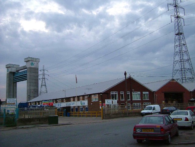
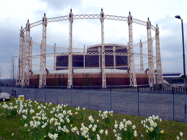
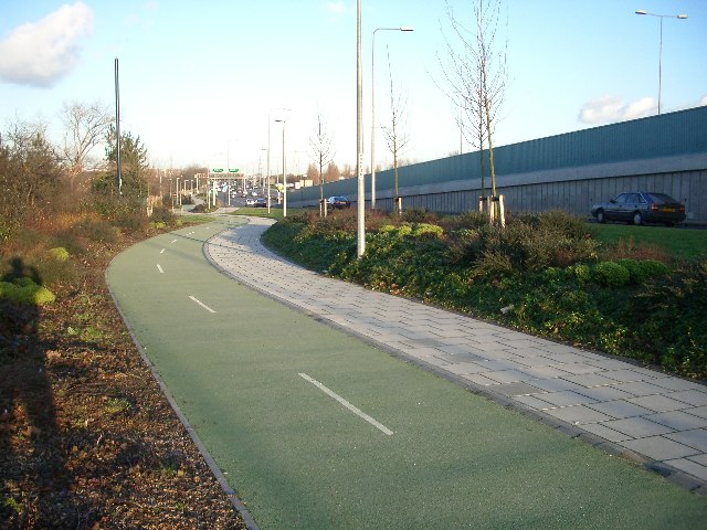
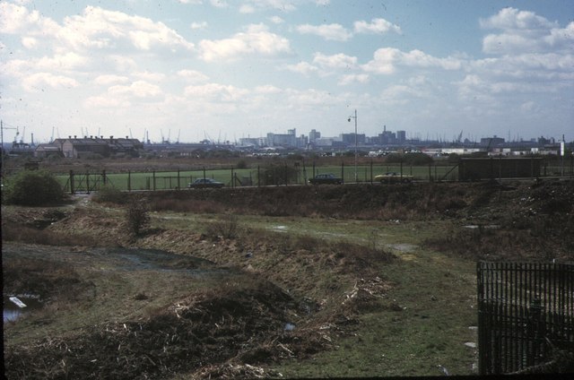
Cuckold's Haven is a picturesque coastal marsh and saltings located in Essex, England. Situated along the North Sea coast, it is a nature reserve known for its unique and diverse ecosystem. Spanning an area of approximately 200 acres, the site is characterized by its expansive salt marshes, mudflats, and reed beds.

The marshes at Cuckold's Haven are an important habitat for a wide range of plant and animal species. The nutrient-rich mudflats provide an ideal feeding ground for migratory birds, such as sandpipers, dunlins, and redshanks. The reed beds are home to various bird species, including marsh harriers, bitterns, and bearded tits, as well as numerous insects and small mammals.

The reserve is managed by the Essex Wildlife Trust, ensuring the preservation and conservation of this unique coastal ecosystem. Visitors can explore the area via a network of well-maintained footpaths and boardwalks, which offer stunning views of the surrounding landscape and allow for birdwatching opportunities.

Cuckold's Haven also offers educational and recreational activities for visitors of all ages. The reserve hosts guided walks, nature talks, and workshops to raise awareness about the importance of coastal habitats and their conservation. It is also a popular spot for photography enthusiasts, who are drawn to the area's natural beauty and diverse wildlife.

Overall, Cuckold's Haven in Essex is a tranquil and scenic coastal marshland, providing a haven for both wildlife and nature lovers alike.

If you have any feedback on the listing, please let us know in the comments section below.

Cuckold's Haven Images

Images are sourced within 2km of 51.52868/0.078592713 or Grid Reference TQ4483. Thanks to Geograph Open Source API. All images are credited.

Paper Recycling in Creekmouth This is a photo of one of SITA’s paper recycling depots. SITA is the country’s largest waste management company. The group as a whole recycle some 1.4 million tonnes of waste per year. This plant handles some of the 350,000 tonnes of paper and card the company recycles each year. In the background can be seen the Barking Creek flood defence barrier.
Paper Recycling in Creekmouth
This is a photo of one of SITA’s paper recycling depots. SITA is the country’s largest waste management company. The group as a whole recycle some 1.4 million tonnes of waste per year. This plant handles some of the 350,000 tonnes of paper and card the company recycles each year. In the background can be seen the Barking Creek flood defence barrier.
Blumsom timber merchants This is a photo of Blumsom timber merchants kiln drying plant. The company declare they only use wood from legal renewable resources and have a written environmental policy.
Blumsom timber merchants
This is a photo of Blumsom timber merchants kiln drying plant. The company declare they only use wood from legal renewable resources and have a written environmental policy.
Eastbury Manor Barking This is a photograph of Eastbury Manor Barking. The kind of building that is far from typical in the area. Built in the mid 17th Century by a wealthy merchant; Clement Sysley on land once owned by Barking Abbey. Over the centuries the building passed through many hands falling into decay in the early part of the 20th century. The manor was saved for the nation by the National Trust in 1918.
Eastbury Manor Barking
This is a photograph of Eastbury Manor Barking. The kind of building that is far from typical in the area. Built in the mid 17th Century by a wealthy merchant; Clement Sysley on land once owned by Barking Abbey. Over the centuries the building passed through many hands falling into decay in the early part of the 20th century. The manor was saved for the nation by the National Trust in 1918.
Turn Off For Barking This is the Barking and Becontree junction on the A13. The flyover marks the point where Alfreds Way becomes Ripple Road. The photograph was taken looking eastbound.
Turn Off For Barking
This is the Barking and Becontree junction on the A13. The flyover marks the point where Alfreds Way becomes Ripple Road. The photograph was taken looking eastbound.
A Pair of Dogs The picture is of Station Parade Longbridge Rd Barking. A dozen or so years ago everyone knew where you meant when you said "I'll meet you in the Barking Dog".
There was only one dog and that was the spotted one in the background with the half timbered gable end. When Wetherspoons opened their new drinking emporium in the retail unit below the office block Tim Martin cheekily named it "The Barking Dog" causing confusion for a while. However the two hounds seem to get on fairly well these days.
A Pair of Dogs
The picture is of Station Parade Longbridge Rd Barking. A dozen or so years ago everyone knew where you meant when you said "I'll meet you in the Barking Dog". There was only one dog and that was the spotted one in the background with the half timbered gable end. When Wetherspoons opened their new drinking emporium in the retail unit below the office block Tim Martin cheekily named it "The Barking Dog" causing confusion for a while. However the two hounds seem to get on fairly well these days.
Gas holders at Beckton Was part of the giant Beckton gasworks - now right beside a bleak modern shopping centre.
Gas holders at Beckton
Was part of the giant Beckton gasworks - now right beside a bleak modern shopping centre.
Beckton. D.L.R. unit approaching Station.
Beckton.
D.L.R. unit approaching Station.
Beckton. The D.L.R. Station.
Beckton.
The D.L.R. Station.
Greenway and Becton Alps The Greenway (see <a href="https://www.geograph.org.uk/gridref/TQ4082">TQ4082</a>) with the Becton Alps on the right. These were constructed from a derelict waste heap to become a short-lived artificial ski slope.
Greenway and Becton Alps
The Greenway (see TQ4082) with the Becton Alps on the right. These were constructed from a derelict waste heap to become a short-lived artificial ski slope.
No litter or graffiti in East Ham Landscaped planting, textured paving on the footpath and coloured asphalt on the cycle track all help humanise the otherwise brutal concrete wilderness of the A13 flyover at East Ham.  And there's no litter or graffiti.
No litter or graffiti in East Ham
Landscaped planting, textured paving on the footpath and coloured asphalt on the cycle track all help humanise the otherwise brutal concrete wilderness of the A13 flyover at East Ham. And there's no litter or graffiti.
Up Barking Creek Footbridge over the River Roding near where it becomes known as Barking Creek.
Up Barking Creek
Footbridge over the River Roding near where it becomes known as Barking Creek.
Beckton Alps, 1973 The north end of the great spoil heaps of Beckton Gas works, looking east from the A13 Newham Way. Part later became an artificial ski slope, but the nickname pre-dates this.
Beckton Alps, 1973
The north end of the great spoil heaps of Beckton Gas works, looking east from the A13 Newham Way. Part later became an artificial ski slope, but the nickname pre-dates this.
Beckton Alps and Gas Works, 1973 Looking south east from A13 Newham Way to the southern part of the great spoil heaps of Beckton Gas Works, once the largest such plant in the world. Part of the works can be seen beyond. See also <a href="https://www.geograph.org.uk/gridref/TQ4382">TQ4382</a>
Beckton Alps and Gas Works, 1973
Looking south east from A13 Newham Way to the southern part of the great spoil heaps of Beckton Gas Works, once the largest such plant in the world. Part of the works can be seen beyond. See also TQ4382
Royal Docks Skyline, 1973 A view from the NW perimeter of Beckton Alps SW past East Ham Manor Way (A117). The cranes of the Royal Docks span the horizon, with the Albert Dock to the left and Victoria to the right. In the centre are the flour mills south of Victoria Dock and beyond is the old chimney at Tate & Lyle.
Royal Docks Skyline, 1973
A view from the NW perimeter of Beckton Alps SW past East Ham Manor Way (A117). The cranes of the Royal Docks span the horizon, with the Albert Dock to the left and Victoria to the right. In the centre are the flour mills south of Victoria Dock and beyond is the old chimney at Tate & Lyle.
Keppel and Kempton Rds East Ham This is the Junction of Keppel and Kempton Roads in East Ham. The terraced houses are typical of the area.
Keppel and Kempton Rds East Ham
This is the Junction of Keppel and Kempton Roads in East Ham. The terraced houses are typical of the area.
River Roding This is the River Roding before it becomes Barking Creek. Effectively the River is the boundary between East Ham & Barking.
River Roding
This is the River Roding before it becomes Barking Creek. Effectively the River is the boundary between East Ham & Barking.
St Marys Estate, Barking This is the St Mary’s Community Housing Project in Barking.
St Marys Estate, Barking
This is the St Mary’s Community Housing Project in Barking.
Gallions Reach Entertainment Centre This is the Gallions Reach entertainment complex, it actually stands on Barking Creek which runs into the Thames at Gallions Reach.
Gallions Reach Entertainment Centre
This is the Gallions Reach entertainment complex, it actually stands on Barking Creek which runs into the Thames at Gallions Reach.
Show me another place!

Cuckold's Haven is located at Grid Ref: TQ4483 (Lat: 51.52868, Lng: 0.078592713)

Unitary Authority: Newham

Police Authority: Metropolitan

What 3 Words

///poster.jars.rice. Near Barking, London

Related Wikis

Battle of Barking Creek

The Battle of Barking Creek was a friendly fire incident over England on 6 September 1939 that caused the first death of a British fighter pilot in the...

East End Women's Museum

East End Women's Museum (EEWM) is a virtual, pop-up museum and the only dedicated women's museum in England. It was established in 2015 as a positive protest...

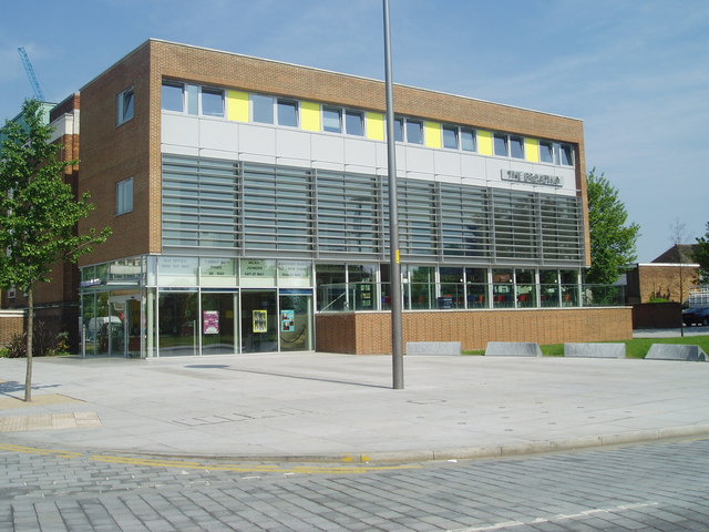
The Broadway (theatre)

The Broadway is a performance venue in Barking town centre. The building was previously a facility known as Barking Assembly Hall, forming part of Barking...

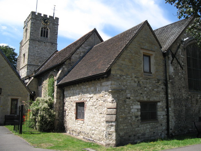
St Margaret's Church, Barking

St Margaret's Church or the Church of St Margaret of Antioch is a Church of England parish church in Barking, East London. The church is a Grade I listed...

Nearby Amenities

Located within 500m of 51.52868,0.078592713
Traffic Signals
Lat/Long: 51.5261296/0.0735449
Crossing
Bicycle: yes
Crossing: unmarked
Crossing Markings: no
Tactile Paving: yes
Lat/Long: 51.5286215/0.0835863
Motorway Junction
Beckton Roundabout
Lat/Long: 51.5268503/0.0780331
Bus Stop
Jenkins Lane
Bench: no
Lit: no
Naptan AtcoCode: 490003754N
Naptan Bearing: N
Naptan CommonName: Beckton Showcase Cinema
Naptan Street: JENKINS LANE
Naptan Verified: no
Public Transport: platform
Ref: 77448
Shelter: no
Tactile Paving: no
Lat/Long: 51.5256376/0.0790494
Bus Stop
Jenkins Lane
Bench: no
Lit: yes
Naptan AtcoCode: 490003754S
Naptan Bearing: N
Naptan CommonName: Beckton Showcase Cinema
Naptan Street: JENKINS LANE
Naptan Verified: no
Public Transport: platform
Ref: 54673
Shelter: no
Tactile Paving: no
Lat/Long: 51.5255636/0.0792293
Bus Stop
Boundary Road
Bench: yes
Bus: yes
Naptan AtcoCode: 490004189S
Naptan Bearing: N
Naptan CommonName: Boundary Road Gascoigne Road
Naptan Street: GASCOIGNE ROAD
Naptan Verified: no
Public Transport: platform
Ref: 74462
Shelter: yes
Lat/Long: 51.5307474/0.081728
Bus Stop
Gascoigne Estate
Bench: yes
Bus: yes
Naptan AtcoCode: 490007132S
Naptan Bearing: N
Naptan CommonName: Barking Gascoigne Estate
Naptan Street: GASCOIGNE ROAD
Naptan Verified: no
Public Transport: platform
Ref: 51973
Shelter: yes
Lat/Long: 51.5296649/0.0827673
Bus Stop
Jenkins Lane
Bus: yes
Naptan AtcoCode: 490008545E2
Naptan Bearing: E
Naptan CommonName: Jenkins LaneNorth Circular Rd
Naptan Indicator: Stop
Naptan Street: NEWHAM WAY
Naptan Verified: no
Public Transport: platform
Lat/Long: 51.5270281/0.0777495
Bus Stop
North Circular Road
Bench: no
Naptan AtcoCode: 490008545W
Naptan Bearing: W
Naptan CommonName: Jenkins LaneNorth Circular Rd
Naptan Indicator: Stop
Naptan Street: NEWHAM WAY
Public Transport: platform
Shelter: no
Lat/Long: 51.5264354/0.0773508
Bus Stop
Gascoigne Primary School
Bench: yes
Bus: yes
Naptan AtcoCode: 490012573S
Naptan Bearing: S
Naptan CommonName: Gascoigne Primary School
Naptan Street: GASCOIGNE ROAD
Naptan Verified: no
Public Transport: platform
Ref: 57803
Shelter: yes
Lat/Long: 51.5327886/0.07987
Give Way
Direction: forward
Lat/Long: 51.5294693/0.0728223
Turning Circle
Lat/Long: 51.5311457/0.0750783
Crossing
Bicycle: yes
Crossing: uncontrolled
Lat/Long: 51.5262277/0.0770813
Generator Method: photovoltaic
Generator Output Electricity: 14 kW
Generator Source: solar
Note: Estimated location, it's on Building 4
Operator: Metropolitan Police Service
Power: generator
Source: London Datastore
Lat/Long: 51.5303492/0.0740596
Traffic Signals
Lat/Long: 51.5253507/0.0746151
Barrier: cycle_barrier
Bicycle: dismount
Cycle Barrier: triple
Foot: yes
Source: survey/image
Lat/Long: 51.5291166/0.07203
Give Way
Direction: forward
Lat/Long: 51.5287825/0.0732164
Noexit: yes
Lat/Long: 51.5266771/0.0818416
Barrier: yes
Lat/Long: 51.5256199/0.0813185
Barrier: yes
Lat/Long: 51.5269708/0.0814765
Barrier: cycle_barrier
Lat/Long: 51.5268717/0.0819474
Access: private
Barrier: lift_gate
Bicycle: yes
Foot: yes
Lat/Long: 51.5302395/0.072764
Noexit: yes
Lat/Long: 51.5264734/0.0792812
Crossing
Crossing: uncontrolled
Crossing Island: no
Crossing Ref: zebra
Lat/Long: 51.5260159/0.0790717
Power: tower
Lat/Long: 51.5283792/0.07428
Power: tower
Lat/Long: 51.5304056/0.0719289
Operator: National Grid
Power: tower
Ref: ZBH-45
Lat/Long: 51.5259436/0.0771219
Power: tower
Lat/Long: 51.5248474/0.0795799
Street Lamp
Lamp Type: SON
Source: Personal memory
Lat/Long: 51.5264577/0.0735084
Traffic Signals
Lat/Long: 51.5253373/0.0744258
Traffic Signals
Lat/Long: 51.5260245/0.0734135
Street Lamp
Lamp Model: Schréder Ampera Maxi
Lamp Type: LED
Source: Personal memory
Lat/Long: 51.5271663/0.0724248
Street Lamp
Lamp Model: Schréder Ampera Maxi
Lamp Type: LED
Source: Personal memory
Lat/Long: 51.5266538/0.0731384
Street Lamp
Lamp Model: Schréder Ampera Maxi
Lamp Type: LED
Source: Personal memory
Lat/Long: 51.5271978/0.0729295
Street Lamp
Lamp Model: Schréder Ampera Maxi
Lamp Type: LED
Source: Personal memory
Lat/Long: 51.5266315/0.0725325
Street Lamp
Lamp Model: Schréder Ampera Maxi
Lamp Type: LED
Source: Personal memory
Lat/Long: 51.5276983/0.0727173
Street Lamp
Lamp Model: Schréder Ampera Maxi
Lamp Type: LED
Source: Personal memory
Lat/Long: 51.5276953/0.0723796
Street Lamp
Lamp Model: Schréder Ampera Maxi
Lamp Type: LED
Source: Personal memory
Lat/Long: 51.5282125/0.072567
Tactile Paving: yes
Lat/Long: 51.5289188/0.0729258
Street Lamp
Lamp Model: Schréder Ampera Maxi
Lamp Type: LED
Source: Personal memory
Lat/Long: 51.5297071/0.0724409
Street Lamp
Lamp Model: Schréder Ampera Maxi
Lamp Type: LED
Source: Personal memory
Lat/Long: 51.5293986/0.0724333
Street Lamp
Lamp Model: Schréder Ampera Maxi
Lamp Type: LED
Source: Personal memory
Lat/Long: 51.5302349/0.0724199
Street Lamp
Lamp Model: Schréder Ampera Maxi
Lamp Type: LED
Source: Personal memory
Lat/Long: 51.5290649/0.0724382
Street Lamp
Lamp Model: Schréder Ampera Maxi
Lamp Type: LED
Source: Personal memory
Lat/Long: 51.530822/0.0723365
Street Lamp
Lamp Model: Schréder Ampera Maxi
Lamp Type: LED
Source: Personal memory
Lat/Long: 51.5305163/0.0723846
Check Date: 2017-10-30
Ref GB Tflcid: RWG181578
Surface: sett
Traffic Calming: bump
Lat/Long: 51.5262556/0.079289
Crossing
Crossing: uncontrolled
Crossing Ref: zebra
Lat/Long: 51.5329672/0.0796214
Give Way
Direction: backward
Lat/Long: 51.5294701/0.0829151
Noexit: yes
Lat/Long: 51.5298285/0.0826573
Noexit: yes
Lat/Long: 51.5300432/0.0825784
Noexit: yes
Lat/Long: 51.530123/0.082787
Give Way
Lat/Long: 51.5306572/0.0779414
Give Way
Lat/Long: 51.5308384/0.0836224
Crossing
Crossing: unmarked
Crossing Markings: no
Tactile Paving: yes
Traffic Calming: choker
Lat/Long: 51.5311557/0.0812971
Crossing
Bicycle: yes
Crossing: traffic_signals
Crossing Island: no
Crossing Ref: toucan
Lat/Long: 51.5314925/0.0809887
Give Way
Direction: forward
Lat/Long: 51.5315029/0.080819
Give Way
Direction: backward
Lat/Long: 51.5315441/0.0810761
Give Way
Lat/Long: 51.5317414/0.083083
Traffic Calming: chicane
Lat/Long: 51.5317979/0.0807025
Give Way
Direction: forward
Lat/Long: 51.5318759/0.082282
Boundary Road
Bus: yes
Public Transport: stop_position
Ref: 74462
Lat/Long: 51.5307476/0.0816753
Gascoigne Estate
Bus: yes
Public Transport: stop_position
Ref: 51973
Lat/Long: 51.5296319/0.0826991
Gascoigne Primary School
Bus: yes
Public Transport: stop_position
Ref: 57803
Lat/Long: 51.5327678/0.0797997
Give Way
Direction: forward
Lat/Long: 51.52856/0.0837339
Give Way
Direction: forward
Lat/Long: 51.5294624/0.0827713
Give Way
Direction: forward
Lat/Long: 51.5309702/0.0813925
Give Way
Direction: forward
Lat/Long: 51.5321622/0.0802819
Crossing
Crossing: unmarked
Crossing Island: yes
Crossing Markings: no
Lat/Long: 51.5323247/0.0802083
Give Way
Direction: backward
Lat/Long: 51.5331212/0.0795631
Bus Stop
Quay Road
Bench: no
Lit: yes
Naptan AtcoCode: 490003305S
Naptan NaptanCode: 91558
Public Transport: platform
Ref: 91558
Shelter: no
Tactile Paving: no
Lat/Long: 51.5303531/0.072833
Bus Stop
Quay Road
Bench: yes
Lit: yes
Naptan AtcoCode: 490003305N
Naptan NaptanCode: 91557
Public Transport: platform
Ref: 91557
Shelter: yes
Tactile Paving: no
Lat/Long: 51.5305994/0.0726274
Crossing
Crossing: unmarked
Crossing Markings: no
Lat/Long: 51.5312103/0.0772788
Ref GB Tflcid: RWG170435
Traffic Calming: hump
Lat/Long: 51.5303222/0.0770542
Ref GB Tflcid: RWG170444
Traffic Calming: hump
Lat/Long: 51.5298174/0.0809472
Ref GB Tflcid: RWG170446
Traffic Calming: hump
Lat/Long: 51.5297222/0.0808304
Benita Yoga
Leisure: sports_centre
Lat/Long: 51.5318448/0.0756903
Euro Car Parts
Shop: car_parts
Lat/Long: 51.5305916/0.0734933
Roding Riverside
Place: neighbourhood
Lat/Long: 51.5322759/0.0755699
Addr City: Barking
Addr Housename: Site of 1-2 Riverside Cottages
Addr Postcode: IG11 0AY
Addr Street: Alfred's Way
Communication Mobile Phone: yes
Man Made: mast
Operator: Vodafone
Operator Wikidata: Q122141
Tower Type: communication
Lat/Long: 51.5283621/0.0850862
Bench
Lat/Long: 51.5283128/0.0780868
Bench
Lat/Long: 51.5292982/0.0759487
Bench
Lat/Long: 51.5292629/0.0761387
Bench
Lat/Long: 51.5292886/0.0759259
Bench
Lat/Long: 51.5292695/0.0761849
Bench
Lat/Long: 51.5291046/0.0744691
Barking & Dagenham Canoe Club
Leisure: sports_centre
Lat/Long: 51.5306169/0.0761943
Tactile Paving: yes
Lat/Long: 51.5261726/0.0770673
Street Lamp
Lamp Model: Schréder Ampera Maxi
Lamp Type: LED
Source: Personal memory
Lat/Long: 51.5282171/0.0723952
Street Lamp
Lamp Model: Schréder Ampera Maxi
Lamp Type: LED
Source: Personal memory
Lat/Long: 51.5279733/0.0721943
Street Lamp
Lamp Model: Schréder Ampera Maxi
Lamp Type: LED
Source: Personal memory
Lat/Long: 51.5287313/0.0724199
Street Lamp
Lamp Model: Schréder Ampera Maxi
Lamp Type: LED
Source: Personal memory
Lat/Long: 51.5280049/0.0728058
Street Lamp
Lamp Model: Schréder Ampera Maxi
Lamp Type: LED
Source: Personal memory
Lat/Long: 51.5274643/0.0730151
Street Lamp
Lamp Model: Schréder Ampera Maxi
Lamp Type: LED
Source: Personal memory
Lat/Long: 51.5284905/0.0726932
Street Lamp
Lamp Model: Schréder Ampera Maxi
Lamp Type: LED
Source: Personal memory
Lat/Long: 51.5284822/0.0722184
Street Lamp
Lamp Model: Schréder Ampera Maxi
Lamp Type: LED
Source: Personal memory
Lat/Long: 51.5287294/0.0724754
Street Lamp
Lamp Model: Schréder Ampera Maxi
Lamp Type: LED
Source: Personal memory
Lat/Long: 51.5274158/0.0722023
Street Lamp
Lamp Model: Schréder Ampera Maxi
Lamp Type: LED
Source: Personal memory
Lat/Long: 51.5269085/0.072264
Street Lamp
Lamp Model: Schréder Ampera Maxi
Lamp Type: LED
Source: Personal memory
Lat/Long: 51.5262664/0.0733616
Street Lamp
Lamp Model: Schréder Ampera Maxi
Lamp Type: LED
Source: Personal memory
Lat/Long: 51.5269391/0.0732378
Street Lamp
Lamp Model: Schréder Ampera Maxi
Lamp Type: LED
Source: Personal memory
Lat/Long: 51.5260742/0.0737956
Street Lamp
Lamp Model: Schréder Ampera Maxi
Lamp Type: LED
Source: Personal memory
Lat/Long: 51.5262178/0.0736051
Street Lamp
Lamp Model: CU Phosco P850
Lamp Type: LED
Source: Personal memory
Lat/Long: 51.5260846/0.0729268
Street Lamp
Lamp Model: Schréder Ampera Maxi
Lamp Type: LED
Source: Personal memory
Lat/Long: 51.5261013/0.0734311
Street Lamp
Lamp Model: Schréder Ampera Maxi
Lamp Type: LED
Source: Personal memory
Lat/Long: 51.5258606/0.074069
Street Lamp
Lamp Model: Schréder Ampera Maxi
Lamp Type: LED
Source: Personal memory
Lat/Long: 51.52514/0.074713
Street Lamp
Lamp Model: Schréder Ampera Maxi
Lamp Type: LED
Source: Personal memory
Lat/Long: 51.5253887/0.0745199
Street Lamp
Lamp Model: Schréder Ampera Maxi
Lamp Type: LED
Source: Personal memory
Lat/Long: 51.5248697/0.0747533
Street Lamp
Lamp Model: Schréder Ampera Maxi
Lamp Type: LED
Source: Personal memory
Lat/Long: 51.5255236/0.0743909
Street Lamp
Lamp Model: Schréder Ampera Maxi
Lamp Type: LED
Source: Personal memory
Lat/Long: 51.530885/0.0725376
Crossing
Bicycle: yes
Crossing: uncontrolled
Crossing Island: no
Traffic Calming: table
Lat/Long: 51.5278456/0.0766768
Crossing
Crossing: unmarked
Lat/Long: 51.5278937/0.0765557
Crossing
Crossing: unmarked
Lat/Long: 51.528016/0.0765684
Crossing
Crossing: uncontrolled
Crossing Island: no
Crossing Markings: zebra
Not Crossing Ref: zebra
Lat/Long: 51.5269464/0.0758961
Crossing
Crossing: unmarked
Crossing Island: separate
Crossing Markings: no
Tactile Paving: yes
Lat/Long: 51.5268632/0.0769552
Crossing
Crossing: unmarked
Crossing Island: separate
Crossing Markings: no
Tactile Paving: yes
Lat/Long: 51.5268235/0.0767877
Barrier: kerb
Kerb: lowered
Tactile Paving: yes
Lat/Long: 51.52684/0.076933
Crossing
Crossing: unmarked
Lat/Long: 51.5272082/0.0763051
Tactile Paving: yes
Lat/Long: 51.5279861/0.076547
Crossing
Bicycle: yes
Crossing: unmarked
Crossing Island: no
Crossing Markings: no
Lat/Long: 51.5288861/0.0849723
Barrier: kissing_gate
Lat/Long: 51.5251321/0.079318
Nisa Local
Brand: Nisa Local
Brand Wikidata: Q16999069
Contact Website: https://www.nisalocally.co.uk/stores/greater-london/barking/unit-1-jute-court
Opening Hours: Mo-Su 07:00-23:00
Shop: convenience
Lat/Long: 51.5316336/0.0765527
Restaurant
The Boathouse Café and Bar
Lat/Long: 51.5315686/0.0758184
Crossing
Bicycle: yes
Crossing: unmarked
Crossing Markings: no
Kerb: lowered
Segregated: no
Tactile Paving: no
Lat/Long: 51.5282701/0.083982
Traffic Signals
Traffic Signals Direction: forward
Lat/Long: 51.5315324/0.0809484
Traffic Signals
Traffic Signals Direction: backward
Lat/Long: 51.5314528/0.0810235
Barrier: bollard
Lat/Long: 51.5319585/0.0825192
Barrier: bollard
Foot: yes
Lat/Long: 51.5318974/0.0824405
Barrier: cycle_barrier
Bicycle: dismount
Foot: yes
Lat/Long: 51.5266252/0.0818648
Seamark Type: gate
Waterway: lock_gate
Lat/Long: 51.5304206/0.0758449
Bicycle Parking
Bicycle Parking: upright_stands
Capacity: 6
Lat/Long: 51.5319667/0.0830827
Bicycle Parking
Bicycle Parking: stands
Capacity: 10
Lat/Long: 51.530562/0.0802541
Bicycle Parking
Bicycle Parking: upright_stands
Capacity: 3
Lat/Long: 51.531549/0.081375
Bicycle Parking
Bicycle Parking: stands
Capacity: 6
Lat/Long: 51.531913/0.0758784
Bicycle Parking
Bicycle Parking: stands
Capacity: 6
Lat/Long: 51.5322676/0.0793377
Bicycle Parking
Bicycle Parking: stands
Capacity: 8
Lat/Long: 51.5316357/0.0764592
Give Way
Direction: backward
Lat/Long: 51.5274882/0.0777642
Crossing
Bicycle: yes
Crossing: uncontrolled
Crossing Island: no
Lat/Long: 51.5275237/0.0777907
Crossing
Crossing: unmarked
Lat/Long: 51.5275558/0.0776797
Crossing
Crossing: marked
Lat/Long: 51.5272115/0.0770738
Crossing
Crossing: marked
Lat/Long: 51.5275091/0.0774026
Charging Station
Lat/Long: 51.5272222/0.0772127
Noexit: yes
Lat/Long: 51.5269915/0.0765169
Give Way
Direction: backward
Lat/Long: 51.5289682/0.0729254
Seamark Type: mooring
Lat/Long: 51.5322339/0.075077
Seamark Type: mooring
Lat/Long: 51.532445/0.0748745
Seamark Type: mooring
Lat/Long: 51.5315903/0.0752661
Seamark Type: mooring
Lat/Long: 51.5311389/0.0753599
Seamark Type: mooring
Lat/Long: 51.5309011/0.0753812
Seamark Type: mooring
Lat/Long: 51.5306986/0.0754148
Seamark Type: mooring
Lat/Long: 51.5308406/0.0759386
Leisure: marina
Seamark Harbour Category: marina
Seamark Type: harbour
Lat/Long: 51.5309738/0.0754891
Traffic Calming: choker
Lat/Long: 51.5318639/0.0806065
Check Date: 2017-10-30
Ref GB Tflcid: RWG181579
Surface: sett
Traffic Calming: bump
Lat/Long: 51.5264895/0.0793005
Tactile Paving: yes
Lat/Long: 51.5264846/0.0775539
Tactile Paving: yes
Lat/Long: 51.5279139/0.0765714
Tactile Paving: yes
Lat/Long: 51.5278771/0.0765423
Give Way
Direction: forward
Lat/Long: 51.5287687/0.0727869
Barrier: bollard
Foot: yes
Lat/Long: 51.530384/0.0765958
Crossing
Bicycle: yes
Crossing: unmarked
Crossing Island: no
Crossing Markings: no
Lat/Long: 51.5287451/0.0843929
Ref GB Tflcid: RWG170445
Traffic Calming: hump
Lat/Long: 51.5293702/0.0797004
Madison Brook
Office: estate_agent
Lat/Long: 51.5311154/0.0770132
Bicycle Parking
Capacity: 6
Source: mapillary
Lat/Long: 51.5300012/0.0783241
Crossing
Lat/Long: 51.5324881/0.0801577
Crossing
Crossing: unmarked
Crossing Island: yes
Crossing Markings: no
Tactile Paving: yes
Lat/Long: 51.5320215/0.0804978
Traffic Calming: choker
Lat/Long: 51.5317425/0.0807851
Traffic Calming: island
Lat/Long: 51.5315922/0.080895
Give Way
Direction: forward
Lat/Long: 51.5319574/0.0805521
Give Way
Direction: forward
Lat/Long: 51.5312328/0.0812261
Crossing
Crossing: unmarked
Crossing Markings: no
Lat/Long: 51.5309532/0.0815718
Crossing
Crossing: unmarked
Crossing Markings: no
Lat/Long: 51.529476/0.0829371
Crossing
Crossing: unmarked
Crossing Markings: no
Lat/Long: 51.5288381/0.0835133
Crossing
Crossing: unmarked
Crossing Markings: no
Lat/Long: 51.5294564/0.0827466
Crossing
Crossing: unmarked
Crossing Markings: no
Lat/Long: 51.53037/0.081923
Crossing
Crossing: unmarked
Crossing Markings: no
Lat/Long: 51.5309618/0.0813637
Crossing
Crossing: unmarked
Crossing Markings: no
Lat/Long: 51.5321514/0.0802435
Crossing
Crossing: unmarked
Crossing Markings: no
Lat/Long: 51.5325003/0.079944
Barrier: kerb
Kerb: lowered
Lat/Long: 51.5264848/0.0788302
Noexit: yes
Lat/Long: 51.5264546/0.0792371
Give Way
Direction: backward
Lat/Long: 51.5278225/0.0766474
Give Way
Direction: forward
Lat/Long: 51.5278789/0.0767155
Give Way
Direction: backward
Lat/Long: 51.5279163/0.0767549
Give Way
Direction: backward
Lat/Long: 51.5272607/0.0764625
Give Way
Direction: forward
Lat/Long: 51.5268268/0.0771932
Bus: yes
Public Transport: stop_position
Lat/Long: 51.5270032/0.0777674
Give Way
Direction: forward
Lat/Long: 51.5275558/0.0778186
Give Way
Direction: backward
Lat/Long: 51.527582/0.0778364
Barrier: kerb
Kerb: lowered
Lat/Long: 51.5269383/0.0787495
Barrier: bollard
Foot: yes
Lat/Long: 51.52776/0.0776158
Crossing
Crossing: unmarked
Lat/Long: 51.5276925/0.0775543
Crossing
Crossing: unmarked
Crossing Island: no
Lat/Long: 51.527567/0.0778262
Tactile Paving: yes
Lat/Long: 51.5275353/0.0779535
Crossing
Crossing: unmarked
Lat/Long: 51.5275559/0.0780852
Crossing
Crossing: unmarked
Lat/Long: 51.5287933/0.0734751
Crossing
Crossing: unmarked
Lat/Long: 51.5276973/0.077729
Traffic Calming: island
Lat/Long: 51.526502/0.0789026
Information: map
Map Size: local
Map Type: street
Note: estate map
Operator: London Borough of Barking & Dagenham
Tourism: information
Lat/Long: 51.5314587/0.0808701
Traffic Calming: island
Lat/Long: 51.5313511/0.0811171
Barrier: kerb
Kerb: lowered
Lat/Long: 51.5286962/0.073607
Waterway: weir
Lat/Long: 51.5302623/0.075632
Noexit: yes
Lat/Long: 51.528256/0.078267
Speed Camera
Direction: 240
Lat/Long: 51.5263876/0.0758444
Speed Camera
Direction: 55
Lat/Long: 51.5260951/0.0761814
Street Lamp
Lat/Long: 51.5261348/0.0758909
Street Lamp
Lat/Long: 51.525968/0.0758749
Street Lamp
Lat/Long: 51.5263073/0.0759824
Street Lamp
Lat/Long: 51.5259705/0.0754344
Street Lamp
Lat/Long: 51.5260778/0.0751916
Street Lamp
Lat/Long: 51.5263032/0.0763685
Street Lamp
Lat/Long: 51.5261389/0.076553
Street Lamp
Lat/Long: 51.526273/0.0755269
Colour: red and white
Marker: aerial
Material: plastic
Utility: gas
Lat/Long: 51.5264003/0.0757177
Colour: yellow
Marker: post
Material: concrete
Utility: gas
Lat/Long: 51.5264037/0.0756959
Colour: yellow
Marker: post
Material: concrete
Utility: gas
Lat/Long: 51.5264134/0.0757288
Colour: yellow
Marker: post
Material: plastic
Utility: gas
Lat/Long: 51.5263985/0.0757196
Colour: yellow
Marker: post
Material: concrete
Utility: gas
Lat/Long: 51.5258686/0.0760849
Colour: yellow
Marker: post
Material: concrete
Utility: gas
Lat/Long: 51.5258882/0.0761356
Direction: 60
Traffic Sign: yes
Lat/Long: 51.5259082/0.076191
Crossing
Bicycle: yes
Crossing: uncontrolled
Crossing Island: no
Traffic Calming: table
Lat/Long: 51.5288022/0.0728045
Give Way
Direction: backward
Lat/Long: 51.5288318/0.0728266
Give Way
Direction: forward
Lat/Long: 51.5289025/0.0729439
Bus: yes
Public Transport: stop_position
Lat/Long: 51.5264996/0.0772801
Direction: forward
Foot: no
Traffic Sign: GB:625.1
Lat/Long: 51.5261653/0.0765111
Bicycle: no
Direction: forward
Traffic Sign: GB:951
Lat/Long: 51.5261632/0.0765063
Direction: forward
Foot: no
Traffic Sign: GB:625.1
Lat/Long: 51.5260985/0.0765721
Bicycle: no
Direction: forward
Traffic Sign: GB:951
Lat/Long: 51.526097/0.0765674
Barrier: kerb
Kerb: lowered
Tactile Paving: yes
Lat/Long: 51.5268852/0.0769759
Barrier: kerb
Kerb: lowered
Tactile Paving: yes
Lat/Long: 51.5268209/0.0768311
Barrier: kerb
Kerb: lowered
Tactile Paving: yes
Lat/Long: 51.5268267/0.0767493
Crossing
Crossing: unmarked
Crossing Island: no
Lat/Long: 51.5289382/0.0729641
Tactile Paving: yes
Lat/Long: 51.5289561/0.073001
Tactile Paving: yes
Lat/Long: 51.526011/0.0790142
Tactile Paving: yes
Lat/Long: 51.5260203/0.0791238
Give Way
Direction: backward
Lat/Long: 51.5314964/0.0738112
Tactile Paving: yes
Lat/Long: 51.5275975/0.0777129
Barrier: block
Lat/Long: 51.5293462/0.0728039
Give Way
Direction: forward
Lat/Long: 51.5283517/0.0837553
Barrier: bollard
Foot: yes
Lat/Long: 51.5312114/0.0772596
Barrier: bollard
Foot: yes
Lat/Long: 51.5312341/0.0774481
Traffic Calming: table
Lat/Long: 51.5289336/0.0714627
Traffic Calming: table
Lat/Long: 51.5289624/0.0714639
Man Made: manhole
Manhole: drain
Lat/Long: 51.5289769/0.0713875
Man Made: manhole
Manhole: drain
Lat/Long: 51.5289798/0.071539
Man Made: manhole
Manhole: drain
Lat/Long: 51.5289829/0.0717592
Man Made: manhole
Manhole: drain
Lat/Long: 51.5289915/0.0720058
Man Made: manhole
Manhole: drain
Lat/Long: 51.5290528/0.0720567
Bicycle Parking
Lat/Long: 51.5323634/0.0760409
The data included in this document is from www.openstreetmap.org. The data is made available under ODbL.

Have you been to Cuckold's Haven?

Leave your review of Cuckold's Haven below (or comments, questions and feedback).