Foulholme Sands

Coastal Marsh, Saltings in Yorkshire

England

Foulholme Sands

At Ground Level - a Vision of 20-20 Taken standing on the ground in TA2020... at last!  Foot access to this square is very difficult as it requires traversing difficult terrain including a 1.5m wide deep and very muddy creek. I scrutinised my detailed drone aerial photos from a couple of months ago to find the narrowest point of this 3Km+ long channel to make the necessary leap across it to reach TA2020.  My previous photos of this square were taken from a drone at the same spot and only 3m above the ground, but they failed to get full Geograph status.  At this time, I took a photo of my GPS to prove that we were actually standing on the ground and in the square at last!

TA2020 is the last square in Hectad TA22 to have a qualifying photo of it.  I hope this one and the several others I'm submitting will suffice!

The industrial complex across the River Humber at Immingham can be seen on the horizon.
At Ground Level - a Vision of 20-20 Credit: Andy Beecroft

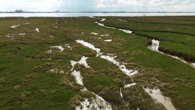
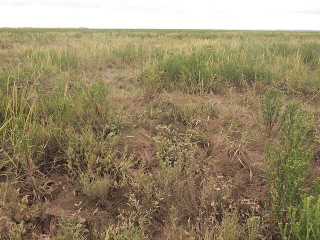
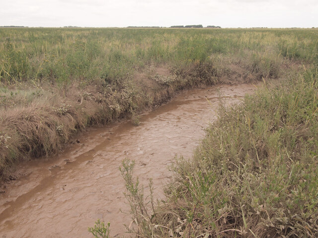
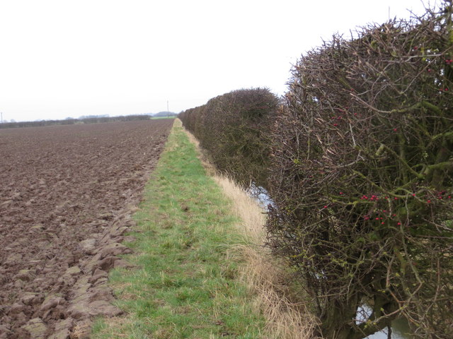
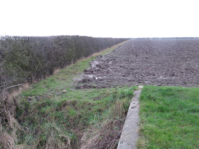
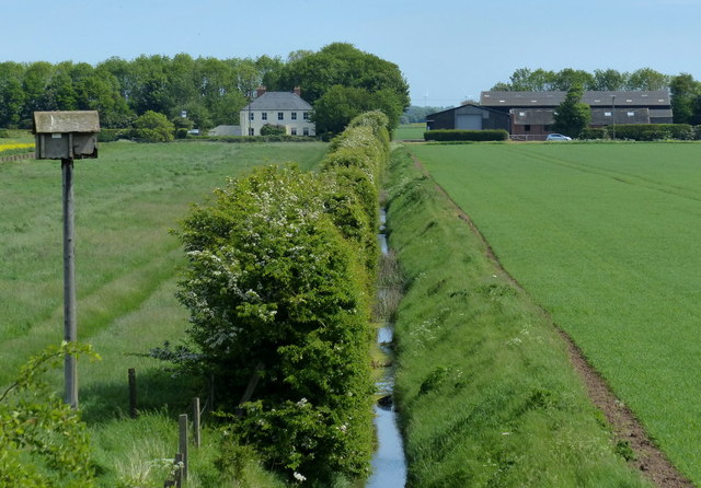
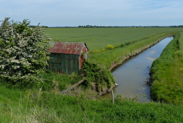
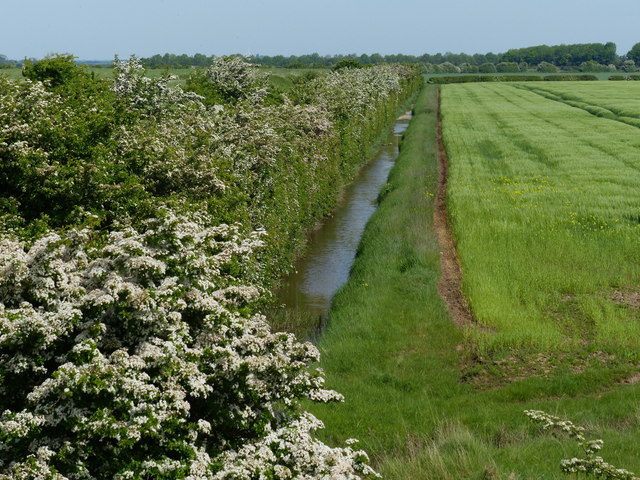
Foulholme Sands is a coastal marsh located in the county of Yorkshire, England. This area is known for its picturesque views and diverse wildlife, making it a popular destination for nature lovers and bird watchers. The marsh is characterized by its vast expanse of sandy beaches, mudflats, and salt marshes, known as saltings.

The marsh is home to a variety of plant and animal species, including salt-tolerant grasses, wading birds, and marine invertebrates. The area provides an important habitat for these species, serving as a breeding ground and feeding area for many migratory birds.

Visitors to Foulholme Sands can enjoy leisurely walks along the sandy shores, observing the wildlife and taking in the stunning coastal scenery. The marsh is also a designated Site of Special Scientific Interest (SSSI), recognizing its importance for conservation and protection of the natural environment.

Overall, Foulholme Sands offers a peaceful retreat where visitors can immerse themselves in nature and experience the beauty of Yorkshire's coastal landscape.

If you have any feedback on the listing, please let us know in the comments section below.

Foulholme Sands Images

Images are sourced within 2km of 53.678144/-0.18869972 or Grid Reference TA1921. Thanks to Geograph Open Source API. All images are credited.

At Ground Level - a Vision of 20-20 Taken standing on the ground in TA2020... at last!  Foot access to this square is very difficult as it requires traversing difficult terrain including a 1.5m wide deep and very muddy creek. I scrutinised my detailed drone aerial photos from a couple of months ago to find the narrowest point of this 3Km+ long channel to make the necessary leap across it to reach TA2020.  My previous photos of this square were taken from a drone at the same spot and only 3m above the ground, but they failed to get full Geograph status.  At this time, I took a photo of my GPS to prove that we were actually standing on the ground and in the square at last!

TA2020 is the last square in Hectad TA22 to have a qualifying photo of it.  I hope this one and the several others I'm submitting will suffice!

The industrial complex across the River Humber at Immingham can be seen on the horizon.
At Ground Level - a Vision of 20-20
Taken standing on the ground in TA2020... at last! Foot access to this square is very difficult as it requires traversing difficult terrain including a 1.5m wide deep and very muddy creek. I scrutinised my detailed drone aerial photos from a couple of months ago to find the narrowest point of this 3Km+ long channel to make the necessary leap across it to reach TA2020. My previous photos of this square were taken from a drone at the same spot and only 3m above the ground, but they failed to get full Geograph status. At this time, I took a photo of my GPS to prove that we were actually standing on the ground and in the square at last! TA2020 is the last square in Hectad TA22 to have a qualifying photo of it. I hope this one and the several others I'm submitting will suffice! The industrial complex across the River Humber at Immingham can be seen on the horizon.
Reeds Clump This circular clump of reeds is situated in the marshland of TA2121.  I don't know why, but there are no similar clumps within the locality - why these should grow here, I don't know! I passed the clump on my way to try and 'bag' TA2020.  I had studied, over a number of weeks, the Google aerial photo of this area and had decided on a suitable route.  Two thirds of the way from the river embankment to TA 2098 2098 (where I wanted to be), there was a perpendicular creek in the way.  From the aerial photo it looked to be about a metre wide and therefore 'jumpable'.  It wasn't until I got there, did I find that the creek was about a metre below the surrounding land and had very deep and very sloppy mud banks; no way could this be crossed just on foot!  Therefore, if there are any budding 'square baggers' wanting to go for TA2020, you'll either need an aluminium ladder to cross the creek, use a drone or take a photo of the marshland from the river within that square!!

What's the prize for taking a photo within TA2020?..... it's the last square needed in the TA22 hectad to complete it!
Reeds Clump
This circular clump of reeds is situated in the marshland of TA2121. I don't know why, but there are no similar clumps within the locality - why these should grow here, I don't know! I passed the clump on my way to try and 'bag' TA2020. I had studied, over a number of weeks, the Google aerial photo of this area and had decided on a suitable route. Two thirds of the way from the river embankment to TA 2098 2098 (where I wanted to be), there was a perpendicular creek in the way. From the aerial photo it looked to be about a metre wide and therefore 'jumpable'. It wasn't until I got there, did I find that the creek was about a metre below the surrounding land and had very deep and very sloppy mud banks; no way could this be crossed just on foot! Therefore, if there are any budding 'square baggers' wanting to go for TA2020, you'll either need an aluminium ladder to cross the creek, use a drone or take a photo of the marshland from the river within that square!! What's the prize for taking a photo within TA2020?..... it's the last square needed in the TA22 hectad to complete it!
Humber  Saltmarsh I've finally bagged this square!  I've attempted on several occasions to get here on foot, but a 3m wide creek to the north east of here, to the access this point, is impossible to cross by foot due its custard-like properties!  This photo was accessed by a drone fitted with a GPS from the high water embankment several hundred metres away.  Hopefully, this now completes the TA22 hectad.
Humber Saltmarsh
I've finally bagged this square! I've attempted on several occasions to get here on foot, but a 3m wide creek to the north east of here, to the access this point, is impossible to cross by foot due its custard-like properties! This photo was accessed by a drone fitted with a GPS from the high water embankment several hundred metres away. Hopefully, this now completes the TA22 hectad.
Humber Marshland I've finally bagged this square!  I've attempted on several occasions to get here on foot, but a 3m wide creek to the north east of here, to the access this point, is impossible to cross by foot due its custard-like properties!  This photo was accessed by a drone fitted with a GPS from the high water embankment several hundred metres away.  Hopefully, this now completes the TA22 hectad.
Humber Marshland
I've finally bagged this square! I've attempted on several occasions to get here on foot, but a 3m wide creek to the north east of here, to the access this point, is impossible to cross by foot due its custard-like properties! This photo was accessed by a drone fitted with a GPS from the high water embankment several hundred metres away. Hopefully, this now completes the TA22 hectad.
20-20 Creek to the Humber A photo taken from the ground of this marshland which is riddled with creeks - most of which can't be seen at ground level; look at my aerial photos of this square to see how complex the channels are in this area!
20-20 Creek to the Humber
A photo taken from the ground of this marshland which is riddled with creeks - most of which can't be seen at ground level; look at my aerial photos of this square to see how complex the channels are in this area!
At the Head of a (TA) 20-20 Creek This is the start of a creek on the marshland that leads into the River Humber. It is fed from many small creeks (less than 15cm diameter) that are generally hidden in the undergrowth.  This bog land will only be covered in River Humber water at very high tides.
At the Head of a (TA) 20-20 Creek
This is the start of a creek on the marshland that leads into the River Humber. It is fed from many small creeks (less than 15cm diameter) that are generally hidden in the undergrowth. This bog land will only be covered in River Humber water at very high tides.
Across the Marshland to the West Taken at ground level, the marshland superficially looks to be uniform into the distance.  Just twenty metres or so away from the camera position there's a substantial creek - one of several before the land reaches the River Humber.
Across the Marshland to the West
Taken at ground level, the marshland superficially looks to be uniform into the distance. Just twenty metres or so away from the camera position there's a substantial creek - one of several before the land reaches the River Humber.
TA Twenty Twenty and Beyond Looking southwards from the north east corner of the square.  The marshland looks to be uniform, but is interrupted by several creeks as they wind their ways into the River Humber.  On the distant horizon can be seen the industrial complex at Immingham.
TA Twenty Twenty and Beyond
Looking southwards from the north east corner of the square. The marshland looks to be uniform, but is interrupted by several creeks as they wind their ways into the River Humber. On the distant horizon can be seen the industrial complex at Immingham.
We Got Here! After several years of trying, we've finally got to this square on foot!  The terrain to it is difficult to negotiate as it's riddled with creeks of all different widths and depths. It also has very long grass in places.  I've spent a long time, using aerial photos I've taken with my drone and from Google Earth, working out the best way to get here! Two previous attempts have failed.  Here's the proof that we've finally made it!
We Got Here!
After several years of trying, we've finally got to this square on foot! The terrain to it is difficult to negotiate as it's riddled with creeks of all different widths and depths. It also has very long grass in places. I've spent a long time, using aerial photos I've taken with my drone and from Google Earth, working out the best way to get here! Two previous attempts have failed. Here's the proof that we've finally made it!
Near the Head of the Creek Looking back from the top right hand corner of the square towards the Holderness river embankment about 500m in the distance.  This is just one of many muddy creeks in the vicinity.

I was pondering earlier - it's quite likely that nobody else will have ever stood here before - there's no reason except for Geograph square bagging for anyone to want to come here!!  I have seen deer in the past trampling on this marshland though.
Near the Head of the Creek
Looking back from the top right hand corner of the square towards the Holderness river embankment about 500m in the distance. This is just one of many muddy creeks in the vicinity. I was pondering earlier - it's quite likely that nobody else will have ever stood here before - there's no reason except for Geograph square bagging for anyone to want to come here!! I have seen deer in the past trampling on this marshland though.
Housing Crescent and Thorney Crofts Farm The photo was taken from 100m high and shows the typical flat and arable land here in South Holderness.
Housing Crescent and Thorney Crofts Farm
The photo was taken from 100m high and shows the typical flat and arable land here in South Holderness.
Ploughed field and hedge at Cherry Cobb Sands Looking north-eastward.
Ploughed field and hedge at Cherry Cobb Sands
Looking north-eastward.
Ploughed field and hedge viewed from bridge over Cherry Cobb Sands Drain Looking south-westward.
Ploughed field and hedge viewed from bridge over Cherry Cobb Sands Drain
Looking south-westward.
Fence across the saltmarsh The Immingham oil refinery is about four miles away across the Humber estuary.
Fence across the saltmarsh
The Immingham oil refinery is about four miles away across the Humber estuary.
New House Farm viewed from the Humber sea defences
Old pump house and drain Tucked away behind the Humber sea defences at Foulholme Sands.
Old pump house and drain
Tucked away behind the Humber sea defences at Foulholme Sands.
Fence across the saltmarsh At Foulholme Sands along the north bank of the Humber estuary.
Fence across the saltmarsh
At Foulholme Sands along the north bank of the Humber estuary.
Drain behind the Cherry Cobb Sands Bank
Show me another place!

Foulholme Sands is located at Grid Ref: TA1921 (Lat: 53.678144, Lng: -0.18869972)

Division: East Riding

Unitary Authority: East Riding of Yorkshire

Police Authority: Humberside

What 3 Words

///vowed.bulldozer.miles. Near Thorngumbald, East Yorkshire

Nearby Locations

Foulholme Sands

Related Wikis

Paull Holme Tower

Paull Holme Tower is an unusual late-medieval fortified tower in the East Riding of Yorkshire, England. == History == The tower is part of a rectangular...

North Killingholme Haven

North Killingholme Haven is a water outlet on the south bank of the Humber Estuary in the civil parish of North Killingholme, to the north-west of the...

Killingholme railway station

Killingholme railway station was located on Killingholme Marsh in the parish of South Killingholme, Lincolnshire, England, equidistant from the villages...

Killingholme Admiralty Platform railway station

Killingholme Admiralty Platform railway station, known locally as Admiralty Platform, was near North Killingholme Haven, Lincolnshire, England. The station...

Have you been to Foulholme Sands?

Leave your review of Foulholme Sands below (or comments, questions and feedback).