Paull Holme Sands

Coastal Marsh, Saltings in Yorkshire

England

Paull Holme Sands

Humber Marshland I've finally bagged this square!  I've attempted on several occasions to get here on foot, but a 3m wide creek to the north east of here, to the access this point, is impossible to cross by foot due its custard-like properties!  This photo was accessed by a drone fitted with a GPS from the high water embankment several hundred metres away.  Hopefully, this now completes the TA22 hectad.
Humber Marshland Credit: Andy Beecroft

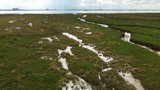
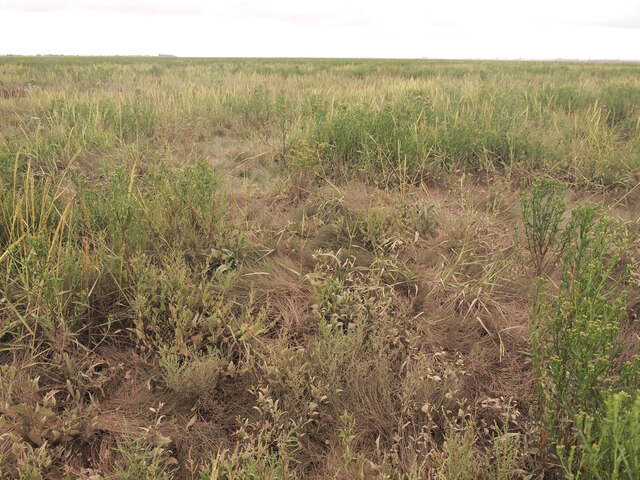
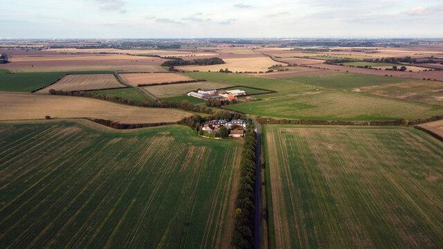
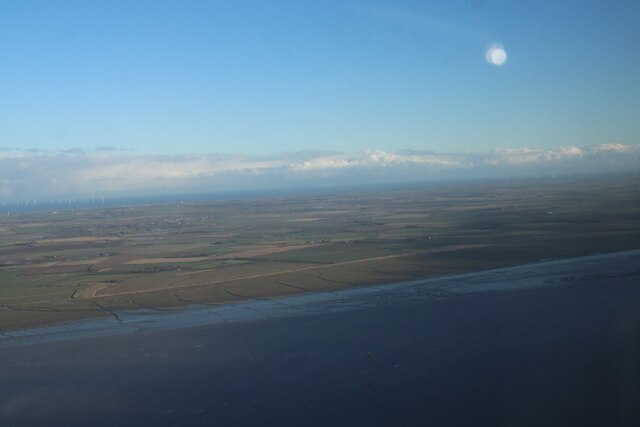
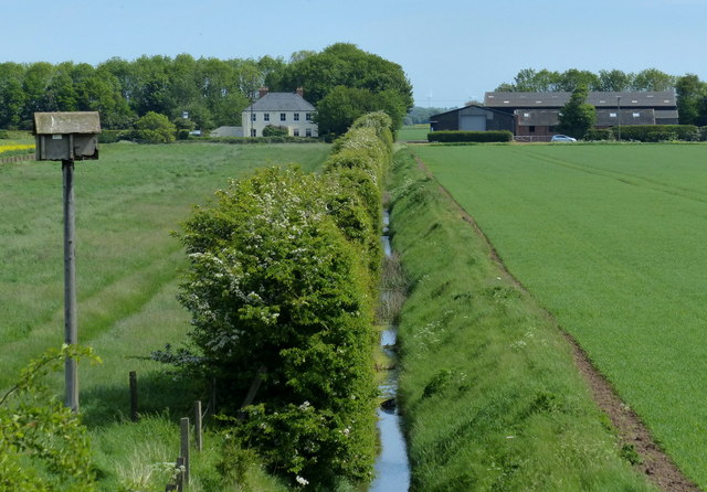
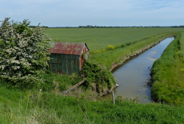
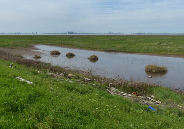
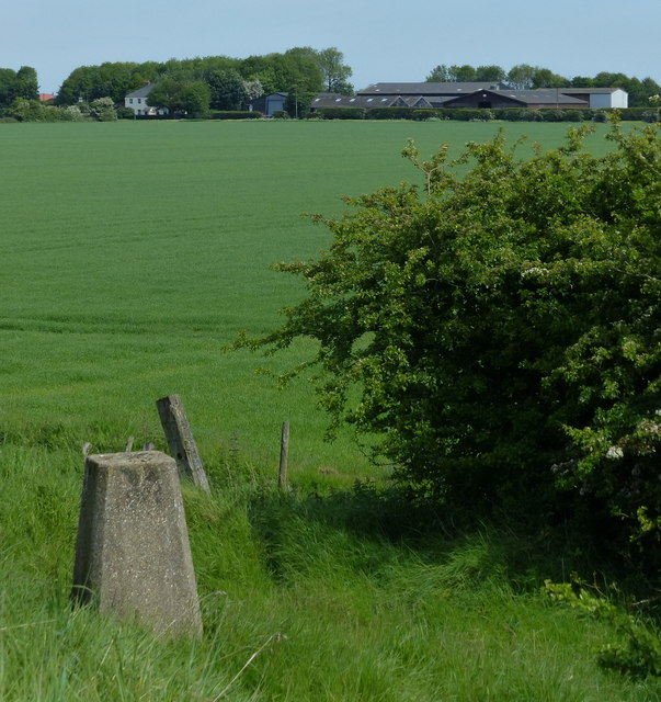
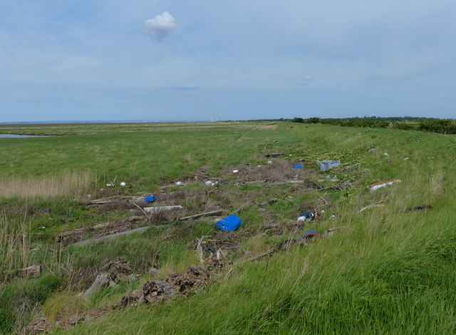
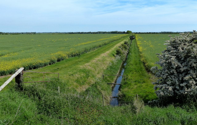
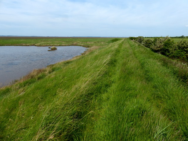
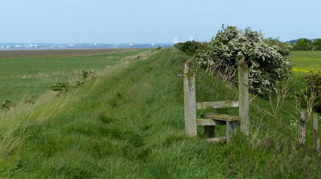
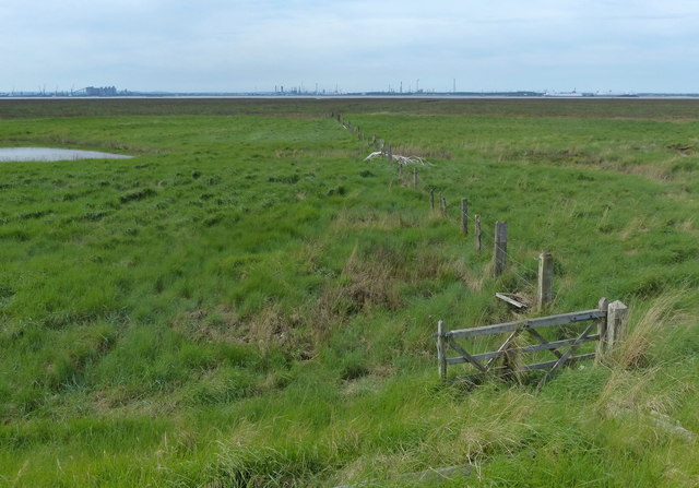
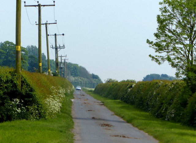
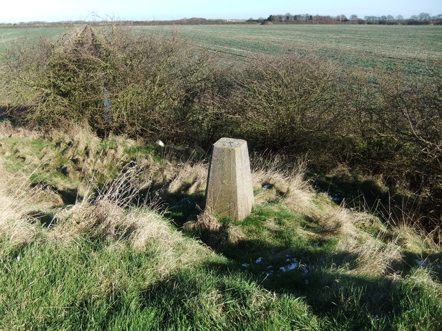
Paull Holme Sands is a coastal marsh and saltings area located in Yorkshire, England. It is an important natural habitat for a variety of bird species, including wading birds, ducks, and geese. The area is characterized by its vast stretches of salt marsh, mudflats, and sand dunes, which provide nesting and feeding grounds for the diverse bird population.

The marshland is also home to a variety of plant species, such as sea lavender and sea purslane, which thrive in the saltwater environment. The vegetation plays a crucial role in stabilizing the coastal ecosystem and providing food and shelter for the wildlife that inhabits the area.

Paull Holme Sands is a popular destination for birdwatchers and nature enthusiasts, who come to observe the diverse birdlife and enjoy the peaceful surroundings. The area is also important for its role in flood protection, helping to absorb excess water and reduce the risk of coastal erosion.

Overall, Paull Holme Sands is a valuable natural asset, providing a haven for wildlife and offering visitors the opportunity to experience the beauty of a coastal marshland ecosystem.

If you have any feedback on the listing, please let us know in the comments section below.

Paull Holme Sands Images

Images are sourced within 2km of 53.685467/-0.19265589 or Grid Reference TA1922. Thanks to Geograph Open Source API. All images are credited.

Humber Marshland I've finally bagged this square!  I've attempted on several occasions to get here on foot, but a 3m wide creek to the north east of here, to the access this point, is impossible to cross by foot due its custard-like properties!  This photo was accessed by a drone fitted with a GPS from the high water embankment several hundred metres away.  Hopefully, this now completes the TA22 hectad.
Humber Marshland
I've finally bagged this square! I've attempted on several occasions to get here on foot, but a 3m wide creek to the north east of here, to the access this point, is impossible to cross by foot due its custard-like properties! This photo was accessed by a drone fitted with a GPS from the high water embankment several hundred metres away. Hopefully, this now completes the TA22 hectad.
Across the Marshland to the West Taken at ground level, the marshland superficially looks to be uniform into the distance.  Just twenty metres or so away from the camera position there's a substantial creek - one of several before the land reaches the River Humber.
Across the Marshland to the West
Taken at ground level, the marshland superficially looks to be uniform into the distance. Just twenty metres or so away from the camera position there's a substantial creek - one of several before the land reaches the River Humber.
Housing Crescent and Thorney Crofts Farm The photo was taken from 100m high and shows the typical flat and arable land here in South Holderness.
Housing Crescent and Thorney Crofts Farm
The photo was taken from 100m high and shows the typical flat and arable land here in South Holderness.
Farm buildings at Thorney Crofts
Humber North Bank south of Paull: aerial 2024 (1)
New House Farm viewed from the Humber sea defences
Old pump house and drain Tucked away behind the Humber sea defences at Foulholme Sands.
Old pump house and drain
Tucked away behind the Humber sea defences at Foulholme Sands.
Salt marsh at the Outstray A flotsam strewn corner of salt marsh along the north shore of the Humber estuary.
Salt marsh at the Outstray
A flotsam strewn corner of salt marsh along the north shore of the Humber estuary.
Trig point at the Outstray Along the Humber estuary near New House Farm.
Trig point at the Outstray
Along the Humber estuary near New House Farm.
Flotsam on the salt marsh at the Outstray The Humber is a large tidal estuary on the east coast of Northern England. It is formed at Trent Falls, Faxfleet, by the confluence of the tidal rivers Ouse and Trent. From here to the North Sea, it forms part of the boundary between the East Riding of Yorkshire on the north bank and North Lincolnshire and North East Lincolnshire on the south bank. Although the Humber is an estuary from the point at which it is formed, many maps show it as the River Humber.
Below Trent Falls, the Humber passes the confluence of the River Ancholme on the south shore; between North Ferriby and South Ferriby and under the Humber Bridge; between Barton-upon-Humber on the south bank and Kingston upon Hull on the north bank (where the River Hull joins), then meets the North Sea between Cleethorpes on the Lincolnshire side and the long and thin (but rapidly changing) headland of Spurn Head to the north.
Ports on the Humber include Kingston upon Hull (better known as simply Hull), Grimsby, Immingham, New Holland and Killingholme. The estuary is navigable here for the largest of deep-sea vessels.
Flotsam on the salt marsh at the Outstray
The Humber is a large tidal estuary on the east coast of Northern England. It is formed at Trent Falls, Faxfleet, by the confluence of the tidal rivers Ouse and Trent. From here to the North Sea, it forms part of the boundary between the East Riding of Yorkshire on the north bank and North Lincolnshire and North East Lincolnshire on the south bank. Although the Humber is an estuary from the point at which it is formed, many maps show it as the River Humber. Below Trent Falls, the Humber passes the confluence of the River Ancholme on the south shore; between North Ferriby and South Ferriby and under the Humber Bridge; between Barton-upon-Humber on the south bank and Kingston upon Hull on the north bank (where the River Hull joins), then meets the North Sea between Cleethorpes on the Lincolnshire side and the long and thin (but rapidly changing) headland of Spurn Head to the north. Ports on the Humber include Kingston upon Hull (better known as simply Hull), Grimsby, Immingham, New Holland and Killingholme. The estuary is navigable here for the largest of deep-sea vessels.
Drain and farmland near New House Farm
Sea defences along the Humber estuary shoreline A footpath runs along the top of the sea defences, travelling for over six and a half miles from Stone Creek to Fort Paul.
Sea defences along the Humber estuary shoreline
A footpath runs along the top of the sea defences, travelling for over six and a half miles from Stone Creek to Fort Paul.
Stile on the Humber flood defences A footpath runs along the top of the sea defences, travelling for over six and a half miles from Stone Creek to Fort Paul.
Stile on the Humber flood defences
A footpath runs along the top of the sea defences, travelling for over six and a half miles from Stone Creek to Fort Paul.
Fence across the salt marsh at Foulholme Sands The Humber is a large tidal estuary on the east coast of Northern England. It is formed at Trent Falls, Faxfleet, by the confluence of the tidal rivers Ouse and Trent. From here to the North Sea, it forms part of the boundary between the East Riding of Yorkshire on the north bank and North Lincolnshire and North East Lincolnshire on the south bank. Although the Humber is an estuary from the point at which it is formed, many maps show it as the River Humber.
Below Trent Falls, the Humber passes the confluence of the River Ancholme on the south shore; between North Ferriby and South Ferriby and under the Humber Bridge; between Barton-upon-Humber on the south bank and Kingston upon Hull on the north bank (where the River Hull joins), then meets the North Sea between Cleethorpes on the Lincolnshire side and the long and thin (but rapidly changing) headland of Spurn Head to the north.
Ports on the Humber include Kingston upon Hull (better known as simply Hull), Grimsby, Immingham, New Holland and Killingholme. The estuary is navigable here for the largest of deep-sea vessels.
Fence across the salt marsh at Foulholme Sands
The Humber is a large tidal estuary on the east coast of Northern England. It is formed at Trent Falls, Faxfleet, by the confluence of the tidal rivers Ouse and Trent. From here to the North Sea, it forms part of the boundary between the East Riding of Yorkshire on the north bank and North Lincolnshire and North East Lincolnshire on the south bank. Although the Humber is an estuary from the point at which it is formed, many maps show it as the River Humber. Below Trent Falls, the Humber passes the confluence of the River Ancholme on the south shore; between North Ferriby and South Ferriby and under the Humber Bridge; between Barton-upon-Humber on the south bank and Kingston upon Hull on the north bank (where the River Hull joins), then meets the North Sea between Cleethorpes on the Lincolnshire side and the long and thin (but rapidly changing) headland of Spurn Head to the north. Ports on the Humber include Kingston upon Hull (better known as simply Hull), Grimsby, Immingham, New Holland and Killingholme. The estuary is navigable here for the largest of deep-sea vessels.
Driveway to Old Little Humber Farm
Phone box at Thorney Crofts
Cherry Cobb Sands Road A long straight road leading to Stone Creek on the Humber shoreline, two and a half miles away.
Cherry Cobb Sands Road
A long straight road leading to Stone Creek on the Humber shoreline, two and a half miles away.
Cherry Cobb Trig pillar
Show me another place!

Paull Holme Sands is located at Grid Ref: TA1922 (Lat: 53.685467, Lng: -0.19265589)

Division: East Riding

Unitary Authority: East Riding of Yorkshire

Police Authority: Humberside

What 3 Words

///punt.blindfold.grit. Near Thorngumbald, East Yorkshire

Nearby Locations

Paull Holme Sands

Related Wikis

Paull Holme Tower

Paull Holme Tower is an unusual late-medieval fortified tower in the East Riding of Yorkshire, England. == History == The tower is part of a rectangular...

North Killingholme Haven

North Killingholme Haven is a water outlet on the south bank of the Humber Estuary in the civil parish of North Killingholme, to the north-west of the...

Humber Gas Tunnel

The Humber Gas Tunnel is a natural gas-carrying pipeline that runs underneath the Humber Estuary between Paull in the East Riding of Yorkshire, and Goxhill...

Fort Paull

Fort Paull was a gun battery situated on the north bank of the Humber, near the village of Paull, downstream from Hull in northern England. == History... ==

Have you been to Paull Holme Sands?

Leave your review of Paull Holme Sands below (or comments, questions and feedback).