Sammy's Point
Coastal Marsh, Saltings in Yorkshire
England
Sammy's Point

Sammy's Point is a picturesque area located in Yorkshire, England, known for its stunning coastal marshes and saltings. Situated along the coast, this natural landscape offers a unique blend of wetlands, mudflats, and salt marshes, creating a haven for a diverse range of plant and animal species.
The marshes at Sammy's Point are a vital habitat for many bird species, providing nesting grounds and feeding areas for both resident and migratory birds. Visitors can witness an array of avian species, including wading birds such as curlews, redshanks, and oystercatchers, as well as gulls and terns. The mudflats are also home to various invertebrates, attracting birds and other wildlife.
The saltings, which are areas of land regularly flooded by tides, boast a unique ecological system. Salt-tolerant vegetation, such as samphire and sea lavender, thrives in these conditions, creating a colorful and vibrant landscape. The saltings also support a variety of marine life, including crabs, shrimp, and small fish.
Sammy's Point is not only a haven for wildlife enthusiasts but also a popular destination for nature lovers and photographers. Its untouched beauty and tranquility make it an ideal location for long walks, birdwatching, and capturing breathtaking views of the surrounding coastline.
The area is well-maintained, with footpaths and observation points available for visitors to explore and appreciate the natural wonders of Sammy's Point. Its accessibility and proximity to nearby towns and villages make it a popular choice for day trips or weekend getaways.
In conclusion, Sammy's Point in Yorkshire offers a remarkable glimpse into the diverse and thriving coastal marshes and saltings of the region. With its abundant wildlife, stunning scenery, and peaceful ambiance, it is a must-visit destination for nature enthusiasts seeking a unique and memorable experience.
If you have any feedback on the listing, please let us know in the comments section below.
Sammy's Point Images
Images are sourced within 2km of 53.738692/-0.33139917 or Grid Reference TA1028. Thanks to Geograph Open Source API. All images are credited.


Sammy's Point is located at Grid Ref: TA1028 (Lat: 53.738692, Lng: -0.33139917)
Division: East Riding
Unitary Authority: Kingston upon Hull
Police Authority: Humberside
What 3 Words
///pigs.forced.knee. Near Kingston upon Hull, East Yorkshire
Nearby Locations
Related Wikis
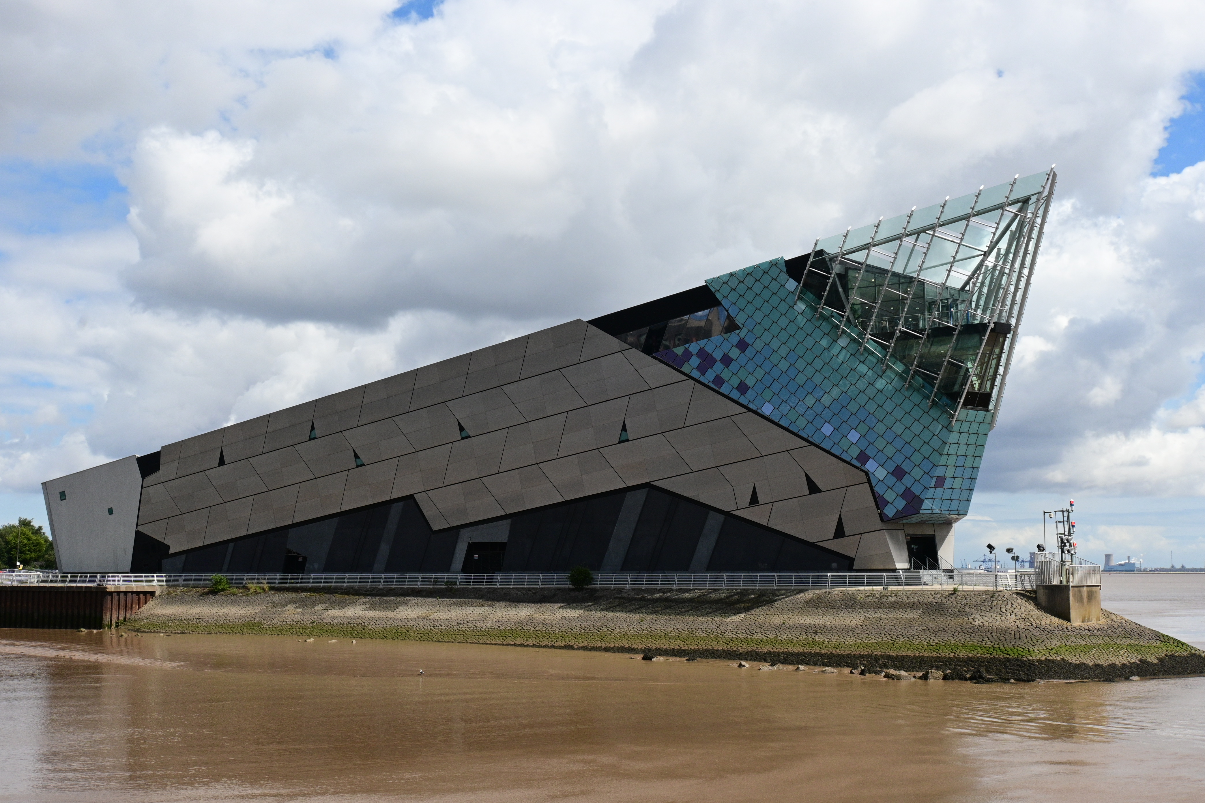
The Deep (aquarium)
The Deep is a public aquarium situated at Sammy's Point, at the confluence of the River Hull and the Humber Estuary in Hull, England. It opened in March...
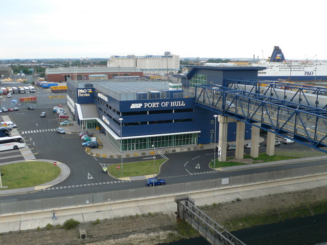
Port of Hull
The Port of Hull is a port at the confluence of the River Hull and the Humber Estuary in Kingston upon Hull, in the East Riding of Yorkshire, England....
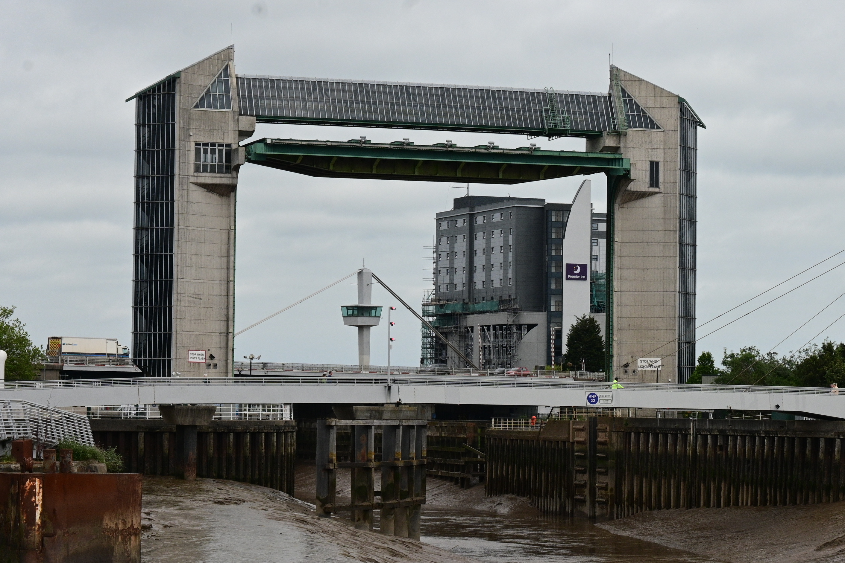
River Hull tidal surge barrier
The River Hull tidal surge barrier is a flood control gate located on the River Hull in the city of Kingston upon Hull, in the East Riding of Yorkshire...
C4DI
C4DI (the Centre for Digital Innovation in Hull) is a digital hub located at the Fruit Market in Kingston upon Hull, England. The company provides services...
Nearby Amenities
Located within 500m of 53.738692,-0.33139917Have you been to Sammy's Point?
Leave your review of Sammy's Point below (or comments, questions and feedback).