Cock Marsh

Lake, Pool, Pond, Freshwater Marsh in Berkshire

England

Cock Marsh

Old Track Bed The old track bed of the dismantled railway line from Bourne End to Wooburn Green
Old Track Bed Credit: Shaun Ferguson

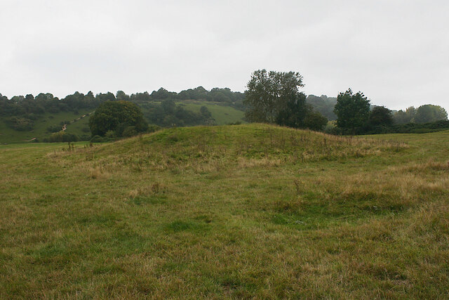
Cock Marsh is a freshwater marsh located in the county of Berkshire, England. This natural area is known for its picturesque landscape and diverse ecosystem, making it a popular destination for nature enthusiasts and wildlife observers.

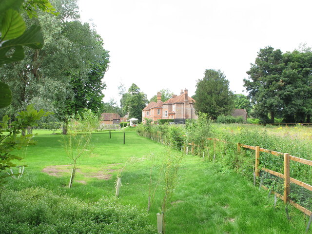
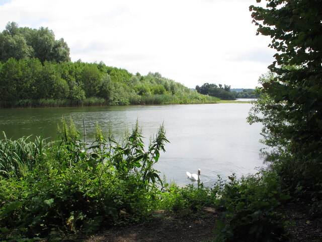
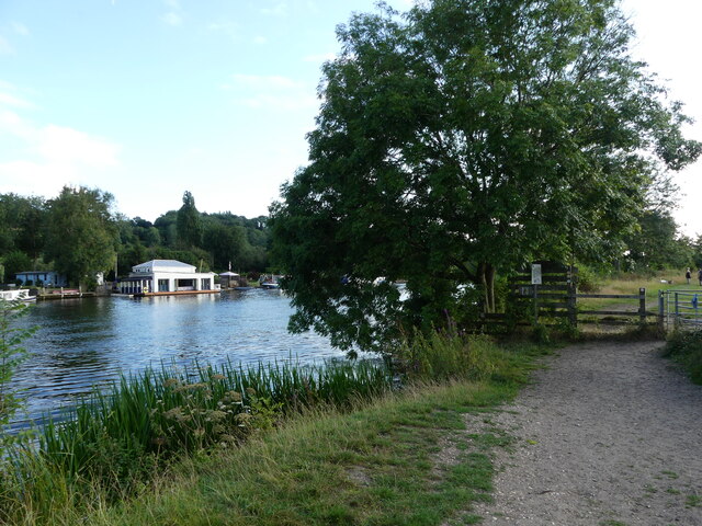
Covering an area of approximately 40 hectares, Cock Marsh is situated between the towns of Bourne End and Cookham, bordered by the River Thames to the east and the Jubilee River to the west. The marsh itself is predominantly composed of wetlands, including a lake, pool, and pond, which are all interconnected and fed by various streams and springs.

The marshland is characterized by its lush vegetation, consisting of reeds, sedges, and grasses that thrive in the marshy conditions. This abundant plant life provides a habitat for a wide variety of animal species, including numerous bird species such as herons, kingfishers, and waterfowl. The marsh also supports a diverse range of aquatic life, including fish, frogs, and insects, which contribute to the overall biodiversity of the area.

In addition to its ecological significance, Cock Marsh offers recreational opportunities for visitors. It is a popular spot for birdwatching, with several designated observation points and walking trails that allow visitors to explore the marsh and its surroundings. The tranquil atmosphere and scenic beauty of Cock Marsh make it an ideal location for nature walks, picnics, and photography.

Overall, Cock Marsh in Berkshire is a precious natural asset, providing both ecological and recreational value to the local community and visitors alike.

If you have any feedback on the listing, please let us know in the comments section below.
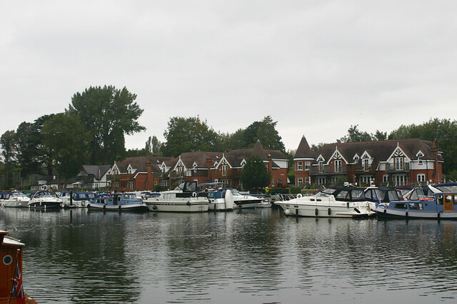
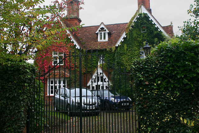
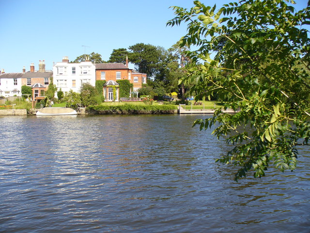
Cock Marsh Images

Images are sourced within 2km of 51.573647/-0.72456902 or Grid Reference SU8886. Thanks to Geograph Open Source API. All images are credited.

Old Track Bed The old track bed of the dismantled railway line from Bourne End to Wooburn Green
Old Track Bed
The old track bed of the dismantled railway line from Bourne End to Wooburn Green
Footpath to Hedsor Hill Off Hedsor Road the footpath to Hedsor Hill
Footpath to Hedsor Hill
Off Hedsor Road the footpath to Hedsor Hill
Stream at Hedsor It does not seem to have a name, let's call it Hedsor Stream.  Neither, on the 1:25,000 map, does it seem to actually flow into the River Thames, although it does on the 1:50,000 map.  This is an artificially created pond at the rear of the houses at Hedsor Wharf.
Stream at Hedsor
It does not seem to have a name, let's call it Hedsor Stream. Neither, on the 1:25,000 map, does it seem to actually flow into the River Thames, although it does on the 1:50,000 map. This is an artificially created pond at the rear of the houses at Hedsor Wharf.
Footpath at Cores End Just ahead, the footpath to Flackwell Heath crosses the old Bourne End to High Wycombe railway line.  It is a bright, crisp day and very difficult to get pictures that don't have strong shadows and bleached out sections.  I failed here to show clearly that the sign says that, courtesy of Wooburn Parish Council this is a nature walk as part of the European Year of the Environment 1988.  Remember that?
Footpath at Cores End
Just ahead, the footpath to Flackwell Heath crosses the old Bourne End to High Wycombe railway line. It is a bright, crisp day and very difficult to get pictures that don't have strong shadows and bleached out sections. I failed here to show clearly that the sign says that, courtesy of Wooburn Parish Council this is a nature walk as part of the European Year of the Environment 1988. Remember that?
Permissive path round Spade Oak Lake This is the entrance to Spade Oak Nature Reserve from a public footpath through pasture.
Permissive path round Spade Oak Lake
This is the entrance to Spade Oak Nature Reserve from a public footpath through pasture.
Borehole monitor for groundwater This is near Spade Oak Lake which is a former gravel pit, and near Little Marlow sewage treatment works, and not far from the River Thames. The wording around the top or at various angles includes: Borehole; observation, monitoring;  Do not fill; Supplied by Stuart Well Services Ltd, Attleborough NR17 1AD.
Borehole monitor for groundwater
This is near Spade Oak Lake which is a former gravel pit, and near Little Marlow sewage treatment works, and not far from the River Thames. The wording around the top or at various angles includes: Borehole; observation, monitoring; Do not fill; Supplied by Stuart Well Services Ltd, Attleborough NR17 1AD.
Houses on Coldmoorhome Lane seen across field View from public footpath across rough pasture near Spade Oak, Little Marlow.
Houses on Coldmoorhome Lane seen across field
View from public footpath across rough pasture near Spade Oak, Little Marlow.
Old Vicarage, Little Marlow View from public footpath.
Old Vicarage, Little Marlow
View from public footpath.
Spade Oak Lake with swan This former gravel pit is now a local nature reserve.
Spade Oak Lake with swan
This former gravel pit is now a local nature reserve.
Level crossing at Spade Oak Farm, Bourne End, Bucks The crossing is a pedestrian crossing, and a gate for authorised vehicles over a single track railway line.  There are lights to indicate whether it is safe to cross.  Beyond the crossing is the Thames Path and the River Thames.
Level crossing at Spade Oak Farm, Bourne End, Bucks
The crossing is a pedestrian crossing, and a gate for authorised vehicles over a single track railway line. There are lights to indicate whether it is safe to cross. Beyond the crossing is the Thames Path and the River Thames.
Class 165 train approaching the level crossing, Bourne End, Bucks A boat on the nearby River Thames can be seen in the background.
Class 165 train approaching the level crossing, Bourne End, Bucks
A boat on the nearby River Thames can be seen in the background.
Gate on the Thames Path, Little Marlow
Crowne Plaza Hotel Crowne Plaza is a chain of upscale hotels catering to business travelers and to the meetings and conventions market. It forms part of the InterContinental Hotels Group family of brands, which include InterContinental Hotels & Resorts and Holiday Inn Hotels & Resorts, and operates in 52 countries, usually located in city centres, resorts, or near major airports. The chain ws founded in 1983, in the USA, and has nearly 400 hotels worldwide.
Wikipedia: <span class="nowrap"><a title="http://en.wikipedia.org/wiki/Crowne_Plaza" rel="nofollow ugc noopener" href="http://en.wikipedia.org/wiki/Crowne_Plaza">Link</a><img style="margin-left:2px;" alt="External link" title="External link - shift click to open in new window" src="https://s1.geograph.org.uk/img/external.png" width="10" height="10"/></span>
Crowne Plaza Hotel
Crowne Plaza is a chain of upscale hotels catering to business travelers and to the meetings and conventions market. It forms part of the InterContinental Hotels Group family of brands, which include InterContinental Hotels & Resorts and Holiday Inn Hotels & Resorts, and operates in 52 countries, usually located in city centres, resorts, or near major airports. The chain ws founded in 1983, in the USA, and has nearly 400 hotels worldwide. Wikipedia: LinkExternal link
Tumulus, Cock Marsh, Cookham This is the most conspicuous of the four round barrows on Cock Marsh. C19 excavations found the remains of a child dating from the Early Bronze Age along with some much later Anglo-Saxon artefacts. It is stated in the 'Buildings of England' that "It is unusual for a small cemetery of this kind to have survived on such low-lying ground, and it may originally have occupied a natural island enclosed by braided river channels".
Tumulus, Cock Marsh, Cookham
This is the most conspicuous of the four round barrows on Cock Marsh. C19 excavations found the remains of a child dating from the Early Bronze Age along with some much later Anglo-Saxon artefacts. It is stated in the 'Buildings of England' that "It is unusual for a small cemetery of this kind to have survived on such low-lying ground, and it may originally have occupied a natural island enclosed by braided river channels".
Thames river frontage, Bourne End The houses are situated in Wharf Lane part of which fronts the river. The moorings are at Bourne End Marina.
Thames river frontage, Bourne End
The houses are situated in Wharf Lane part of which fronts the river. The moorings are at Bourne End Marina.
Chimneys, Winter Hill, Cookham Dean One of several large houses along the crest of Winter Hill with views across the Thames valley.
Chimneys, Winter Hill, Cookham Dean
One of several large houses along the crest of Winter Hill with views across the Thames valley.
Holy Trinity, Cookham - east elevation From left-right we see the southern addition to the chancel (early C14), the east window (1860-61) and the Lady Chapel (late C12).
Holy Trinity, Cookham - east elevation
From left-right we see the southern addition to the chancel (early C14), the east window (1860-61) and the Lady Chapel (late C12).
Holy Trinity, Cookham - north-east elevation This shows the north wall of the Lady Chapel that was refaced in brick in the C18.
Holy Trinity, Cookham - north-east elevation
This shows the north wall of the Lady Chapel that was refaced in brick in the C18.
Show me another place!

Cock Marsh is located at Grid Ref: SU8886 (Lat: 51.573647, Lng: -0.72456902)

Unitary Authority: Windsor and Maidenhead

Police Authority: Thames Valley

What 3 Words

///mild.reset.duke. Near Bourne End, Buckinghamshire

Nearby Locations

Cock Marsh Cookham Dean

Related Wikis

Cock Marsh

Cock Marsh is an area of marsh land and steep chalk slope covering more than 150-acre (61-hectare) north of Maidenhead in Berkshire. It includes a 45-acre...

Bourne End Railway Bridge

Bourne End Railway Bridge is a railway bridge carrying the Marlow Branch Line, and a footpath over the River Thames in Bourne End, Buckinghamshire, England...

Coldmoorholme

Coldmoorholme (or Coldmoorholm, formerly Coldmoorham or Coldmorham) is a hamlet in the parish of Little Marlow in Buckinghamshire, England. It is now considered...

River Wye, Buckinghamshire

The River Wye is a river in Buckinghamshire, England. It takes its name from the town of High Wycombe through which it flows, rather than the town being...

Bourne End railway station

Bourne End railway station serves Bourne End in Buckinghamshire, England. It is on the Marlow Branch Line between Maidenhead and Marlow, 4 miles 36 chains...

Well End, Buckinghamshire

Well End is a hamlet in the parish of Little Marlow, in Buckinghamshire, England. It is situated on the north-west side of the village of Bourne End. Although...

Bourne End, Buckinghamshire

Bourne End is a village mostly in the parish of Wooburn, but partly in that of Little Marlow in Buckinghamshire, England. It is about five miles (8 km...

Gibraltar Islands

Gibraltar Islands are a pair of islands in the River Thames in England above Bourne End Railway Bridge on the reach above Cookham Lock, near Cookham Dean...

Nearby Amenities

Located within 500m of 51.573647,-0.72456902
Barrier: kissing_gate
Lat/Long: 51.5773804/-0.72247
Barrier: kissing_gate
Lat/Long: 51.5733686/-0.7280407
Barrier: kissing_gate
Lat/Long: 51.5779063/-0.7264987
Barrier: kissing_gate
Foot: yes
Lat/Long: 51.5714035/-0.7274554
Barrier: kissing_gate
Lat/Long: 51.570981/-0.7189652
Archaeological Site: tumulus
Historic: archaeological_site
Source: Bing;survey
Lat/Long: 51.5748631/-0.7213748
Archaeological Site: tumulus
Historic: archaeological_site
Source: Bing;survey
Lat/Long: 51.5743094/-0.721128
Bench
Lat/Long: 51.577878/-0.7268921
Information: guidepost
Tourism: information
Lat/Long: 51.572872/-0.7279594
Bench
Material: wood
Lat/Long: 51.5713967/-0.7286851
The data included in this document is from www.openstreetmap.org. The data is made available under ODbL.

Have you been to Cock Marsh?

Leave your review of Cock Marsh below (or comments, questions and feedback).