Black Point
Coastal Marsh, Saltings in Hampshire Havant
England
Black Point

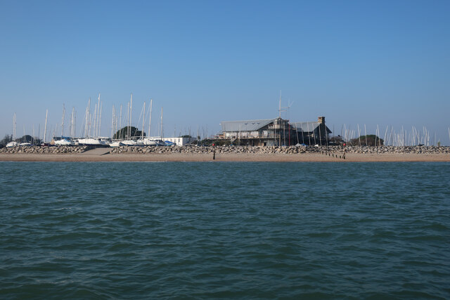
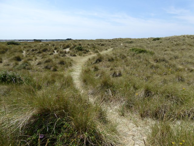
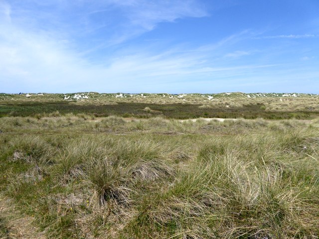
Black Point is a picturesque coastal marsh located in Hampshire, England. Situated on the southern coast, it is a part of the larger Solent and Isle of Wight estuarine system. The area is characterized by its unique landscape of salt marshes and saltings, making it a significant habitat for a diverse range of flora and fauna.
The marshes of Black Point are known for their rich biodiversity. The saline environment supports a variety of plant species, including samphire, sea lavender, and cordgrass. These plants not only play a crucial role in stabilizing the coastal ecosystem but also provide a habitat for numerous bird species. The area is particularly renowned for hosting a wide range of wading birds, such as redshanks, dunlins, and curlews, which can be observed feeding and nesting here.
In addition to its ecological importance, Black Point offers visitors a chance to enjoy the natural beauty of the coastline. The marshes provide stunning panoramic views of the Solent and Isle of Wight, with the distant outline of the Needles providing a dramatic backdrop. The area is popular among nature enthusiasts and birdwatchers who can explore the network of footpaths and trails that meander through the marshes.
Black Point also presents opportunities for scientific research and education. The unique ecosystem provides a valuable case study for studying coastal processes, biodiversity conservation, and the impact of climate change on salt marshes. Local educational institutions and research organizations often conduct studies and field trips to explore and learn from this remarkable coastal marsh.
Overall, Black Point in Hampshire stands as an important coastal marsh and saltings, combining ecological significance, scenic beauty, and educational value.
If you have any feedback on the listing, please let us know in the comments section below.
Black Point Images
Images are sourced within 2km of 50.786086/-0.93589939 or Grid Reference SZ7599. Thanks to Geograph Open Source API. All images are credited.


Black Point is located at Grid Ref: SZ7599 (Lat: 50.786086, Lng: -0.93589939)
Administrative County: Hampshire
District: Havant
Police Authority: Hampshire
What 3 Words
///hoops.differ.lifestyle. Near Hayling Island, Hampshire
Nearby Locations
Related Wikis

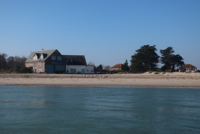
Hayling Island Lifeboat Station
Hayling Island Lifeboat Station is a Royal National Lifeboat Institution station located on Hayling Island close to the town of Mengham in the English...

Tourner Bury
Tourner Bury is an area on Hayling Island, Hampshire, England, lying East of Mengham. As well as woodland, the area is the site of an Iron Age hill fort...

Hayling Seaside Railway
The Hayling Seaside Railway, formerly East Hayling Light Railway, is a 2 ft (610 mm) narrow gauge railway on Hayling Island, Hampshire, England. It is...
South Hayling
South Hayling is a village and former civil parish on Hayling Island, about 5 miles from Havant, in the Havant district, in the county of Hampshire, England...
Nearby Amenities
Located within 500m of 50.786086,-0.93589939Have you been to Black Point?
Leave your review of Black Point below (or comments, questions and feedback).