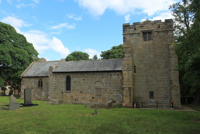
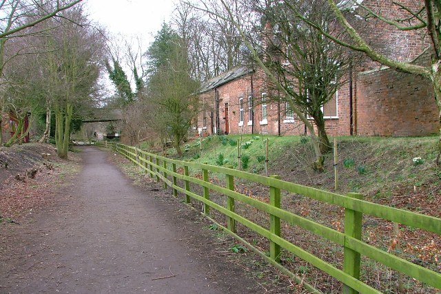
Bridlegill Bog
Coastal Marsh, Saltings in Yorkshire
England
Bridlegill Bog

Bridlegill Bog is a coastal marsh located in Yorkshire, England. Situated near the town of Bridlington, the bog is a significant natural habitat in the area. Covering a vast area of land, it is characterized by its diverse range of flora and fauna, making it a popular spot for nature enthusiasts and researchers alike.
The bog is primarily composed of peat, a type of soil formed from decaying plant matter. This unique soil composition provides ideal conditions for the growth of various plant species, including sedges, reeds, and grasses. These plants create a dense and lush vegetation cover, attracting a plethora of bird species, such as curlews, redshanks, and skylarks. The area is also home to several species of insects and small mammals, adding to its biodiversity.
Bridlegill Bog is considered a coastal marsh due to its proximity to the sea. The bog's location near the coast allows it to benefit from tidal influences, resulting in the presence of saltings. Saltings are areas of land that are periodically flooded by seawater during high tides. This unique ecosystem supports the growth of halophytic plants that are tolerant of saltwater, such as sea lavender and glasswort.
The bog serves not only as a haven for wildlife but also as a natural barrier against coastal erosion. The dense vegetation acts as a buffer, absorbing the impact of strong tides and protecting the surrounding land from erosion.
Overall, Bridlegill Bog in Yorkshire is a remarkable coastal marsh with its diverse plant and animal life, saltwater influence, and protective role against coastal erosion. It stands as an important natural asset in the region, contributing to the overall ecological balance and providing a serene environment for visitors to enjoy.
If you have any feedback on the listing, please let us know in the comments section below.
Bridlegill Bog Images
Images are sourced within 2km of 54.511037/-1.1039615 or Grid Reference NZ5813. Thanks to Geograph Open Source API. All images are credited.
![Bousdale Brickworks A ‘Brick Field’ is shown on the 1856 Ordnance Survey map (surveyed 1853). It is thought to have been set up to provide bricks for the construction of the houses at Hutton village, which must be the row of ten cottages called ‘Wat’s Lane’ that were located south of the later school site (now a private residence). You will need to compare the 1856 map with the 1895 one to appreciate how much has changed in this area. Courtesy of Joseph Pease when he built his Hutton Hall.
Wat’s Lane was built just before 1853 by Henry Thomas, the owner of Codhill Farm but they were soon leased to Pease. The 1861 census records 52 folks living there and none ten years later.
Pease also leased land from Thomas called Bank Bottom Close (the site of the modern Hutton village) but agreed the latter could build houses on it. I’m not sure exactly how Pease would have benefitted from this. In 1855, the land was sold to Matthew Armitage of Darlington (again presumably with Pease’s agreement) to build 12 cottages again using bricks from the Bousdale brickworks.
Pease was soon leasing the houses from Armitage and built another nine or ten cottages for his ironstone miners, plus a row of larger cottages for his supervisors and surveyors. In 1872, he purchased the whole village off Armitage, although by then the cottages no longer housed ironstone miners but workers employed on his estate (and a few jet miners).
As for the Bousdale brickworks, buildings were still mapped on the site in the 1950s but nature has taken back control. The woodland floor is littered with moss covered broken bricks and rubble. An old stone building is the obvious feature which has been adapted as a sheltered rest area.
The brickworks are now part of a fitness course for the Pinchinthorp Visitor Centre.
For sources and references see my blog: Out and about ... (2021). Bousdale Brickworks. [online] Available at: <span class="nowrap"><a title="http://www.fhithich.uk/?p=25230" rel="nofollow ugc noopener" href="http://www.fhithich.uk/?p=25230">Link</a><img style="margin-left:2px;" alt="External link" title="External link - shift click to open in new window" src="https://s1.geograph.org.uk/img/external.png" width="10" height="10"/></span> [Accessed 12 Dec. 2021].](https://s2.geograph.org.uk/geophotos/07/04/19/7041950_4c15d517.jpg)
![Brick structure on the site of Bousdale brickworks A ‘Brick Field’ is shown on the 1856 Ordnance Survey map (surveyed 1853). It is thought to have been set up to provide bricks for the construction of the houses at Hutton village, which must be the row of ten cottages called ‘Wat’s Lane’ that were located south of the later school site (now a private residence). You will need to compare the 1856 map with the 1895 one to appreciate how much has changed in this area. Courtesy of Joseph Pease when he built his Hutton Hall.
Wat’s Lane was built just before 1853 by Henry Thomas, the owner of Codhill Farm but they were soon leased to Pease. The 1861 census records 52 folks living there and none ten years later.
Pease also leased land from Thomas called Bank Bottom Close (the site of the modern Hutton village) but agreed the latter could build houses on it. I’m not sure exactly how Pease would have benefitted from this. In 1855, the land was sold to Matthew Armitage of Darlington (again presumably with Pease’s agreement) to build 12 cottages again using bricks from the Bousdale brickworks.
Pease was soon leasing the houses from Armitage and built another nine or ten cottages for his ironstone miners, plus a row of larger cottages for his supervisors and surveyors. In 1872, he purchased the whole village off Armitage, although by then the cottages no longer housed ironstone miners but workers employed on his estate (and a few jet miners).
As for the Bousdale brickworks, buildings were still mapped on the site in the 1950s but nature has taken back control. The woodland floor is littered with moss covered broken bricks and rubble. An old stone building is the obvious feature which has been adapted as a sheltered rest area.
The brickworks are now part of a fitness course for the Pinchinthorp Visitor Centre.
For sources and references see my blog: Out and about ... (2021). Bousdale Brickworks. [online] Available at: <span class="nowrap"><a title="http://www.fhithich.uk/?p=25230" rel="nofollow ugc noopener" href="http://www.fhithich.uk/?p=25230">Link</a><img style="margin-left:2px;" alt="External link" title="External link - shift click to open in new window" src="https://s1.geograph.org.uk/img/external.png" width="10" height="10"/></span> [Accessed 12 Dec. 2021].](https://s1.geograph.org.uk/geophotos/07/04/19/7041953_c8016c24.jpg)
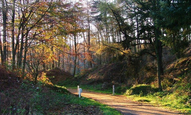
![Creep beneath the Middlesbrough & Guisborough Railway originally to a farm called Barn Hill A ‘Brick Field’ is shown on the 1856 Ordnance Survey map (surveyed 1853). It is thought to have been set up to provide bricks for the construction of the houses at Hutton village, which must be the row of ten cottages called ‘Wat’s Lane’ that were located south of the later school site (now a private residence). You will need to compare the 1856 map with the 1895 one to appreciate how much has changed in this area. Courtesy of Joseph Pease when he built his Hutton Hall.
Wat’s Lane was built just before 1853 by Henry Thomas, the owner of Codhill Farm but they were soon leased to Pease. The 1861 census records 52 folks living there and none ten years later.
Pease also leased land from Thomas called Bank Bottom Close (the site of the modern Hutton village) but agreed the latter could build houses on it. I’m not sure exactly how Pease would have benefitted from this. In 1855, the land was sold to Matthew Armitage of Darlington (again presumably with Pease’s agreement) to build 12 cottages again using bricks from the Bousdale brickworks.
Pease was soon leasing the houses from Armitage and built another nine or ten cottages for his ironstone miners, plus a row of larger cottages for his supervisors and surveyors. In 1872, he purchased the whole village off Armitage, although by then the cottages no longer housed ironstone miners but workers employed on his estate (and a few jet miners).
As for the Bousdale brickworks, buildings were still mapped on the site in the 1950s but nature has taken back control. The woodland floor is littered with moss covered broken bricks and rubble. An old stone building is the obvious feature which has been adapted as a sheltered rest area.
The brickworks are now part of a fitness course for the Pinchinthorp Visitor Centre.
For sources and references see my blog: Out and about ... (2021). Bousdale Brickworks. [online] Available at: <span class="nowrap"><a title="http://www.fhithich.uk/?p=25230" rel="nofollow ugc noopener" href="http://www.fhithich.uk/?p=25230">Link</a><img style="margin-left:2px;" alt="External link" title="External link - shift click to open in new window" src="https://s1.geograph.org.uk/img/external.png" width="10" height="10"/></span> [Accessed 12 Dec. 2021].](https://s3.geograph.org.uk/geophotos/07/04/19/7041959_7e30fb59.jpg)


Bridlegill Bog is located at Grid Ref: NZ5813 (Lat: 54.511037, Lng: -1.1039615)
Division: North Riding
Unitary Authority: Redcar and Cleveland
Police Authority: Cleveland
What 3 Words
///dared.hopefully.spenders. Near Great Ayton, North Yorkshire
Nearby Locations
Related Wikis

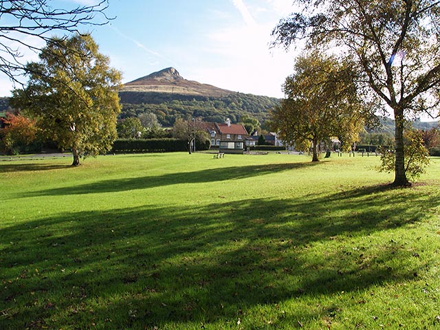
Roseberry Topping
Roseberry Topping is a distinctive hill in North Yorkshire, England. It is situated near Great Ayton and Newton under Roseberry. Its summit has a distinctive...

Roseberry Mine
Roseberry Mine was an ironstone mine in the North Riding of Yorkshire, England, which operated between 1883 and 1924, with a break of 24 years. Both periods...
Newton under Roseberry
Newton under Roseberry is a village in the borough of Redcar and Cleveland and the ceremonial county of North Yorkshire, England. It is on the A173, between...
Pinchinthorpe railway station
Pinchinthorpe railway station was a railway station on the Middlesbrough and Guisborough Railway (M&GR). It was opened on 25 February 1854 and closed in...
Pinchinthorpe
Pinchinthorpe is a small hamlet near Guisborough in Redcar and Cleveland, England. It is a linear settlement spread along the A173. The postcode is TS14...
Hutton Village
Hutton Village is a settlement in the Hutton Lowcross area of Guisborough in North Yorkshire, England. Whilst the area itself is mentioned in the Domesday...

Hutton Hall, Guisborough
Hutton Hall is a grade II listed country house in the Hutton Lowcross area to the south west of Guisborough, North Yorkshire, England. == History == The...

Langbaurgh Ridge
Langbaurgh Ridge (grid reference NZ560121) is an 8.0 hectare geological Site of Special Scientific Interest near the hamlet of Langbaurgh in North Yorkshire...
Nearby Amenities
Located within 500m of 54.511037,-1.1039615Have you been to Bridlegill Bog?
Leave your review of Bridlegill Bog below (or comments, questions and feedback).