The Taing

Coastal Marsh, Saltings in Shetland

Scotland

The Taing

The southern part of Houss Ness Seen from just south of the summit of Ward of Symbister.
The southern part of Houss Ness Credit: David Purchase

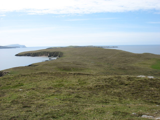
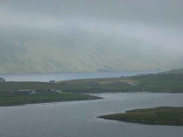
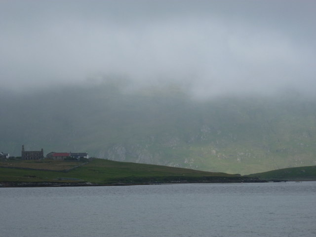
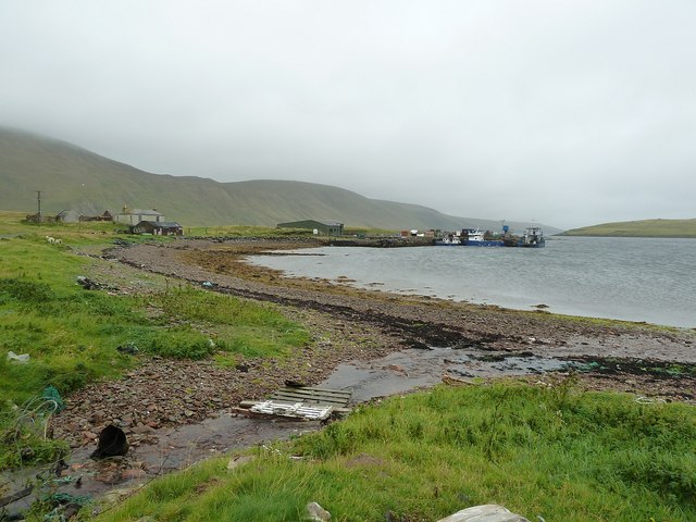
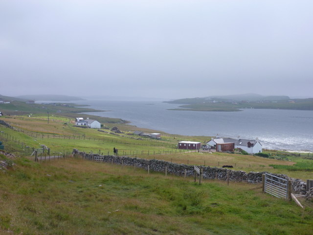
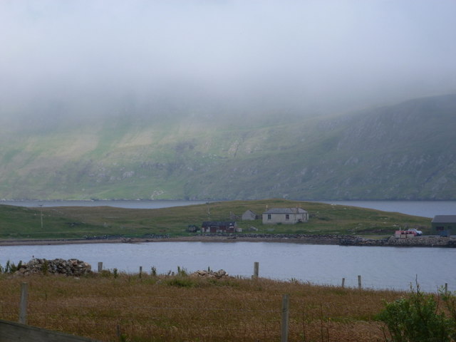
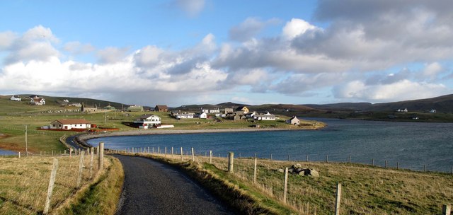
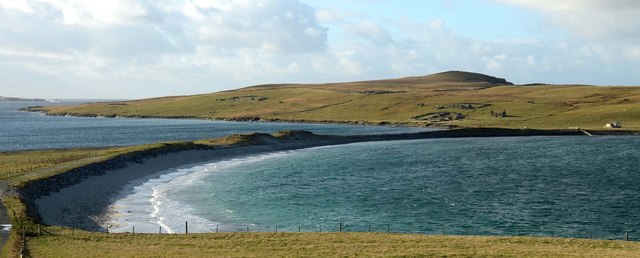
The Taing is a coastal marsh located in Shetland, Scotland. It is characterized by its unique saltings, which are areas of coastal land that are regularly flooded by the tides. The Taing covers an extensive area and is an important habitat for a variety of plant and animal species.

The landscape of The Taing is dominated by salt-tolerant vegetation, such as saltmarsh grasses and sea asters. These plants have adapted to the harsh coastal environment, where they are exposed to saltwater and strong winds. The marsh is also home to several species of wading birds, including oystercatchers and redshanks, which can be observed feeding on the mudflats during low tide.

The Taing's location on the coast provides an essential link between the land and sea ecosystems. It acts as a buffer zone, helping to protect the mainland from erosion and storm surges. The marsh also plays a vital role in filtering and purifying water, improving the overall water quality in the area.

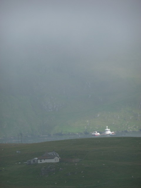
Due to its ecological significance, The Taing has been designated as a Site of Special Scientific Interest (SSSI), ensuring its protection and conservation. It is a popular destination for nature enthusiasts, who can explore the area through a network of footpaths and observation points. The Taing offers stunning views of the surrounding coastline and provides visitors with an opportunity to observe and appreciate the unique flora and fauna that thrive in this coastal marsh ecosystem.

If you have any feedback on the listing, please let us know in the comments section below.

The Taing Images

Images are sourced within 2km of 60.064795/-1.3178356 or Grid Reference HU3831. Thanks to Geograph Open Source API. All images are credited.
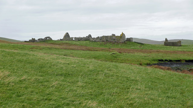
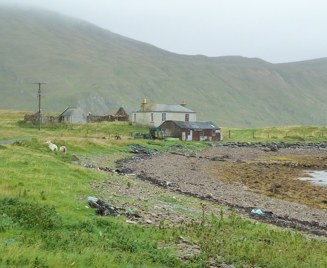
The southern part of Houss Ness Seen from just south of the summit of Ward of Symbister.
The southern part of Houss Ness
Seen from just south of the summit of Ward of Symbister.
Symbister, East Burra An extensive set of ruined buildings.
Symbister, East Burra
An extensive set of ruined buildings.
Small fishing boat and salmon cages off Teisti Geo Teisti Geo is a prominent indentation in the otherwise smooth coastline of Clift Sound.
Small fishing boat and salmon cages off Teisti Geo
Teisti Geo is a prominent indentation in the otherwise smooth coastline of Clift Sound.
Burnt Mound at Symbister One of three burnt mounds indicated on the 1:25,000 OS mapping.  This was a smaller mound.  Often features like this are marked on maps yet are hard to find. A Eureka moment followed after the  GPS location was checked. I understand the purpose of burnt mounds is a contentious issue.
Burnt Mound at Symbister
One of three burnt mounds indicated on the 1:25,000 OS mapping. This was a smaller mound. Often features like this are marked on maps yet are hard to find. A Eureka moment followed after the GPS location was checked. I understand the purpose of burnt mounds is a contentious issue.
Symbister This croft site was abandoned in the early 1950s largely because there was no road to it. [P. Guy, Walking the Coastline of Shetland, South Mainland, Shetland Times, Lerwick, 2000.]
Symbister
This croft site was abandoned in the early 1950s largely because there was no road to it. [P. Guy, Walking the Coastline of Shetland, South Mainland, Shetland Times, Lerwick, 2000.]
East Burra: the Baptist church Looking across the dip between the two Burras towards this small church on East Burra.
East Burra: the Baptist church
Looking across the dip between the two Burras towards this small church on East Burra.
East Burra: Houss from West Burra Looking across South Voe towards the scattered dwellings of Houss with the mighty slopes of Shetland's south mainland on the far side of Clift Sound beyond.
East Burra: Houss from West Burra
Looking across South Voe towards the scattered dwellings of Houss with the mighty slopes of Shetland's south mainland on the far side of Clift Sound beyond.
Houss: view from Papil Looking across the water separating West Burra (our side) from East Burra, on which we see a few of the buildings, one of them ruined, in the hamlet of Houss. Immediately to the south (right) of these is the narrow strip of land connecting Houss Ness to the 'main' part of East Burra. The Clift Hills, on the mainland, are the backdrop, shrouded in cloud.
Houss: view from Papil
Looking across the water separating West Burra (our side) from East Burra, on which we see a few of the buildings, one of them ruined, in the hamlet of Houss. Immediately to the south (right) of these is the narrow strip of land connecting Houss Ness to the 'main' part of East Burra. The Clift Hills, on the mainland, are the backdrop, shrouded in cloud.
Houss: a house with a dramatic backdrop Looking across to a Houss house, as it were, from West Burra. I haven't been able to exactly locate the house on the map but it's somewhere hereabouts. In the background, a couple of vessels, below the cliffs of the Clift Hills, are catching a very rare bit of sun today - the rarity of the fine weather hinted at by the low mist towards the top of the hills.
Houss: a house with a dramatic backdrop
Looking across to a Houss house, as it were, from West Burra. I haven't been able to exactly locate the house on the map but it's somewhere hereabouts. In the background, a couple of vessels, below the cliffs of the Clift Hills, are catching a very rare bit of sun today - the rarity of the fine weather hinted at by the low mist towards the top of the hills.
Boats at The Taing The boats seen here are moored at a yard on the east coast of the Voe of North House, on the small peninsula called The Taing on East Burra. East Burra is a very narrow island (as is West Burra) that is linked to Mainland Shetland via bridges to Trondra and West Burra. The bridge between West and East Burra is a simple stone arch bridge in Bridge End.
Boats at The Taing
The boats seen here are moored at a yard on the east coast of the Voe of North House, on the small peninsula called The Taing on East Burra. East Burra is a very narrow island (as is West Burra) that is linked to Mainland Shetland via bridges to Trondra and West Burra. The bridge between West and East Burra is a simple stone arch bridge in Bridge End.
The Taing and Voe of North House The Taing is a small promontory of East Burra island into Clift Sound, with the Voe of North House on the right. The little stream entering the Voe at this point is a drain from the small Loch of Houss a few hundred yards to the north.
A closer view of the end of the Taing can be seen here <a href="https://www.geograph.org.uk/photo/2586774">HU3831 : Boats at The Taing</a> and of the cottages on the left of the image, here <a href="https://www.geograph.org.uk/photo/2695373">HU3831 : Cottages on The Taing</a>
The Taing and Voe of North House
The Taing is a small promontory of East Burra island into Clift Sound, with the Voe of North House on the right. The little stream entering the Voe at this point is a drain from the small Loch of Houss a few hundred yards to the north. A closer view of the end of the Taing can be seen here HU3831 : Boats at The Taing and of the cottages on the left of the image, here HU3831 : Cottages on The Taing
Cottages on The Taing A cluster of current and former dwellings at the northern end of The Taing, a small promontory of East Burra island. The Clift Hills of Mainland Shetland rise up behind them as a quite dramatic backdrop.
Cottages on The Taing
A cluster of current and former dwellings at the northern end of The Taing, a small promontory of East Burra island. The Clift Hills of Mainland Shetland rise up behind them as a quite dramatic backdrop.
East Burra: view down South Voe Looking down South Voe, the long inlet separating the islands of East Burra and West Burra.
East Burra: view down South Voe
Looking down South Voe, the long inlet separating the islands of East Burra and West Burra.
East Burra: across Voe of North House Looking across this small bay, towards a house with coastal outlooks both front and back - Clift Sound is beyond, with the Clift Hills on the Shetland mainland rising into the mist.
East Burra: across Voe of North House
Looking across this small bay, towards a house with coastal outlooks both front and back - Clift Sound is beyond, with the Clift Hills on the Shetland mainland rising into the mist.
Papil, West Burra
Papil, West Burra
Tombolo at Banna Minn
Bridge End South Voe in the foreground, Lang Sound beyond.
Bridge End
South Voe in the foreground, Lang Sound beyond.
Newton and North Ho Abandoned croft to left of picture.  Newer dispersed settlement.
Newton and North Ho
Abandoned croft to left of picture. Newer dispersed settlement.
Show me another place!

The Taing is located at Grid Ref: HU3831 (Lat: 60.064795, Lng: -1.3178356)

Unitary Authority: Shetland Islands

Police Authority: Highlands and Islands

What 3 Words

///singer.sideburns.mountains. Near Sandwick, Shetland Islands

Nearby Locations

Scarf Skerry The Taing

Related Wikis

Burra, Shetland

Burra (Old Norse: Barrey ) is the collective name for two of the Shetland Islands, West (pop. 753) and East Burra (pop. 66), which are connected by bridge...

West Burra

West Burra is one of the Scalloway Islands, a subgroup of the Shetland Islands in Scotland. It is connected by bridge to East Burra. With an area of 743...

Scalloway Islands

The Scalloway Islands are in Shetland opposite Scalloway on south west of the Mainland. They form a mini-archipelago and include: Burra (two islands linked...

East Burra

East Burra (Scots: East Burra; Old Norse: "Barrey") is one of the Scalloway Islands, a subgroup of the Shetland Islands in Scotland. It is connected by...

South Mainland

The South Mainland of the Shetland Islands is the southern peninsula of Mainland island. It lies south of Hellister (60° 14′N). The greater southern part...

South Havra

South Havra (Scots: Sooth Haevra; Old Norse: Hafrey), formerly Hevera, is an uninhabited island in the Scalloway Islands, Shetland, Scotland. == Geography... ==

Cunningsburgh

Cunningsburgh, formerly also known as Coningsburgh (Old Norse: Konungsborgr meaning "King's castle"), is a new hamlet and ancient parish in the south of...

Bremirehoull

Bremirehoull is a settlement on the island of Mainland, in Shetland, Scotland. Bremirehoull is situated on the A970 in the Cunningsburgh area. == References... ==

Nearby Amenities

Located within 500m of 60.064795,-1.3178356
Houss
Place: hamlet
Lat/Long: 60.0643258/-1.3249676
Power: pole
Lat/Long: 60.0669405/-1.3168171
Power: pole
Lat/Long: 60.0672804/-1.3174877
Power: pole
Lat/Long: 60.0676792/-1.3182601
Power: pole
Lat/Long: 60.0681102/-1.319612
Power: pole
Lat/Long: 60.0685037/-1.3207573
Power: pole
Lat/Long: 60.0688449/-1.3217658
Power: pole
Lat/Long: 60.0637683/-1.3263631
Power: pole
Lat/Long: 60.0644322/-1.3268137
Power: pole
Lat/Long: 60.0659715/-1.3263819
Power: pole
Lat/Long: 60.0664519/-1.3258535
Power: pole
Lat/Long: 60.0671385/-1.3250783
Power: pole
Lat/Long: 60.067785/-1.32433
Power: pole
Lat/Long: 60.0665055/-1.3249284
Bus Stop
Houss
Bus: yes
Fixme: Location unknown
Public Transport: platform
Lat/Long: 60.06351/-1.324802
The data included in this document is from www.openstreetmap.org. The data is made available under ODbL.

Have you been to The Taing?

Leave your review of The Taing below (or comments, questions and feedback).