Bury Marsh
Coastal Marsh, Saltings in Hampshire New Forest
England
Bury Marsh

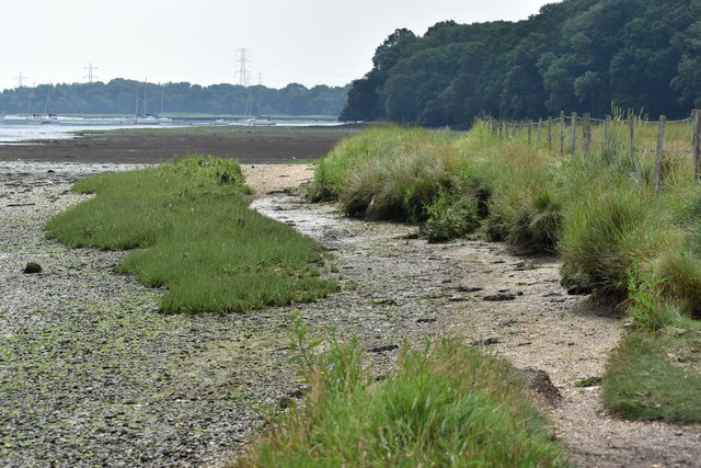
Bury Marsh is a coastal marsh located in Hampshire, England. It is situated near the village of Bury and stretches along the coast, encompassing a vast expanse of salt marshes and saltings. The marsh is known for its unique and diverse ecosystem, making it an important area for wildlife conservation.
The marsh is primarily composed of salt marshes, which are characterized by their high salt content due to the proximity to the sea. This unique environment supports a variety of plant species that are adapted to survive in saline conditions, such as samphire and sea lavender. These plants provide essential habitat and food sources for a range of bird species, including waders, gulls, and terns.
Bury Marsh is also home to several rare and protected species, such as the European eel and the marsh fritillary butterfly. These species thrive in the marsh's diverse habitats, including mudflats, creeks, and shallow pools. The area is a designated Site of Special Scientific Interest (SSSI) due to its ecological importance.
In addition to its natural significance, Bury Marsh is also of historical importance. The marsh has been used for grazing livestock for centuries, and evidence of ancient field systems can still be seen today. The area's rich history and cultural heritage add to its overall charm and appeal.
Bury Marsh provides a unique opportunity for visitors to explore and appreciate the beauty of a coastal marsh ecosystem. With its diverse wildlife, stunning landscapes, and historical significance, Bury Marsh is a must-visit destination for nature enthusiasts and history buffs alike.
If you have any feedback on the listing, please let us know in the comments section below.
Bury Marsh Images
Images are sourced within 2km of 50.903166/-1.4601107 or Grid Reference SU3811. Thanks to Geograph Open Source API. All images are credited.


Bury Marsh is located at Grid Ref: SU3811 (Lat: 50.903166, Lng: -1.4601107)
Administrative County: Hampshire
District: New Forest
Police Authority: Hampshire
What 3 Words
///beyond.opens.locals. Near Marchwood, Hampshire
Nearby Locations
Related Wikis

Eling and Bury Marshes
Eling and Bury Marshes is a 112.3-hectare (277-acre) biological Site of Special Scientific Interest between Totton and Southampton in Hampshire. It is...

SS Shieldhall
SS Shieldhall is a preserved steamship that operates from Southampton. She is one of the last reciprocating steam engined ships built, using technology...
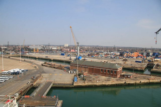
King George V Graving Dock
King George V Graving Dock, also known as No. 7 Dry Dock, is a former dry dock situated in Southampton's Western Docks. It was designed by F.E. Wentworth...

Marchwood
Marchwood is a village and civil parish located in Hampshire, England. It lies between Totton and Hythe on the western shore of Southampton Water and directly...

Marchwood ERF
Marchwood ERF (or Marchwood Energy Recovery Facility) is a waste incineration plant in Marchwood, near Southampton, England. It is situated beside the...

Millbrook, Southampton
Millbrook is a suburb and former civil parish of Southampton. As the area developed, several settlements grew within the parish, some of them becoming...
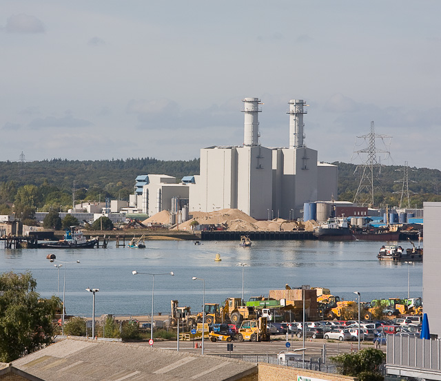
Marchwood Power Station
Marchwood Power Station is an 898.1 MW gas-fired power station in Marchwood, near Southampton, England. It is situated beside estuary of the River Test...
Staplewood Campus
Staplewood Campus in Marchwood, Hampshire is the training ground of Southampton Football Club. It was the home ground of Road-Sea Southampton until 1987...
Nearby Amenities
Located within 500m of 50.903166,-1.4601107Have you been to Bury Marsh?
Leave your review of Bury Marsh below (or comments, questions and feedback).