Beck Houses
Settlement in Westmorland South Lakeland
England
Beck Houses
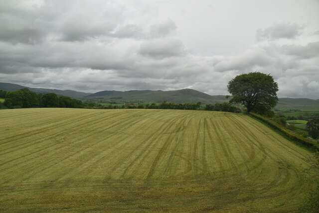
Beck Houses is a small hamlet located in the district of Westmorland, in the county of Cumbria, England. Situated in the picturesque region of the Lake District, it is nestled within the beautiful countryside and surrounded by rolling hills and stunning landscapes.
The hamlet consists of a cluster of traditional stone-built houses, which give it a charming and timeless character. The architecture reflects the local heritage, with many of the buildings dating back several centuries. The houses are typically constructed with local materials, such as limestone, and feature slate roofs.
Beck Houses is known for its peaceful and tranquil surroundings, attracting those who seek a quiet and idyllic rural lifestyle. The hamlet is surrounded by farmland and fields, where sheep and cattle graze freely. The nearby beck, or stream, from which the hamlet takes its name, adds to the natural beauty of the area, providing a soothing and calming atmosphere.
Despite its secluded location, Beck Houses is conveniently located near several larger towns and villages, offering easy access to amenities and services. The nearby town of Kendal, known as the gateway to the Lake District, is just a short drive away, providing residents with a range of shops, schools, and leisure facilities.
Overall, Beck Houses offers a charming and picturesque setting, ideal for those seeking a peaceful and rural lifestyle while still enjoying the convenience of nearby towns and the natural beauty of the Lake District.
If you have any feedback on the listing, please let us know in the comments section below.
Beck Houses Images
Images are sourced within 2km of 54.357787/-2.6477814 or Grid Reference SD5896. Thanks to Geograph Open Source API. All images are credited.


Beck Houses is located at Grid Ref: SD5896 (Lat: 54.357787, Lng: -2.6477814)
Administrative County: Cumbria
District: South Lakeland
Police Authority: Cumbria
What 3 Words
///mega.stars.reworked. Near Burneside, Cumbria
Nearby Locations
Related Wikis
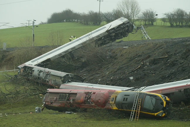
Grayrigg derailment
The Grayrigg derailment was a fatal railway accident that occurred at approximately 20:15 GMT on 23 February 2007, just to the south of Grayrigg, Cumbria...
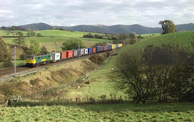
Beck Houses
Beck Houses is a hamlet in Cumbria, England. It lies south of Grayrigg in the Westmorland and Furness unitary authority area. The West Coast Main Line...

Grayrigg
Grayrigg is a small village and civil parish in the South Lakeland district of Cumbria, England. In the 2001 census the parish had a population of 223...

Docker, Cumbria
Docker is a civil parish in the South Lakeland district of the English county of Cumbria. Docker is 4.3 miles north east of the market town of Kendal....
Nearby Amenities
Located within 500m of 54.357787,-2.6477814Have you been to Beck Houses?
Leave your review of Beck Houses below (or comments, questions and feedback).