Iver Stye

Coastal Marsh, Saltings in Orkney

Scotland

Iver Stye

Flooded track near Cleat, Sanday
Flooded track near Cleat, Sanday Credit: Alpin Stewart

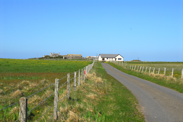
Iver Stye is a picturesque coastal marsh located in Orkney, a group of islands situated off the northeastern coast of Scotland. This stunning natural landscape encompasses a vast expanse of salt marshes and saltings, providing a unique and diverse habitat for numerous species of flora and fauna.

The marshland of Iver Stye is characterized by its low-lying topography and is situated adjacent to the North Sea. As a result, it is significantly influenced by tidal fluctuations and is partially submerged during high tide. This constant ebb and flow of the tides has shaped the landscape, creating a mix of mudflats, channels, and salt marshes.

The area is renowned for its rich biodiversity, attracting a wide range of migratory birds throughout the year. These include wading birds such as curlews, redshanks, and oystercatchers, which seek refuge in the marshes during the winter months. The salt marsh vegetation consists mainly of samphire, sea lavender, and various species of grasses, which provide food and shelter for numerous invertebrates.

Iver Stye is not only a haven for wildlife but also offers visitors a tranquil and scenic environment to explore. The marshland is crisscrossed by a network of footpaths, enabling visitors to wander through this unique ecosystem and observe the diverse array of plants and animals. The area is also frequented by nature enthusiasts, birdwatchers, and photographers who come to capture the beauty of this coastal marsh throughout the seasons.

In summary, Iver Stye in Orkney is a captivating coastal marshland that boasts a remarkable landscape shaped by the tides. It serves as a vital habitat for numerous species, particularly migratory birds, and offers visitors an opportunity to immerse themselves in the beauty of this unique environment.

If you have any feedback on the listing, please let us know in the comments section below.

Iver Stye Images

Images are sourced within 2km of 59.266807/-2.5511612 or Grid Reference HY6842. Thanks to Geograph Open Source API. All images are credited.

Flooded track near Cleat, Sanday
Traditional house on Sanday A long low house alongside the road to Cleat, on the eastern shore of Otters Wick.
Traditional house on Sanday
A long low house alongside the road to Cleat, on the eastern shore of Otters Wick.
Drainage ditch on Sanday This ditch is just east of the track shown on the map, which barely exists on the ground although there is still a space between the fences. The eastern peninsula of Sanday is less than 10 metres height across its whole width at this point.
Drainage ditch on Sanday
This ditch is just east of the track shown on the map, which barely exists on the ground although there is still a space between the fences. The eastern peninsula of Sanday is less than 10 metres height across its whole width at this point.
The brickie hut This wartime building was the control room for a dummy airfield on the Plain of Fidge. It was one of eight dummy installations intended as decoys for air raids on the fleet at Scapa Flow.
The brickie hut
This wartime building was the control room for a dummy airfield on the Plain of Fidge. It was one of eight dummy installations intended as decoys for air raids on the fleet at Scapa Flow.
Saltmarsh near Cleat In Lady parish in the island of Sanday
Saltmarsh near Cleat
In Lady parish in the island of Sanday
Ponies on Sanday Ponies on a croft just outside Lady village. An abandoned croft house has been adapted to provide them with shelter.
Ponies on Sanday
Ponies on a croft just outside Lady village. An abandoned croft house has been adapted to provide them with shelter.
Sanday Fire Station
Sanday Fire Station
Roadside Shop, Lady Village Roadside is the name of the shop, not a description. On the 1940s OS map, Lady Village is called Roadside.
Roadside Shop, Lady Village
Roadside is the name of the shop, not a description. On the 1940s OS map, Lady Village is called Roadside.
Leavisgarth
Leavisgarth
Black Rock Jetty Mail was taken from here to North Ronaldsay before there was a regular air service to that island.
Black Rock Jetty
Mail was taken from here to North Ronaldsay before there was a regular air service to that island.
Lady, Temperance Hall Built 1894
Lady, Temperance Hall
Built 1894
View toward Lama Ness, Sanday Taken from coast dune near to Saville. This is part of Otters Wick Bay.
View toward Lama Ness, Sanday
Taken from coast dune near to Saville. This is part of Otters Wick Bay.
Anchor Cottage, Lady Village, Sanday
Looking southwest along road in Lady Village, Sanday
Road bettween Norhskaill & Oyce, Sanday
Lamaness Firth View out across the wide open Lamaness Firth from near Otterswick on Sanday. At low tide there is a mile and a half of sand between here and the houses in the distance.
Lamaness Firth
View out across the wide open Lamaness Firth from near Otterswick on Sanday. At low tide there is a mile and a half of sand between here and the houses in the distance.
Milestone at Cata Sand, Sanday, Orkney K = Kettletoft.
Milestone at Cata Sand, Sanday, Orkney
K = Kettletoft.
Ruin at Cleat
Ruin at Cleat
Show me another place!

Iver Stye is located at Grid Ref: HY6842 (Lat: 59.266807, Lng: -2.5511612)

Unitary Authority: Orkney Islands

Police Authority: Highlands and Islands

What 3 Words

///doubts.tracks.savers. Near Kettletoft, Orkney Islands

Related Wikis

East Sanday Coast

The East Sanday Coast is a protected wetland area on and around the island of Sanday, the third-largest of the Orkney islands off the north coast of Scotland...

Sanday, Orkney

Sanday (, Scots: Sandee) is one of the inhabited islands of Orkney that lies off the north coast of mainland Scotland. With an area of 50.43 km2 (19.5...

Sanday Airport

Sanday Airport (IATA: NDY, ICAO: EGES) is located 20 NM (37 km; 23 mi) north northeast of Kirkwall Airport on Sanday, Orkney Islands, Scotland. Sanday...

Broughtown

Broughtown is a village on the island of Sanday, in Orkney, Scotland. The settlement is within the parish of Cross and Burness. Sanday Airport is adjacent...

Have you been to Iver Stye?

Leave your review of Iver Stye below (or comments, questions and feedback).