McGowan's Harbour

Coastal Marsh, Saltings in Fife

Scotland

McGowan's Harbour

Sand Martin nests There is a distinct stratum of softer sand in the bank at the top of the beach. Sand Martins have made their nests there.
Sand Martin nests Credit: Rob Burke

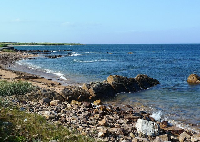
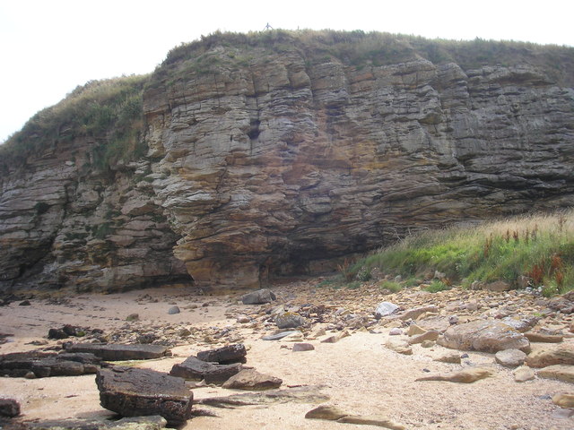
McGowan's Harbour is a picturesque coastal marsh located in Fife, Scotland. Situated on the eastern coast of the country, this area is renowned for its natural beauty and diverse ecosystem. The harbour is nestled between the charming towns of Crail and Anstruther, making it easily accessible for visitors.

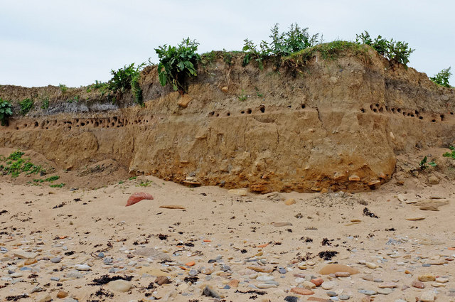
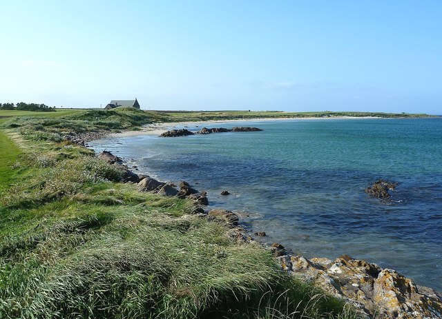
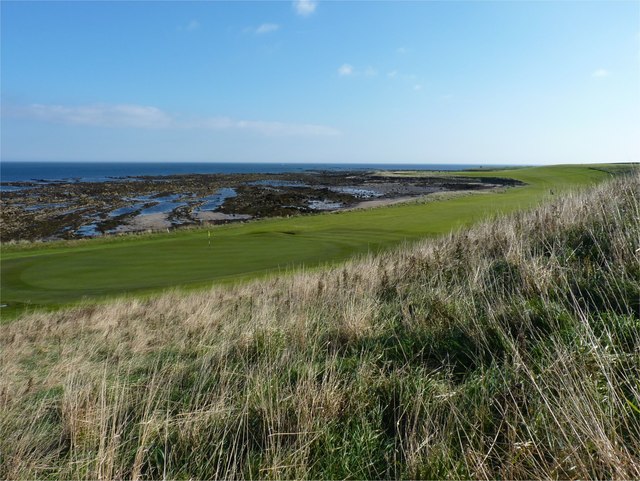
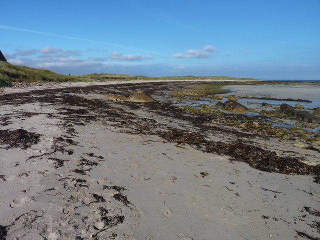
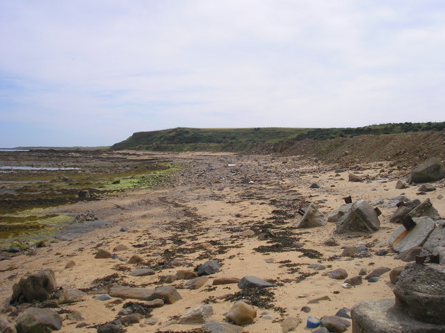
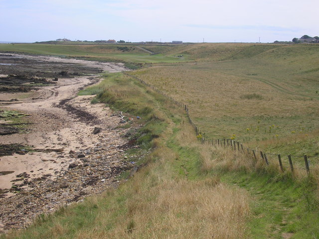
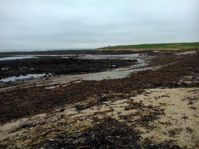
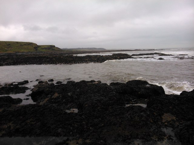
The main feature of McGowan's Harbour is its sprawling coastal marsh, which is characterized by its extensive saltings. Saltings are coastal wetlands that are periodically flooded by the tides. These marshy areas are home to a wide variety of plant and animal life, creating a vibrant and dynamic ecosystem.

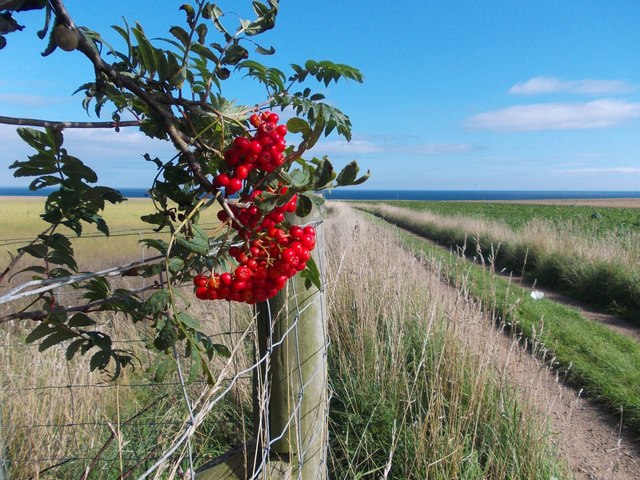
The marshland at McGowan's Harbour is teeming with an array of plant species, including saltmarsh grasses, sea lavender, and samphire. These plants thrive in the brackish water, creating a lush and verdant landscape. The marsh also serves as an important habitat for various bird species, such as curlews, oystercatchers, and redshanks, which can be spotted wading through the shallow waters in search of food.

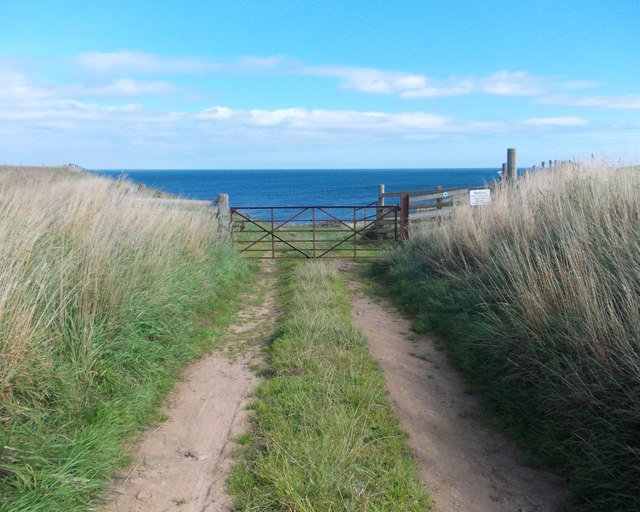
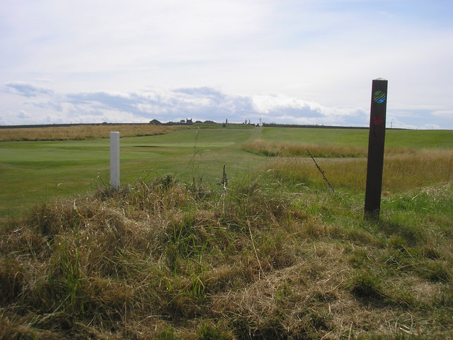
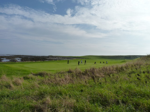
Visitors to McGowan's Harbour can enjoy leisurely walks along the coastline, taking in the stunning panoramic views of the North Sea. The area is also popular for birdwatching, as it provides an ideal vantage point to observe the diverse avian population. Additionally, the harbour offers opportunities for fishing and boating, attracting enthusiasts from near and far.

Overall, McGowan's Harbour is a remarkable coastal marsh that showcases the beauty and biodiversity of Scotland's coastline. With its scenic vistas, abundant wildlife, and recreational activities, it is a must-visit destination for nature lovers and outdoor enthusiasts alike.

If you have any feedback on the listing, please let us know in the comments section below.

McGowan's Harbour Images

Images are sourced within 2km of 56.285504/-2.5972605 or Grid Reference NO6310. Thanks to Geograph Open Source API. All images are credited.

Sand Martin nests There is a distinct stratum of softer sand in the bank at the top of the beach. Sand Martins have made their nests there.
Sand Martin nests
There is a distinct stratum of softer sand in the bank at the top of the beach. Sand Martins have made their nests there.
Observation post north of Fife Ness This small structure is at the top of the beach. It has a stone base covered by an iron partial cylinder with a domed top.

It is a wartime two-man observation post, possibly associated with Crail airfield.

It may be the one recorded as Canmore ID 80388, Site Number NO61SW 16, to the north-east and noted as "Not seen (knocked down?)".
Observation post north of Fife Ness
This small structure is at the top of the beach. It has a stone base covered by an iron partial cylinder with a domed top. It is a wartime two-man observation post, possibly associated with Crail airfield. It may be the one recorded as Canmore ID 80388, Site Number NO61SW 16, to the north-east and noted as "Not seen (knocked down?)".
Observation post roof This is the corroded iron roof of <a href="https://www.geograph.org.uk/photo/2456612">NO6310 : Observation post north of Fife Ness</a>.
Observation post roof
This is the corroded iron roof of NO6310 : Observation post north of Fife Ness.
Fife Ness View Looking along the northern edge of the Ness on a very windy September afternoon.  The in-shore water was remarkably sheltered.
Fife Ness View
Looking along the northern edge of the Ness on a very windy September afternoon. The in-shore water was remarkably sheltered.
Fife Ness View Looking along the northern coastline of Fife Ness, at Balcomie Links, on a very windy afternoon which presented the golfers with a real challenge.
Fife Ness View
Looking along the northern coastline of Fife Ness, at Balcomie Links, on a very windy afternoon which presented the golfers with a real challenge.
Rowan berries by a track to the sea North of Wormiston Farm on the coast of Fife.
Rowan berries by a track to the sea
North of Wormiston Farm on the coast of Fife.
Track to the sea from Wormiston
Former lifeboat station above Balcomie Sands Now a feature on the Balcomie Golf Links and used by the greenkeepers for storage.
Former lifeboat station above Balcomie Sands
Now a feature on the Balcomie Golf Links and used by the greenkeepers for storage.
Balcomie Golf Course There can be but few golf courses with such scenic surroundings as Crail Golfing Society's Balcomie Links course, designed by golfing legend Old Tom Morris and laid out in 1895.
Balcomie Golf Course
There can be but few golf courses with such scenic surroundings as Crail Golfing Society's Balcomie Links course, designed by golfing legend Old Tom Morris and laid out in 1895.
Balcomie beach The Fife Coastal Path involves a 400 metre sand and rock section along this beach to avoid the risk of being struck by a golf ball on the golf course of Balcomie Links.
Balcomie beach
The Fife Coastal Path involves a 400 metre sand and rock section along this beach to avoid the risk of being struck by a golf ball on the golf course of Balcomie Links.
Beach at Randerston The view of the beach at Randerston, looking towards Randerston Castle.  The route of the Fife Coastal Path follows the shore line due to livestock in the fields on the right.
Beach at Randerston
The view of the beach at Randerston, looking towards Randerston Castle. The route of the Fife Coastal Path follows the shore line due to livestock in the fields on the right.
Caves at Randerston Castle The view of two caves at Randerston Castle.  The second cave, the opening of which is beyond the cave in view, is the larger of the two caves.
Caves at Randerston Castle
The view of two caves at Randerston Castle. The second cave, the opening of which is beyond the cave in view, is the larger of the two caves.
Fife Coastal Path The view of the Fife Coastal Path after it has climbed from the beach up the eastern side of Randerston Castle.  The golf course in the distance is the Balcomie course at Crail.
Fife Coastal Path
The view of the Fife Coastal Path after it has climbed from the beach up the eastern side of Randerston Castle. The golf course in the distance is the Balcomie course at Crail.
Balcomie Links from the Fife Coastal Path The view from the Fife Coastal Path from the wooden shelter on the golf course <a href="https://www.geograph.org.uk/photo/1461722">NO6210 : Two greens</a>.  The path goes behind the green coloured shelter and the sign post on the right directs walkers on the correct path.
Balcomie Links from the Fife Coastal Path
The view from the Fife Coastal Path from the wooden shelter on the golf course NO6210 : Two greens. The path goes behind the green coloured shelter and the sign post on the right directs walkers on the correct path.
Former life boat station The view of the former life boat station at the 2nd tee of the 493 yard 2nd hole on the Balcomie links. One of the tees is in front of the building.
Former life boat station
The view of the former life boat station at the 2nd tee of the 493 yard 2nd hole on the Balcomie links. One of the tees is in front of the building.
Putting it out Golfers on a green at Balcomie golf course.
Putting it out
Golfers on a green at Balcomie golf course.
Fluke dub - low tide covered in weed
Fluke dub - low tide
covered in weed
sea view view NW from wormiston hind
sea view
view NW from wormiston hind
Show me another place!

McGowan's Harbour is located at Grid Ref: NO6310 (Lat: 56.285504, Lng: -2.5972605)

Unitary Authority: Fife

Police Authority: Fife

What 3 Words

///drawn.jogged.hopeless. Near Crail, Fife

Related Wikis

Fife Ness

Fife Ness (Scottish Gaelic: Rubha Fiobha) is a headland forming the most eastern point in Fife, Scotland. Anciently the area was called Muck Ross, which...

North Carr

The Carr (also known as Carr Briggs and Carr Rock) is a sandstone reef on the headland between the Firth of Forth and St Andrews Bay. There have been many...

RNAS Crail (HMS Jackdaw)

Royal Naval Air Station Crail (RNAS Crail, also known as HMS Jackdaw) is a former Royal Naval Air Station of the Fleet Air Arm located 4.9 miles (7.9 km...

Cambo Estate

Cambo Estate lies close to the village of Kingsbarns in north-east Fife, Scotland. It is within the East Neuk, 10 kilometres (6.2 mi) south-east of St...

Crail Parish Church

Crail Parish Church is an ancient church building in Crail, Fife, Scotland. It is Category A listed, its oldest part dating to the 12th century. The walls...

Crail Tolbooth and Town Hall

Crail Tolbooth and Town Hall is a municipal structure in Crail, Fife, Scotland. The building, which stands in Marketgate, at its junction with Tolbooth...

Crail

Crail (); Scottish Gaelic: Cathair Aile) is a former royal burgh, parish and community council area (Royal Burgh of Crail and District) in the East Neuk...

Golf Hotel

The Golf Hotel is a hotel and restaurant in Crail, Fife, Scotland. It is a Category A listed building dating to the early 18th century, although one source...

Nearby Amenities

Located within 500m of 56.285504,-2.5972605
Constantine's Cave
Natural: cave_entrance
Tourism: attraction
Lat/Long: 56.2819208/-2.5948207
Golf: pin
Lat/Long: 56.2834985/-2.601751
Golf: pin
Lat/Long: 56.2860561/-2.6020785
Golf: pin
Lat/Long: 56.2818441/-2.6013863
Golf: pin
Lat/Long: 56.2862822/-2.5996536
Power: pole
Lat/Long: 56.2834235/-2.6042767
Power: pole
Lat/Long: 56.2831886/-2.6031616
Power: pole
Lat/Long: 56.2829461/-2.6020385
Power: pole
Lat/Long: 56.2813876/-2.5985519
Power: pole
Lat/Long: 56.281079/-2.5980213
The data included in this document is from www.openstreetmap.org. The data is made available under ODbL.

Have you been to McGowan's Harbour?

Leave your review of McGowan's Harbour below (or comments, questions and feedback).