Blackstone Point

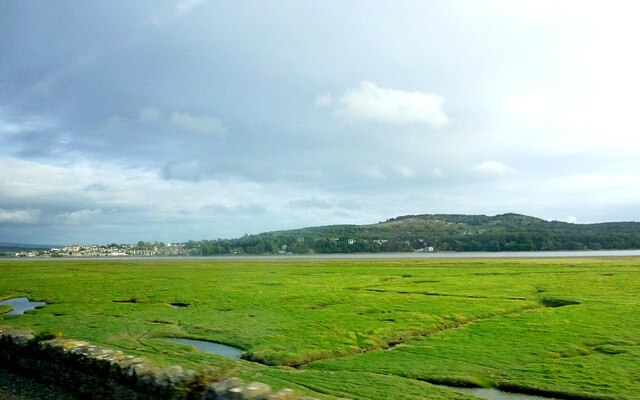
Coastal Marsh, Saltings in Westmorland South Lakeland

England

Blackstone Point

Kent estuary near Holme Island The islets of Great Crag and Little Crag seen in distance
Kent estuary near Holme Island Credit: Raymond Knapman

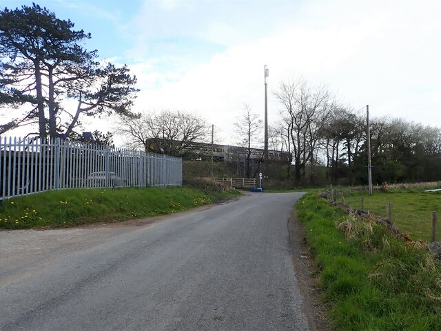
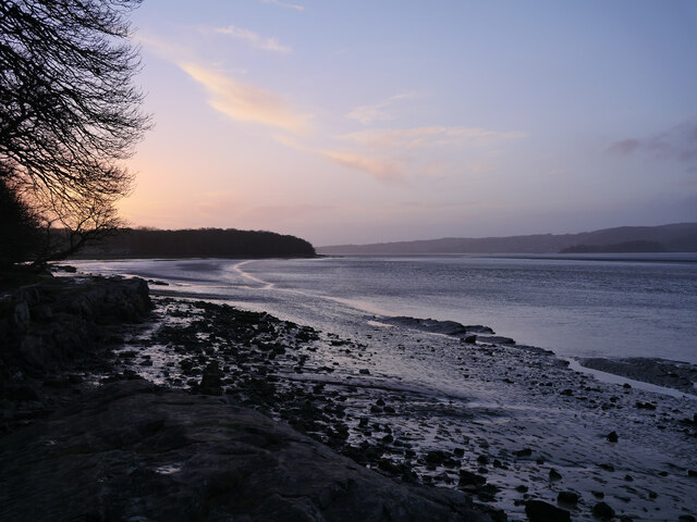
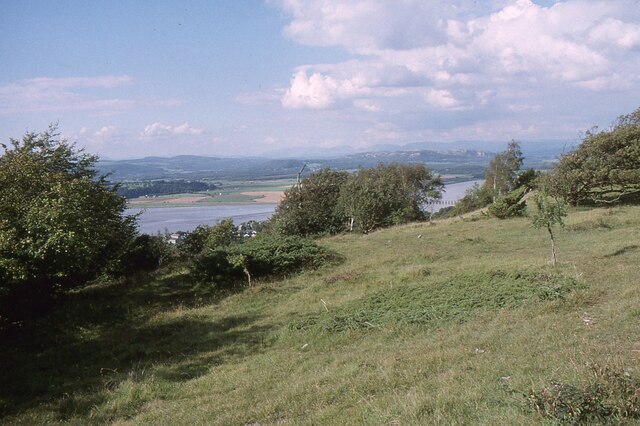
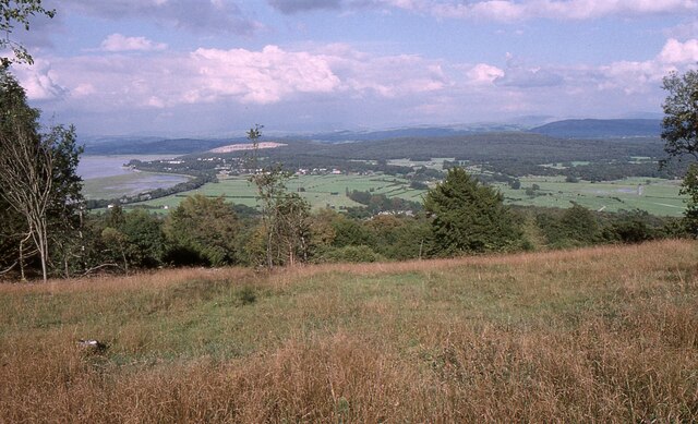
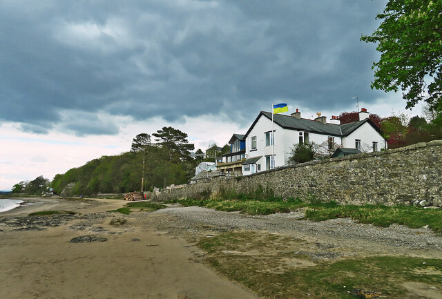
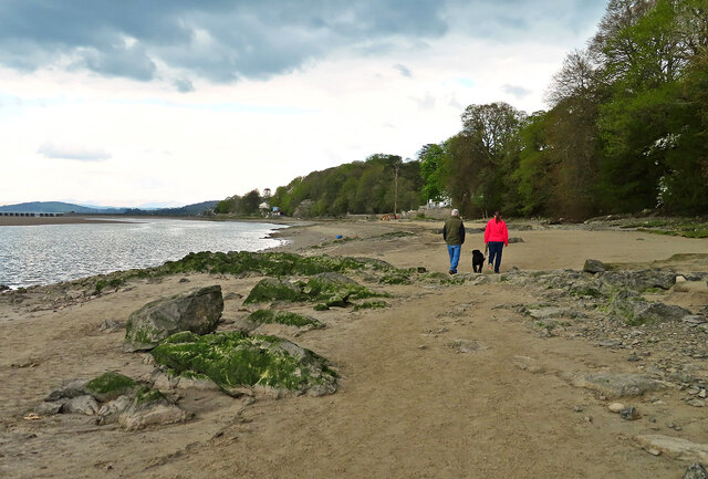
Blackstone Point is a picturesque coastal area located in Westmorland, a county in northwestern England. Situated along the scenic coastline, it is known for its unique and diverse ecosystem, comprised of Coastal Marsh and Saltings.

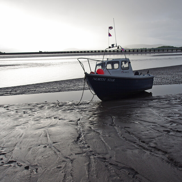
The Coastal Marsh in Blackstone Point is a wetland area that is influenced by the tides of the nearby sea. It is characterized by its lush vegetation, consisting of various grasses, reeds, and sedges. This marshland serves as a vital habitat for a range of plant and animal species, particularly those adapted to the brackish water environment.

Adjacent to the Coastal Marsh, the Saltings are expansive areas of salt marshes. These marshes are formed as a result of the deposition of sediment carried by tidal waters. The Saltings are home to a multitude of species, including migratory birds, wading birds, and numerous invertebrates such as crabs and snails. These marshes play a crucial role in providing a feeding ground and nesting site for many avian species, making it a popular destination for birdwatchers.

Blackstone Point offers visitors a chance to explore and appreciate the natural beauty of the coastal marshes and saltings. The area is known for its tranquil atmosphere, scenic views, and abundant wildlife. It is a haven for nature enthusiasts, birdwatchers, and photographers who can observe a wide variety of birds and other creatures in their natural habitat. The marshes and saltings also contribute to the overall biodiversity of the region, making Blackstone Point an important ecological site in Westmorland.

If you have any feedback on the listing, please let us know in the comments section below.

Blackstone Point Images

Images are sourced within 2km of 54.191808/-2.8639171 or Grid Reference SD4377. Thanks to Geograph Open Source API. All images are credited.

Kent estuary near Holme Island The islets of Great Crag and Little Crag seen in distance
Kent estuary near Holme Island
The islets of Great Crag and Little Crag seen in distance
Holme Island The lodge house can be seen at the end of the causeway
Holme Island
The lodge house can be seen at the end of the causeway
Saltmarsh on the Kent estuary Arnside Knott in background, Arnside town to the left.
Saltmarsh on the Kent estuary
Arnside Knott in background, Arnside town to the left.
Craggy southern end of Meathop Fell
River Winster Between Lindale and Meathop. The river was the boundary between the ancient counties of Lancashire and Westmorland.
River Winster
Between Lindale and Meathop. The river was the boundary between the ancient counties of Lancashire and Westmorland.
River Winster nearing its end The River discharges into the River Kent just east of Grange-Over-Sands. To the left are quarried rocks of Meathop Fell, then the river flows under a railway bridge.
River Winster nearing its end
The River discharges into the River Kent just east of Grange-Over-Sands. To the left are quarried rocks of Meathop Fell, then the river flows under a railway bridge.
Cattle grazing at Holme Farm
Coastal train heading for Grange-Over-Sands Two carriages on the Furness Line, which runs between Lancaster and Barrow-in-Furness
Coastal train heading for Grange-Over-Sands
Two carriages on the Furness Line, which runs between Lancaster and Barrow-in-Furness
Teeing off at Grange-Over-Sands Golf Club
Fairway, Grange-Over-Sands Golf Course
Estuary of the River Kent at Blawith Point The wooded island joined to the mainland by a causeway is Holme Island
Estuary of the River Kent at Blawith Point
The wooded island joined to the mainland by a causeway is Holme Island
The Kent Estuary near Grubbins Wood A late afternoon view of the Kent Estuary on New Year's Day 2022 after the hordes had headed back to Arnside.

This photograph was taken during the Coronavirus (COVID-19) pandemic of 2020/21/22.
The Kent Estuary near Grubbins Wood
A late afternoon view of the Kent Estuary on New Year's Day 2022 after the hordes had headed back to Arnside. This photograph was taken during the Coronavirus (COVID-19) pandemic of 2020/21/22.
Arnside Knott Looking north-northeast over the Kent Estuary. Part of the Kent Viaduct is visible behind the trees in the centre.

Arnside Knott is a National Trust property renowned for its wildlife on this important limestone outcrop.

Position within the square uncertain.
Arnside Knott
Looking north-northeast over the Kent Estuary. Part of the Kent Viaduct is visible behind the trees in the centre. Arnside Knott is a National Trust property renowned for its wildlife on this important limestone outcrop. Position within the square uncertain.
Arnside Knott Looking northeast towards Storth and Sandside Quarry.

Arnside Knott is a National Trust property renowned for its wildlife on this important limestone outcrop.

Position within the square uncertain.
Arnside Knott
Looking northeast towards Storth and Sandside Quarry. Arnside Knott is a National Trust property renowned for its wildlife on this important limestone outcrop. Position within the square uncertain.
Beachwood House Right down there on the foreshore of the Kent Estuary.
Beachwood House
Right down there on the foreshore of the Kent Estuary.
A quick foreshore walk The deteriorating weather discouraged walkers from going very far from Arnside on this late-April afternoon.
A quick foreshore walk
The deteriorating weather discouraged walkers from going very far from Arnside on this late-April afternoon.
Holme Island View over the sea marshes from near the railway station to the private estate
Holme Island
View over the sea marshes from near the railway station to the private estate
Small boat on the mud
Show me another place!

Blackstone Point is located at Grid Ref: SD4377 (Lat: 54.191808, Lng: -2.8639171)

Administrative County: Cumbria

District: South Lakeland

Police Authority: Cumbria

What 3 Words

///computer.instead.recliner. Near Arnside, Cumbria

Related Wikis

River Winster

The River Winster is a river in the English county of Cumbria. The Winster was the boundary between the ancient counties of Lancashire and Westmorland...

Arnside Bore

The Arnside Bore is a tidal bore on the estuary of the River Kent in England, United Kingdom.The bore occurs at high tides, especially spring tides, where...

Far Arnside

Far Arnside is a hamlet in Arnside civil parish in the South Lakeland district, Cumbria, England. == Location == It is located near the large villages...

Arnside Knott

Arnside Knott is a hill with a summit elevation of 159 metres (522 ft), near Arnside, Cumbria, England. Although it is in South Lakeland district it is...
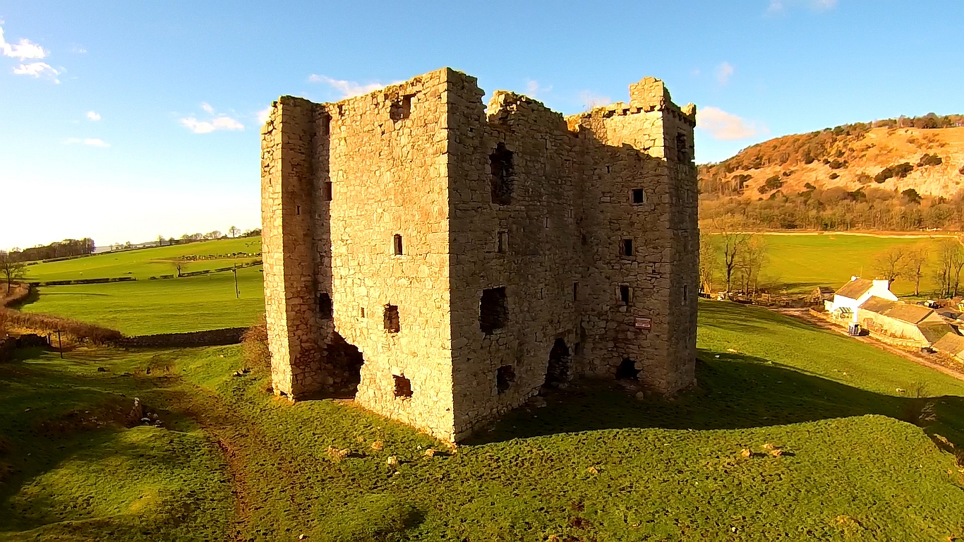
Arnside Tower

Arnside Tower is a late-medieval tower house (or Pele tower) between Arnside and Silverdale immediately to the south of Arnside Knott in Cumbria, England...

Arnside Viaduct

Arnside Viaduct is a viaduct carrying the Lancaster to Barrow railway line over the River Kent. Construction started in 1856, finished in 1857 and expanded...

Arnside

Arnside is a village and civil parish in Cumbria, historically part of Westmorland, near the border with Lancashire, England. The Lake District National...

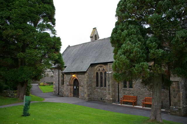
St James' Church, Arnside

St James' Church is in the village of Arnside, Cumbria, England. It is an active Anglican parish church in the deanery of Kendal, the archdeaconry of...

Nearby Amenities

Located within 500m of 54.191808,-2.8639171
Source: PGS
Lat/Long: 54.1934082/-2.857099
Source: PGS
Lat/Long: 54.1934182/-2.8571846
Source: PGS
Lat/Long: 54.1935345/-2.8585956
Source: PGS
Lat/Long: 54.1935344/-2.858985
Source: PGS
Lat/Long: 54.1935877/-2.8597602
Source: PGS
Lat/Long: 54.1935746/-2.8604292
Source: PGS
Lat/Long: 54.1932665/-2.8612086
Source: PGS
Lat/Long: 54.1928261/-2.861722
Source: PGS
Lat/Long: 54.1927978/-2.8621404
Source: PGS
Lat/Long: 54.1921965/-2.8629327
Source: PGS
Lat/Long: 54.1921007/-2.8633774
Source: PGS
Lat/Long: 54.1917967/-2.8636548
Source: PGS
Lat/Long: 54.1916623/-2.8639315
Source: PGS
Lat/Long: 54.1908356/-2.864328
Source: PGS
Lat/Long: 54.1903233/-2.8633436
Source: PGS
Lat/Long: 54.1901243/-2.862864
Source: PGS
Lat/Long: 54.1888927/-2.8619767
Source: PGS
Lat/Long: 54.1880384/-2.862234
Source: PGS
Lat/Long: 54.1875405/-2.86356
New Barns
Is In: South Lakeland, Cumbria, England, UK
Place: locality
Source: NPE; survey
Lat/Long: 54.1931395/-2.8573336
Blackstone Point
Natural: cape
Source: NPE; survey
Lat/Long: 54.1909048/-2.8641142
White Creek Mine
Man Made: adit
Resource: iron_ore
Lat/Long: 54.1883431/-2.8604138
Toilets
Access: customers
Fee: no
Lat/Long: 54.1927085/-2.8564775
The data included in this document is from www.openstreetmap.org. The data is made available under ODbL.

Have you been to Blackstone Point?

Leave your review of Blackstone Point below (or comments, questions and feedback).