Arnside Point

Coastal Feature, Headland, Point in Westmorland South Lakeland

England

Arnside Point

Holme Island The lodge house can be seen at the end of the causeway
Holme Island Credit: Raymond Knapman

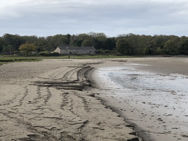
Arnside Point is a prominent coastal feature located in Westmorland, a historic county in northwest England. It is a headland that juts out into the Irish Sea, forming a distinct point that offers breathtaking views of the surrounding area.

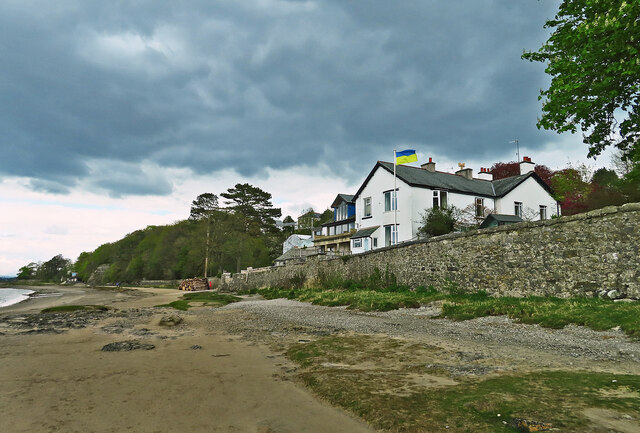
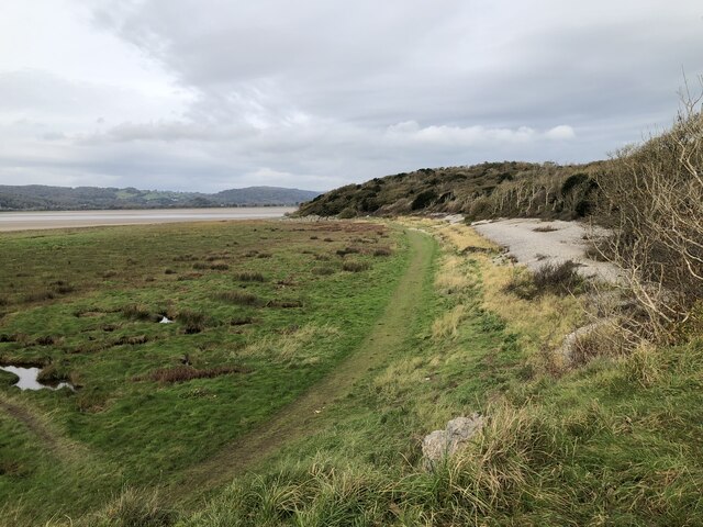
Situated near the village of Arnside, Arnside Point is characterized by its rugged cliffs, which provide a striking contrast to the nearby rolling hills and lush vegetation. The headland is composed of sedimentary rocks, primarily limestone, which have been shaped by erosion over millions of years, resulting in its distinctive appearance.

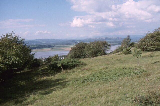
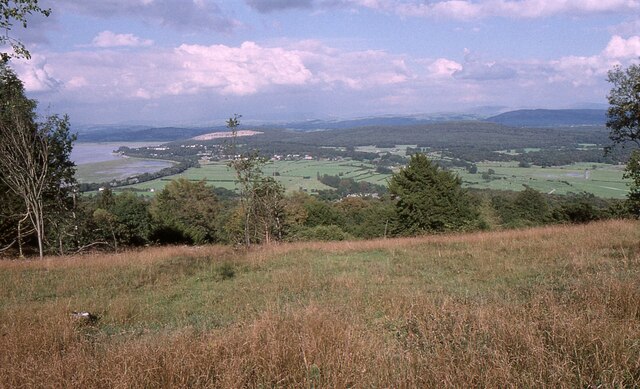
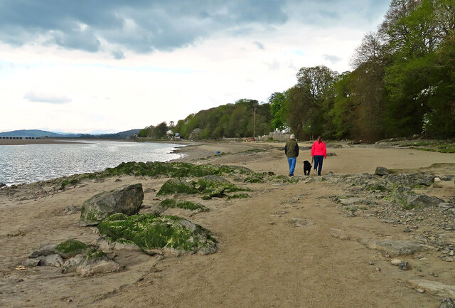
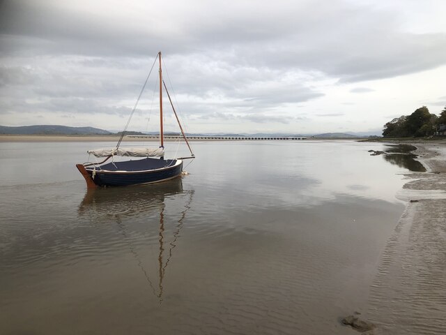
The point itself offers a panoramic view of the Irish Sea, with clear visibility of the neighboring coastline and the distant hills of Cumbria and Lancashire. On a clear day, it is possible to spot the Isle of Man across the water. The area is also known for its diverse wildlife, including various seabirds and marine mammals, which can often be seen from the point.

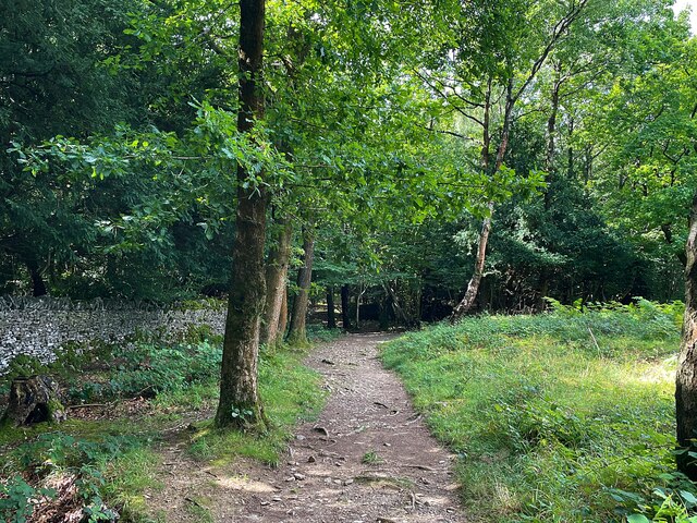
Arnside Point is a popular destination for nature enthusiasts, hikers, and photographers, who are drawn to its natural beauty and the opportunity to explore the surrounding coastal paths. The headland is part of the Arnside and Silverdale Area of Outstanding Natural Beauty, which recognizes its ecological importance and stunning landscape.

Visitors to Arnside Point can enjoy a leisurely stroll along the coastal path, taking in the breathtaking views and observing the diverse flora and fauna. The area is also a great spot for picnicking and enjoying the tranquility of the coastal setting.

If you have any feedback on the listing, please let us know in the comments section below.

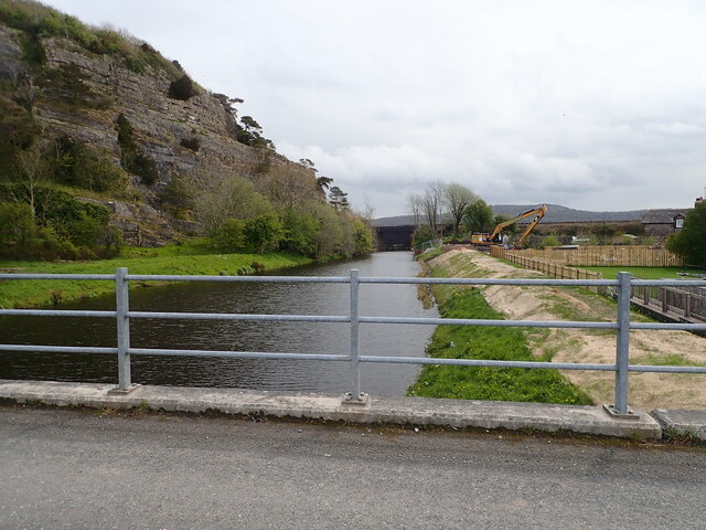
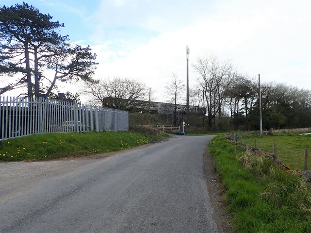
Arnside Point Images

Images are sourced within 2km of 54.187237/-2.863362 or Grid Reference SD4377. Thanks to Geograph Open Source API. All images are credited.

Holme Island The lodge house can be seen at the end of the causeway
Holme Island
The lodge house can be seen at the end of the causeway
River Winster nearing its end The River discharges into the River Kent just east of Grange-Over-Sands. To the left are quarried rocks of Meathop Fell, then the river flows under a railway bridge.
River Winster nearing its end
The River discharges into the River Kent just east of Grange-Over-Sands. To the left are quarried rocks of Meathop Fell, then the river flows under a railway bridge.
Coastal train heading for Grange-Over-Sands Two carriages on the Furness Line, which runs between Lancaster and Barrow-in-Furness
Coastal train heading for Grange-Over-Sands
Two carriages on the Furness Line, which runs between Lancaster and Barrow-in-Furness
The Kent Estuary near Grubbins Wood A late afternoon view of the Kent Estuary on New Year's Day 2022 after the hordes had headed back to Arnside.

This photograph was taken during the Coronavirus (COVID-19) pandemic of 2020/21/22.
The Kent Estuary near Grubbins Wood
A late afternoon view of the Kent Estuary on New Year's Day 2022 after the hordes had headed back to Arnside. This photograph was taken during the Coronavirus (COVID-19) pandemic of 2020/21/22.
Arnside Knott Looking north-northeast over the Kent Estuary. Part of the Kent Viaduct is visible behind the trees in the centre.

Arnside Knott is a National Trust property renowned for its wildlife on this important limestone outcrop.

Position within the square uncertain.
Arnside Knott
Looking north-northeast over the Kent Estuary. Part of the Kent Viaduct is visible behind the trees in the centre. Arnside Knott is a National Trust property renowned for its wildlife on this important limestone outcrop. Position within the square uncertain.
Arnside Knott Looking northeast towards Storth and Sandside Quarry.

Arnside Knott is a National Trust property renowned for its wildlife on this important limestone outcrop.

Position within the square uncertain.
Arnside Knott
Looking northeast towards Storth and Sandside Quarry. Arnside Knott is a National Trust property renowned for its wildlife on this important limestone outcrop. Position within the square uncertain.
Beachwood House Right down there on the foreshore of the Kent Estuary.
Beachwood House
Right down there on the foreshore of the Kent Estuary.
A quick foreshore walk The deteriorating weather discouraged walkers from going very far from Arnside on this late-April afternoon.
A quick foreshore walk
The deteriorating weather discouraged walkers from going very far from Arnside on this late-April afternoon.
Holme Island View over the sea marshes from near the railway station to the private estate
Holme Island
View over the sea marshes from near the railway station to the private estate
Path through Copridding Wood
Windblown tree on Arnside Knott
Sailboat, Arnside
Sailboat, Arnside
Cottages at New Barns
The edge of Leighton Moss Nature Reserve
Channel in Morecambe Bay at low tide
Small sheltered shingle beach at Park Point
Wooded path to Arnside Knott
A bench with a view On the top of Arnside Knott
A bench with a view
On the top of Arnside Knott
Show me another place!

Arnside Point is located at Grid Ref: SD4377 (Lat: 54.187237, Lng: -2.863362)

Administrative County: Cumbria

District: South Lakeland

Police Authority: Cumbria

What 3 Words

///buffoon.spades.assembles. Near Arnside, Cumbria

Related Wikis

Far Arnside

Far Arnside is a hamlet in Arnside civil parish in the South Lakeland district, Cumbria, England. == Location == It is located near the large villages...

River Winster

The River Winster is a river in the English county of Cumbria. The Winster was the boundary between the ancient counties of Lancashire and Westmorland...

Arnside Knott

Arnside Knott is a hill with a summit elevation of 159 metres (522 ft), near Arnside, Cumbria, England. Although it is in South Lakeland district it is...
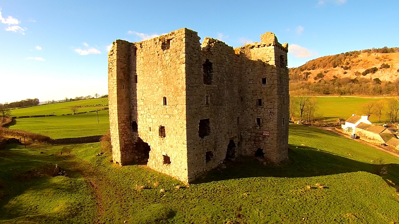
Arnside Tower

Arnside Tower is a late-medieval tower house (or Pele tower) between Arnside and Silverdale immediately to the south of Arnside Knott in Cumbria, England...

Arnside Bore

The Arnside Bore is a tidal bore on the estuary of the River Kent in England, United Kingdom.The bore occurs at high tides, especially spring tides, where...

Arnside

Arnside is a village and civil parish in Cumbria, historically part of Westmorland, near the border with Lancashire, England. The Lake District National...

Arnside Viaduct

Arnside Viaduct is a viaduct carrying the Lancaster to Barrow railway line over the River Kent. Construction started in 1856, finished in 1857 and expanded...

St James' Church, Arnside

St James' Church is in the village of Arnside, Cumbria, England. It is an active Anglican parish church in the deanery of Kendal, the archdeaconry of...

Nearby Amenities

Located within 500m of 54.187237,-2.863362
Source: PGS
Lat/Long: 54.1916623/-2.8639315
Source: PGS
Lat/Long: 54.1908356/-2.864328
Source: PGS
Lat/Long: 54.1903233/-2.8633436
Source: PGS
Lat/Long: 54.1901243/-2.862864
Source: PGS
Lat/Long: 54.1888927/-2.8619767
Source: PGS
Lat/Long: 54.1880384/-2.862234
Source: PGS
Lat/Long: 54.1875405/-2.86356
Source: PGS
Lat/Long: 54.1871422/-2.8638487
Source: PGS
Lat/Long: 54.1861912/-2.8640805
Source: PGS
Lat/Long: 54.1854256/-2.8642215
Source: PGS
Lat/Long: 54.1845494/-2.8644892
Source: PGS
Lat/Long: 54.1836184/-2.864015
Source: PGS
Lat/Long: 54.1832391/-2.8636282
Arnside Point
Natural: cape
Source: NPE; survey
Lat/Long: 54.1848531/-2.8640284
Blackstone Point
Natural: cape
Source: NPE; survey
Lat/Long: 54.1909048/-2.8641142
White Creek Mine
Man Made: adit
Resource: iron_ore
Lat/Long: 54.1883431/-2.8604138
The data included in this document is from www.openstreetmap.org. The data is made available under ODbL.

Have you been to Arnside Point?

Leave your review of Arnside Point below (or comments, questions and feedback).