Arrad Marsh

Coastal Marsh, Saltings in Lancashire South Lakeland

England

Arrad Marsh

Boggy Field Looking towards Arad Foot from the mossland near Causeway End.
Boggy Field Credit: Michael Graham

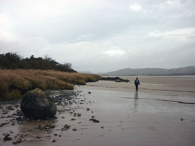
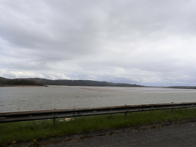
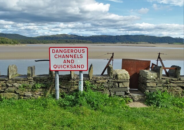
Arrad Marsh is a coastal marsh and saltings area located in Lancashire, England. It stretches along the coastline, covering an approximate area of several square kilometers. The marsh is characterized by its unique ecosystem, which consists of a mixture of salt marsh, mudflats, and salt pans.

The marsh is situated next to the River Lune estuary, which is an important source of freshwater for the area. This estuary is influenced by tidal movements, resulting in regular flooding of the marsh. As a result, the vegetation found in Arrad Marsh is adapted to tolerate high salt levels and periodic inundation.

The vegetation in the marsh is diverse and includes plants such as saltmarsh grass, sea lavender, and samphire. These plants provide important habitat and feeding grounds for a variety of bird species, including wading birds and waterfowl. The marsh is also an important breeding ground for several bird species, making it a popular spot for birdwatching enthusiasts.

In addition to its ecological importance, Arrad Marsh is also of historical significance. The area has evidence of human activity dating back thousands of years, with archaeological finds including ancient tools and pottery. The marsh has also been used for salt production in the past, with evidence of salt pans and other infrastructure.

Overall, Arrad Marsh is a valuable coastal ecosystem that supports a diverse range of plant and animal species. Its unique blend of salt marsh and mudflats, combined with its historical significance, make it an important area for both conservation and cultural heritage.

If you have any feedback on the listing, please let us know in the comments section below.

Arrad Marsh Images

Images are sourced within 2km of 54.217536/-3.0520279 or Grid Reference SD3180. Thanks to Geograph Open Source API. All images are credited.

Boggy Field Looking towards Arad Foot from the mossland near Causeway End.
Boggy Field
Looking towards Arad Foot from the mossland near Causeway End.
Great Oath Hill On the skyline.
Great Oath Hill
On the skyline.
The banks of the river Leven At high tide, as shown here, this river increases massively in size.
The banks of the river Leven
At high tide, as shown here, this river increases massively in size.
Low cliffs on the river Leven Gorse covers these low cliffs above the high water level of the Leven estuary.
Low cliffs on the river Leven
Gorse covers these low cliffs above the high water level of the Leven estuary.
Ashes Point
Ashes Point
Footpath to Newlands
Alpine Road
Alpine Road
The Alps
The Alps
A road to Newland Bottom
Houses at Newland Bottom
Walking by the Leven estuary At low tide it is possible to pass underneath the Leven Viaduct and head upriver on the exposed sands - a pleasant alternative to the soft, sodden footpath just inland as we soon found out. The large, rounded boulder in the foreground is a glacial erratic borne here by a glacier flowing out of the Lake District mountains then dumped here as the ice retreated.
Walking by the Leven estuary
At low tide it is possible to pass underneath the Leven Viaduct and head upriver on the exposed sands - a pleasant alternative to the soft, sodden footpath just inland as we soon found out. The large, rounded boulder in the foreground is a glacial erratic borne here by a glacier flowing out of the Lake District mountains then dumped here as the ice retreated.
Tree on outcrop near Moss Nook Looking towards the lighthouse-like Barrow Monument on Hoad Hill.
Tree on outcrop near Moss Nook
Looking towards the lighthouse-like Barrow Monument on Hoad Hill.
Cottage near Moss Nook Looking towards the Barrow Monument on Hoad Hill above Ulverston.
Cottage near Moss Nook
Looking towards the Barrow Monument on Hoad Hill above Ulverston.
Sands near Plumpton Hall
Estuary of the River Leven
River Crake at Greenodd Near its confluence with the River Leven
River Crake at Greenodd
Near its confluence with the River Leven
Greenodd Sands
Greenodd Sands
Farm building in Arrad Foot
Show me another place!

Arrad Marsh is located at Grid Ref: SD3180 (Lat: 54.217536, Lng: -3.0520279)

Administrative County: Cumbria

District: South Lakeland

Police Authority: Cumbria

What 3 Words

///uncouth.funny.remake. Near Ulverston, Cumbria

Related Wikis

Arrad Foot

Arrad Foot is a hamlet in South Lakeland, Cumbria, England. The hamlet is situated on a minor road just off the A590 road, with the village of Greenodd...

Greenodd railway station

Greenodd railway station was on the route between Ulverston and Lakeside, built by the Furness Railway. It served the village of Greenodd, then in Lancashire...

River Crake

The River Crake is a short river in the English Lake District. The name probably derives from the Celtic languages (most likely Brythonic languages; ie...

Greenodd

Greenodd is a village in the Furness area of the county of Cumbria, England, but within the historical county of Lancashire. For local government purposes...

Nearby Amenities

Located within 500m of 54.217536,-3.0520279
Source: PGS
Lat/Long: 54.218968/-3.044739
Source: PGS
Lat/Long: 54.218968/-3.045613
Source: PGS
Lat/Long: 54.21884/-3.04605
Source: PGS
Lat/Long: 54.2184818/-3.0464598
Source: PGS
Lat/Long: 54.218199/-3.046923
Source: PGS
Lat/Long: 54.2179957/-3.047507
Source: PGS
Lat/Long: 54.2178116/-3.0485877
Source: PGS
Lat/Long: 54.2178326/-3.0490519
Source: PGS
Lat/Long: 54.217941/-3.049546
Source: PGS
Lat/Long: 54.2180371/-3.0499426
Source: PGS
Lat/Long: 54.2182494/-3.0507113
Source: PGS
Lat/Long: 54.2186574/-3.0516087
Source: PGS
Lat/Long: 54.2192299/-3.0524951
Source: PGS
Lat/Long: 54.2196938/-3.052821
Source: PGS
Lat/Long: 54.220438/-3.0533017
Source: PGS
Lat/Long: 54.2209678/-3.0532165
Source: PGS
Lat/Long: 54.2214709/-3.0530645
Source: PGS
Lat/Long: 54.2219162/-3.0530819
Source: PGS
Lat/Long: 54.2178854/-3.0492927
Power: pole
Lat/Long: 54.215675/-3.0584672
Power: pole
Lat/Long: 54.2151079/-3.0563423
Power: pole
Lat/Long: 54.2146604/-3.054707
Power: pole
Lat/Long: 54.2144366/-3.0538466
Power: pole
Lat/Long: 54.2133887/-3.0538799
The data included in this document is from www.openstreetmap.org. The data is made available under ODbL.

Have you been to Arrad Marsh?

Leave your review of Arrad Marsh below (or comments, questions and feedback).