Flisk Point

Coastal Marsh, Saltings in Fife

Scotland

Flisk Point

Looking towards Tay Estuary at Fliskmillan
Looking towards Tay Estuary at Fliskmillan Credit: Becky Williamson

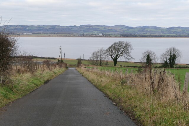
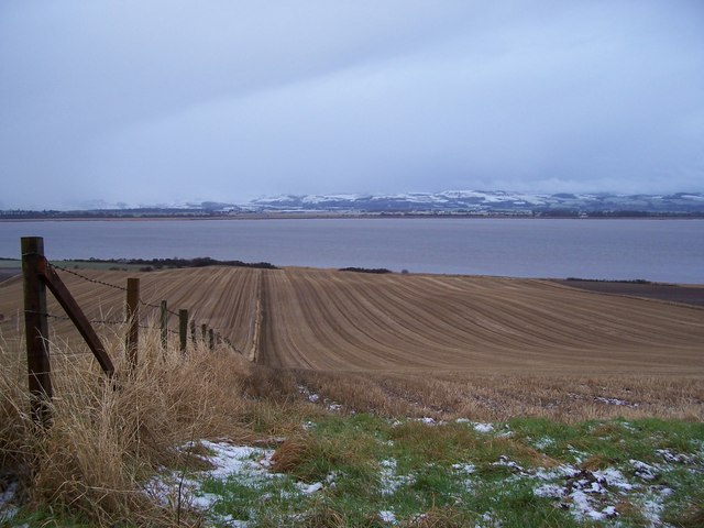
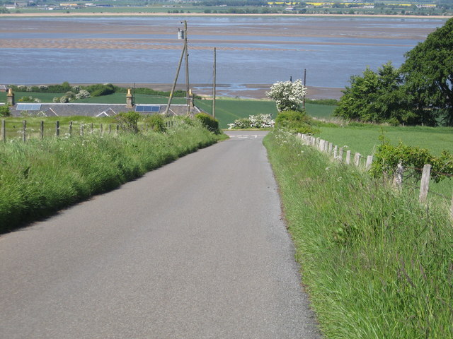
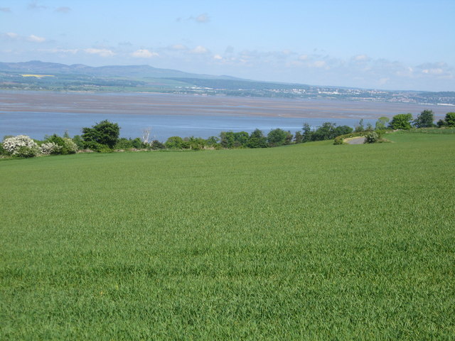
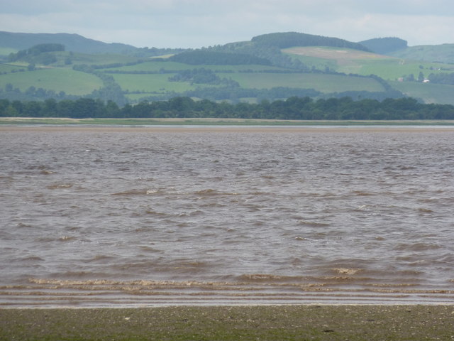
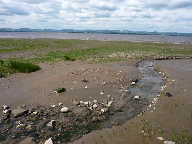
Flisk Point is a coastal marsh located in Fife, Scotland. Situated along the eastern coast of the country, it is part of a larger area known as the Firth of Tay. The marsh is characterized by its unique ecosystem, consisting of both saltwater and freshwater habitats, making it a significant ecological site.

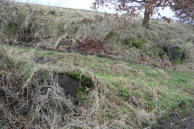
The marsh is primarily composed of saline marshes and saltings, which are low-lying areas subject to tidal flooding. These habitats support a diverse range of plant and animal species, including various grasses, sedges, and rushes, as well as a multitude of bird species. Flisk Point is particularly renowned for its importance as a breeding and feeding area for waterfowl, such as waders and wildfowl.

The coastal marsh acts as a vital stopping point for migratory birds, providing them with essential sustenance during their long journeys. It also serves as a nesting site for several bird species, including the common tern and the little tern. The surrounding saltmarsh vegetation provides a suitable environment for these birds to lay their eggs and raise their young.

In addition to its ecological importance, Flisk Point offers breathtaking panoramic views of the coastline and the Firth of Tay. The site is a popular destination for birdwatchers and nature enthusiasts, who can explore the area via designated footpaths and trails. The marsh is also a designated Site of Special Scientific Interest (SSSI), highlighting its significance in terms of conservation.

Overall, Flisk Point's coastal marsh and saltings not only provide a haven for diverse plant and animal life but also offer visitors a unique opportunity to witness the beauty and serenity of Scotland's coastal landscapes.

If you have any feedback on the listing, please let us know in the comments section below.

Flisk Point Images

Images are sourced within 2km of 56.392105/-3.1159051 or Grid Reference NO3122. Thanks to Geograph Open Source API. All images are credited.

Looking towards Tay Estuary at Fliskmillan
Well at West Flisk There is an Ordnance Survey benchmark on the right hand side of this former well. See also <a href="https://www.geograph.org.uk/photo/7687230">NO3122 : Benchmark on well at West Flisk</a>.
Well at West Flisk
There is an Ordnance Survey benchmark on the right hand side of this former well. See also NO3122 : Benchmark on well at West Flisk.
Benchmark on well at West Flisk Ordnance Survey benchmark. For database entry, see <span class="nowrap"><a title="https://www.bench-marks.org.uk/bm211339" rel="nofollow ugc noopener" href="https://www.bench-marks.org.uk/bm211339">Link</a><img style="margin-left:2px;" alt="External link" title="External link - shift click to open in new window" src="https://s1.geograph.org.uk/img/external.png" width="10" height="10"/></span>.  See also <a href="https://www.geograph.org.uk/photo/7687227">NO3122 : Well at West Flisk</a>.
Benchmark on well at West Flisk
Ordnance Survey benchmark. For database entry, see LinkExternal link. See also NO3122 : Well at West Flisk.
Benchmark, Carseview Cottage, Flisk Ordnance Survey benchmark.  For database entry, see <span class="nowrap"><a title="https://www.bench-marks.org.uk/bm211337" rel="nofollow ugc noopener" href="https://www.bench-marks.org.uk/bm211337">Link</a><img style="margin-left:2px;" alt="External link" title="External link - shift click to open in new window" src="https://s1.geograph.org.uk/img/external.png" width="10" height="10"/></span>.  See also <a href="https://www.geograph.org.uk/photo/7687279">NO3021 : Carseview Cottage, Flisk</a>.
Benchmark, Carseview Cottage, Flisk
Ordnance Survey benchmark. For database entry, see LinkExternal link. See also NO3021 : Carseview Cottage, Flisk.
Benchmark location, East Flisk This benchmark took quite a bit of finding.  We covered it back up as best we could once we had photographed it.  The original stone has been dislodged and the benchmark is lying on its side.
Benchmark location, East Flisk
This benchmark took quite a bit of finding. We covered it back up as best we could once we had photographed it. The original stone has been dislodged and the benchmark is lying on its side.
Balhelvie Cottage There is an Ordnance Survey benchmark on this cottage, just above fence line to the right of the drainpipe in this photo. See also <a href="https://www.geograph.org.uk/photo/7687265">NO3021 : Benchmark, Balhelvie Cottages</a>.
Balhelvie Cottage
There is an Ordnance Survey benchmark on this cottage, just above fence line to the right of the drainpipe in this photo. See also NO3021 : Benchmark, Balhelvie Cottages.
West Flisk
West Flisk
East Flisk Farm On south side of River Tay.
East Flisk Farm
On south side of River Tay.
Ordnance Survey benchmark on fallen stone, East Flisk Described on database at <span class="nowrap"><a title="https://www.bench-marks.org.uk/bm211340" rel="nofollow ugc noopener" href="https://www.bench-marks.org.uk/bm211340">Link</a><img style="margin-left:2px;" alt="External link" title="External link - shift click to open in new window" src="https://s1.geograph.org.uk/img/external.png" width="10" height="10"/></span>.  See also <a href="https://www.geograph.org.uk/photo/7687235">NO3222 : Benchmark location, East Flisk</a>.
Ordnance Survey benchmark on fallen stone, East Flisk
Described on database at LinkExternal link. See also NO3222 : Benchmark location, East Flisk.
Benchmark, Balhelvie Cottages Ordnance Survey benchmark, described on database at <span class="nowrap"><a title="https://www.bench-marks.org.uk/bm211338" rel="nofollow ugc noopener" href="https://www.bench-marks.org.uk/bm211338">Link</a><img style="margin-left:2px;" alt="External link" title="External link - shift click to open in new window" src="https://s1.geograph.org.uk/img/external.png" width="10" height="10"/></span>.  See also <a href="https://www.geograph.org.uk/photo/7687247">NO3021 : Balhelvie Cottage</a>.
Benchmark, Balhelvie Cottages
Ordnance Survey benchmark, described on database at LinkExternal link. See also NO3021 : Balhelvie Cottage.
Road leading north-east from Balhelvie
Cottages at Flisk There is an Ordnance Survey benchmark on the nearest cottage.
Cottages at Flisk
There is an Ordnance Survey benchmark on the nearest cottage.
Carseview Cottage, Flisk There is an Ordnance Survey benchmark on this building.
Carseview Cottage, Flisk
There is an Ordnance Survey benchmark on this building.
North Fife Fields By The Tay Looking down a fence line in a stubble field towards the Tay and the Perthshire hills in early January.
North Fife Fields By The Tay
Looking down a fence line in a stubble field towards the Tay and the Perthshire hills in early January.
Looking towards the Tay From the minor road down Fliskmillan Hill. The rocks back left are known as Durward's Scalp.
Looking towards the Tay
From the minor road down Fliskmillan Hill. The rocks back left are known as Durward's Scalp.
Farmlands on the banks of Tay Near Fliskmillan in Fife.
Farmlands on the banks of Tay
Near Fliskmillan in Fife.
Eppie's Taes I have long coveted this square, as it gave its name to one of the fishing stations operated by my ancestor. The photo was taken 1/2 hour after a 0.0 low tide after walking along from Flisk Point, and finding my way out on to the shingly mud at the edge of the water. Probably more of the sand bank would normally be visible, but there was a strong easterly wind blowing, stirring up the water in the Tay Estuary. Who Eppie was I do not know.
Eppie's Taes
I have long coveted this square, as it gave its name to one of the fishing stations operated by my ancestor. The photo was taken 1/2 hour after a 0.0 low tide after walking along from Flisk Point, and finding my way out on to the shingly mud at the edge of the water. Probably more of the sand bank would normally be visible, but there was a strong easterly wind blowing, stirring up the water in the Tay Estuary. Who Eppie was I do not know.
Low tide on the Tay Estuary Just after a very low tide. A small burn runs down here, through the shingly mud.
Low tide on the Tay Estuary
Just after a very low tide. A small burn runs down here, through the shingly mud.
Show me another place!

Flisk Point is located at Grid Ref: NO3122 (Lat: 56.392105, Lng: -3.1159051)

Unitary Authority: Fife

Police Authority: Fife

What 3 Words

///mothering.soldiers.fetching. Near Errol, Perth & Kinross

Related Wikis

Flisk

Flisk (Scottish Gaelic: Fleasg meaning "Stalk" or "Rod") was a parish in Fife, Scotland. == Description == According to the 1853 Gazetteer, in part: "Flisk...

Creich, Fife

Creich (Scottish Gaelic: Craoich, pronounced [kʰɾɯːç]; OS: Criech), is a hamlet in Fife, Scotland. The local parish is named after Creich. The ruins of...

Birkhill Castle

Birkhill Castle is a stately home, the residence of the Earl of Dundee, located on the banks of the River Tay, a short drive from St. Andrews. The castle...

Norman's Law

Norman's Law is a prominent hill at the far eastern end of the Ochil Fault, Scotland. It sits above the south bank of the River Tay, around four miles...

Nearby Amenities

Located within 500m of 56.392105,-3.1159051
Created By: almien_coastlines
Lat/Long: 56.391422/-3.113729
Created By: almien_coastlines
Lat/Long: 56.391422/-3.114191
Created By: almien_coastlines
Lat/Long: 56.391806/-3.114886
Created By: almien_coastlines
Lat/Long: 56.391548/-3.11627
Power: pole
Lat/Long: 56.3893194/-3.112274
Power: pole
Lat/Long: 56.3889015/-3.1120899
Power: pole
Lat/Long: 56.3884756/-3.1118893
The data included in this document is from www.openstreetmap.org. The data is made available under ODbL.

Have you been to Flisk Point?

Leave your review of Flisk Point below (or comments, questions and feedback).